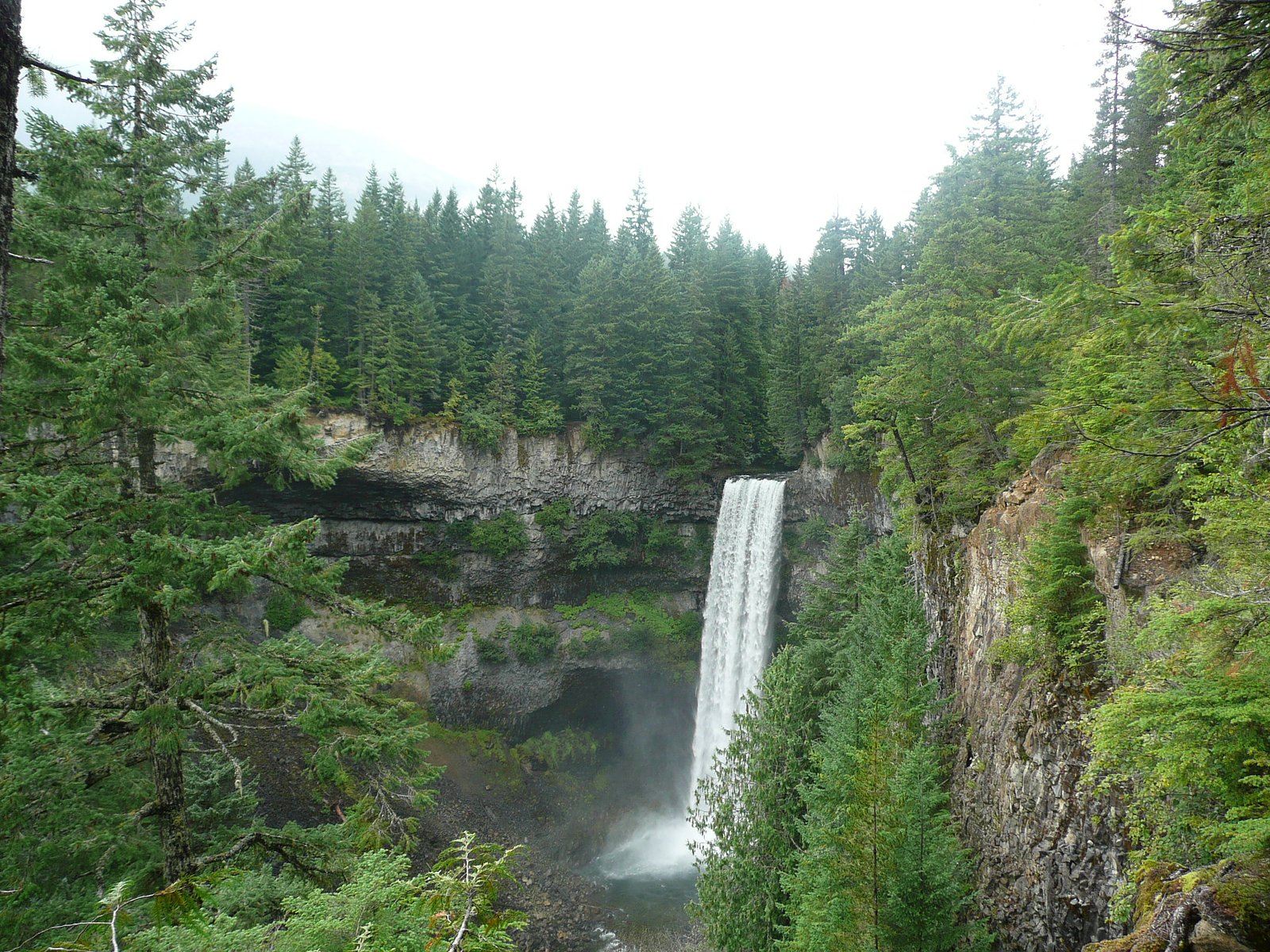
Crooked Falls
British Columbia • 60 m
By Armen Suny · Last verified Jun 2026
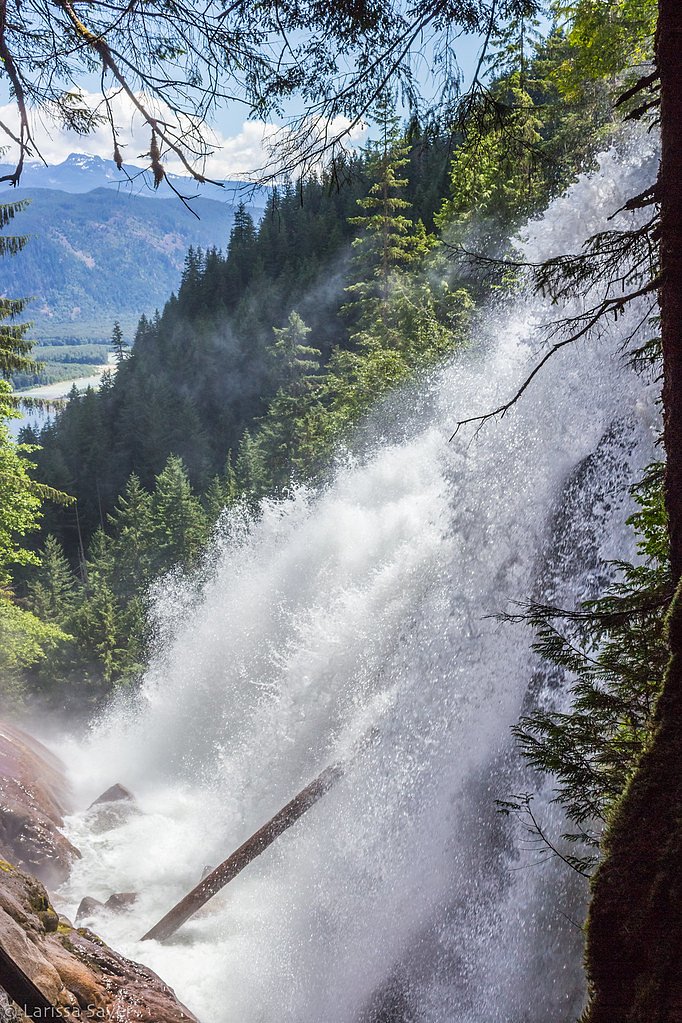
Photo Credits (2)
Difficulty
Moderate
Trail Length
6.4 km
Trail Type
Out And Back
Elevation Gain
427 m
About Crooked Falls
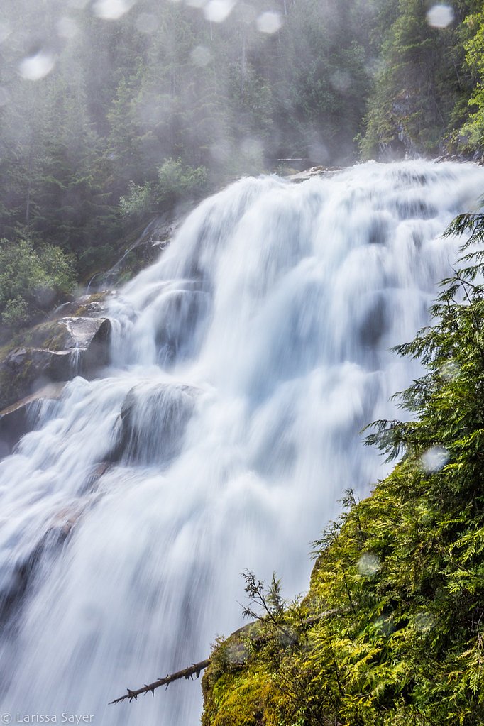
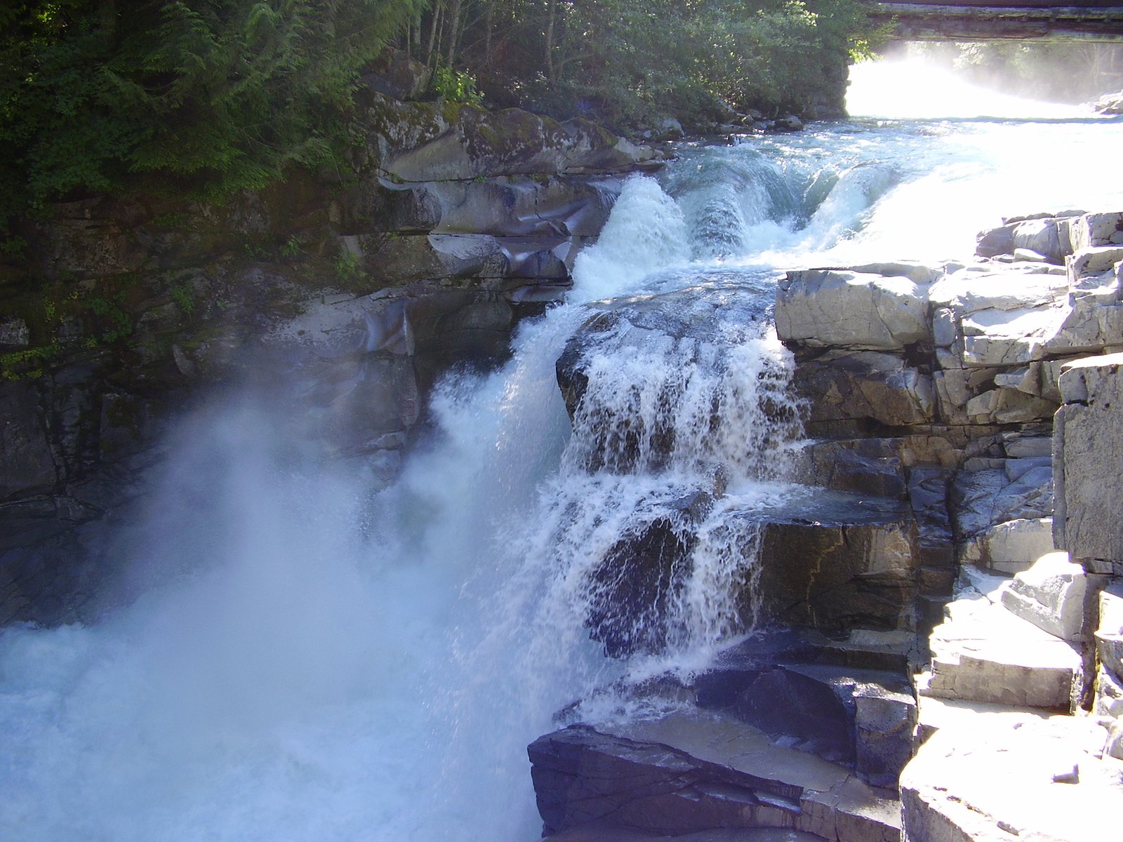
Crooked Falls is a small-to-moderate cascade-style waterfall located in the coastal temperate rainforest north of Vancouver, BC (approx. 39.7 miles / ~64 km from downtown Vancouver). The falls drop through a forested stream channel with multiple cascades and pools; flow is highly seasonal and typically strongest in spring snowmelt and after fall/winter rains. Exact height and official naming/park status for this specific coordinate (49.8974, -123.3244) are not confirmed, details below use cautious language where sources are uncertain.
The Setting
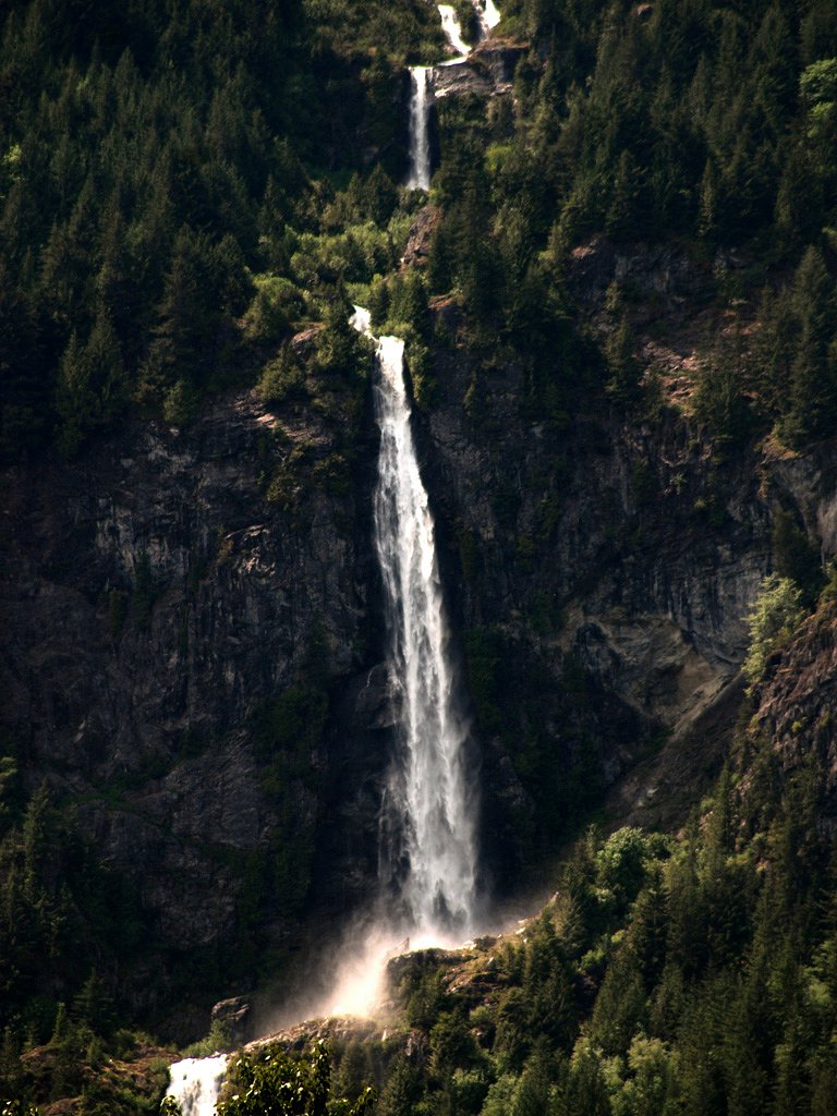
Crooked Falls sits at 469 metres within ESTÉ-TIWILH/SIGURD CREEK CONSERVANCY, in the hills of British Columbia. At 60 metres, it is among the taller waterfalls in British Columbia.
Why This Waterfall Exists
Crooked Falls flows over hard intrusive rock laid down about 145-162 million years ago. These resistant rocks form a durable ledge that water cannot easily wear away, creating a 197-foot drop where softer material downstream has already eroded.
Nearby Falls Worth Visiting
Madden Falls (579 m) lies 1.1 kilometres to the southeast. Also nearby: Phantom Falls (100 m, 12.4 km) and Brandywine falls (70 m, 21.2 km).
Trail & Hike Details
The Approach
The moderate 6.4-km out-and-back trail gains 427 metres of elevation on the way to the falls.
Trail Description
Access to Crooked Falls typically follows a forested trail that parallels a creek or branches up to a terrace above the stream. Trails in this area often include rooted, often muddy tread, occasional short steep sections and possibly one or more small creek crossings. There may be informal social trails close to the falls for viewpoints; these can be steep and slippery. Expect a relatively short approach from the nearest parking area if the falls are a local feature, but exact trail length and technical difficulty are not confirmed here.
What to Expect
The falls plunge 60 metres over hard intrusive rock.
Accessibility
The trail involves steep, uneven terrain with significant elevation change and is not accessible to mobility devices.
Frequently Asked Questions
🐶 Are Dogs Allowed at Crooked Falls?
❌ Dogs are not allowed
Are There Any Fees or Permits Required?
🆖 No fees required
🏊 Is There Swimming at Crooked Falls?
❌ Swimming is not allowed
When to Visit
Late spring (snowmelt) and fall/early winter after rains typically provide the best water flow. Summer can be pleasant for drier, more stable trail conditions but flows may be lower. Winter can create icy conditions, only attempt with proper equipment and local knowledge.
Seasonal Access
The best time to visit is Spring, Summer, Fall, and Winter. Check with the managing park or local authority for current conditions.
Safety Information
Hazards may include slippery wet rock, steep or unstable banks, fast water, sudden flow changes after rain, limited cell reception, and wildlife encounters. Do not stand on or below unstable ledges or attempt to climb cascades. Wear appropriate footwear, avoid alcohol or risky behavior near water, and let someone know your route and expected return time. If uncertain about conditions, choose an alternate, better-documented destination.
Current Water Conditions
10.6 m³/s
Current discharge — how much water is flowing
Lower than usual for this time of year
Based on 33 years of record
2.96 m
Water depth at gauge
7-Day Discharge Trend
What does this mean for your visit?
Flow is lower than usual for this time of year.
About This Gauge
This gauge is on a nearby waterway and may not reflect exact conditions at the falls.
7-Day Flow Outlook
Based on the WSC gauge CLOWHOM RIVER NEAR CLOWHOM LAKE (14 km away).
Today
Low
11 m³/s
6/10Tomorrow
Low
11 m³/s
5/10Tue
Low
10 m³/s
5/10Wed
Low
10 m³/s
5/10Thu
Low
11 m³/s
5/10Fri
Low
12 m³/s
4/10Sat
Low
11 m³/s
4/10Best window: Today — low flow, sunny (trip score 6/10).
Best time of year: this gauge typically runs highest from early May to late July, peaking in June.
How we calculate this
This is a transparent outlook, not a precise forecast. We take the waterfall's current flow strength (how it ranks against its historical normal for today, from the nearest WSC stream gauge), carry that ranking forward along the gauge's seasonal curve, and nudge it for forecast rain. Confidence is highest for the next day or two and falls further out. Always check official conditions and your own judgment before visiting — high flows can be dangerous.
Know when to go.
Get a free email alert when waterfalls near Vancouver hit peak flow. We only send when conditions are worth the trip — no weekly newsletters, no spam.
Weather Forecast
Location & Access
Getting There
General approach: travel north from Vancouver via the appropriate regional highway (Sea-to-Sky/Highway 99 or local routes depending on final segment). The provided coordinates (49.8974, -123.3244) place the falls in a forested area north of Vancouver; the last part of access is likely on a short forest or municipal trail from a small trailhead or roadside parking. Exact turn-by-turn directions and the official trailhead location should be confirmed with local maps or a trusted hiking resource prior to travel.
Get Directions on Google MapsParking
Parking may be limited to a small trailhead lot or roadside pullout. Expect minimal to no facilities (no guaranteed toilets or potable water). Park legally and avoid blocking gates or private driveways. On busy weekends spaces may fill quickly.
Elevation
469 metres above sea level
Coordinates
49.897429° N, -123.324383° W
Land Management
Managed by Government of British Columbia
Visitor Tips & Gear
• Confirm exact trailhead and current access conditions with local resources before you go (municipal parks, BC Parks, or local hiking sites). • Wear sturdy, waterproof footwear with good traction; expect mud and wet rocks. • Bring a map, GPS coordinates, or offline maps, cell reception may be unreliable. • Respect private property and posted signs. Do not park in gated or restricted areas. • Avoid climbing on wet rock ledges near the falls; falls and fast water are hazardous. • Pack out everything you bring in; no guaranteed waste facilities. • If visiting in bear country, carry bear deterrents and follow local wildlife safety guidance.
As an Amazon Associate, we earn from qualifying purchases.
With 6.4 km and 427 m of elevation gain, sturdy boots and trekking poles will help on this moderate trail. Icy conditions are common in winter — traction cleats are a smart addition.

Columbia Watertight II Rain Jacket
Packs into its own pocket, seam-sealed, and keeps you dry from spray and surprise rain.

Polarized Sunglasses (Knockaround)
Cuts glare off the water so you actually see the falls — and your photos turn out better too.

Earth Pak Waterproof Dry Bag
Keeps your phone and gear dry when waterfall mist soaks everything else.

Waterproof Phone Pouch (AiRunTech)
Cheap insurance — take photos right next to the falls without killing your phone.

Timberland Euro Sprint Mid Waterproof
Trusted waterproof boot with premium leather and grippy rubber sole — reliable on rocky, wet trails.

TrailBuddy Trekking Poles
Lightweight aluminum, cork grips, and flip-locks that actually hold — a best-seller for good reason.
Where to Stay
Browse vacation cabins and private rentals nearby
Unique outdoor stays — tents, yurts, and treehouses
Rent a campervan or RV for your waterfall road trip
Some links are affiliate links. We may earn a commission at no extra cost to you.
Nearby Campground
Squamish Riverside Campground
2.9 km away
Additional Information
Nearby Attractions
This area of coastal BC commonly features other waterfalls, day hikes, provincial parks and viewpoints along the Sea-to-Sky corridor and surrounding recreation areas. Notable nearby destinations in the broader region may include larger, well-known falls and provincial park trails, consult local maps for exact proximities.
Wildlife
Typical wildlife in coastal British Columbia forests: black bears, coyotes, deer, small mammals, and a variety of birds and amphibians. Mosquitoes and biting insects may be present in warmer months. Be cautious and follow standard wildlife-safety practices.
Cities near Crooked Falls
Nearby Waterfalls
Other waterfalls named Crooked Falls
1 other waterfall shares this name across Canada.
Writing about Crooked Falls? Embed this waterfall on your site for free.