Brandywine falls
British Columbia • 70 m
By Armen Suny · Last verified Jun 2026
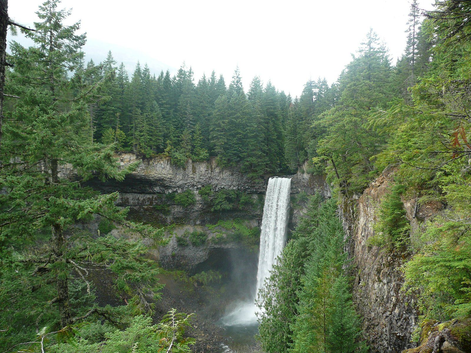
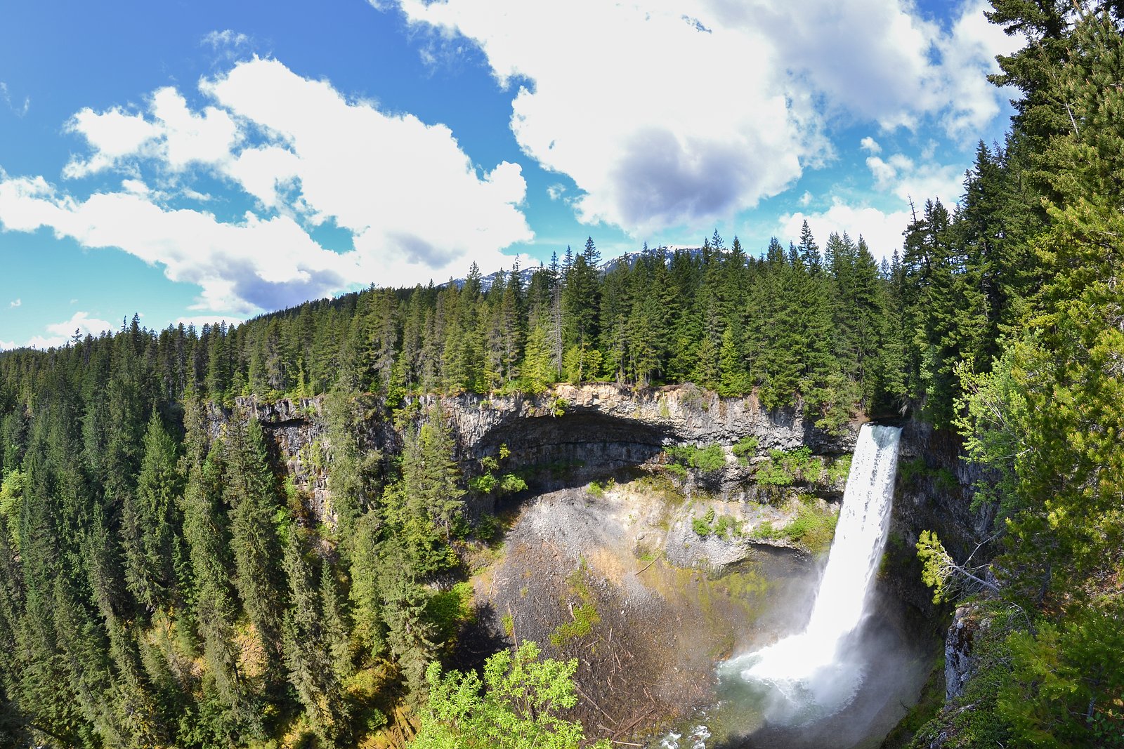
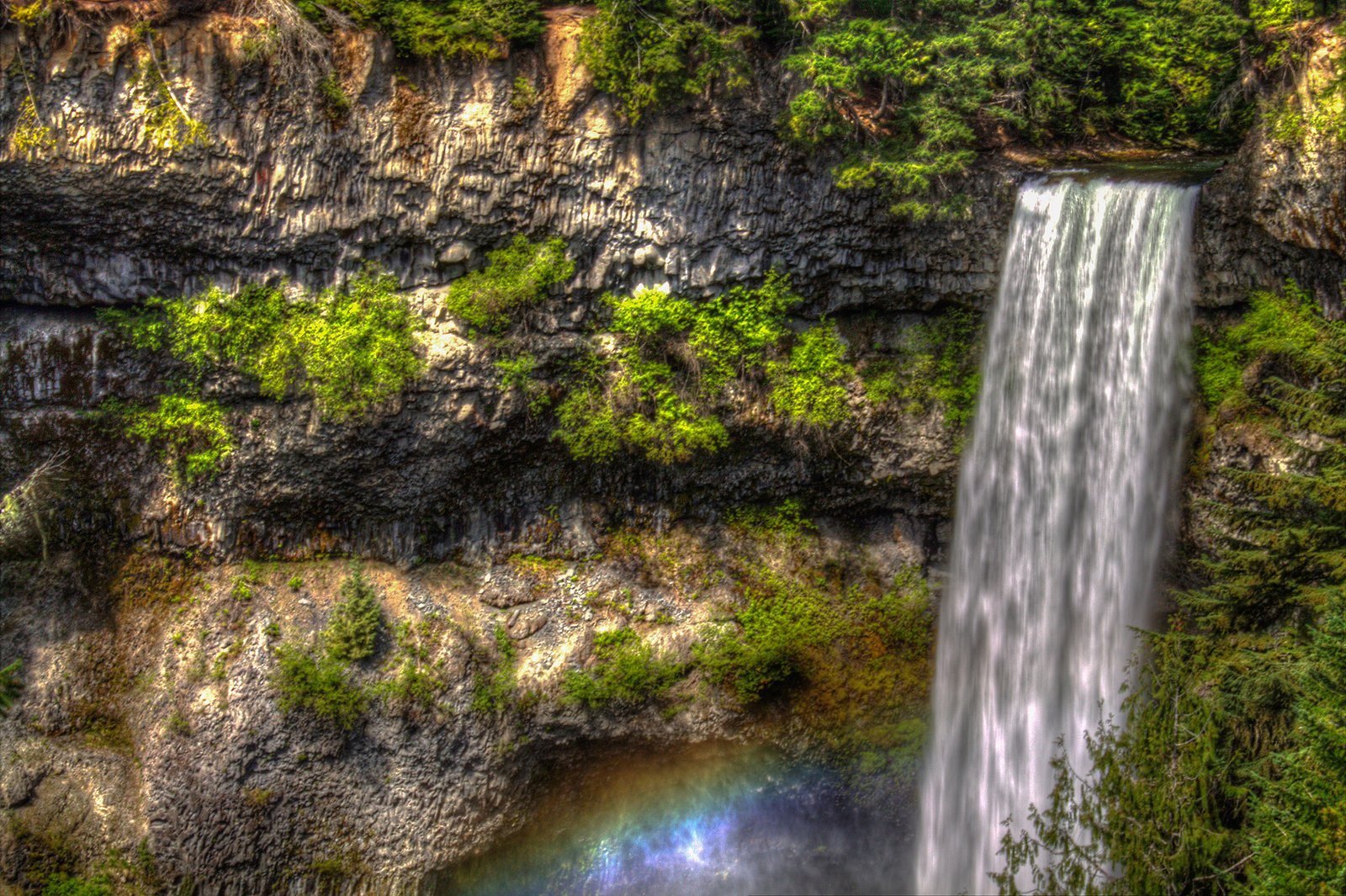
Photo Credits (5)
Difficulty
Easy
Trail Length
1.1 km
Trail Type
Out And Back
Elevation Gain
54 m
About Brandywine falls
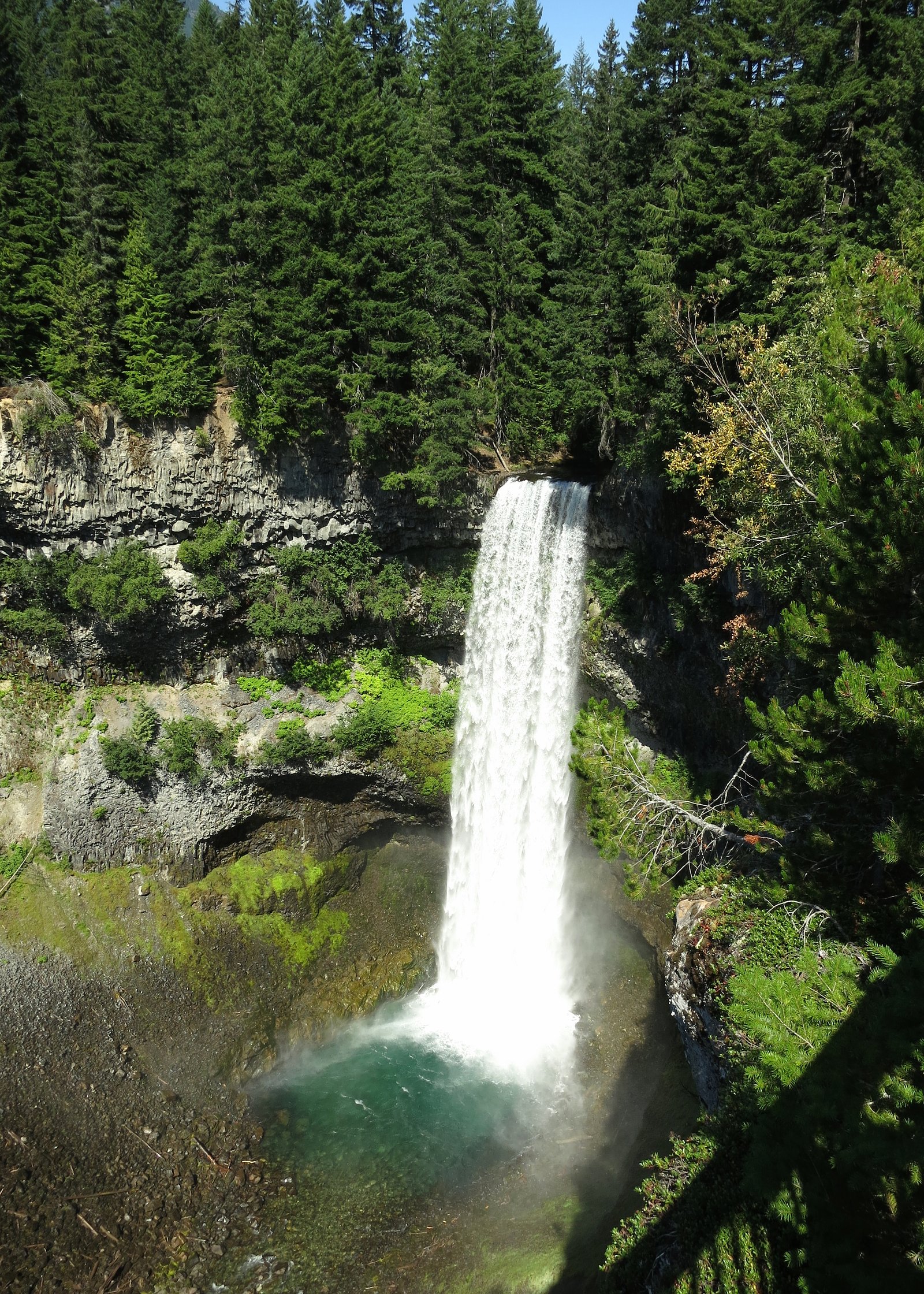
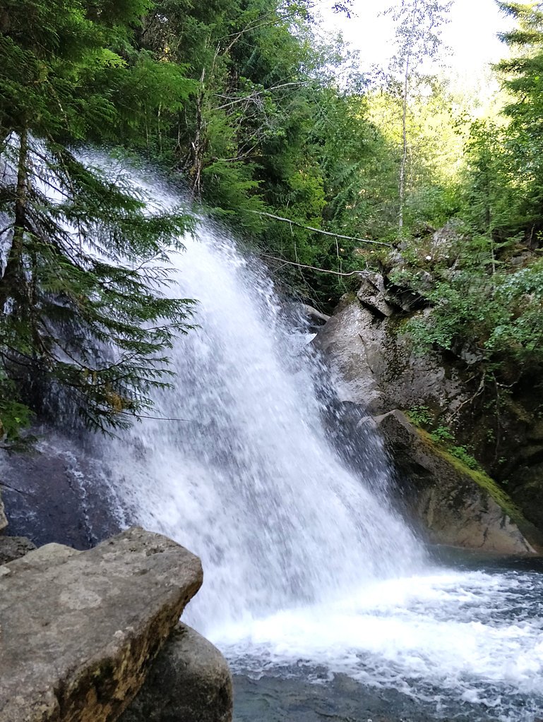
Brandywine Falls is a dramatic plunge waterfall on Brandywine Creek in Brandywine Falls Provincial Park, located on the Sea-to-Sky corridor between Squamish and Whistler, BC. The falls drop over a volcanic basalt ledge into a deep, forested canyon. A short, well-maintained trail and boardwalk lead to an elevated viewing platform with interpretive panels. Flow is typically highest in spring during snowmelt; the site is scenic year-round but conditions vary with season.
The Setting
Brandywine falls sits at 483 metres in the hills of British Columbia. At 70 metres, it is among the taller waterfalls in British Columbia.
Why This Waterfall Exists
Brandywine falls flows over hard volcanic rock laid down about 101-145 million years ago. These resistant rocks form a durable ledge that water cannot easily wear away, creating a 230-foot drop where softer material downstream has already eroded.
Nearby Falls Worth Visiting
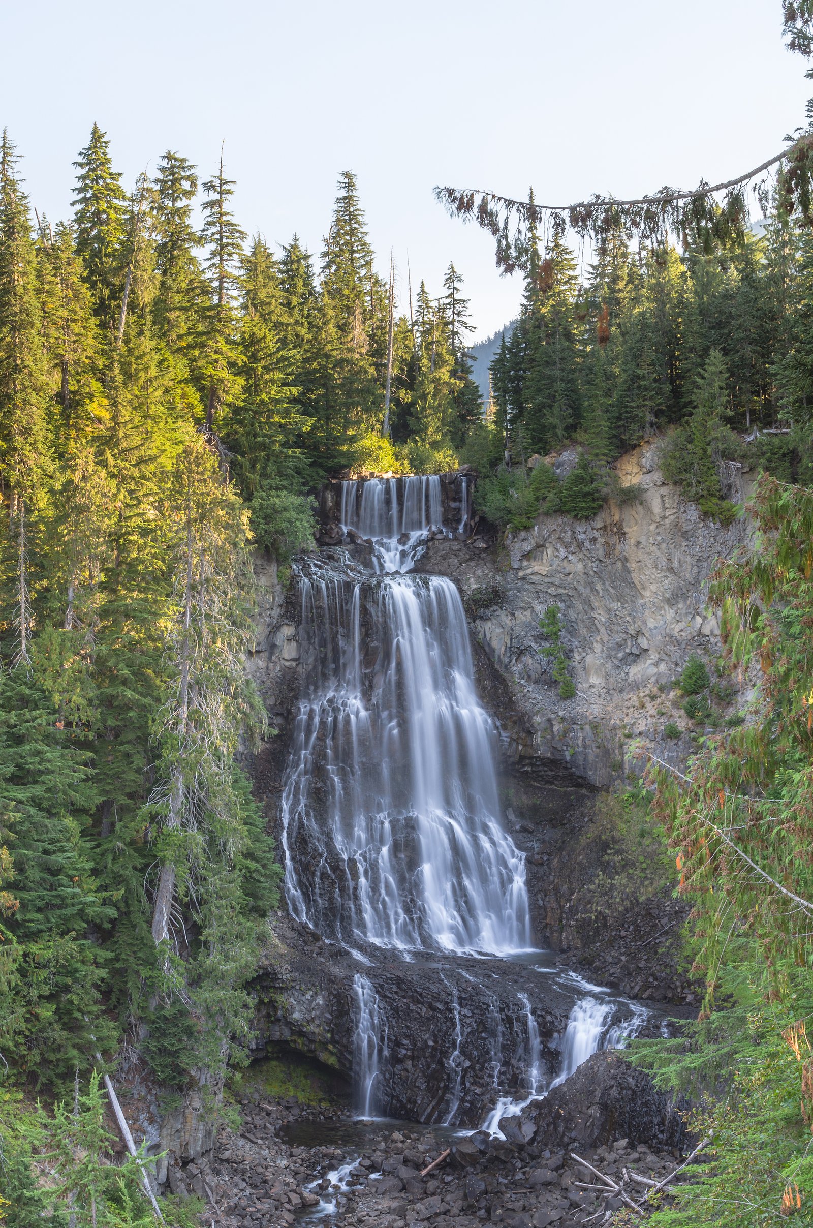
Alexander Falls (43 m) lies 10.9 kilometres to the north. Also nearby: Rainbow Falls (29 m, 13.8 km).
Trail & Hike Details
The Approach
The easy 1.1-km out-and-back trail gains 54 metres of elevation on the way to the falls.
Trail Description
The trail from the parking lot is short and well-maintained with boardwalk sections, interpretive signs and a viewing platform overlooking the falls and canyon. There are some stairs and short inclines; surfaces can be muddy or icy depending on season. The primary viewpoint provides a safe overlook of the main plunge; venturing off the marked trail or below the falls is dangerous and discouraged.
What to Expect
The falls plunge 70 metres over hard volcanic rock.
Accessibility
The trail is short and relatively flat, but the surface may be uneven. Contact the managing agency for accessibility details.
Frequently Asked Questions
🐶 Are Dogs Allowed at Brandywine falls?
❌ Dogs are not allowed
Are There Any Fees or Permits Required?
🆖 No fees required
🏊 Is There Swimming at Brandywine falls?
❌ Swimming is not allowed
When to Visit
Spring (snowmelt months) for highest flows and dramatic water. Summer for reliable access and warmer weather. Fall for foliage and lower crowds. Winter for icy/frozen scenery if you are prepared for cold and slippery conditions.
Seasonal Access
The best time to visit is Spring, Summer, Fall, and Winter. Check with the managing park or local authority for current conditions.
Safety Information
Hazards include steep, slippery or unstable cliff edges, strong currents and cold water, falling rock in the canyon, muddy or icy trail surfaces in wet/winter seasons, and limited parking at peak times. Stay on marked trails, respect barriers, supervise children closely, keep dogs leashed, and wear appropriate footwear. Cell service may be limited in parts of the corridor. In winter, expect icy conditions and dress accordingly.
Current Water Conditions
31.9 m³/s
Current discharge — how much water is flowing
Much lower than usual for this time of year
Based on 43 years of record
2.43 m
Water depth at gauge
7-Day Discharge Trend
What does this mean for your visit?
Flow is well below normal for this time of year, so the waterfall may be a trickle.
About This Gauge
7-Day Flow Outlook
Based on the WSC gauge CHEAKAMUS RIVER ABOVE MILLAR CREEK (8 km away).
Today
Barely Flowing
32 m³/s
4/10Tomorrow
Barely Flowing
33 m³/s
4/10Tue
Barely Flowing
34 m³/s
4/10Wed
Barely Flowing
36 m³/s
4/10Thu
Barely Flowing
34 m³/s
4/10Fri
Barely Flowing
36 m³/s
3/10Sat
Low
36 m³/s
4/10Best window: Today — barely flowing flow, cloudy (trip score 4/10).
Best time of year: this gauge typically runs highest from late May to late August, peaking in July.
How we calculate this
This is a transparent outlook, not a precise forecast. We take the waterfall's current flow strength (how it ranks against its historical normal for today, from the nearest WSC stream gauge), carry that ranking forward along the gauge's seasonal curve, and nudge it for forecast rain. Confidence is highest for the next day or two and falls further out. Always check official conditions and your own judgment before visiting — high flows can be dangerous.
Weather Forecast
Location & Access
Getting There
From Highway 99 (Sea-to-Sky Hwy) follow the signed turnoff for Brandywine Falls Provincial Park between Squamish and Whistler. There is a paved park entrance and a small day-use parking area. The site is roadside and well signed from the highway.
Get Directions on Google MapsParking
Small paved day-use parking lot at the trailhead. Parking can fill on busy summer and weekend days; avoid blocking the highway or pullouts. No confirmed overnight parking facilities.
Elevation
483 metres above sea level
Coordinates
50.036354° N, -123.119689° W
Visitor Tips & Gear
Arrive early on weekends and in summer to secure parking. Stay on marked trails and behind railings, cliff edges and unstable banks are hazardous. Wear sturdy shoes; trails may be muddy or icy. Check road and weather conditions in winter; bring microspikes if icy. Keep dogs under control and clean up after pets. Do not attempt to descend into the canyon or swim near the falls.
As an Amazon Associate, we earn from qualifying purchases.
For this easy 1.1 km trail, lightweight trail shoes and a water bottle are usually sufficient. Icy conditions are common in winter — traction cleats are a smart addition.

Columbia Watertight II Rain Jacket
Packs into its own pocket, seam-sealed, and keeps you dry from spray and surprise rain.

Polarized Sunglasses (Knockaround)
Cuts glare off the water so you actually see the falls — and your photos turn out better too.

Earth Pak Waterproof Dry Bag
Keeps your phone and gear dry when waterfall mist soaks everything else.

Waterproof Phone Pouch (AiRunTech)
Cheap insurance — take photos right next to the falls without killing your phone.

Kahtoola MICROspikes
Cult-favorite traction cleats that grip ice and wet rock — essential for winter waterfall hikes.

JOBY GorillaPod Starter Kit
Wraps around railings and rocks for long-exposure waterfall shots — no flat surface needed.
Where to Stay
Browse vacation cabins and private rentals nearby
Unique outdoor stays — tents, yurts, and treehouses
Rent a campervan or RV for your waterfall road trip
Some links are affiliate links. We may earn a commission at no extra cost to you.
Nearby Campground
Cal Cheak South Camp
2.9 km away
Additional Information
Nearby Attractions
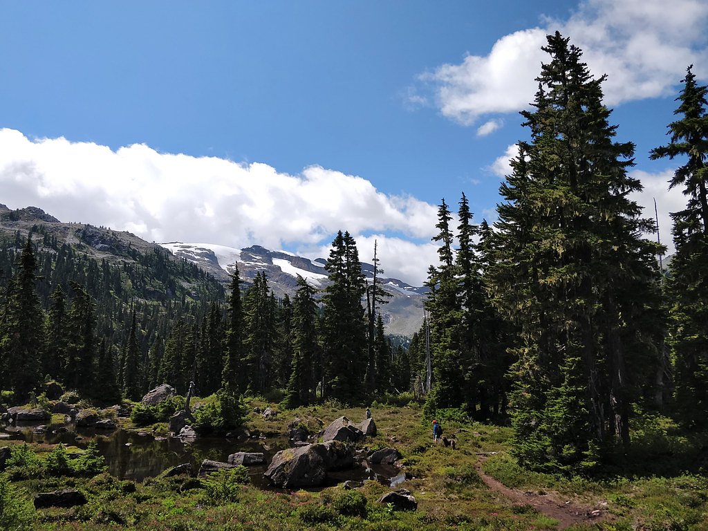
Whistler village, Callaghan Valley trails, Daisy Lake/Recreational areas, Sea-to-Sky Gondola (Squamish), Shannon Falls Provincial Park are all in the general Sea-to-Sky corridor.
Wildlife
Common wildlife includes black bears, deer, small mammals and a variety of birds. Standard wildlife precautions apply (store food securely, keep distance, avoid surprising animals).
Nearby Waterfalls
Writing about Brandywine falls? Embed this waterfall on your site for free.