Phantom Falls
British Columbia • 100 m
By Armen Suny · Last verified Jun 2026
About Phantom Falls
Phantom Falls (coords: 49.8465, -123.4783) is a coastal temperate-rainforest waterfall on the British Columbia mainland Sunshine Coast region. Detailed, official trail information is limited. The falls appear to be seasonal to semi-perennial and are typically strongest in spring and after heavy rain. Access is not well-documented and may require travel on secondary or forestry roads and some route-finding. Visitors should treat descriptions here as provisional and confirm local conditions before traveling.
The Setting
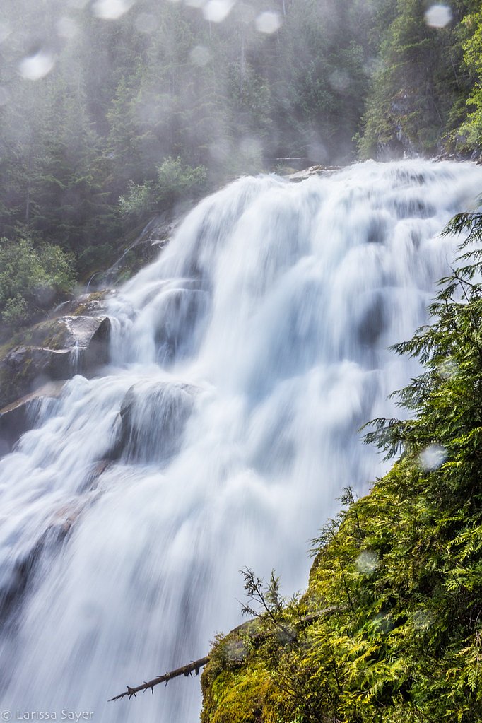
Phantom Falls sits at 733 metres within Old Growth Management Areas (Mapped Legal), in the hills of British Columbia. At 100 metres, it is among the taller waterfalls in British Columbia.
Why This Waterfall Exists
Phantom Falls flows over hard intrusive rock laid down about 66-101 million years ago. These resistant rocks form a durable ledge that water cannot easily wear away, creating a 328-foot drop where softer material downstream has already eroded.
Nearby Falls Worth Visiting
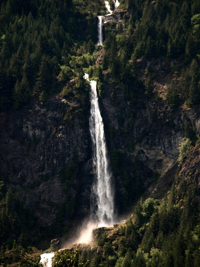
Madden Falls (579 m) lies 12.7 kilometres to the east. Also nearby: Crooked Falls (60 m, 12.4 km) and Ashlu Falls (10 m, 12.9 km).
Trail & Hike Details
Trail Description
There is no widely published, maintained trail description for Phantom Falls at these coordinates. Reports indicate access may require travel down unmarked or faint user paths, possible short bushwhacks, and negotiating steep or muddy sections near the creek and falls. Route-finding skills, sturdy footwear, and caution around wet, mossy rock are advised. If you rely on logging or service roads, those may be gated or seasonally closed.
What to Expect
The falls plunge a dramatic 100 metres over hard intrusive rock.
Accessibility
Likely not accessible for people with limited mobility. Approach appears to be on rough, uneven, and possibly steep terrain with no developed infrastructure.
Frequently Asked Questions
🐶 Are Dogs Allowed at Phantom Falls?
❌ Dogs are not allowed
Are There Any Fees or Permits Required?
🆖 No fees required
🏊 Is There Swimming at Phantom Falls?
❌ Swimming is not allowed
When to Visit
Late winter through spring (high flows) or late spring to early summer after rains typically provide the most impressive flow. Summer can be drier and the waterfall may be reduced. Avoid visiting right after heavy rain without experience on slippery terrain.
Seasonal Access
The best time to visit is Spring, Summer, and Fall. Winter access may be limited. Check with the managing park or local authority for current conditions.
Safety Information
Hazards may include slippery and mossy rock, steep drop-offs, unstable ledges, flashier flows after rain, cold water temperatures, rough or gated forestry roads, limited or no cell service, and wildlife encounters. Use caution around edges, avoid going onto wet rocks, do not attempt technical climbs without proper gear and experience, and check local conditions and permissions before accessing. Bring emergency supplies and leave an itinerary with someone.
Current Water Conditions
10.6 m³/s
Current discharge — how much water is flowing
Lower than usual for this time of year
Based on 33 years of record
2.96 m
Water depth at gauge
7-Day Discharge Trend
What does this mean for your visit?
Flow is lower than usual for this time of year.
About This Gauge
7-Day Flow Outlook
Based on the WSC gauge CLOWHOM RIVER NEAR CLOWHOM LAKE (8 km away).
Today
Low
11 m³/s
6/10Tomorrow
Low
11 m³/s
5/10Tue
Low
10 m³/s
5/10Wed
Low
10 m³/s
5/10Thu
Low
11 m³/s
5/10Fri
Low
12 m³/s
4/10Sat
Low
11 m³/s
4/10Best window: Today — low flow, mainly sunny (trip score 6/10).
Best time of year: this gauge typically runs highest from early May to late July, peaking in June.
How we calculate this
This is a transparent outlook, not a precise forecast. We take the waterfall's current flow strength (how it ranks against its historical normal for today, from the nearest WSC stream gauge), carry that ranking forward along the gauge's seasonal curve, and nudge it for forecast rain. Confidence is highest for the next day or two and falls further out. Always check official conditions and your own judgment before visiting — high flows can be dangerous.
Know when to go.
Get a free email alert when waterfalls near Vancouver hit peak flow. We only send when conditions are worth the trip — no weekly newsletters, no spam.
Weather Forecast
Location & Access
Getting There
The waterfall is on the BC mainland Sunshine Coast region (approximate straight-line distances: Vancouver ~43.7 miles, Powell River ~47.1 miles, Nanaimo ~52.6 miles). Reaching the area usually requires driving on the Sunshine Coast Highway (Highway 101) followed by secondary/forestry roads or hiking access; travel may involve ferry crossings depending on your start point. Exact public access points and an established trailhead are not well-documented, expect limited signage and possible private/industrial roads. Confirm route and road status locally before setting out.
Get Directions on Google MapsParking
Designated parking is not confirmed. There may be informal pullouts or small gravel/forestry road parking areas nearby. If parking on a road shoulder, choose a safe, legal spot out of the travel lane. Do not block gates or private driveways. Expect rough roads and limited facilities.
Elevation
733 metres above sea level
Coordinates
49.846492° N, -123.478324° W
Land Management
Managed by Government of British Columbia
Visitor Tips & Gear
• Check local maps and recent trip reports before you go; conditions and access can change. • Travel with a partner if possible and tell someone your route and expected return. • Wear waterproof hiking boots with good traction and bring trekking poles for slippery approaches. • Expect limited or no facilities (no toilets, no potable water). Pack out all trash. • Avoid cliff edges and wet rock near the falls; rocks are commonly slippery and unstable. • If the approach involves forestry roads, respect gates, private property, and posted notices. • Be bear-aware: carry bear spray where permitted and know how to use it.
Where to Stay
Browse vacation cabins and private rentals nearby
Unique outdoor stays — tents, yurts, and treehouses
Rent a campervan or RV for your waterfall road trip
Some links are affiliate links. We may earn a commission at no extra cost to you.
Nearby Campground
Squamish Riverside Campground
15.2 km away
Additional Information
Nearby Attractions
General Sunshine Coast attractions and towns (e.g., Gibsons, Sechelt, Powell River) and provincial parks on the Sunshine Coast; specific nearby named attractions to Phantom Falls at these coordinates are not well-documented. If traveling to the area, research local parks and trails for verified options.
Wildlife
Black bears, cougars, deer, small mammals, and numerous bird species including eagles and raptors. Salmon runs may occur in nearby streams depending on watershed. Take standard wildlife precautions.
Cities near Phantom Falls
Nearby Waterfalls
Other waterfalls named Phantom Falls
1 other waterfall shares this name across Canada.
Writing about Phantom Falls? Embed this waterfall on your site for free.