
Photo Credits (3)
Difficulty
Easy
Trail Length
4.0 km
Trail Type
Out And Back
Elevation Gain
52 m
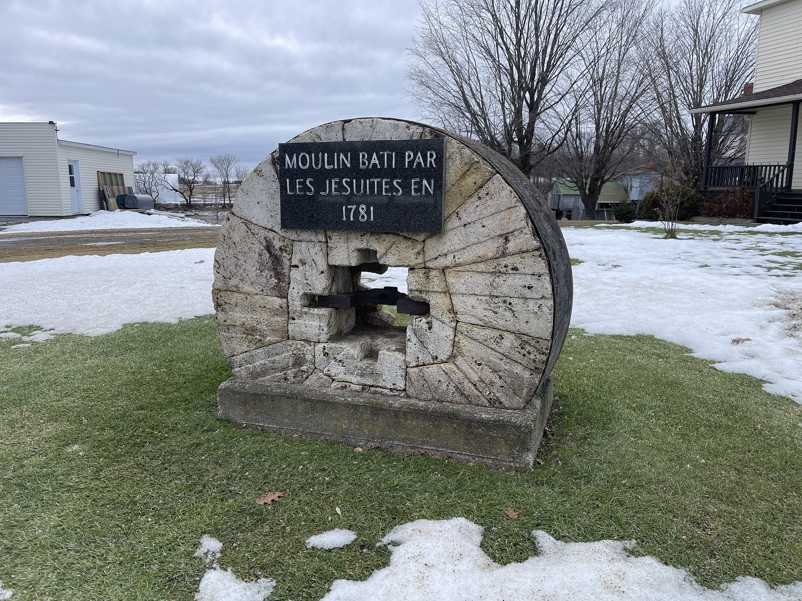
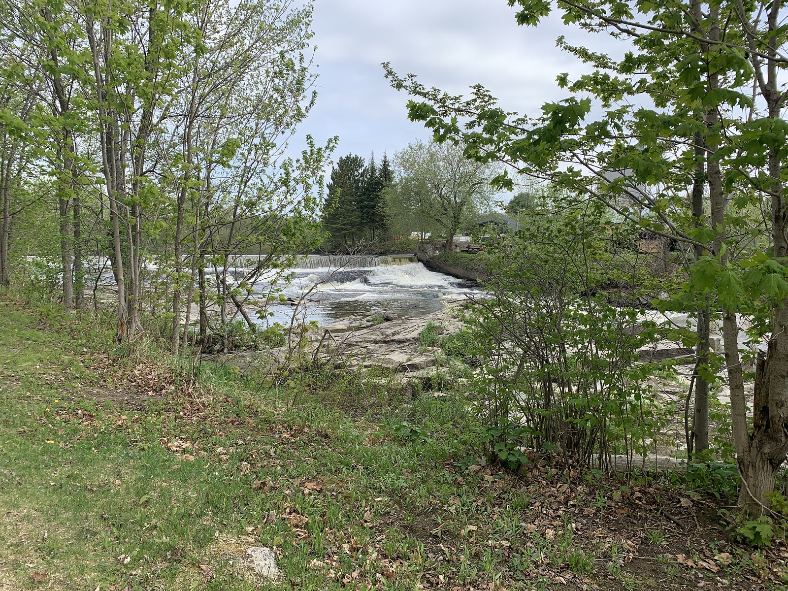
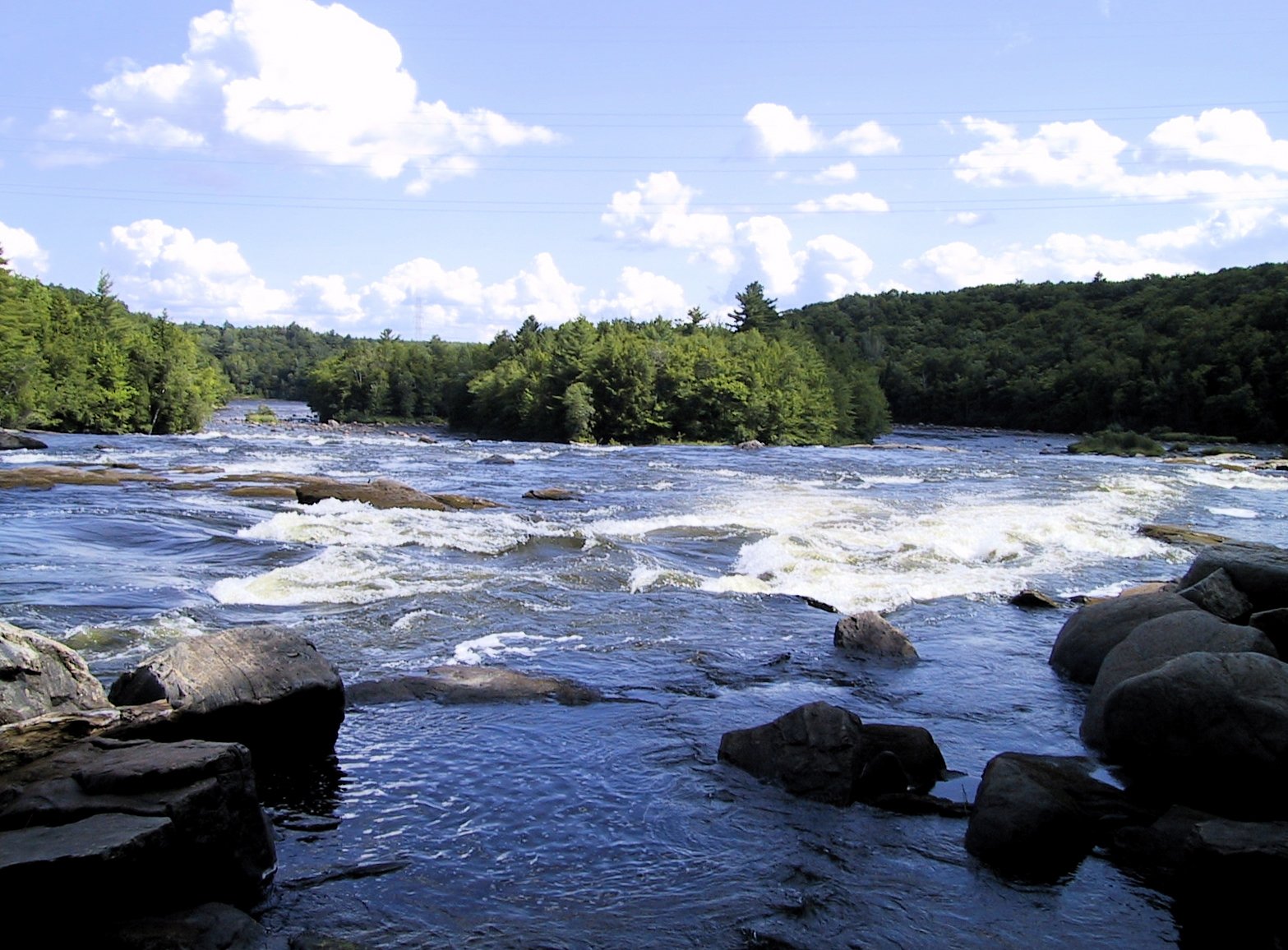
About Chute à Prince
Chute à Prince is a natural waterfall located in the Mauricie region of Quebec near Shawinigan-Sud. The falls sit in a forested, rural setting and can be reached from local roads; flow and appearance vary seasonally with highest flows in spring runoff. Detailed official descriptions of the falls are limited; visitors should consult local maps and recent trip reports for up-to-date access information.
Why This Waterfall Exists
Chute à Prince flows over hard crystalline rock laid down over 1.0-1.6 billion years ago. These resistant rocks form a durable ledge that water cannot easily wear away, creating the falls where softer material downstream has already eroded.
Trail & Hike Details
The Approach
The easy 4.0-km out-and-back trail gains 52 metres of elevation on the way to the falls.
Trail Description
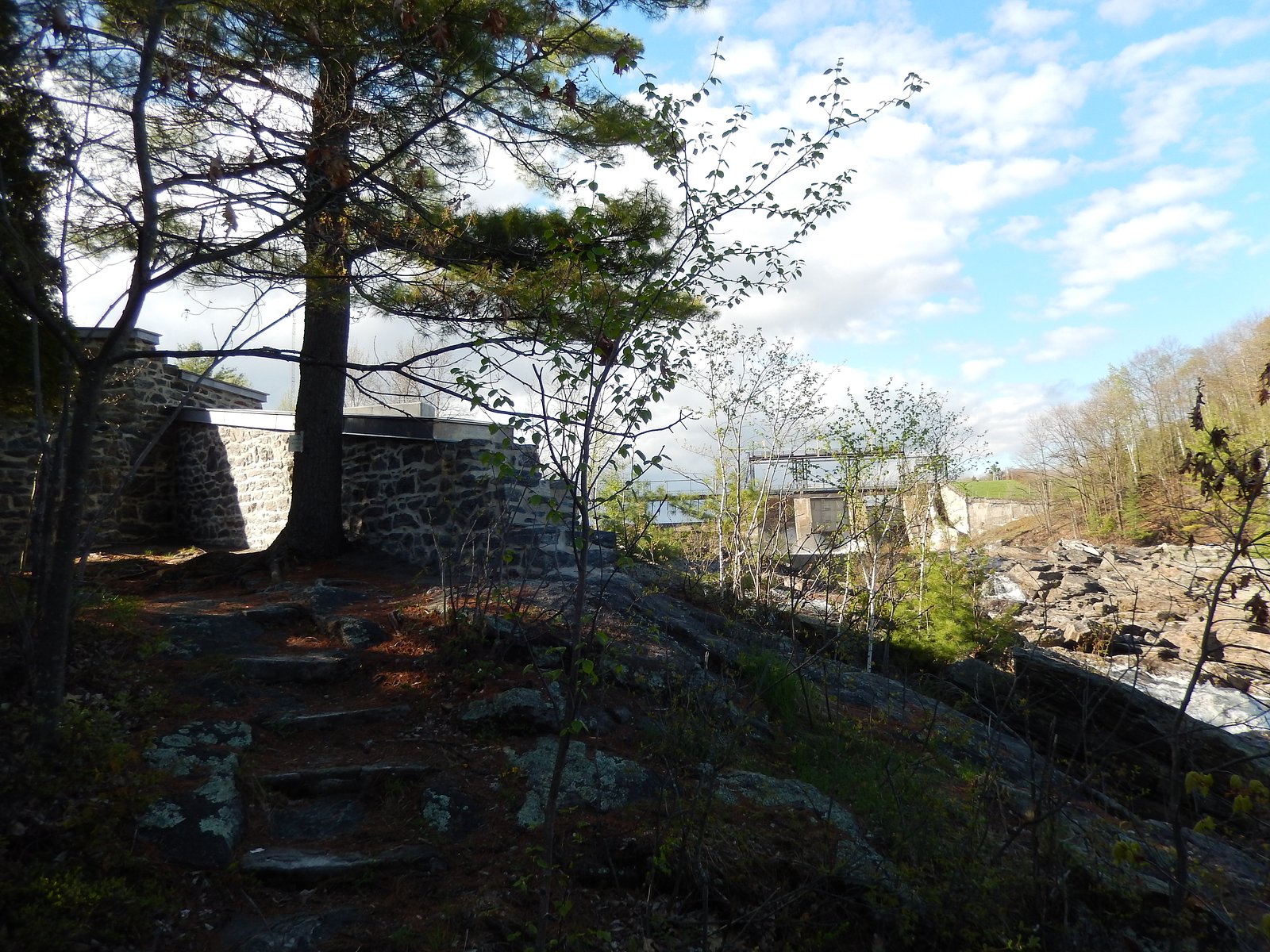
Trail and approach details are not consistently documented. Access may require a short walk from a roadside pullout over uneven, possibly unmaintained terrain. Trails (if present) can be narrow and may include roots, rocks, and wet sections. Expect limited signage and no developed boardwalks or viewing platforms unless noted locally.
What to Expect
A relatively small, scenic waterfall in a forested rural setting. Flow varies with season, highest in spring during snowmelt and after heavy rains, lower in late summer and early fall. No guaranteed facilities (restrooms, trash cans, or picnic infrastructure). Rocks and banks around the falls are likely slippery and can be steep. Cell coverage may be spotty depending on provider.
Accessibility
The trail is not wheelchair accessible. Uneven terrain and elevation changes require steady footing.
Frequently Asked Questions
🐶 Are Dogs Allowed at Chute à Prince?
❌ Dogs are not allowed
Are There Any Fees or Permits Required?
🆖 No fees required
🏊 Is There Swimming at Chute à Prince?
❌ Swimming is not allowed
When to Visit
Spring (late March–May) for highest flows and dramatic water volume. Early summer offers pleasant hiking conditions and fuller flow. Fall provides colorful foliage but lower flows; winter can produce ice formations but is more hazardous and requires winter gear.
Seasonal Access
The best time to visit is Spring, Summer, Fall, and Winter. Check with the managing park or local authority for current conditions.
Safety Information
Hazards may include slippery rocks and banks, steep drop-offs near the falls, cold water (risk of hypothermia), changing flow conditions after rains, limited cell service, and potential private property boundaries. Travel with a partner when possible, tell someone your plan, and avoid approaching the edge of the falls. In winter, ice near waterfalls can be unstable and unpredictable, exercise extreme caution and consider specialized equipment.
7-Day Flow Outlook
Based on the WSC gauge BATISCAN (RIVIERE) A 3,4 KM EN AVAL DE LA RIVIERE DES ENVIES (4 km away).
Best time of year: this gauge typically runs highest from early April to mid June, peaking in April.
How we calculate this
This is a transparent outlook, not a precise forecast. We take the waterfall's current flow strength (how it ranks against its historical normal for today, from the nearest WSC stream gauge), carry that ranking forward along the gauge's seasonal curve, and nudge it for forecast rain. Confidence is highest for the next day or two and falls further out. Always check official conditions and your own judgment before visiting — high flows can be dangerous.
Know when to go.
Get a free email alert when waterfalls near Shawinigan-Sud hit peak flow. We only send when conditions are worth the trip — no weekly newsletters, no spam.
Weather Forecast
Location & Access
Getting There
Coordinates: 46.617, -72.4007. The falls are located in the general Shawinigan/Trois-Rivières area (roughly 19–20 miles from Shawinigan-Sud and Trois-Rivières). Access is typically from local secondary roads; exact approach routes may vary and may require unpaved or forestry roads. Use a detailed map or GPS to navigate and confirm access before you go. Check with local municipal or park sources if unsure.
Get Directions on Google MapsParking
There may be limited or informal roadside parking near the trailhead or access point. Expect unmarked pullouts rather than a formal parking lot. Park legally and avoid blocking private driveways or forestry equipment access.
Elevation
111 metres above sea level
Coordinates
46.616987° N, -72.400696° W
Visitor Tips & Gear
• Check recent trip reports or contact local tourism/municipal offices for current access conditions. • Wear sturdy, waterproof footwear with good traction; rocks will be slippery. • Respect private property and posted signs, some access routes may cross private land. • Bring a paper map or offline GPS track in case of poor cell coverage. • Leave no trace: pack out what you bring in and avoid disturbing vegetation or stream banks.
As an Amazon Associate, we earn from qualifying purchases.
This easy 4.0 km hike is straightforward — comfortable trail shoes and plenty of water should do. Icy conditions are common in winter — traction cleats are a smart addition.

Columbia Watertight II Rain Jacket
Packs into its own pocket, seam-sealed, and keeps you dry from spray and surprise rain.

Polarized Sunglasses (Knockaround)
Cuts glare off the water so you actually see the falls — and your photos turn out better too.

Earth Pak Waterproof Dry Bag
Keeps your phone and gear dry when waterfall mist soaks everything else.

Waterproof Phone Pouch (AiRunTech)
Cheap insurance — take photos right next to the falls without killing your phone.

Kahtoola MICROspikes
Cult-favorite traction cleats that grip ice and wet rock — essential for winter waterfall hikes.

JOBY GorillaPod Starter Kit
Wraps around railings and rocks for long-exposure waterfall shots — no flat surface needed.
Where to Stay
Browse vacation cabins and private rentals nearby
Unique outdoor stays — tents, yurts, and treehouses
Rent a campervan or RV for your waterfall road trip
Some links are affiliate links. We may earn a commission at no extra cost to you.
Nearby Campground
Camping de la Rivière
3.7 km away
Additional Information
Nearby Attractions
Shawinigan and downtown attractions, Parc national de la Mauricie (national park with established trails and facilities), Trois-Rivières historic district. Distances to larger centers: Shawinigan-Sud ~19.2 miles, Trois-Rivières ~19.4 miles, Victoriaville ~45.8 miles (approx.).
Wildlife
Typical Mauricie-region wildlife may include various songbirds, waterfowl, beavers, white-tailed deer, and possibly moose. Observe wildlife from a distance and do not feed animals.
Cities near Chute à Prince
Nearby Waterfalls
Writing about Chute à Prince? Embed this waterfall on your site for free.