

Photo Credits (3)
About Chute à Goulet
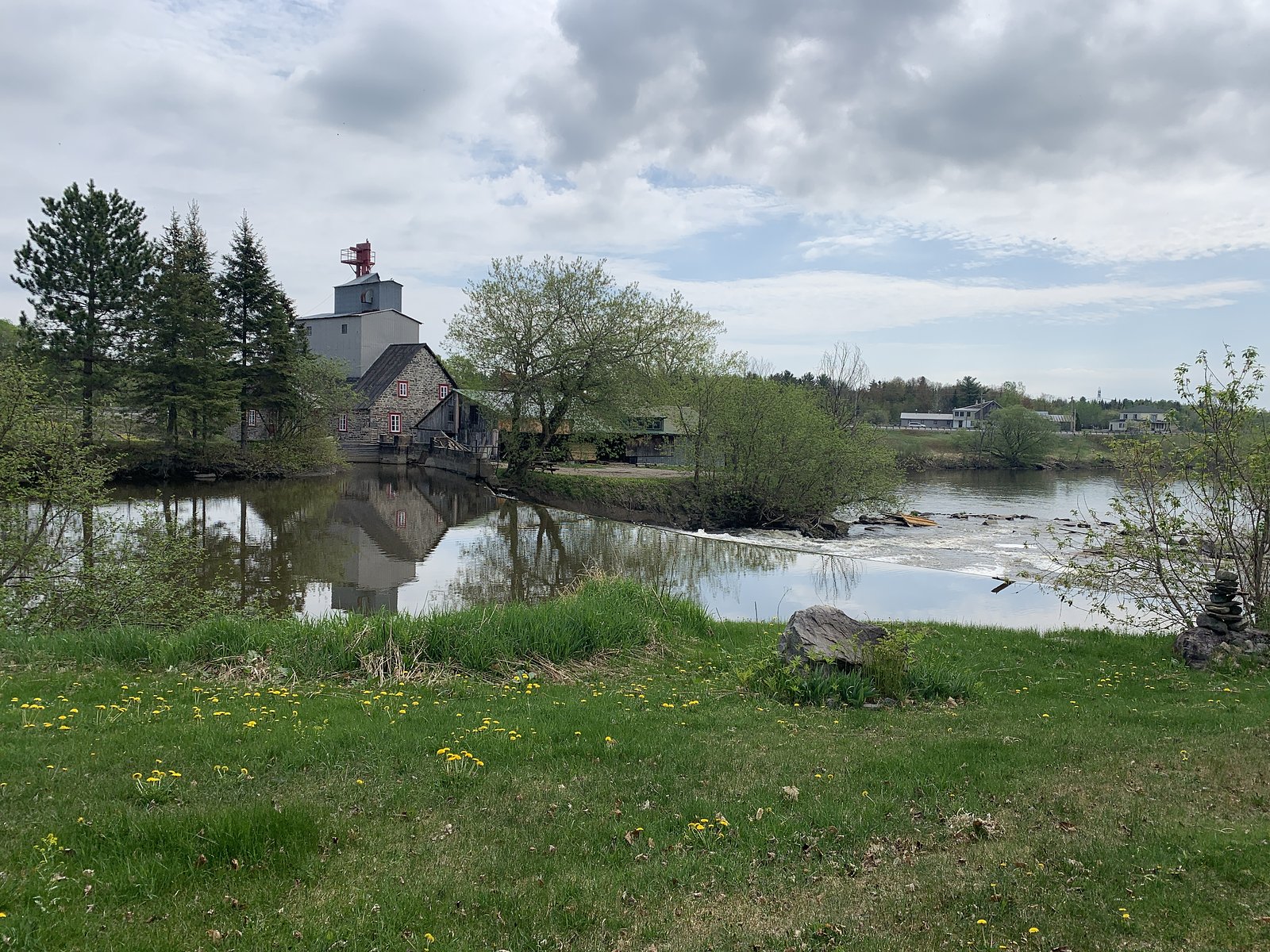
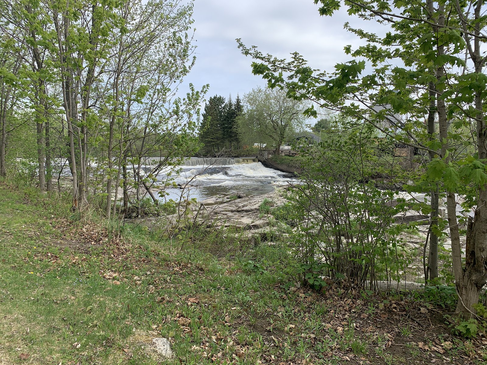
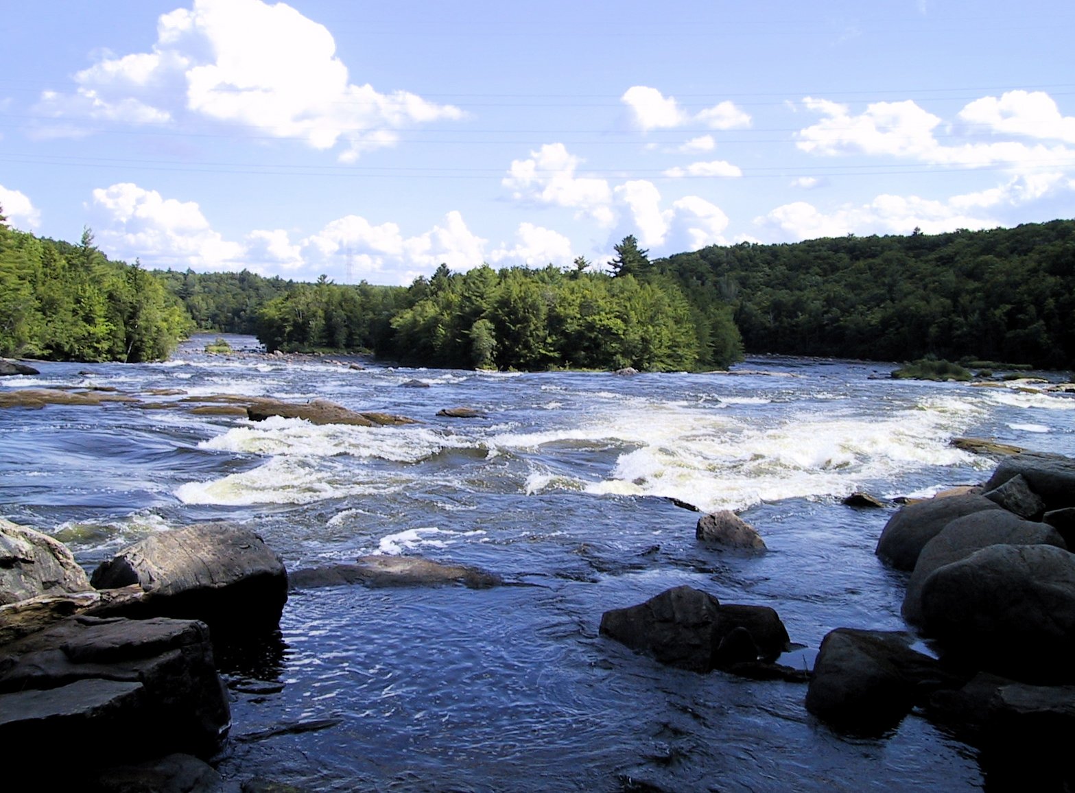
Chute à Goulet is a local waterfall in central Quebec near Shawinigan-Sud and Trois-Rivières (coordinates: 46.6228, -72.4087). It is a natural river chute likely set in a mixed forest and rocky stream channel typical of the region. Visitor reports and local maps describe it as a scenic spot popular with locals for short visits and seasonal photography. Specifics such as official name variants, exact drop, and river name may vary by map and landowner.
Why This Waterfall Exists
Chute à Goulet flows over hard crystalline rock laid down over 1.0-1.6 billion years ago. These resistant rocks form a durable ledge that water cannot easily wear away, creating the falls where softer material downstream has already eroded.
Trail & Hike Details
Trail Description
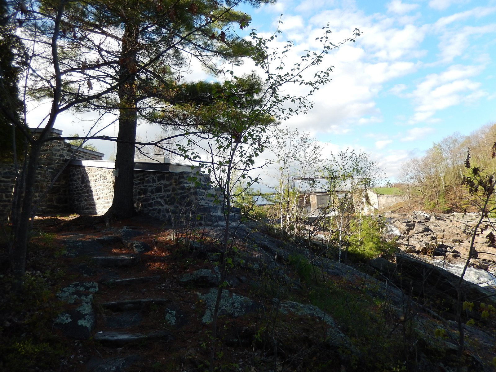
Trail information is not well documented in major trail databases. The approach to the chute is likely a short, informal path from a roadside parking/pullout. Trails in the area are commonly uneven, with exposed roots and rocks; expect an unmaintained or minimally maintained path. There may be short steep sections to reach viewpoints or the stream edge.
What to Expect
A natural river chute set among mixed forest and rock outcrops. Water flow will be highest in spring (snowmelt) and after heavy rains; summer flows may be lower but scenery remains attractive. There may be limited visitor infrastructure (no boardwalks, railings, or interpretive signs). Views may require stepping onto uneven, wet rocks. Winter conditions can produce ice formations and frozen falls but are potentially hazardous without proper gear.
Accessibility
Likely limited. The approach is expected to be on unpaved or uneven surfaces with steps or rock scrambles to viewpoints. Not suitable for wheelchairs or those requiring firm, even surfaces unless specific infrastructure is present (none documented).
Frequently Asked Questions
🐶 Are Dogs Allowed at Chute à Goulet?
❌ Dogs are not allowed
Are There Any Fees or Permits Required?
🆖 No fees required
🏊 Is There Swimming at Chute à Goulet?
❌ Swimming is not allowed
When to Visit
Late spring (peak runoff) for the fullest flow and dramatic photos. Early fall offers good water flow plus fall colors. Summer is pleasant for a short visit; winter can show ice features but carries added hazard and requires winter traction.
Seasonal Access
The best time to visit is Spring, Summer, Fall, and Winter. Check with the managing park or local authority for current conditions.
Safety Information
Potential hazards include slippery rocks, unstable riverbanks, fast-moving water, sudden changes in water level after rain, and ice in winter. Cell coverage may be limited. There are likely no lifeguards or emergency services immediately on site. Always stay on stable ground, maintain distance from the water edge, and do not climb on wet rock ledges. If someone is in danger, call local emergency services and provide coordinates if possible.
7-Day Flow Outlook
Based on the WSC gauge BATISCAN (RIVIERE) A 3,4 KM EN AVAL DE LA RIVIERE DES ENVIES (4 km away).
Best time of year: this gauge typically runs highest from early April to mid June, peaking in April.
How we calculate this
This is a transparent outlook, not a precise forecast. We take the waterfall's current flow strength (how it ranks against its historical normal for today, from the nearest WSC stream gauge), carry that ranking forward along the gauge's seasonal curve, and nudge it for forecast rain. Confidence is highest for the next day or two and falls further out. Always check official conditions and your own judgment before visiting — high flows can be dangerous.
Know when to go.
Get a free email alert when waterfalls near Shawinigan-Sud hit peak flow. We only send when conditions are worth the trip — no weekly newsletters, no spam.
Weather Forecast
Location & Access
Getting There
Located roughly 19 miles (≈30 km) from Shawinigan-Sud and Trois-Rivières (user-supplied distances). Access is by local secondary roads off the regional highway network. Expect to navigate rural roads and follow local signs or GPS coordinates (46.6228, -72.4087). If visiting from a nearby town, plan for a short drive on two-lane roads; cellphone coverage may be intermittent in places.
Get Directions on Google MapsParking
Parking details are not consistently documented. Visitors report limited roadside parking or a small unpaved pullout near the site. Park off the shoulder where permitted and avoid blocking private driveways or gates. If unsure, plan for a short additional walk from an informal parking area.
Elevation
109 metres above sea level
Coordinates
46.622756° N, -72.408732° W
Visitor Tips & Gear
• Wear sturdy, waterproof footwear with good traction, rocks around waterfalls are slippery. • Check recent weather and river conditions before visiting; flows can rise quickly after rain. • Respect private property, if there are fences or “no trespassing” signs, do not enter. • Bring insect repellent in spring/summer; ticks are possible in the region. • Pack out all trash; there may be no facilities on site. • If planning winter access, use ice cleats/traction and be cautious of hollow ice near edges.
Where to Stay
Browse vacation cabins and private rentals nearby
Unique outdoor stays — tents, yurts, and treehouses
Rent a campervan or RV for your waterfall road trip
Some links are affiliate links. We may earn a commission at no extra cost to you.
Nearby Campground
Camping de la Rivière
4.4 km away
Additional Information
Nearby Attractions
Regional attractions near Shawinigan and Trois-Rivières include urban viewpoints, local parks, and provincial/national parks in the broader Mauricie/Trois-Rivières area. Parc national de la Mauricie and downtown Trois-Rivières are regional destinations, but confirm exact distances and travel times from Chute à Goulet.
Wildlife
Typical wildlife for central Quebec includes white-tailed deer, beaver, small mammals, a variety of forest birds, and occasional black bear. Watch for ticks in warmer months. Keep a safe distance from wildlife.
Cities near Chute à Goulet
Nearby Waterfalls
Writing about Chute à Goulet? Embed this waterfall on your site for free.