Photo Credits (5)
Difficulty
Easy
Trail Length
1.0 km
Trail Type
Out And Back
Elevation Gain
21 m
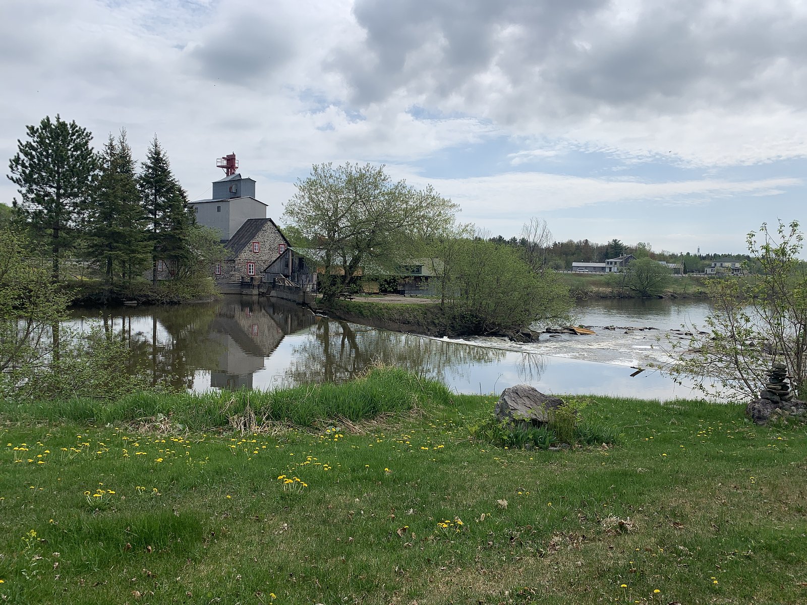
About La Marmite
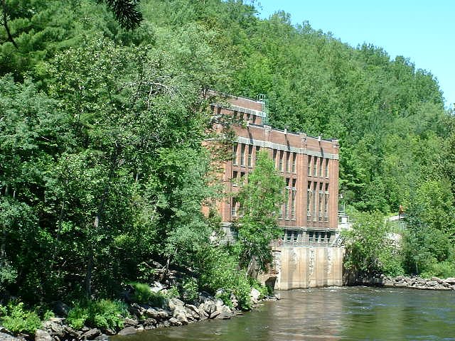
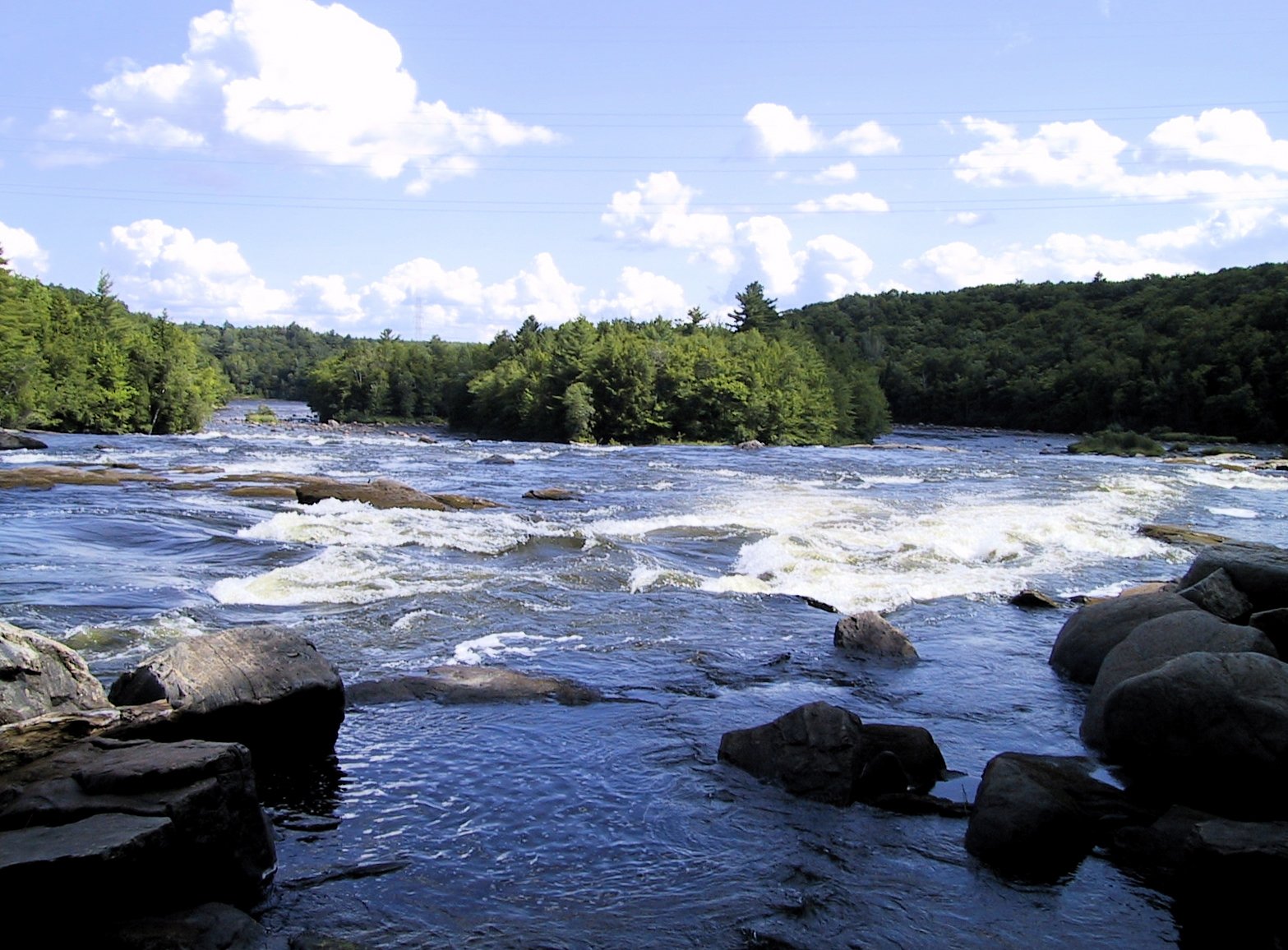
La Marmite is a small natural waterfall feature near Shawinigan-Sud in central Quebec (approx. coordinates 46.5514, -72.4101). The name (French for “the cauldron” or “kettle”) suggests a pothole or plunge pool formation; the waterfall typically has stronger flow in spring runoff and lower flow in late summer. This site is relatively natural and undeveloped, expect limited facilities and informal trails. Specific published measurements for vertical drop are not readily available and may vary by season.
Why This Waterfall Exists
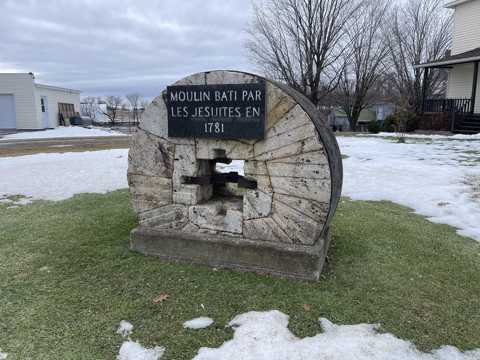
La Marmite flows over layered sedimentary rock laid down about 444-458 million years ago. Over time, the stream has worn through these layers at different rates, creating the step that forms the waterfall.
Trail & Hike Details
The Approach
The easy 1.0-km out-and-back trail gains 21 metres of elevation on the way to the falls.
Trail Description
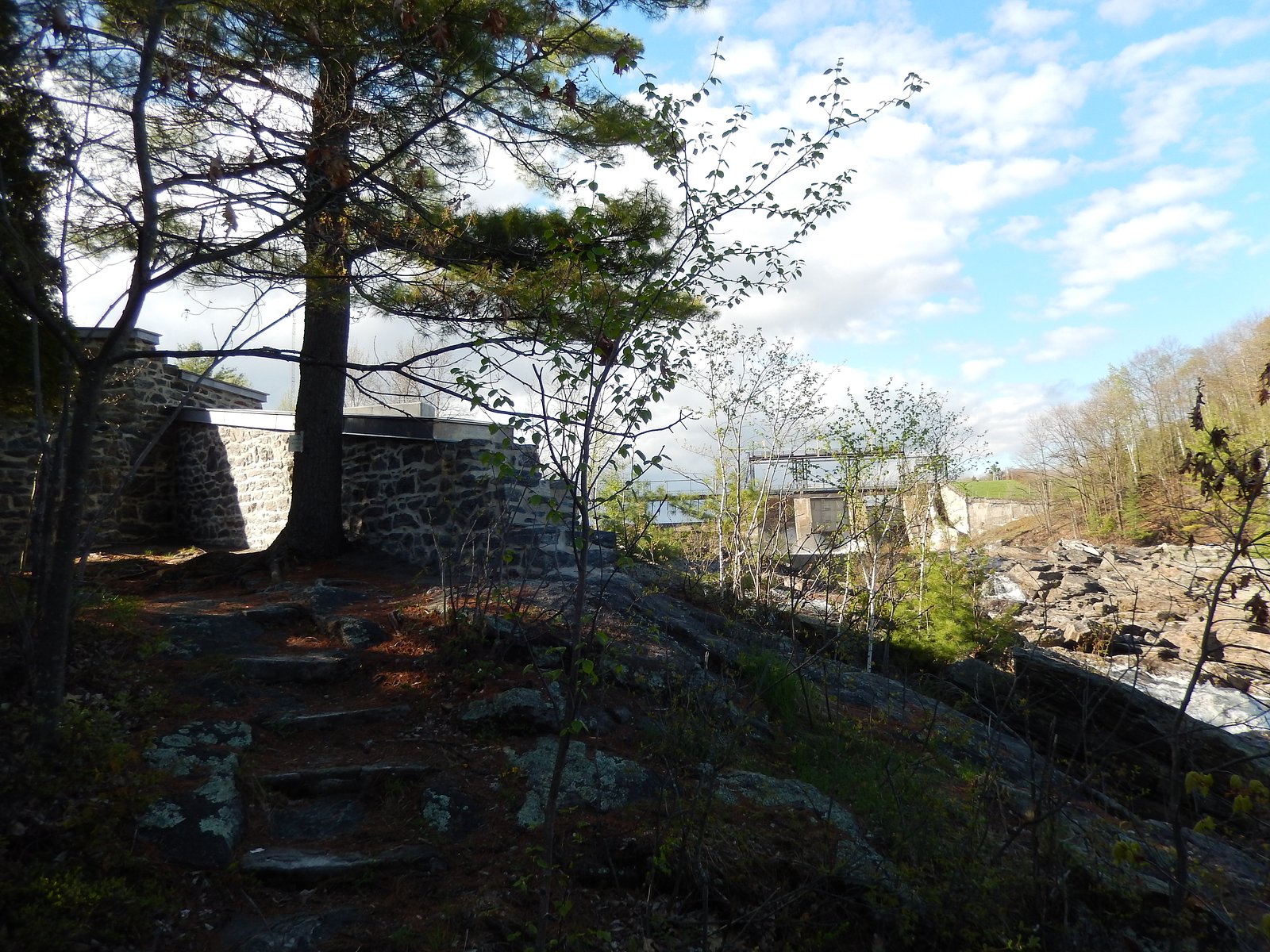
Access typically follows an unpaved or faint footpath from the parking/pullout to the riverbank. Trails may be rocky, muddy, and uneven, with short steep sections down to the water. Expect minimal or no formal trail infrastructure (no boardwalks or railings). Route-finding may be required where trails are informal.
What to Expect
A natural, relatively small waterfall/pothole feature in a forested river setting. Expect exposed rock, a plunge pool or swirling pothole (depending on water level), and limited built infrastructure. Flow is usually highest in spring; summer flows can be lower. The site is generally quiet and lightly visited compared with major provincial park attractions. Cell service may be patchy nearby.
Accessibility
The trail is short and relatively flat, but the surface may be uneven. Contact the managing agency for accessibility details.
Frequently Asked Questions
🐶 Are Dogs Allowed at La Marmite?
❌ Dogs are not allowed
Are There Any Fees or Permits Required?
🆖 No fees required
🏊 Is There Swimming at La Marmite?
❌ Swimming is not allowed
When to Visit
Late spring (high runoff) for the most dramatic flow. Early fall for fall color and generally lower crowds. Summer mornings on weekdays for fewer people. Winter visits may show ice formations but access can be icy and hazardous.
Seasonal Access
The best time to visit is Spring, Summer, Fall, and Winter. Check with the managing park or local authority for current conditions.
Safety Information
Hazards include slippery and unstable rocks, steep drop-offs, cold water and strong currents during spring runoff, falling trees/branches in wind, and ice in winter. Water levels can rise rapidly after heavy rain or dam releases on upstream waterways, watch for posted warnings. Cell service may be unreliable; tell someone your plan and expected return time. If uncertain about conditions, err on the side of caution and avoid getting close to the edge or entering the water.
7-Day Flow Outlook
Based on the WSC gauge BATISCAN (RIVIERE) A 3,4 KM EN AVAL DE LA RIVIERE DES ENVIES (4 km away).
Best time of year: this gauge typically runs highest from early April to mid June, peaking in April.
How we calculate this
This is a transparent outlook, not a precise forecast. We take the waterfall's current flow strength (how it ranks against its historical normal for today, from the nearest WSC stream gauge), carry that ranking forward along the gauge's seasonal curve, and nudge it for forecast rain. Confidence is highest for the next day or two and falls further out. Always check official conditions and your own judgment before visiting — high flows can be dangerous.
Know when to go.
Get a free email alert when waterfalls near Shawinigan-Sud hit peak flow. We only send when conditions are worth the trip — no weekly newsletters, no spam.
Weather Forecast
Location & Access
Getting There
La Marmite is accessed from local roads in the Shawinigan region. Use the coordinates (46.5514, -72.4101) in a GPS or mapping app to locate the small access point/parking area. From Shawinigan-Sud (≈15–16 miles) and Trois-Rivières (≈16 miles) the drive is roughly 20–40 minutes depending on route. Expect narrow rural roads and limited signage near the site.
Get Directions on Google MapsParking
Parking is likely informal and limited, roadside pullouts or a small unpaved lot may be present. Do not block driveways or farm access. Park only where allowed and visible; official maintained parking may not be provided.
Elevation
29 metres above sea level
Coordinates
46.551352° N, -72.410087° W
Visitor Tips & Gear
• Wear sturdy, waterproof footwear with good grip, rocks and banks are slippery. • Stay back from edges and avoid climbing on wet rock ledges; there are steep drop-offs. • Bring insect repellent in spring/summer and traction aids in winter. • Pack out all trash and follow Leave No Trace principles. • If you plan to swim or enter the water, exercise extreme caution, currents and underwater hazards can be present and flows vary seasonally. • Check local park/municipal sources or recent visitor reports for access updates before traveling.
As an Amazon Associate, we earn from qualifying purchases.
For this easy 1.0 km trail, lightweight trail shoes and a water bottle are usually sufficient. Icy conditions are common in winter — traction cleats are a smart addition.

Columbia Watertight II Rain Jacket
Packs into its own pocket, seam-sealed, and keeps you dry from spray and surprise rain.

Polarized Sunglasses (Knockaround)
Cuts glare off the water so you actually see the falls — and your photos turn out better too.

Earth Pak Waterproof Dry Bag
Keeps your phone and gear dry when waterfall mist soaks everything else.

Waterproof Phone Pouch (AiRunTech)
Cheap insurance — take photos right next to the falls without killing your phone.

Kahtoola MICROspikes
Cult-favorite traction cleats that grip ice and wet rock — essential for winter waterfall hikes.

JOBY GorillaPod Starter Kit
Wraps around railings and rocks for long-exposure waterfall shots — no flat surface needed.
Where to Stay
Browse vacation cabins and private rentals nearby
Unique outdoor stays — tents, yurts, and treehouses
Rent a campervan or RV for your waterfall road trip
Some links are affiliate links. We may earn a commission at no extra cost to you.
Nearby Campground
Camping de la Montagne
0.3 km away
Additional Information
Nearby Attractions
Parc national de la Mauricie (regional national park), La Cité de l'Énergie and Shawinigan falls area, historic Trois-Rivières (Old Town). Distances and exact driving times vary, use local maps to plan connections.
Wildlife
Typical central Quebec species may be present: deer, beavers, small mammals, waterfowl, and songbirds. Black bears and moose occur regionally; encounters are uncommon near small roadside falls but remain possible. Take standard wildlife precautions.
Cities near La Marmite
Nearby Waterfalls
Writing about La Marmite? Embed this waterfall on your site for free.