Photo Credits (5)
Difficulty
Easy
Trail Length
3.4 km
Trail Type
Out And Back
Elevation Gain
70 m
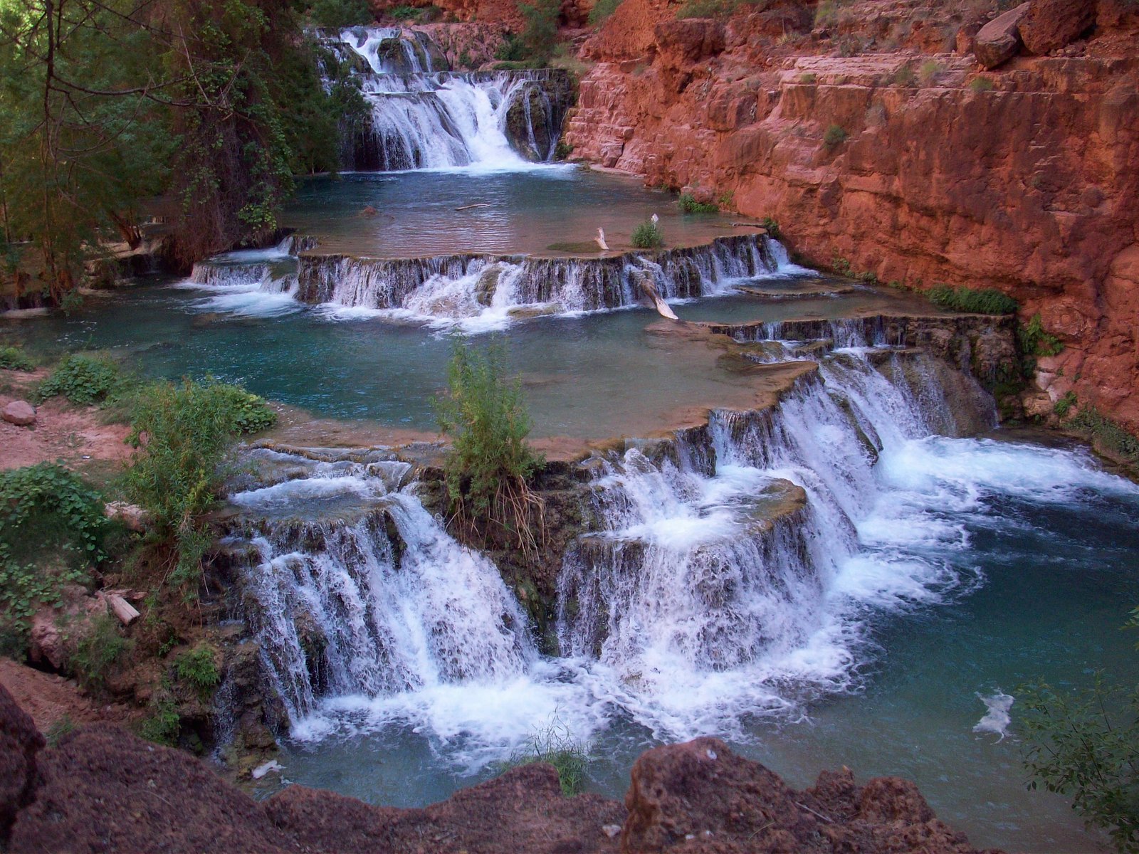
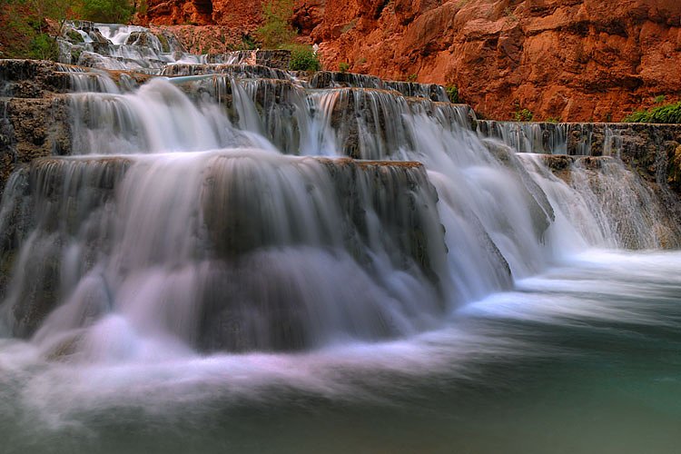
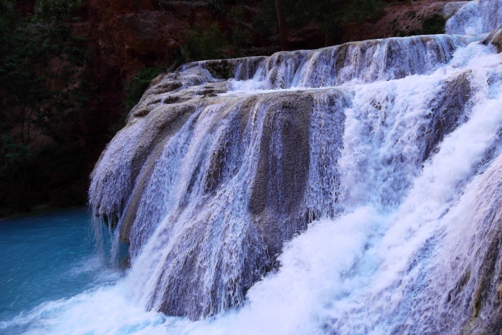
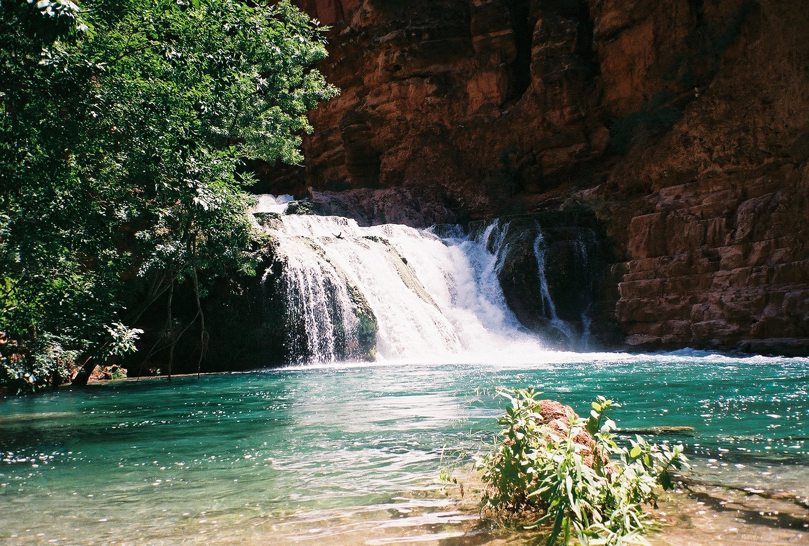
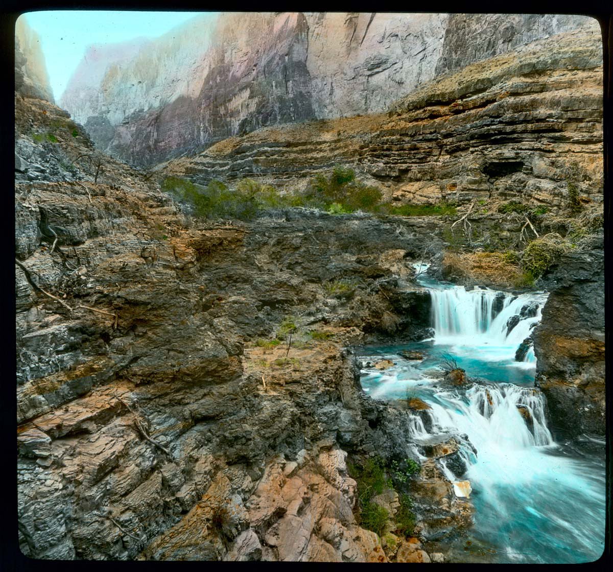
About Beaver Falls
Beaver Falls (BC) is a small, forested cascade located near the Canada–US border in a remote, wooded area. The falls sit at approximately 49.0876, -117.5691 and are reached by secondary forest/river roads and a short trail or game path in many visitor reports. Flow and appearance vary seasonally; spring snowmelt and early summer typically produce the highest flows. Detailed official descriptions are limited, so some aspects below are based on local visitor reports and typical conditions for boundary-region waterfalls.
Why This Waterfall Exists
Beaver Falls flows over Elise Formation, a hard volcanic rock layer deposited about 175-201 million years ago. These resistant rocks form a durable ledge that water cannot easily wear away, creating the falls where softer material downstream has already eroded.
Trail & Hike Details
The Approach
The easy 3.4-km out-and-back trail gains 70 metres of elevation on the way to the falls.
Trail Description
Trail and route information is sparse and variable. Many visitors report a short walk from a forest road pullout to reach viewpoints of the falls, while others describe a faint, sometimes steep path and sections of bushwhack to get closer. Expect uneven footing, roots, and muddy or wet sections near the creek. Official maintained trails and signage appear limited or nonexistent in some approaches.
What to Expect
A modest cascade or tiered waterfall set in mixed conifer forest with typical boundary-region flora. Water volume varies by season; spring and early summer usually offer the fullest flow. The immediate area is natural and undeveloped, no restrooms, railings, or formal viewpoints in most accounts. Expect insects in warm months, muddy sections after rain, and slippery rock near the water.
Accessibility
The trail is not wheelchair accessible. Uneven terrain and elevation changes require steady footing.
Frequently Asked Questions
🐶 Are Dogs Allowed at Beaver Falls?
❌ Dogs are not allowed
Are There Any Fees or Permits Required?
🆖 No fees required
🏊 Is There Swimming at Beaver Falls?
❌ Swimming is not allowed
When to Visit
Late spring to early summer for peak flows and full cascades. Early fall can provide good color and lower crowds. Winter access may be limited by snow and gated roads; if visiting in winter be prepared for snow/ice and limited services.
Seasonal Access
The best time to visit is Spring, Summer, Fall, and Winter. Check with the managing park or local authority for current conditions.
Safety Information
Hazards may include: slippery rocks and steep banks near the falls; fast or cold water; unstable or muddy approach trails; limited cell service; changing conditions on unpaved forest roads; potential wildlife encounters (including bears). If driving on forestry roads, watch for soft shoulders, washouts, and locked gates. Always tell someone your route and expected return time, carry navigation, and check recent road/trail reports before traveling.
7-Day Flow Outlook
Based on the WSC gauge COLUMBIA RIVER AT INTERNATIONAL BOUNDARY (11 km away).
Best time of year: this gauge typically runs highest from early May to early August, peaking in June.
How we calculate this
This is a transparent outlook, not a precise forecast. We take the waterfall's current flow strength (how it ranks against its historical normal for today, from the nearest WSC stream gauge), carry that ranking forward along the gauge's seasonal curve, and nudge it for forecast rain. Confidence is highest for the next day or two and falls further out. Always check official conditions and your own judgment before visiting — high flows can be dangerous.
Know when to go.
Get a free email alert when waterfalls near Nelson hit peak flow. We only send when conditions are worth the trip — no weekly newsletters, no spam.
Weather Forecast
Location & Access
Getting There
The falls are located near the international boundary, roughly 17–20 miles (driving distance) from the small Washington towns of Northport, Metaline, and Metaline Falls. Use coordinates 49.0876, -117.5691 in a GPS unit. Access typically involves driving on secondary gravel or forest service roads; some reports indicate a short unmarked spur or pullout from a logging/forestry road. Because mapping and road signage are inconsistent in this area, bring a map, GPS, and allow extra time for rough roads. Border crossing regulations apply if approaching from the U.S. side, carry appropriate ID and check current border rules.
Get Directions on Google MapsParking
Visitors report informal pullouts on forest roads or small gravel areas near trailheads rather than established parking lots. Parking is likely primitive (no facilities) and may be on soft gravel; park clear of gates and private driveways. If uncertain, choose a safe pullout well off the road.
Elevation
565 metres above sea level
Coordinates
49.087609° N, -117.569138° W
Visitor Tips & Gear
• Use the provided GPS coordinates and don’t rely solely on phone maps, cell coverage can be limited. • Approach from the Canadian side if you prefer to avoid additional border-crossing uncertainty; if approaching from the U.S., carry ID and check crossing rules. • Wear sturdy footwear and expect wet, uneven terrain near the falls. • Park well off the road and avoid blocking gates or forestry access. • Carry insect repellent, waterproof footwear, and a small first-aid kit. • Leave no trace, pack out all trash. • Check with local forest/park authorities or recent trip reports for current road/gate status; logging roads can change rapidly.
As an Amazon Associate, we earn from qualifying purchases.
This easy 3.4 km hike is straightforward — comfortable trail shoes and plenty of water should do. Icy conditions are common in winter — traction cleats are a smart addition.

Columbia Watertight II Rain Jacket
Packs into its own pocket, seam-sealed, and keeps you dry from spray and surprise rain.

Polarized Sunglasses (Knockaround)
Cuts glare off the water so you actually see the falls — and your photos turn out better too.

Earth Pak Waterproof Dry Bag
Keeps your phone and gear dry when waterfall mist soaks everything else.

Waterproof Phone Pouch (AiRunTech)
Cheap insurance — take photos right next to the falls without killing your phone.

Kahtoola MICROspikes
Cult-favorite traction cleats that grip ice and wet rock — essential for winter waterfall hikes.

JOBY GorillaPod Starter Kit
Wraps around railings and rocks for long-exposure waterfall shots — no flat surface needed.
Where to Stay
Browse vacation cabins and private rentals nearby
Unique outdoor stays — tents, yurts, and treehouses
Rent a campervan or RV for your waterfall road trip
Some links are affiliate links. We may earn a commission at no extra cost to you.
Nearby Campground
Beaver Creek Campground
3.9 km away
Additional Information
Nearby Attractions
The area is near the Canada–U.S. border; nearby small towns on the U.S. side include Northport, Metaline, and Metaline Falls. The region has other rivers, forest roads, and backcountry hiking opportunities. For officially maintained attractions and services, consult local tourism pages for the Boundary Country and nearby communities.
Wildlife
Typical interior British Columbia/border-region species: deer, black bears, elk, small mammals, and raptors. Also expect mosquitoes and other biting insects in warm months. Use bear-aware practices and store food securely.
Cities near Beaver Falls
Nearby Waterfalls
Other waterfalls named Beaver Falls
6 other waterfalls share this name across Canada.
Writing about Beaver Falls? Embed this waterfall on your site for free.