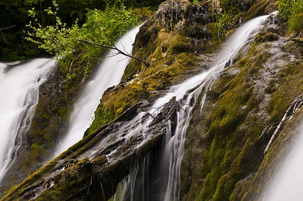
Beaver Falls
Washington • Olympic National Park
By Armen Suny · Last verified Mar 2026
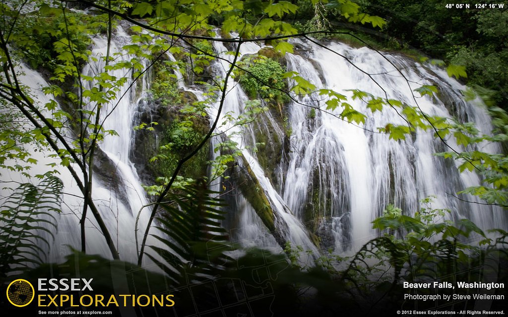
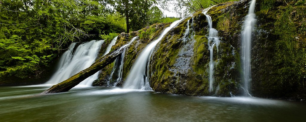
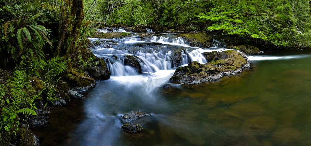
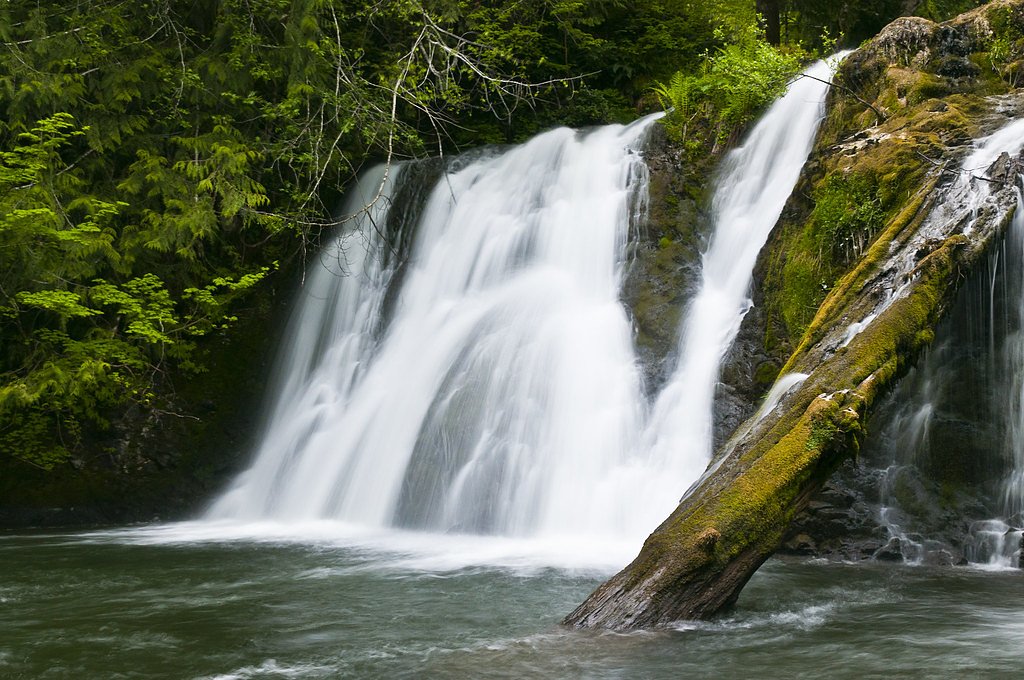
Photo Credits (5)
Difficulty
Moderate
Trail Length
2.4 miles
Trail Type
Out And Back
Elevation Gain
350 ft
About Beaver Falls
Beaver Falls is a quiet, picture-ready cascade tucked into the temperate forests of Washington, set within a Washington State Department of Natural Resources State Resource Management Area (SRMA) and managed by the DNR. The falls sit on the edge of the region that borders Olympic National Park, and its modest drop and wooded setting make it a peaceful, less-crowded alternative to the busier waterfall stops in the area. Mossy boulders, firs, and a close, intimate viewing spot give the site a classic Pacific Northwest feel that photographers and day-hikers will appreciate. Access is straightforward: a short forested approach brings you to a clear vantage point where the stream threads through the trees before tumbling over rock. The trail’s modest length and gentle elevation change make Beaver Falls a great choice for those after a brief, scenic outing rather than a long day on the trail — an inviting stop for anyone looking to soak up a serene slice of Washington’s rainforest edge.
The Setting
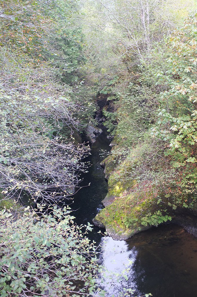
Beaver Falls sits at 587 feet within Olympic National Park, fed by the Calawah River, in the foothills of Washington.
Trail & Hike Details
The Approach
The moderate 2.4-mile out-and-back trail gains 350 feet of elevation on the way to the falls.
Trail Description
The trail to Beaver Falls is a 2.4-mile out-and-back route with roughly 350 feet of elevation gain and is typically rated moderate. Trail type: out-and-back; difficulty: moderate; total distance: 2.4 miles; elevation gain: ~350 ft. No USFS trail name or number, and no official surface, grade, or USFS trail class information was provided in the available data; based on the distance and gain, expect a short, steady climb on forested terrain rather than a technical route. The approach is direct and suitable for hikers prepared for moderate effort who want a quick, scenic visit to the falls.
What to Expect
Dogs are welcome.
Accessibility
The trail is not wheelchair accessible. Uneven terrain and elevation changes require steady footing.
Frequently Asked Questions
🐶 Are Dogs Allowed at Beaver Falls?
✅ Dogs are allowed
Are There Any Fees or Permits Required?
🆖 No fees required
🏊 Is There Swimming at Beaver Falls?
❌ Swimming is not allowed
When to Visit
Spring and early summer are ideal times to visit, as the waterfall flow is typically stronger due to seasonal rainfall.
Seasonal Access
The best time to visit is Spring, Summer, and Fall. Winter access may be limited. Check with Olympic National Park for current conditions.
Safety Information
Exercise caution near the waterfall, as rocks may be slippery. Be aware of changing weather conditions, especially during the rainy season.
Current Water Conditions
212 ft³/s
Current discharge — how much water is flowing
About average for this time of year
Based on 51 years of record
3.10 ft
Water depth at gauge
57°F
ColdBracing — limit time in water
7-Day Discharge Trend
What does this mean for your visit?
Flow is about average for this time of year. Water temperature is a bracing 57 degrees F, limit your time in the water.
About This Gauge
This gauge is on a nearby waterway and may not reflect exact conditions at the falls.
7-Day Flow Outlook
Based on the USGS gauge CALAWAH RIVER NEAR FORKS, WA (18 km away).
Today
Roaring
210 cfs
6/10Tomorrow
Roaring
215 cfs
6/10Mon
Roaring
201 cfs
9/10Tue
Roaring
180 cfs
9/10Wed
Roaring
184 cfs
9/10Thu
Roaring
200 cfs
6/10Fri
Roaring
203 cfs
6/10Best window: Mon — roaring flow, partly sunny (trip score 9/10).
Best time of year: this gauge typically runs highest from mid November to early January, peaking in November.
How we calculate this
This is a transparent outlook, not a precise forecast. We take the waterfall's current flow strength (how it ranks against its historical normal for today, from the nearest USGS stream gauge), carry that ranking forward along the gauge's seasonal curve, and nudge it for forecast rain. Confidence is highest for the next day or two and falls further out. Always check official conditions and your own judgment before visiting — high flows can be dangerous.
Know when to go.
Get a free email alert when waterfalls near Clallam Bay hit peak flow. We only send when conditions are worth the trip — no weekly newsletters, no spam.
Weather Forecast
Location & Access
Getting There
Beaver Falls is located near the town of Naselle in southwestern Washington. It is accessible via Beaver Falls Road, which is a short drive off Highway 4. The waterfall is relatively easy to reach by car.
Get Directions on Google MapsParking
There is a small parking area near the falls, but space may be limited. Visitors should plan to arrive early, especially during weekends or peak seasons.
Elevation
587 feet above sea level
Coordinates
48.094801° N, -124.265768° W
Land Management
Managed by SDNR
Visitor Tips & Gear
Wear sturdy shoes as the trail may be muddy, especially after rain. Arrive early to secure parking and enjoy the falls without crowds. Bring a camera to capture the scenic beauty.
As an Amazon Associate, we earn from qualifying purchases.
With 2.4 miles and 350 ft of elevation gain, sturdy boots and trekking poles will help on this moderate trail. Sun exposure on the trail makes good sun protection a must in summer.

Polarized Sunglasses (Knockaround)
Cuts glare off the water so you actually see the falls — and your photos turn out better too.

Columbia Watertight II Rain Jacket
Packs into its own pocket, seam-sealed, and keeps you dry from spray and surprise rain.

Earth Pak Waterproof Dry Bag
Keeps your phone and gear dry when waterfall mist soaks everything else.

Waterproof Phone Pouch (AiRunTech)
Cheap insurance — take photos right next to the falls without killing your phone.

Timberland Euro Sprint Mid Waterproof
Trusted waterproof boot with premium leather and grippy rubber sole — reliable on rocky, wet trails.

TrailBuddy Trekking Poles
Lightweight aluminum, cork grips, and flip-locks that actually hold — a best-seller for good reason.
Where to Stay

Woodland Inns

Pacific Inn Motel

Forks Fir House

Near Trails & Rivers! 'Trybett Cabin' in Forks
Browse vacation cabins and private rentals nearby
Unique outdoor stays — tents, yurts, and treehouses
Rent a campervan or RV for your waterfall road trip
Some links are affiliate links. We may earn a commission at no extra cost to you.
Nearby Campground
Klahowya Campground
7.4 miles away · 0 sites
Adjacent to the south shore of the Sol Duc River, the rain forest setting hosts an accessible interpretive nature trail, fishing, picnicking, and trails to explore the natural beauty. During the summer when the river is low water, there is tubing or float run between the 'Day Use' areas next to Sites 9 and 45.Interpretive programs are presented in the amphitheater during the summer.
Book on Recreation.govNearby Hot Springs
Hot springs near Clallam Bay, Washington

Sol Duc Hot Springs
Sol Duc Hot Springs flows at 122 degrees Fahrenheit in Olympic National Park with permanently protected Class 1 status under Na...

Olympic Hot Springs
Olympic Hot Springs flows at 118 degrees within Olympic National Park at 2,000 feet elevation, emerging 72 degrees above ambien...
Looking for a soak after your hike? Explore more hot springs near Clallam Bay, Washington on SoakingSprings.
Explore Washington springsAdditional Information
Nearby Attractions
Nearby attractions include the town of Naselle and the Willapa National Wildlife Refuge, which offers additional hiking and wildlife viewing opportunities.
Wildlife
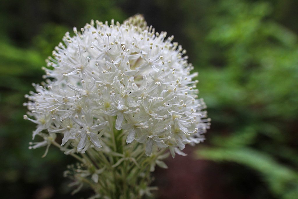
The area around Beaver Falls is home to various bird species, small mammals, and native plants.
Cities near Beaver Falls
Nearby Waterfalls
Other waterfalls named Beaver Falls
6 other waterfalls share this name across the U.S.
Writing about Beaver Falls? Embed this waterfall on your site for free.