Beaver Falls
Oregon • 48 ft
By Armen Suny · Last verified Mar 2026
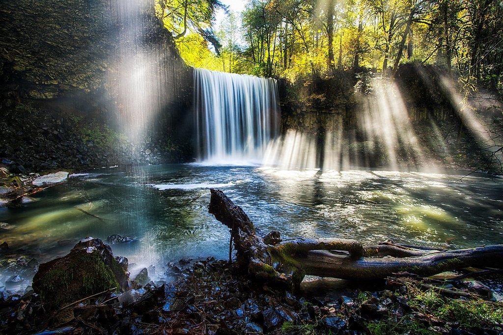
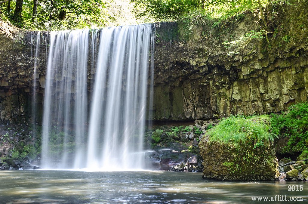
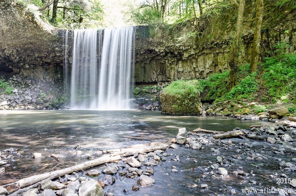
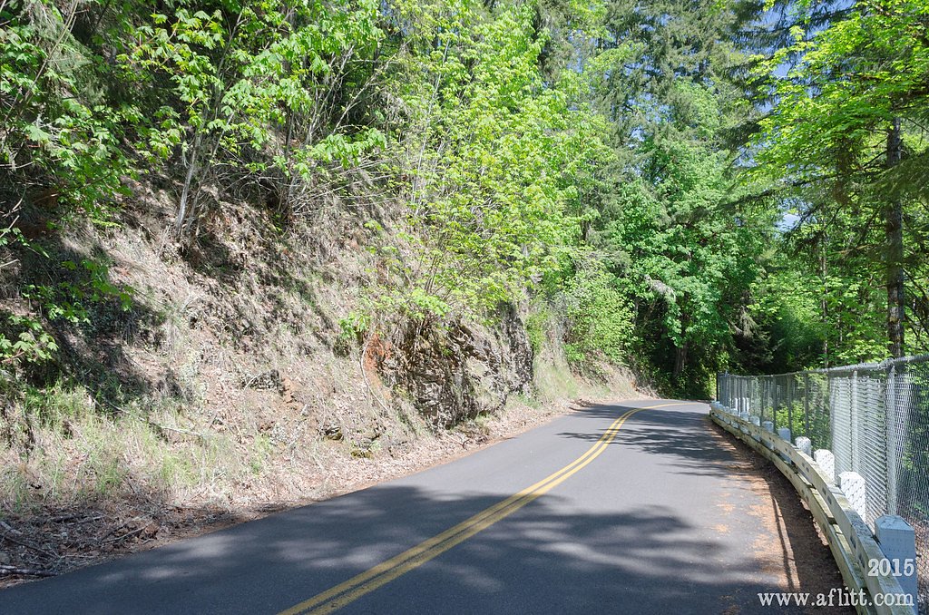

Photo Credits (5)
Difficulty
Moderate
Trail Length
2.4 miles
Trail Type
Out And Back
Elevation Gain
350 ft
About Beaver Falls
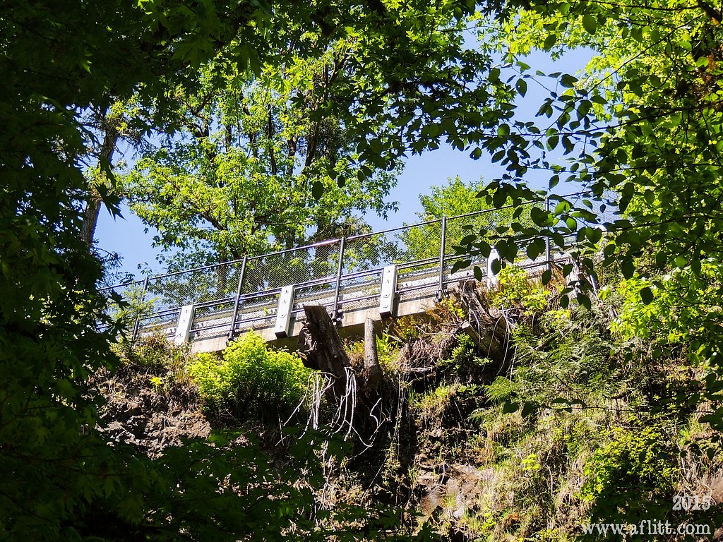
Beaver Falls is a photogenic 48-foot cascade on Beaver Creek just outside the town of Clatskanie in Columbia County, Oregon. Nestled in a quiet, forested stretch of northwest Oregon, the falls are easy to reach via a short out-and-back hike and are often praised for their scenic drop and approachable setting. The route—2.4 miles round-trip with roughly 350 feet of elevation gain—makes for a satisfying half-day outing for most hikers; families and photographers alike find the short distance and clear endpoint appealing. The trail winds through lush timber before opening to the creek and the base of the falls, offering the peaceful woodland experience the region is known for. Expect some uphill sections and potentially muddy or slippery conditions in wet weather, so wear traction-conscious footwear. The falls sit near Clatskanie and are identified on maps as Beaver Falls on Beaver Creek (per Wikipedia), making them an easy destination to add to a Northwest Oregon day trip.
The Setting
Beaver Falls sits at 230 feet along the Columbia River, in the coastal lowlands of Oregon. The falls drop 48 feet.
Height: 48 feet
Trail & Hike Details
The Approach
The moderate 2.4-mile out-and-back trail gains 350 feet of elevation on the way to the falls.
Trail Description
Length: 2.4 miles (out-and-back). Elevation gain: ~350 feet. Difficulty: Moderate. The trail follows a forested corridor along Beaver Creek directly to the base of the 48-foot Beaver Falls. The route includes short uphill/mild-grade sections rather than being flat; surfaces are natural tread through timber and can become muddy or slippery in wet conditions, so appropriate footwear is recommended. No USFS trail number or formal surface/route class was provided in the available trail data.
What to Expect
The falls drop 48 feet. Dogs are welcome.
Accessibility
The trail is not wheelchair accessible. Uneven terrain and elevation changes require steady footing.
Frequently Asked Questions
🐶 Are Dogs Allowed at Beaver Falls?
✅ Dogs are allowed
Are There Any Fees or Permits Required?
🆖 No fees required
🏊 Is There Swimming at Beaver Falls?
❌ Swimming is not allowed
When to Visit
Spring and early summer are ideal times to visit when the water flow is at its peak, but the falls remain beautiful throughout the year.
Seasonal Access
The best time to visit is Spring, Summer, and Fall. Winter access may be limited.
Safety Information
Exercise caution near the base of the falls as rocks can be slippery. Avoid visiting during heavy rain or storms as the trail may become hazardous.
Current Water Conditions
180,000 ft³/s
Current discharge — how much water is flowing
Lower than usual for this time of year
Based on 36 years of record
4.60 ft
Water depth at gauge
7-Day Discharge Trend
What does this mean for your visit?
Flow is lower than usual for this time of year. Expect crystal clear visibility.
Water Quality
Water Clarity
Crystal clearExcellent visibility
About This Gauge
This gauge is on a nearby waterway and may not reflect exact conditions at the falls.
7-Day Flow Outlook
Based on the USGS gauge COLUMBIA RIVER AT PORT WESTWARD, NEAR QUINCY, OR (10 km away).
Today
Moderate
194400 cfs
5/10Tomorrow
Moderate
220865 cfs
6/10Mon
Moderate
207000 cfs
6/10Tue
Moderate
196487 cfs
5/10Wed
Moderate
191374 cfs
5/10Thu
Moderate
176035 cfs
5/10Fri
Moderate
163617 cfs
5/10Best window: Tomorrow — moderate flow, showers and thunderstorms (trip score 6/10).
Best time of year: this gauge typically runs highest from mid April to late June, peaking in June.
How we calculate this
This is a transparent outlook, not a precise forecast. We take the waterfall's current flow strength (how it ranks against its historical normal for today, from the nearest USGS stream gauge), carry that ranking forward along the gauge's seasonal curve, and nudge it for forecast rain. Confidence is highest for the next day or two and falls further out. Always check official conditions and your own judgment before visiting — high flows can be dangerous.
Know when to go.
Get a free email alert when waterfalls near Clatskanie hit peak flow. We only send when conditions are worth the trip — no weekly newsletters, no spam.
Weather Forecast
Location & Access
Getting There
Beaver Falls is located off Highway 30 near the town of Clatskanie, Oregon. The trailhead is accessible via a short drive from the highway, with clear signage directing visitors to the falls.
Get Directions on Google MapsParking
There is a small parking area near the trailhead, but it may fill up quickly during peak seasons. Visitors should plan to arrive early to secure a spot.
Elevation
230 feet above sea level
Coordinates
46.103722° N, -123.121228° W
Visitor Tips & Gear
Arrive early to secure parking, especially during weekends or holidays. Wear sturdy shoes as the trail can be muddy. Bring a camera to capture the scenic views.
As an Amazon Associate, we earn from qualifying purchases.
With 2.4 miles and 350 ft of elevation gain, sturdy boots and trekking poles will help on this moderate trail. Sun exposure on the trail makes good sun protection a must in summer.

Polarized Sunglasses (Knockaround)
Cuts glare off the water so you actually see the falls — and your photos turn out better too.

Columbia Watertight II Rain Jacket
Packs into its own pocket, seam-sealed, and keeps you dry from spray and surprise rain.

Earth Pak Waterproof Dry Bag
Keeps your phone and gear dry when waterfall mist soaks everything else.

Waterproof Phone Pouch (AiRunTech)
Cheap insurance — take photos right next to the falls without killing your phone.

Timberland Euro Sprint Mid Waterproof
Trusted waterproof boot with premium leather and grippy rubber sole — reliable on rocky, wet trails.

TrailBuddy Trekking Poles
Lightweight aluminum, cork grips, and flip-locks that actually hold — a best-seller for good reason.
Where to Stay

Clatskanie River Inn

Lewis River Inn

Timberland Inn & Suites

Comfort Inn & Suites Kelso - Longview
Browse vacation cabins and private rentals nearby
Unique outdoor stays — tents, yurts, and treehouses
Rent a campervan or RV for your waterfall road trip
Some links are affiliate links. We may earn a commission at no extra cost to you.
Nearby Hot Springs
Hot springs near Clatskanie, Oregon

Mt St Helens Fumaroles
Mount St. Helens fumaroles reach 190 degrees at 6,906 feet elevation on the crater rim, emerging 159.1 degrees above ambient in...
Green River Soda Spring
Green River Soda Spring produces 86-degree carbonated water at 1,644 feet elevation, flowing 37.5 degrees above ambient tempera...
Looking for a soak after your hike? Explore more hot springs near Clatskanie, Oregon on SoakingSprings.
Explore Oregon springsAdditional Information
Nearby Attractions
Nearby attractions include the town of Clatskanie and other scenic spots along Highway 30.
Wildlife
The area is home to various bird species and small mammals. Visitors may also spot native plants and wildflowers along the trail.
Cities near Beaver Falls
Other waterfalls named Beaver Falls
6 other waterfalls share this name across the U.S.
Writing about Beaver Falls? Embed this waterfall on your site for free.