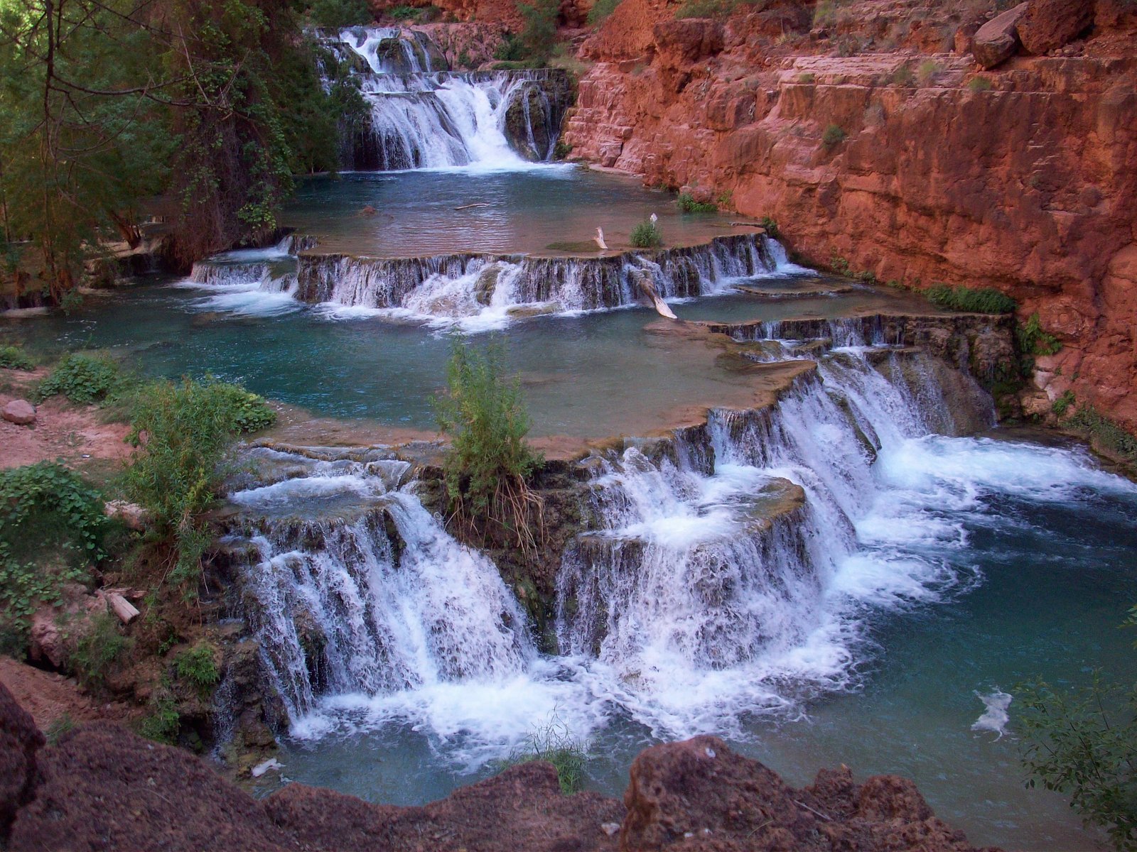
Beaver Falls
By Armen Suny · Last verified Jun 2026
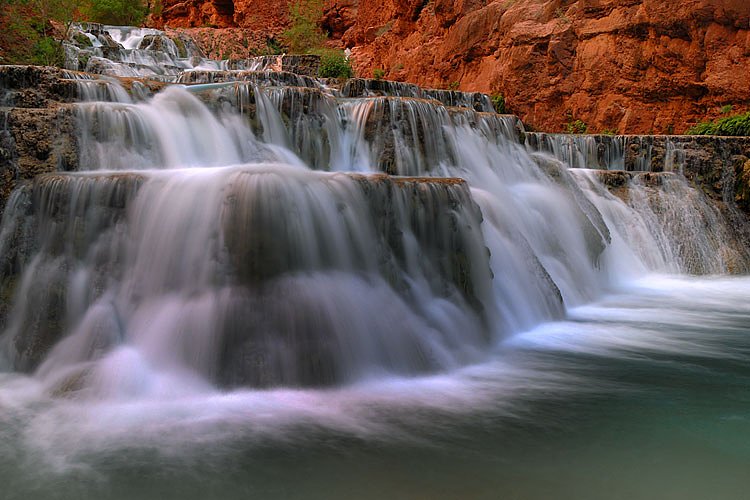
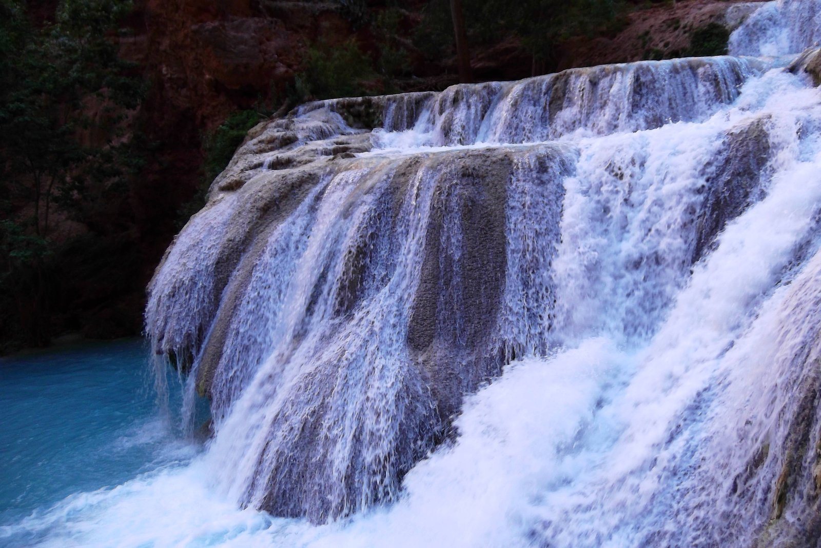
Photo Credits (5)
Difficulty
Easy
Trail Length
1.9 km
Trail Type
Out And Back
Elevation Gain
55 m
About Beaver Falls
Beaver Falls is a waterfall in central British Columbia at approximately 53.2563 N, -120.0251 W. Available information about this specific waterfall is limited; it appears to be a smaller cascade or tiered fall typical of tributary streams in the region. Flow and appearance are likely seasonal, with higher discharge in spring snowmelt and lower flows in late summer and fall. Exact measured height and technical classification are not well documented.
Why This Waterfall Exists
Beaver Falls flows over Miette Group, a layered sedimentary rock layer deposited about 539 million to 1.0 billion years ago. Over time, the stream has worn through these layers at different rates, creating the step that forms the waterfall.
Trail & Hike Details
The Approach
The easy 1.9-km out-and-back trail gains 55 metres of elevation on the way to the falls.
Trail Description
Publicly available, detailed trail descriptions for Beaver Falls at these coordinates are scarce. Visitors should expect informal or unmaintained routes from a nearby road or pullout. Trails, if present, may include short bushwhacks, uneven ground, roots, and rocky approaches to reach viewpoints near the stream. Routes may not be marked; route-finding skills and a map/GPS are recommended.
What to Expect
Expect a remote, natural setting with limited or no infrastructure (no railings, stairs, or official viewpoints). Terrain can be steep, wet, and slippery near the water. Water levels vary with season, peak flows commonly occur during spring snowmelt. Summer and early fall can offer easier access but lower flows. Wildlife (including black bears and other mammals) is possible. Amenities such as toilets, trash service, or potable water are unlikely.
Accessibility
The trail is not wheelchair accessible. Uneven terrain and elevation changes require steady footing.
Frequently Asked Questions
🐶 Are Dogs Allowed at Beaver Falls?
❌ Dogs are not allowed
Are There Any Fees or Permits Required?
🆖 No fees required
🏊 Is There Swimming at Beaver Falls?
❌ Swimming is not allowed
When to Visit
Late spring to early summer for highest flow (snowmelt). Summer and early fall offer easier access and milder weather. Winter access may be possible but can require snowshoes/ skis and avalanche/ice-safety experience; roads may be closed or impassable.
Seasonal Access
The best time to visit is Spring, Summer, Fall, and Winter. Check with the managing park or local authority for current conditions.
Safety Information
Hazards may include: slippery rocks and steep banks at the water; cold and fast-moving water; unstable or eroding edges; limited or no cell service; seasonal road closures and poor road conditions; wildlife encounters (including bears); and rapidly changing weather. Use caution near the water, travel in groups when possible, tell someone your route and expected return time, and carry appropriate emergency equipment. If you are inexperienced in remote travel, consider going with someone who is or hiring a local guide.
Current Water Conditions
645.0 m³/s
Current discharge — how much water is flowing
Higher than usual for this time of year
Based on 72 years of record
6.15 m
Water depth at gauge
7-Day Discharge Trend
What does this mean for your visit?
The water is flowing higher than usual for this time of year.
About This Gauge
This gauge is on a nearby waterway and may not reflect exact conditions at the falls.
7-Day Flow Outlook
Based on the WSC gauge FRASER RIVER AT MCBRIDE (9 km away).
Today
Strong
697 m³/s
8/10Tomorrow
Roaring
675 m³/s
6/10Tue
Roaring
643 m³/s
6/10Wed
Roaring
647 m³/s
6/10Thu
Roaring
636 m³/s
6/10Fri
Strong
594 m³/s
10/10Sat
Strong
604 m³/s
8/10Best window: Fri — strong flow, mainly sunny (trip score 10/10).
Best time of year: this gauge typically runs highest from late May to late August, peaking in June.
How we calculate this
This is a transparent outlook, not a precise forecast. We take the waterfall's current flow strength (how it ranks against its historical normal for today, from the nearest WSC stream gauge), carry that ranking forward along the gauge's seasonal curve, and nudge it for forecast rain. Confidence is highest for the next day or two and falls further out. Always check official conditions and your own judgment before visiting — high flows can be dangerous.
Weather Forecast
Location & Access
Getting There
The falls are located in a remote, forested part of central British Columbia. Access is likely via secondary or forestry roads off the nearest paved highways and may require high-clearance or 4WD vehicles. Nearest towns and formal trailheads may be several kilometers away; visitors should prepare for unmarked access and confirm routing with local maps or land managers before traveling. Cell service may be limited or absent in the area.
Get Directions on Google MapsParking
Parking is likely informal, roadside pullouts or small gravel clearings. There may be no developed parking lot or facilities. Park and leave space for other vehicles; avoid blocking forestry gates or private access.
Elevation
756 metres above sea level
Coordinates
53.256257° N, -120.025113° W
Visitor Tips & Gear
• Check local forestry and park service notices for road conditions and closures before you go. • Use a map or GPS and download offline maps; cell coverage may be unreliable. • Wear sturdy, waterproof footwear and expect wet, slippery rocks near the falls. • Carry bear spray and know how to use it; store food securely. • Pack out all trash and follow Leave No Trace principles. • Avoid getting too close to the edge, banks and rocks can be unstable. • If you’re unsure of road suitability, do not proceed; many forestry roads require high-clearance or 4WD vehicles.
As an Amazon Associate, we earn from qualifying purchases.
This easy 1.9 km hike is straightforward — comfortable trail shoes and plenty of water should do. Icy conditions are common in winter — traction cleats are a smart addition.

Columbia Watertight II Rain Jacket
Packs into its own pocket, seam-sealed, and keeps you dry from spray and surprise rain.

Polarized Sunglasses (Knockaround)
Cuts glare off the water so you actually see the falls — and your photos turn out better too.

Earth Pak Waterproof Dry Bag
Keeps your phone and gear dry when waterfall mist soaks everything else.

Waterproof Phone Pouch (AiRunTech)
Cheap insurance — take photos right next to the falls without killing your phone.

Kahtoola MICROspikes
Cult-favorite traction cleats that grip ice and wet rock — essential for winter waterfall hikes.

JOBY GorillaPod Starter Kit
Wraps around railings and rocks for long-exposure waterfall shots — no flat surface needed.
Where to Stay
Browse vacation cabins and private rentals nearby
Unique outdoor stays — tents, yurts, and treehouses
Rent a campervan or RV for your waterfall road trip
Some links are affiliate links. We may earn a commission at no extra cost to you.
Additional Information
Nearby Attractions
This area of central British Columbia generally features lakes, rivers, forested backcountry, and provincial parks. Specific nearby named attractions to Beaver Falls at these coordinates are not well-documented here; visitors should consult regional tourism or land-management resources for up-to-date local highlights.
Wildlife
Black bears, deer, moose, small mammals, and a variety of birds are typical in central BC forested areas. Practice wildlife awareness: keep distance, secure food, and make noise on the trail to avoid surprising animals.
Other waterfalls named Beaver Falls
6 other waterfalls share this name across Canada.
Writing about Beaver Falls? Embed this waterfall on your site for free.