Toxaway Falls
By Armen Suny · Last verified Mar 2026
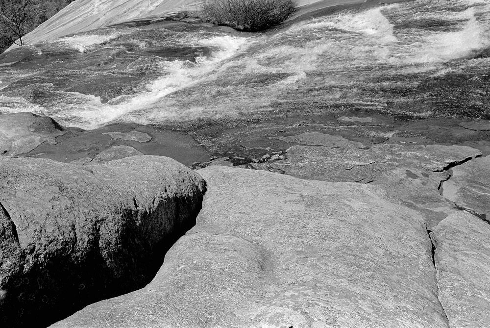
Photo Credits (5)
Difficulty
Easy
Trail Length
0.6 miles
Trail Type
Out And Back
Elevation Gain
150 ft
About Toxaway Falls
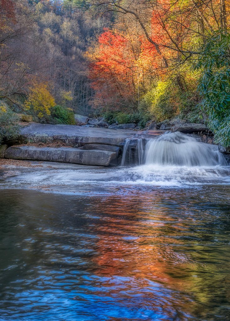
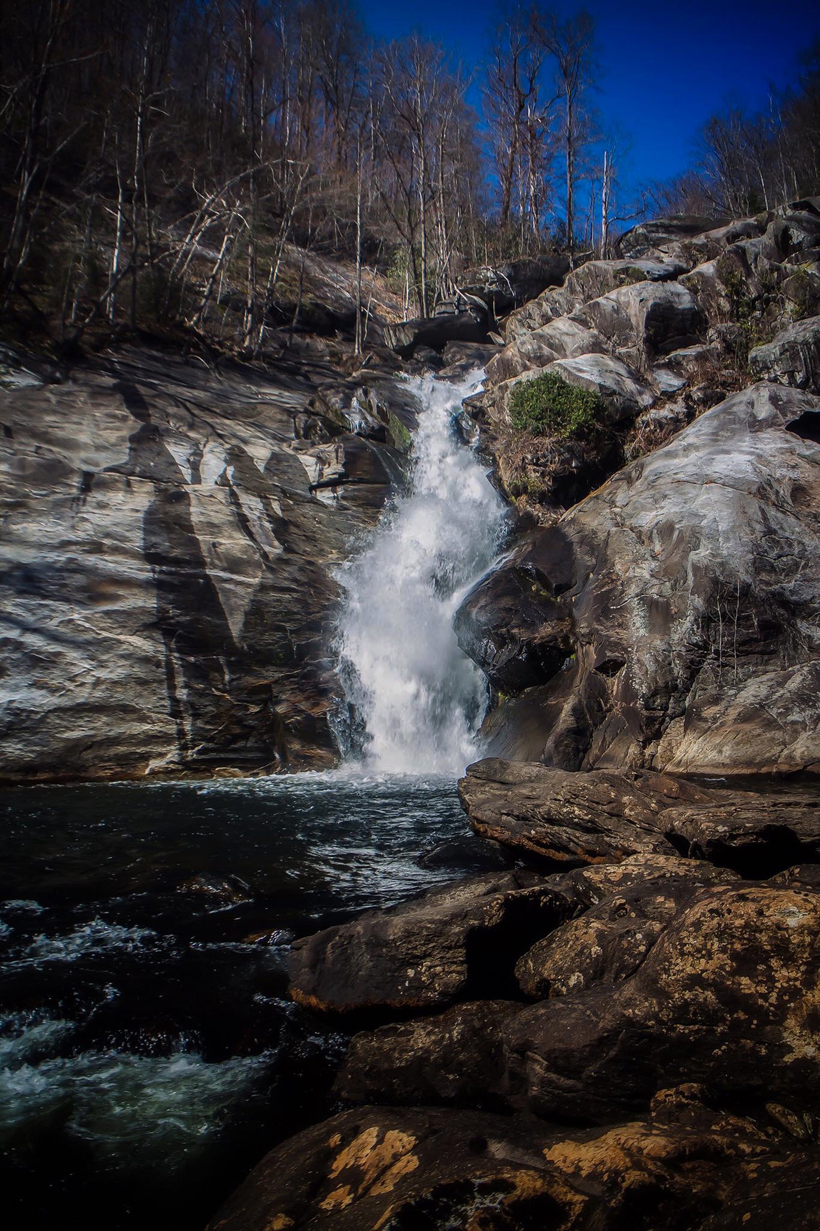
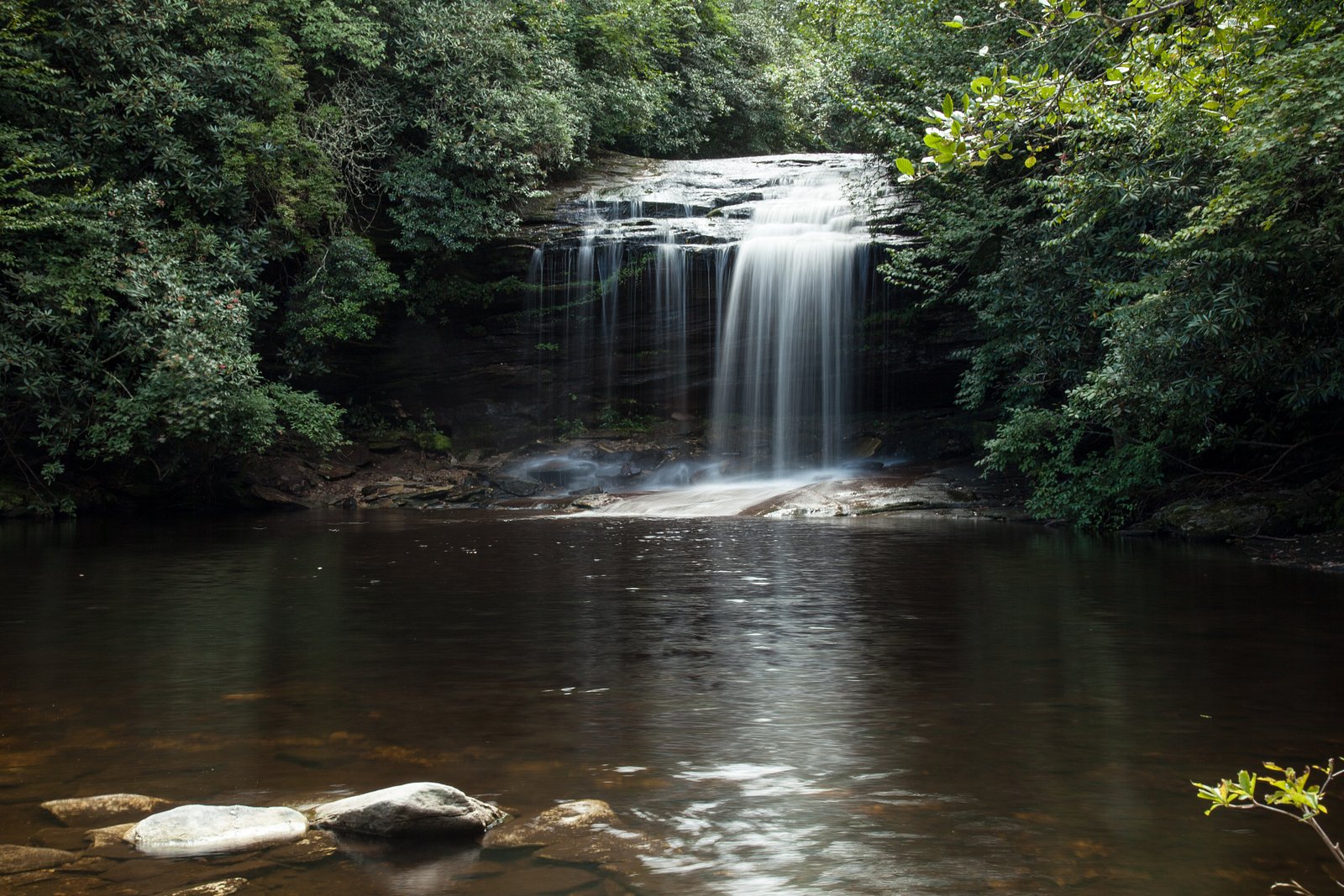
Toxaway Falls tumbles along the Toxaway River just off U.S. Highway 64, offering a dramatic curtain of water that is often visible from the highway pullout. The falls sit within Gorges State Park, a 7,709‑acre North Carolina state park bought from Duke Energy in 1999 and part of a 100,000+ acre conservation corridor stretching roughly 80 miles along the NC/SC line. Nestled in the rugged Jocassee Gorges area, this spot is in North Carolina’s westernmost state park and one of the state’s newest, making a visit feel both wild and newly protected. While the falls can be admired from the roadside, a short trail provides a closer vantage and makes this an easy stop on a larger day of exploring the park. The setting’s steep, forested slopes and conserved lands give the waterfall a remote, scenic character despite its convenient highway access — ideal for photographers, families, and anyone wanting a quick nature break on a drive through Transylvania County.
The Setting
Toxaway Falls sits at 2,871 feet within Gorges State Park, fed by the French Broad River, in the hills of North Carolina.
Nearby Falls Worth Visiting
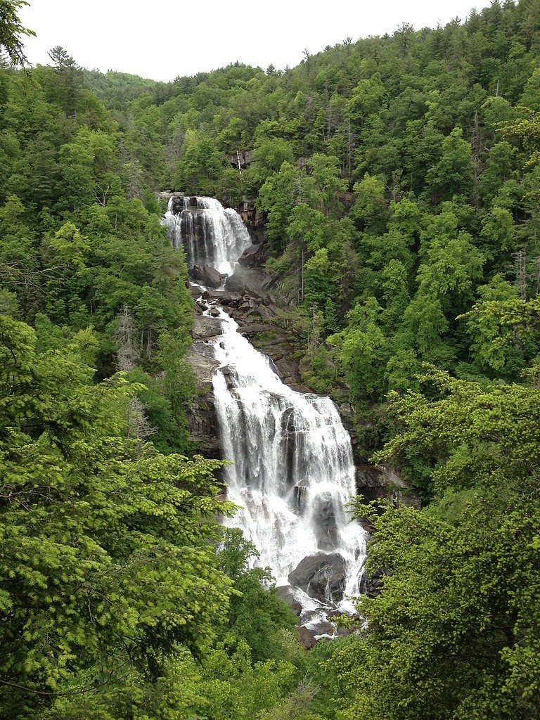
Whitewater Falls, the tallest waterfall in North Carolina at 411 feet, lies 4.4 miles to the southeast. Also nearby: Rainbow Falls (150 ft, 3.0 mi) and Schoolhouse Falls (20 ft, 5.1 mi).
Trail & Hike Details
The Approach
The easy 0.6-mile out-and-back trail gains 150 feet of elevation on the way to the falls.
Trail Description
A short out-and-back trail leads from the highway pullout to viewpoints of Toxaway Falls. Trail statistics: 0.6 miles round-trip, approximately 150 feet elevation gain, rated easy. The falls are also visible from U.S. Highway 64 at the nearby parking/pullout, so no long hike is required if you prefer a roadside view. (Trail surface, grade class, and any USFS trail number are not provided in the available data.)
What to Expect
Dogs are welcome.
Accessibility
The trail is short and relatively flat, but the surface may be uneven. Contact the managing agency for accessibility details.
Frequently Asked Questions
🐶 Are Dogs Allowed at Toxaway Falls?
✅ Dogs are allowed
Are There Any Fees or Permits Required?
🆖 No fees required
🏊 Is There Swimming at Toxaway Falls?
❌ Swimming is not allowed
When to Visit
Toxaway Falls can be visited year-round, but the flow may be more impressive after heavy rains or during the spring when water levels are higher.
Seasonal Access
The best time to visit is Spring, Summer, Fall, and Winter.
Safety Information
Exercise caution when parking and walking near the highway. Do not attempt to climb on the rocks near the waterfall, as they can be slippery and dangerous.
Current Water Conditions
94 ft³/s
Current discharge — how much water is flowing
Much lower than usual for this time of year
Based on 92 years of record
2.09 ft
Water depth at gauge
7-Day Discharge Trend
What does this mean for your visit?
Flow is well below normal for this time of year, so the waterfall may be a trickle.
About This Gauge
This gauge is on a nearby waterway and may not reflect exact conditions at the falls.
7-Day Flow Outlook
Based on the USGS gauge FRENCH BROAD RIVER AT ROSMAN, NC (10 km away).
Today
Moderate
108 cfs
4/10Tomorrow
Moderate
108 cfs
4/10Tue
Moderate
109 cfs
4/10Wed
Low
92 cfs
6/10Thu
Moderate
93 cfs
4/10Fri
Moderate
102 cfs
4/10Sat
Moderate
100 cfs
4/10Best window: Wed — low flow, sunny (trip score 6/10).
Best time of year: this gauge typically runs highest from mid February to early May, peaking in March.
How we calculate this
This is a transparent outlook, not a precise forecast. We take the waterfall's current flow strength (how it ranks against its historical normal for today, from the nearest USGS stream gauge), carry that ranking forward along the gauge's seasonal curve, and nudge it for forecast rain. Confidence is highest for the next day or two and falls further out. Always check official conditions and your own judgment before visiting — high flows can be dangerous.
Know when to go.
Get a free email alert when waterfalls near Rosman hit peak flow. We only send when conditions are worth the trip — no weekly newsletters, no spam.
Weather Forecast
Location & Access
Getting There
Toxaway Falls is located along U.S. Highway 64 near Lake Toxaway in Transylvania County, North Carolina. The waterfall is visible from the highway, and there is a nearby parking area for visitors.
Get Directions on Google MapsParking
There is a small parking area near the waterfall along U.S. Highway 64. Visitors should exercise caution when parking and walking near the highway.
Elevation
2,871 feet above sea level
Coordinates
35.123433° N, -82.930693° W
Land Management
Managed by UNK
Visitor Tips & Gear
Be cautious when parking and walking near the highway, as traffic can be heavy. Visit during daylight hours for the best visibility. Consider combining your visit with nearby attractions in the Lake Toxaway area.
As an Amazon Associate, we earn from qualifying purchases.
For this easy 0.6 miles trail, lightweight trail shoes and a water bottle are usually sufficient. Icy conditions are common in winter — traction cleats are a smart addition.

Columbia Watertight II Rain Jacket
Packs into its own pocket, seam-sealed, and keeps you dry from spray and surprise rain.

Polarized Sunglasses (Knockaround)
Cuts glare off the water so you actually see the falls — and your photos turn out better too.

Earth Pak Waterproof Dry Bag
Keeps your phone and gear dry when waterfall mist soaks everything else.

Waterproof Phone Pouch (AiRunTech)
Cheap insurance — take photos right next to the falls without killing your phone.

Kahtoola MICROspikes
Cult-favorite traction cleats that grip ice and wet rock — essential for winter waterfall hikes.

JOBY GorillaPod Starter Kit
Wraps around railings and rocks for long-exposure waterfall shots — no flat surface needed.
Where to Stay

Foxhunt at Sapphire Valley

Fairway Forest

The Wells Cashiers

Spectacular Mountain Views With Your Own Private Hot Tub!
Browse vacation cabins and private rentals nearby
Unique outdoor stays — tents, yurts, and treehouses
Rent a campervan or RV for your waterfall road trip
Some links are affiliate links. We may earn a commission at no extra cost to you.
Nearby Campground
KUYKENDALL GROUP CAMP
10.9 miles away · 1 sites
Overview Large groups enjoy this cozy mountain campground in the Pisgah National Forest of western North Carolina. Ample opportunities for recreation exist in the area, including hiking, picnicking, scenic driving, swimming, fishing, mountain biking and more.Recreation This is a great place for campers to simply relax in the woods and listen to the sound of the creek. Visitors can also explore the area's numerous hiking trails, check out crystal clear waterfalls or fish for trout in the creek and
Book on Recreation.govAdditional Information
Nearby Attractions
Lake Toxaway, Gorges State Park, Whitewater Falls, and other waterfalls in Transylvania County.
Wildlife
The area around Toxaway Falls is home to various bird species, small mammals, and native plants.
Cities near Toxaway Falls
Nearby Waterfalls
 CC
CC
Writing about Toxaway Falls? Embed this waterfall on your site for free.