
Photo Credits (3)
Difficulty
Moderate
Trail Length
2.4 miles
Trail Type
Out And Back
Elevation Gain
350 ft
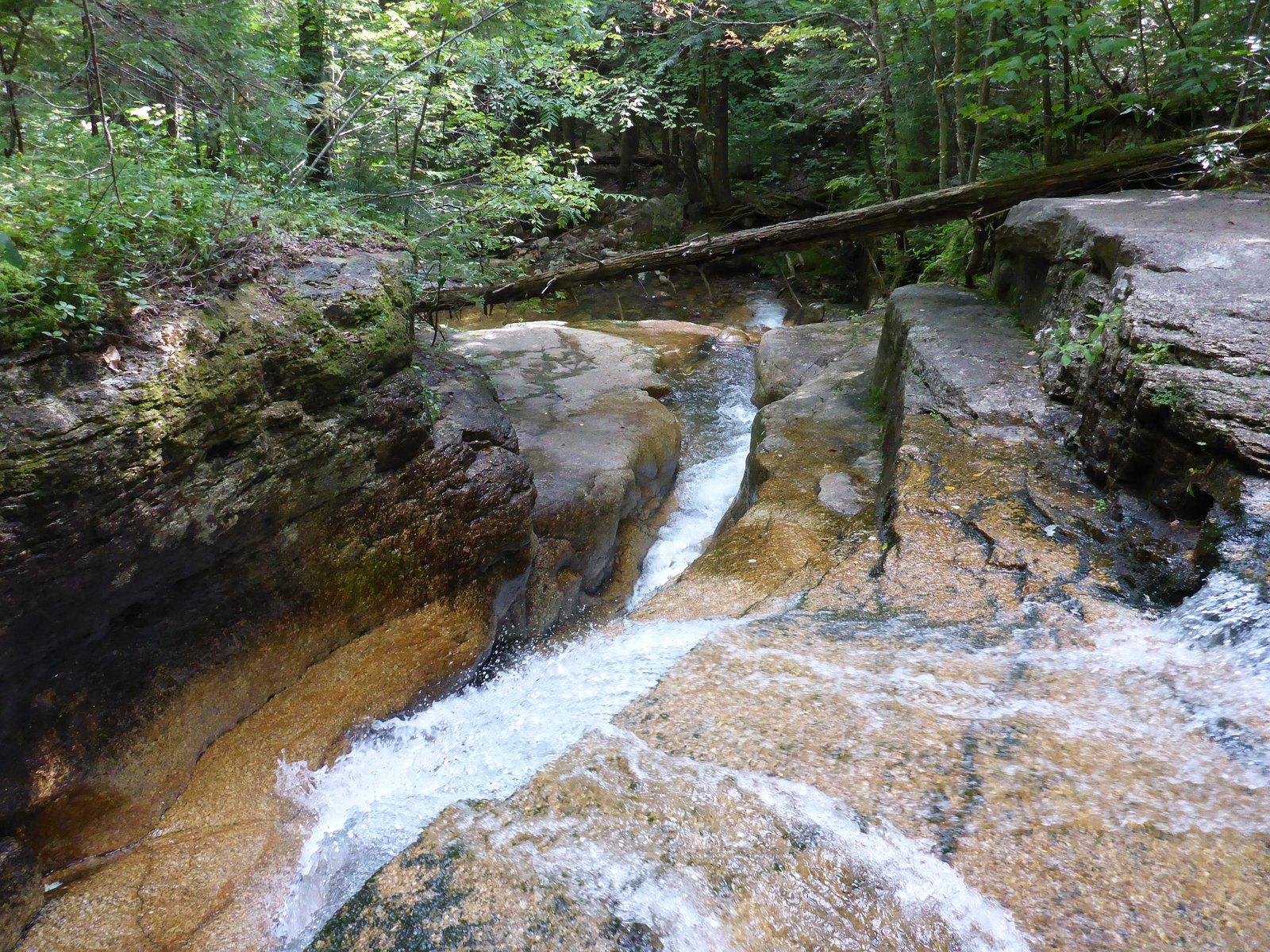
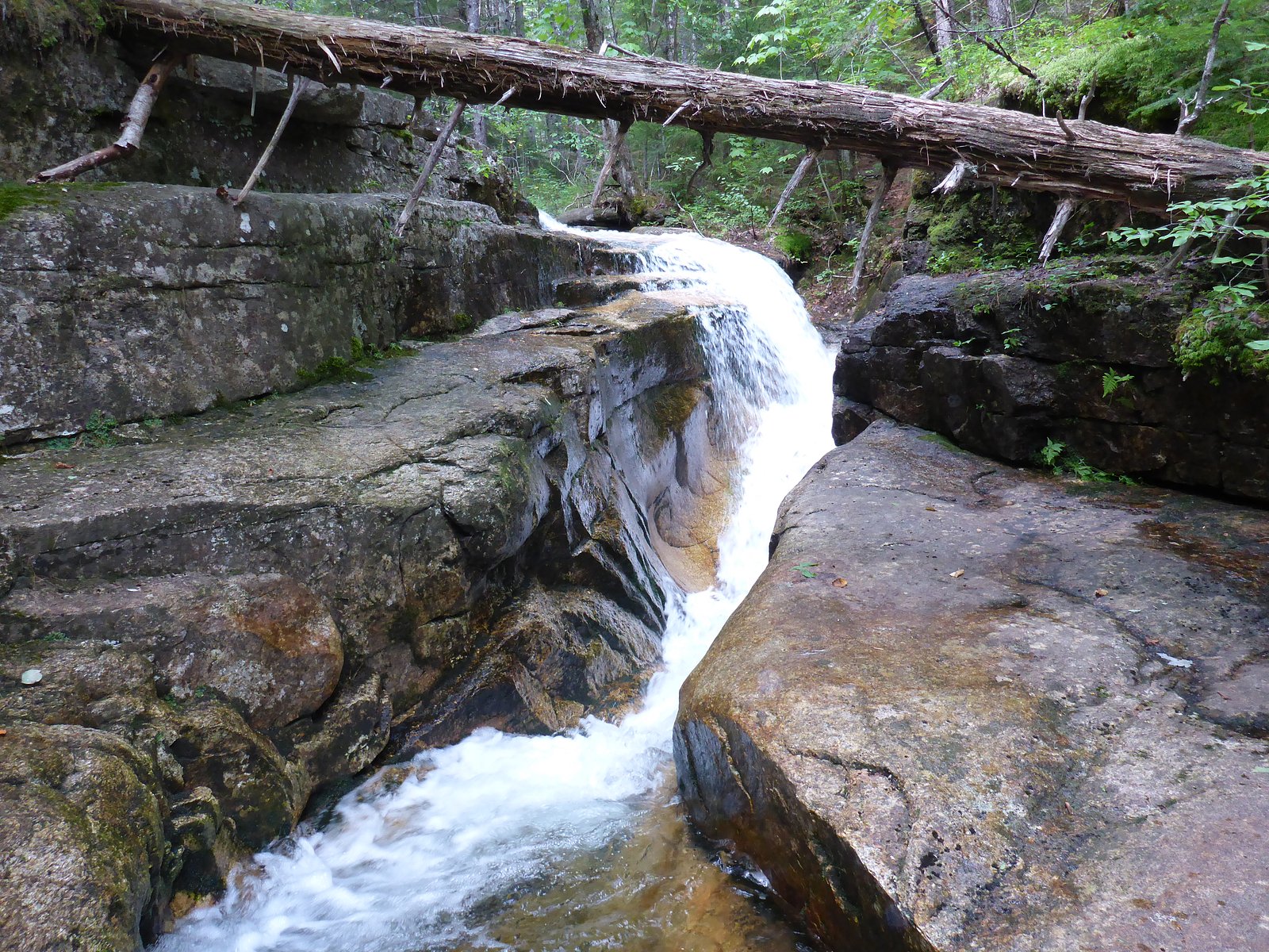
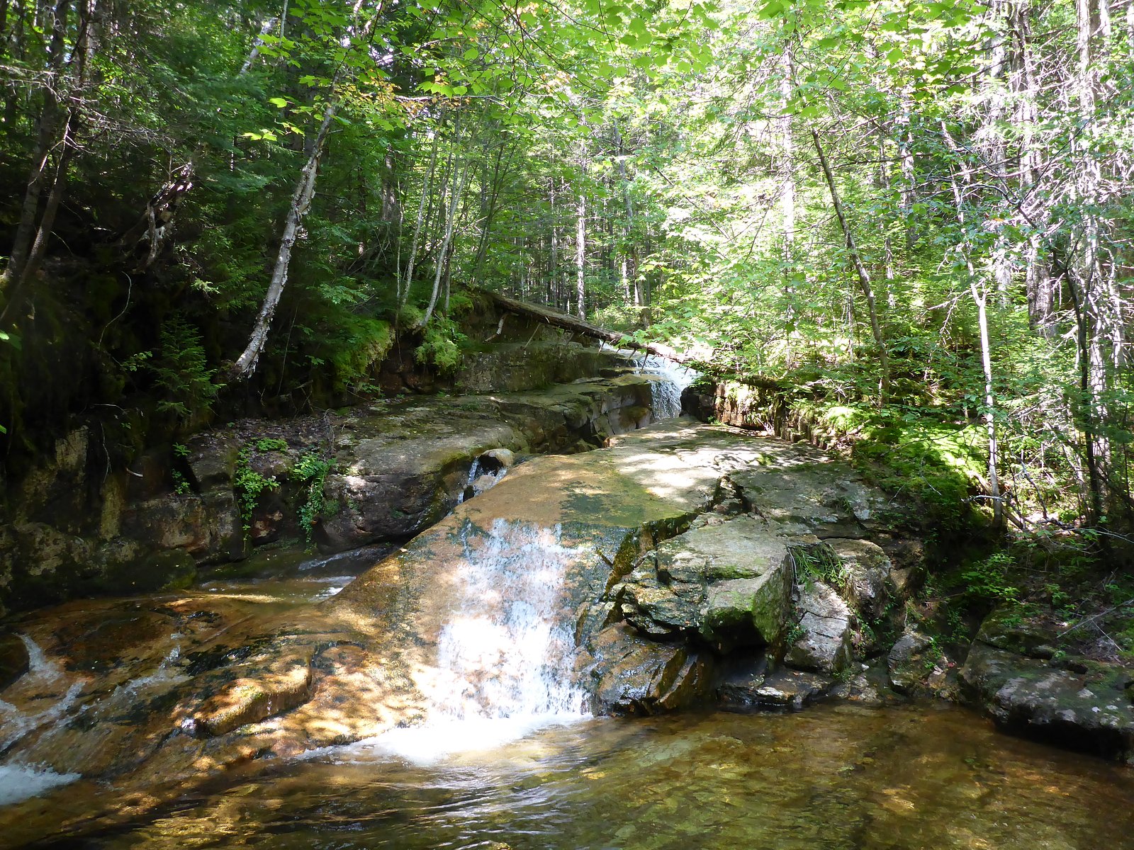
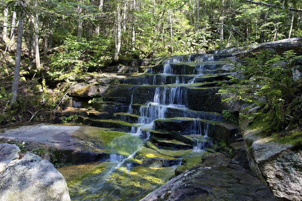
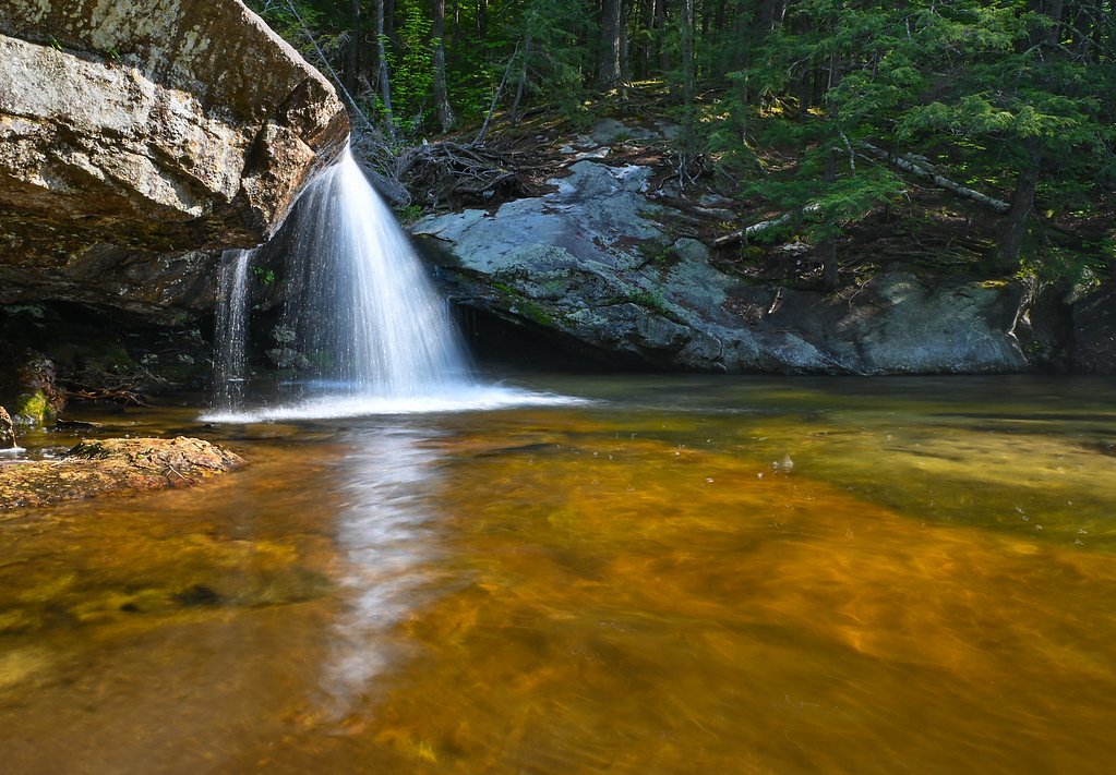
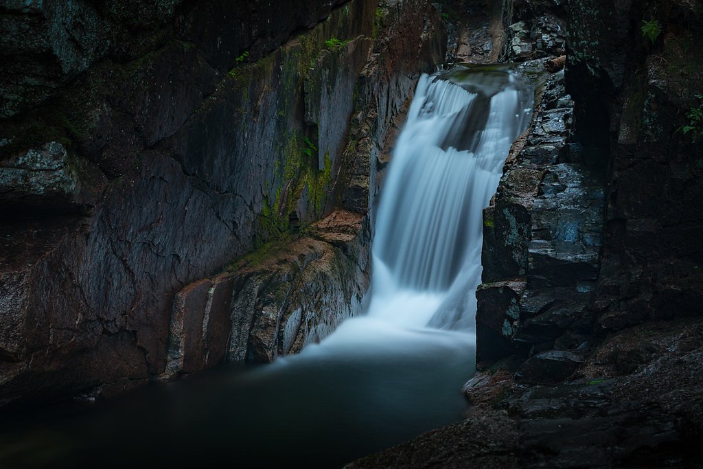
About Shell Cascade
Shell Cascade is a small, photogenic waterfall tucked into the White Mountain National Forest and managed by the U.S. Forest Service. The cascade sits along the Sandwich Mountain Trail (USFS Trail SANDWICH MTN, #32214), offering a peaceful woodland setting that’s ideal for a short nature stop or a photo break on a longer hike. Its modest size and forested surroundings make it feel intimate compared with the larger falls in the region, yet it rewards visitors with classic New England stream scenery. Access to the cascade is straightforward: USFS mapping shows a short 0.3-mile segment of the Sandwich Mountain Trail leading to the area, while popular route information lists a 2.4-mile out-and-back outing with about 350 feet of elevation gain (moderate difficulty) if you include approach and return. Waterville Campground is nearby (about 2.46 km away) for anyone wanting to turn a visit into an overnight stay in the White Mountains.
The Setting
Shell Cascade sits at 1,388 feet within White Mountain National Forest, fed by the Pemigewasset River, in the foothills of New Hampshire.
Trail & Hike Details
The Approach
The moderate hike follows Sandwich Mtn (#32214), a 2.4-mile out-and-back trail over natural surface. Expect 350 feet of elevation gain with grades of 12-20%. The trail is moderately developed (Class 2).
USFS Trail
SANDWICH MTN #32214
Trail Class
Moderately Developed
Surface
Avg Grade
USFS Segment
0.30 miTrail Description
Trail: Sandwich Mountain Trail (USFS Trail SANDWICH MTN, #32214). Class: 2. Surface: native material. Typical grade: 12–20%. USFS GIS segment to the cascade: 0.3 miles. Commonly hiked route statistics: 2.4 miles total (out-and-back) with ~350 ft elevation gain, rated moderate. The tread is natural (dirt/rock) with short, moderately steep sections consistent with the listed grade; expect an unpaved trail surface and moderate footing in places.
What to Expect
Dogs are welcome.
Accessibility
The trail is not wheelchair accessible. Uneven terrain and elevation changes require steady footing.
Frequently Asked Questions
🐶 Are Dogs Allowed at Shell Cascade?
✅ Dogs are allowed
Are There Any Fees or Permits Required?
🤑 Fee: $4.00
🏊 Is There Swimming at Shell Cascade?
❌ Swimming is not allowed
When to Visit
Spring and early summer are the best times to visit, as the water flow is typically strongest during these seasons.
Seasonal Access
The best time to visit is Spring, Summer, and Fall. Winter access may be limited. Check with White Mountain National Forest for seasonal road closures.
Safety Information
The rocks near the waterfall can be slippery, especially after rain. Exercise caution and supervise children closely.
Current Water Conditions
472 ft³/s
Current discharge — how much water is flowing
About average for this time of year
Based on 62 years of record
3.30 ft
Water depth at gauge
7-Day Discharge Trend
What does this mean for your visit?
Flow is about average for this time of year.
About This Gauge
This gauge is on a nearby waterway and may not reflect exact conditions at the falls.
7-Day Flow Outlook
Based on the USGS gauge PEMIGEWASSET RIVER AT WOODSTOCK, NH (13 km away).
Today
Barely Flowing
482 cfs
5/10Tomorrow
Barely Flowing
498 cfs
3/10Tue
Low
539 cfs
3/10Wed
Barely Flowing
429 cfs
5/10Thu
Low
491 cfs
3/10Fri
Low
448 cfs
3/10Sat
Low
420 cfs
4/10Best window: Today — barely flowing flow, sunny (trip score 5/10).
Best time of year: this gauge typically runs highest from late March to mid June, peaking in May.
How we calculate this
This is a transparent outlook, not a precise forecast. We take the waterfall's current flow strength (how it ranks against its historical normal for today, from the nearest USGS stream gauge), carry that ranking forward along the gauge's seasonal curve, and nudge it for forecast rain. Confidence is highest for the next day or two and falls further out. Always check official conditions and your own judgment before visiting — high flows can be dangerous.
Know when to go.
Get a free email alert when waterfalls near Center Sandwich hit peak flow. We only send when conditions are worth the trip — no weekly newsletters, no spam.
Weather Forecast
Location & Access
Getting There
Shell Cascade is located along Route 302 in Crawford Notch State Park. It is accessible via a short walk from the nearby parking area.
Get Directions on Google MapsParking
Parking is available at the Crawford Notch State Park parking lot or nearby pull-offs along Route 302.
Elevation
1,388 feet above sea level
Coordinates
43.929792° N, -71.534799° W
Land Management
Managed by USFS
Visitor Tips & Gear
Visit after recent rain or during spring for the best water flow. Wear sturdy shoes as the area near the cascade may be slippery. Arrive early during peak seasons to secure parking.
As an Amazon Associate, we earn from qualifying purchases.
With 2.4 miles and 350 ft of elevation gain, sturdy boots and trekking poles will help on this moderate trail. Sun exposure on the trail makes good sun protection a must in summer.

Polarized Sunglasses (Knockaround)
Cuts glare off the water so you actually see the falls — and your photos turn out better too.

Columbia Watertight II Rain Jacket
Packs into its own pocket, seam-sealed, and keeps you dry from spray and surprise rain.

Earth Pak Waterproof Dry Bag
Keeps your phone and gear dry when waterfall mist soaks everything else.

Waterproof Phone Pouch (AiRunTech)
Cheap insurance — take photos right next to the falls without killing your phone.

Timberland Euro Sprint Mid Waterproof
Trusted waterproof boot with premium leather and grippy rubber sole — reliable on rocky, wet trails.

TrailBuddy Trekking Poles
Lightweight aluminum, cork grips, and flip-locks that actually hold — a best-seller for good reason.
Where to Stay

1-Bedroom Condo in Thornton

Cozy Ski Condo

The Valley Inn, an Ascend Collection Hotel

Inn 32
Browse vacation cabins and private rentals nearby
Unique outdoor stays — tents, yurts, and treehouses
Rent a campervan or RV for your waterfall road trip
Some links are affiliate links. We may earn a commission at no extra cost to you.
Nearby Campground
WATERVILLE CAMPGROUND
1.5 miles away · 29 sites
Overview Waterville Campground is a popular home base for hikers who want to explore the southern White Mountains, including the scenic Pemigewasset Wilderness. The tremendous choice of local attractions and the proximity to outdoor recreation opportunities - fishing, swimming, hiking and whitewater paddling to name a few - bring campers back to Waterville again and again. The White Mountains boast pristine forests, clear mountain streams and rivers and the tallest peaks in the Northeast. The for
Book on Recreation.govAdditional Information
Nearby Attractions
Nearby attractions include Arethusa Falls, Ripley Falls, and the Mount Willard hiking trail.
Wildlife
The area is home to a variety of wildlife, including birds, squirrels, and occasionally deer. Be cautious of black bears in the region.
Cities near Shell Cascade
Nearby Waterfalls
Writing about Shell Cascade? Embed this waterfall on your site for free.