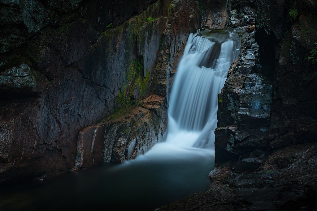
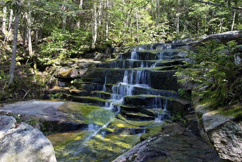
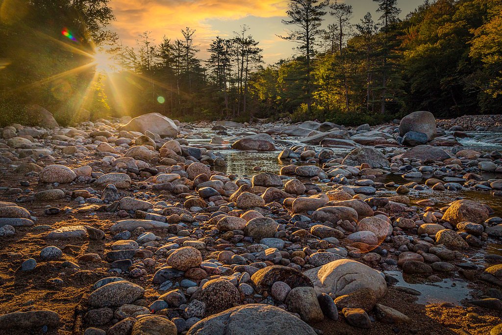
Sabbaday Falls
New Hampshire • 45 ft
By Armen Suny · Last verified Mar 2026
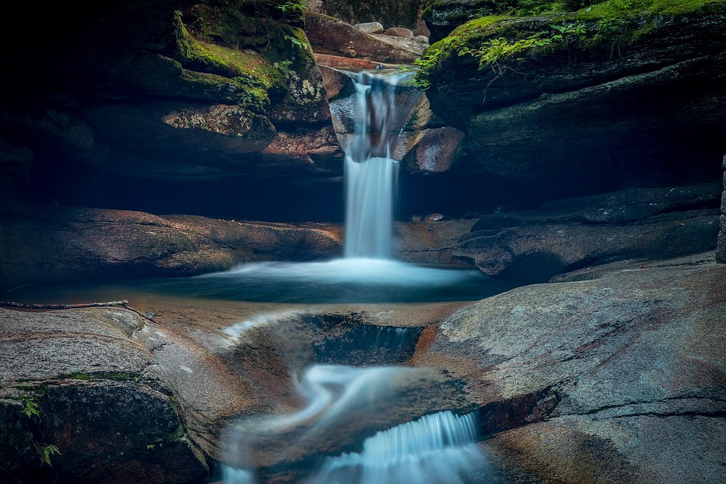
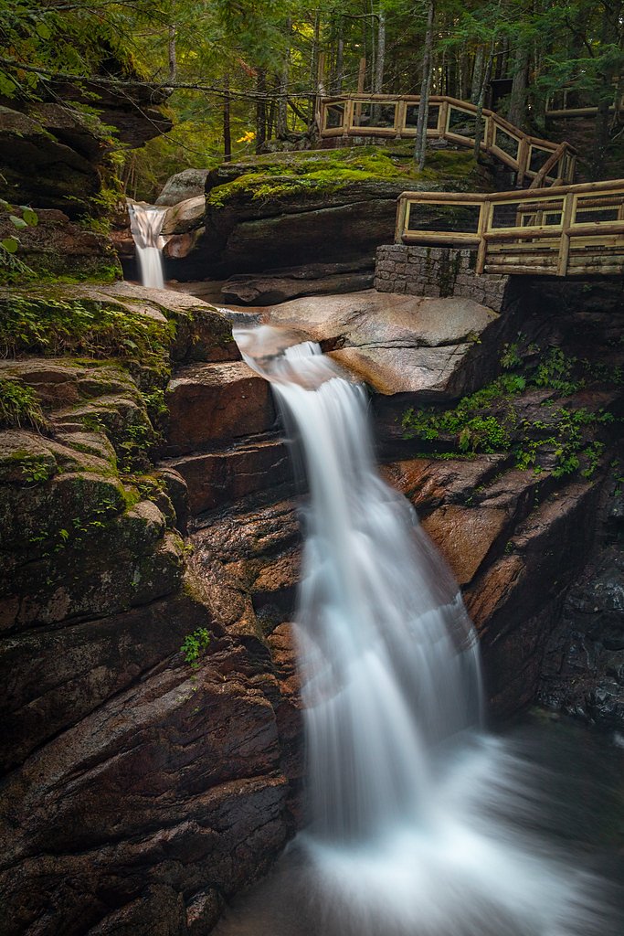
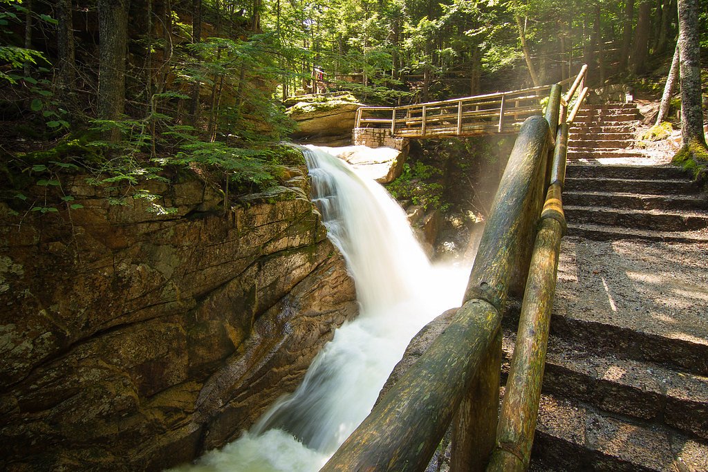
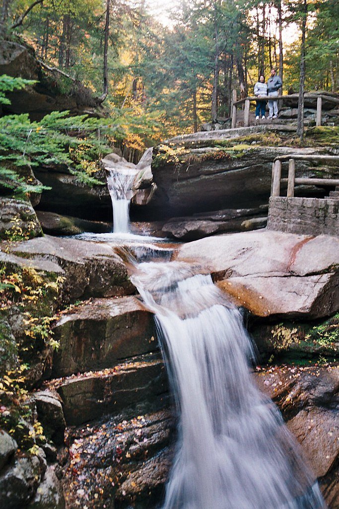

Photo Credits (5)
Difficulty
Easy
Trail Length
0.7 miles
Trail Type
Out And Back
Elevation Gain
100 ft
About Sabbaday Falls
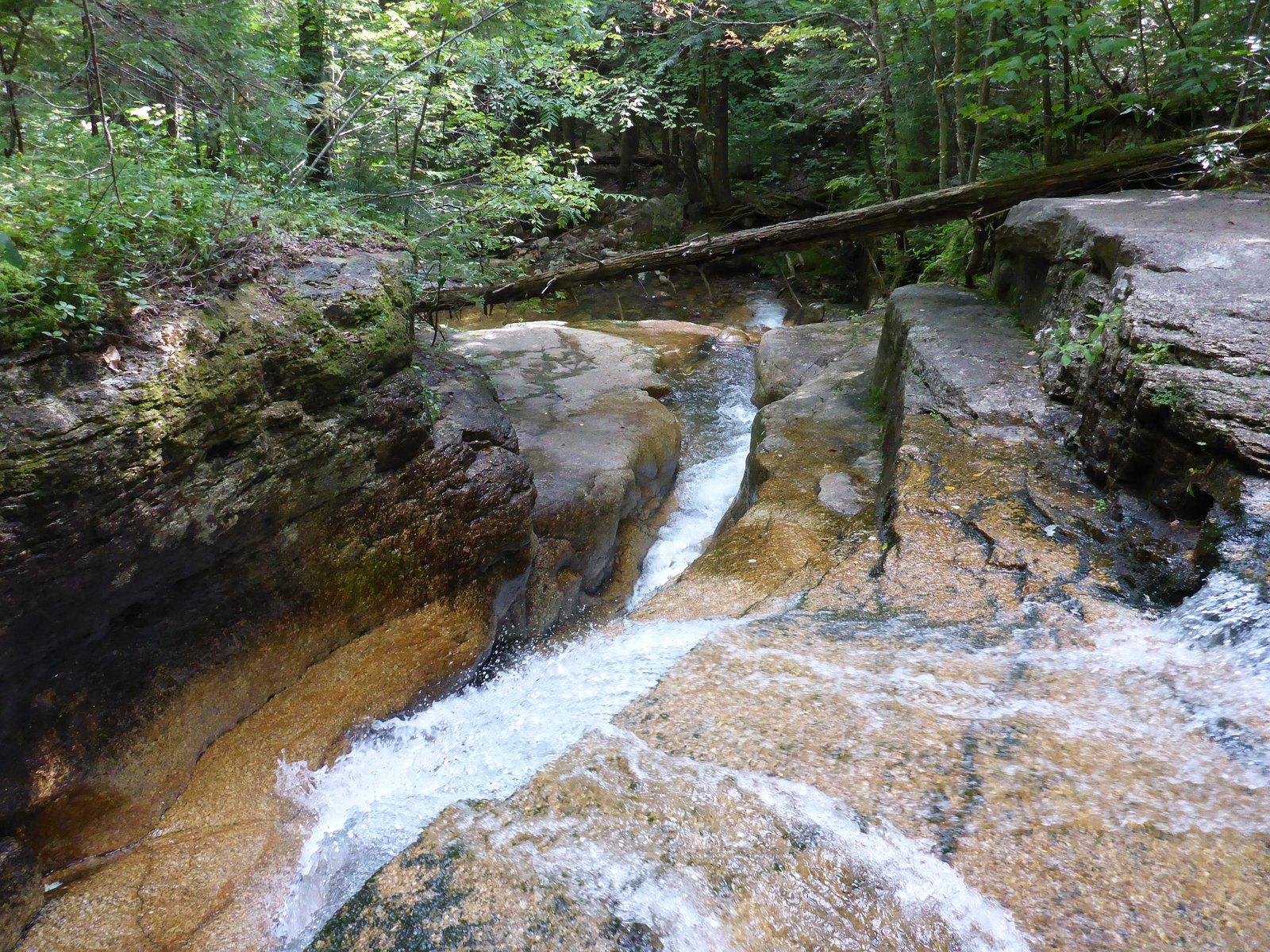
Sabbaday Falls is a picturesque, multi-tiered waterfall located in the White Mountain National Forest in New Hampshire. It is known for its unique geological formations and crystal-clear waters, making it a popular destination for visitors.
The Setting
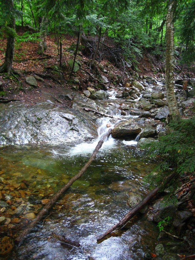
Sabbaday Falls sits at 1,404 feet within White Mountain National Forest, fed by the Bearcamp River, in the foothills of New Hampshire. The falls drop 45 feet.
Height: 45 feet
Nearby Falls Worth Visiting
Nancy Cascades, the tallest waterfall in New Hampshire at 300 feet, lies 8.5 miles to the north.
Trail & Hike Details
The Approach
The easy hike follows Sabbaday Brook Trail (#32401), a 0.7-mile out-and-back trail over natural surface. Expect 100 feet of elevation gain with grades of 12-20%. The trail is developed (Class 3).
USFS Trail
SABBADAY BROOK TRAIL #32401
Trail Class
Developed
Surface
Avg Grade
USFS Segment
0.10 miTrail Description
The trail to Sabbaday Falls is a short, well-maintained path that is suitable for most visitors. It features a gentle incline and leads to a viewing platform where visitors can enjoy the falls. The trail is shaded and offers a pleasant walk through the forest.
What to Expect
The falls drop 45 feet. Dogs are welcome.
Accessibility
The trail is short and relatively flat, but the surface may be uneven. Contact the managing agency for accessibility details.
Frequently Asked Questions
🐶 Are Dogs Allowed at Sabbaday Falls?
✅ Dogs are allowed
Are There Any Fees or Permits Required?
🤑 Fee: $5.00
🏊 Is There Swimming at Sabbaday Falls?
❌ Swimming is not allowed
When to Visit
The best time to visit is during spring and early summer when water flow is at its peak, or in the fall to enjoy the vibrant foliage.
Seasonal Access
The best time to visit is Spring, Summer, and Fall. Winter access may be limited. Check with White Mountain National Forest for seasonal road closures.
Safety Information
Stay on designated trails and viewing platforms. The rocks around the falls can be slippery, especially when wet. Exercise caution and supervise children closely.
Current Water Conditions
180 ft³/s
Current discharge — how much water is flowing
Higher than usual for this time of year
Based on 33 years of record
4.60 ft
Water depth at gauge
7-Day Discharge Trend
What does this mean for your visit?
The water is flowing higher than usual for this time of year.
About This Gauge
This gauge is on a nearby waterway and may not reflect exact conditions at the falls.
7-Day Flow Outlook
Based on the USGS gauge BEARCAMP RIVER AT SOUTH TAMWORTH, NH (20 km away).
Today
Moderate
205 cfs
6/10Tomorrow
Moderate
246 cfs
6/10Mon
Moderate
205 cfs
8/10Tue
Moderate
245 cfs
6/10Wed
Moderate
260 cfs
6/10Thu
Moderate
227 cfs
6/10Fri
Moderate
208 cfs
6/10Best window: Mon — moderate flow, sunny (trip score 8/10).
Best time of year: this gauge typically runs highest from mid March to mid May, peaking in April.
How we calculate this
This is a transparent outlook, not a precise forecast. We take the waterfall's current flow strength (how it ranks against its historical normal for today, from the nearest USGS stream gauge), carry that ranking forward along the gauge's seasonal curve, and nudge it for forecast rain. Confidence is highest for the next day or two and falls further out. Always check official conditions and your own judgment before visiting — high flows can be dangerous.
Know when to go.
Get a free email alert when waterfalls near Center Sandwich hit peak flow. We only send when conditions are worth the trip — no weekly newsletters, no spam.
Weather Forecast
Location & Access
Getting There
Sabbaday Falls is located off the Kancamagus Highway (Route 112) in the White Mountain National Forest. It is approximately 15 miles west of Conway, New Hampshire.
Get Directions on Google MapsParking
There is a designated parking area near the trailhead, which is accessible from the Kancamagus Highway. Parking may fill up quickly during peak seasons.
Elevation
1,404 feet above sea level
Coordinates
43.994792° N, -71.396463° W
Land Management
Managed by USFS
Visitor Tips & Gear
Arrive early during peak seasons to secure parking. Wear sturdy footwear, especially if visiting during wet or icy conditions. Bring a camera to capture the beauty of the falls.
As an Amazon Associate, we earn from qualifying purchases.
For this easy 0.7 miles trail, lightweight trail shoes and a water bottle are usually sufficient. Sun exposure on the trail makes good sun protection a must in summer.

Polarized Sunglasses (Knockaround)
Cuts glare off the water so you actually see the falls — and your photos turn out better too.

Columbia Watertight II Rain Jacket
Packs into its own pocket, seam-sealed, and keeps you dry from spray and surprise rain.

Earth Pak Waterproof Dry Bag
Keeps your phone and gear dry when waterfall mist soaks everything else.

Waterproof Phone Pouch (AiRunTech)
Cheap insurance — take photos right next to the falls without killing your phone.

JOBY GorillaPod Starter Kit
Wraps around railings and rocks for long-exposure waterfall shots — no flat surface needed.

Osprey Daylite Daypack
Light, organized, and just the right size for a day hike — fits water, snacks, and layers.
Where to Stay

Inn 32

The Valley Inn, an Ascend Collection Hotel

White Mountains Getaway with amazing views!

The Inn & More
Browse vacation cabins and private rentals nearby
Unique outdoor stays — tents, yurts, and treehouses
Rent a campervan or RV for your waterfall road trip
Some links are affiliate links. We may earn a commission at no extra cost to you.
Nearby Campground
RADEKE CABIN
1.5 miles away · 1 sites
Overview Radeke Cabin once served as a summer camp for School of Forestry students at the University of New Hampshire until the mid 1960s. It was purchased by the Forest Service in 1969. The cabin is just off the Kancamagus Scenic Byway and easily accessible by car, but guests should be prepared to bring most of the gear and supplies needed to make their stay comfortable. Radeke Cabin offers an ideal year-round getaway for families or small groups.Recreation A trailhead for the UNH Trail is locat
Book on Recreation.govAdditional Information
Nearby Attractions
Other attractions along the Kancamagus Highway include Lower Falls, Rocky Gorge, and the Albany Covered Bridge.
Wildlife
Visitors may encounter wildlife such as birds, squirrels, and occasionally deer. Be cautious and do not feed wildlife.
Cities near Sabbaday Falls
Nearby Waterfalls
Writing about Sabbaday Falls? Embed this waterfall on your site for free.