Photo Credits (5)
Difficulty
Moderate
Trail Length
2.4 miles
Trail Type
Out And Back
Elevation Gain
350 ft
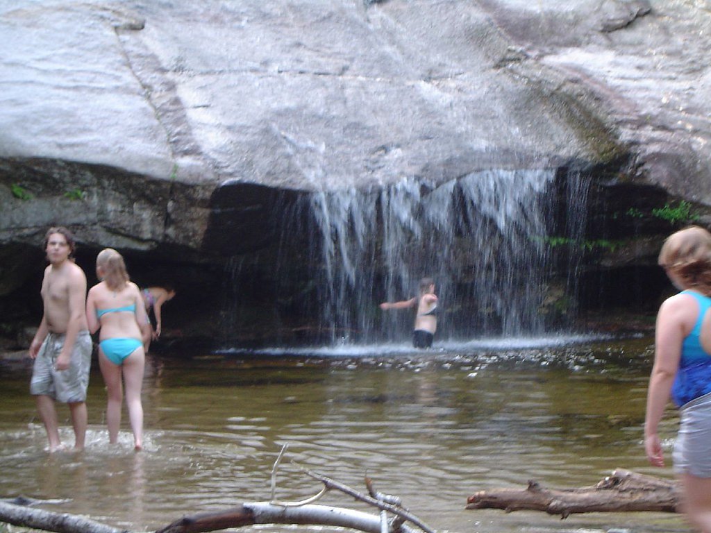
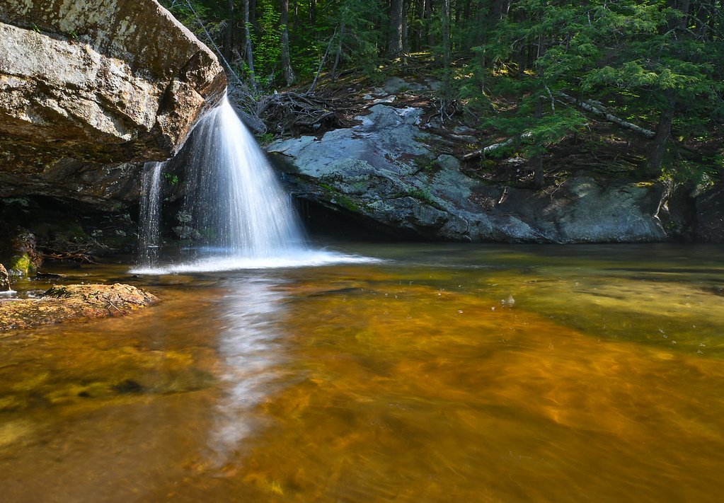
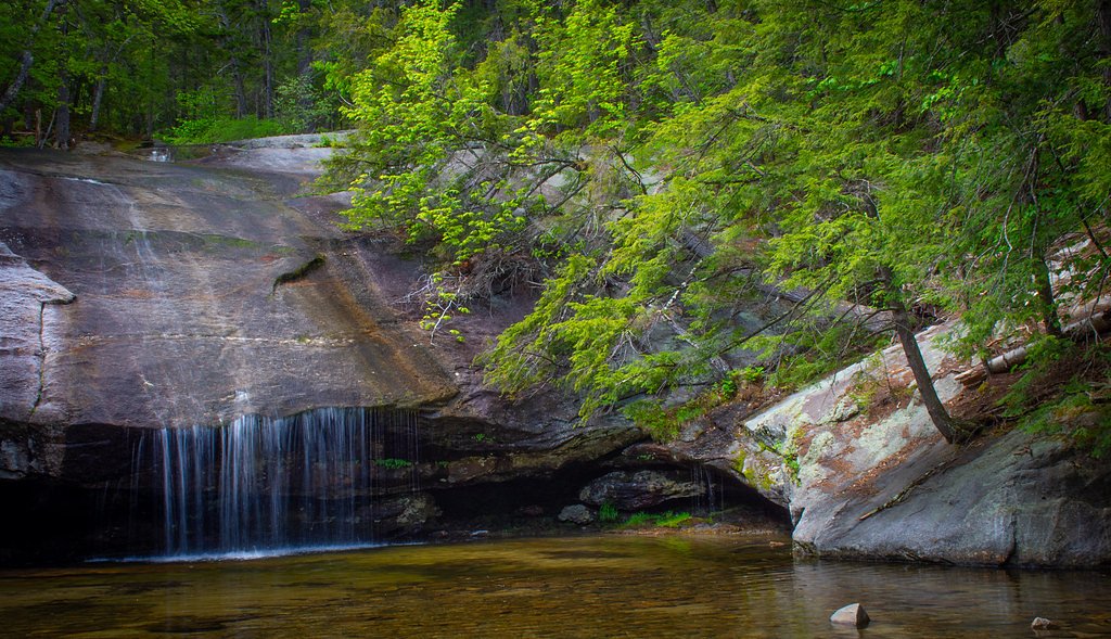
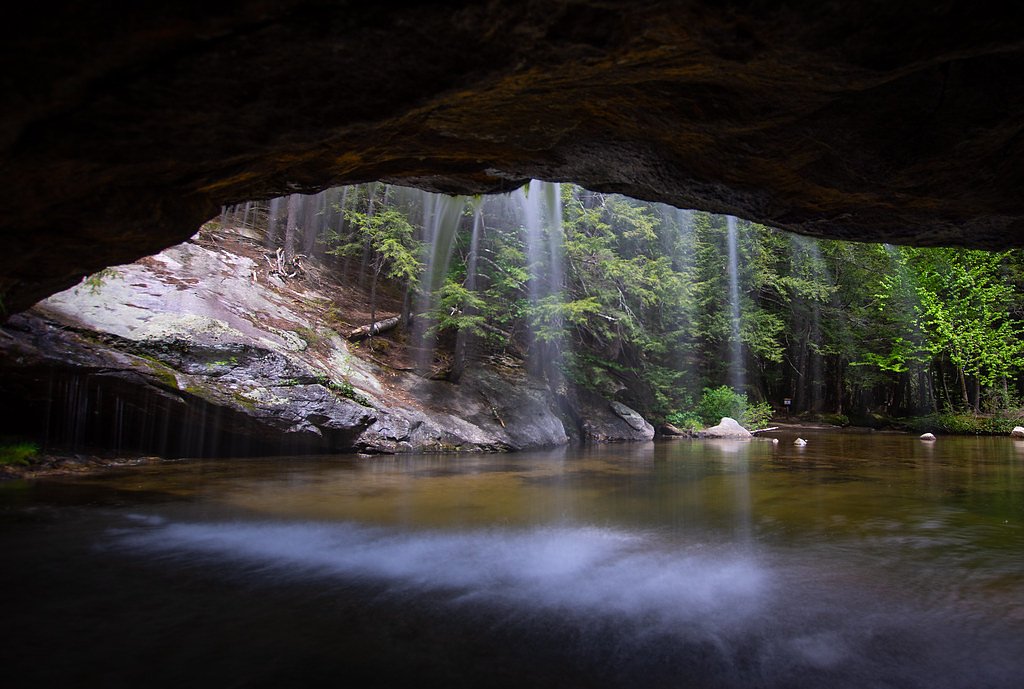
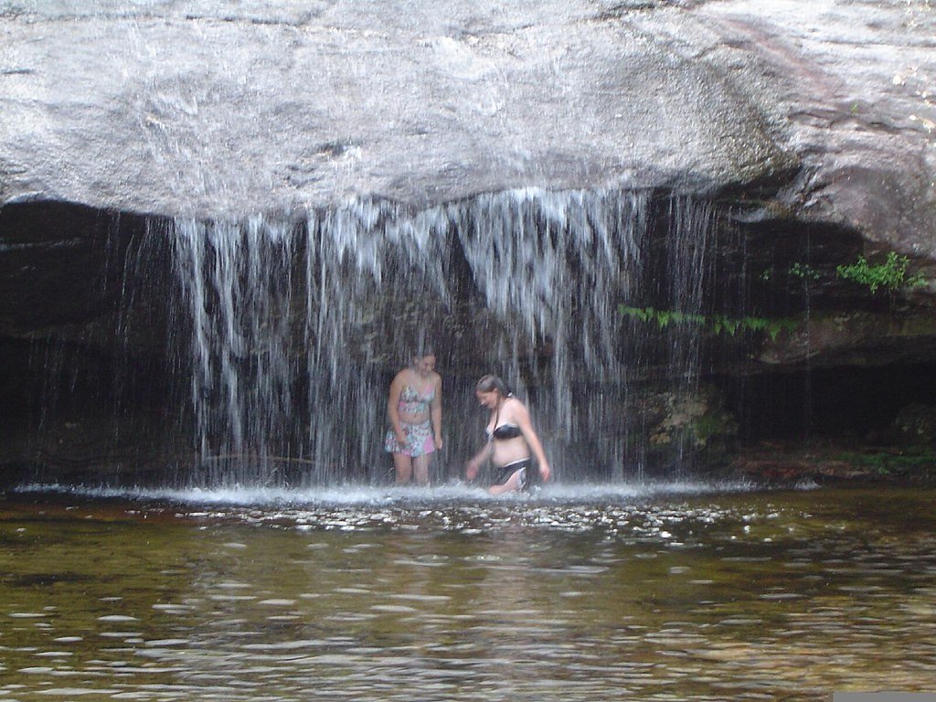
About Beede Falls
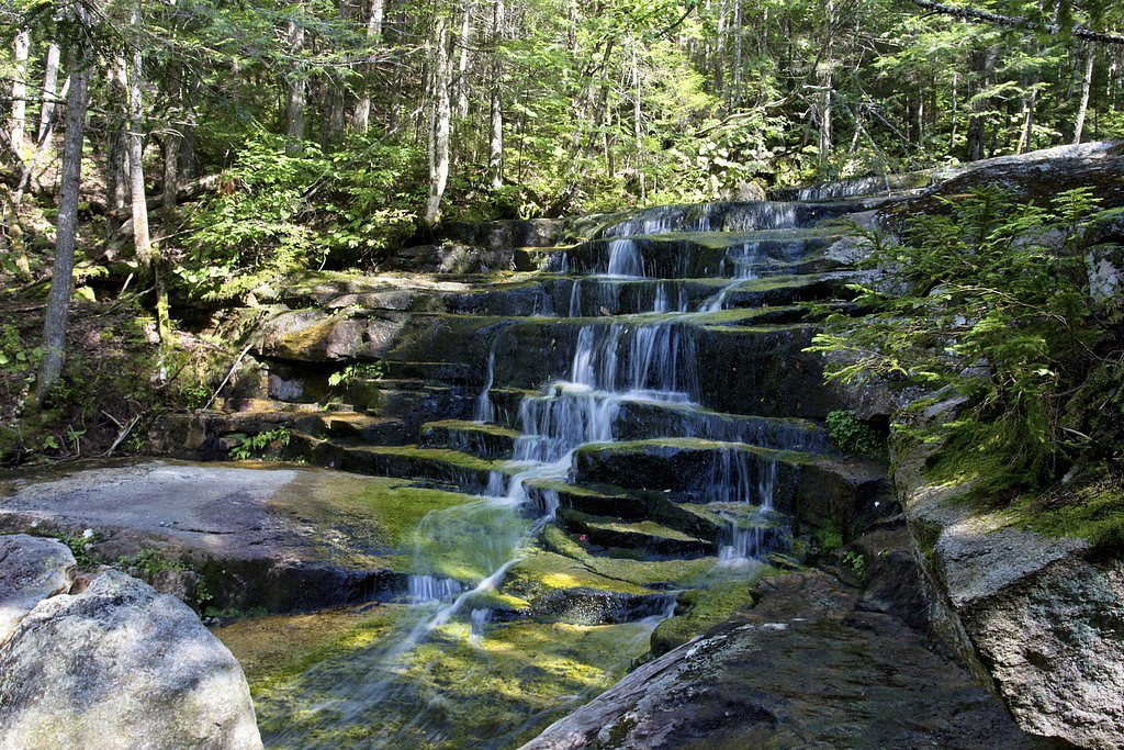
Beede Falls is a picture-perfect cascade in Sandwich, New Hampshire, tucked within the White Mountain Purchase Unit of the White Mountain National Forest and managed by the U.S. Forest Service. The falls spill over a broad rock ledge into a calm pool, offering a peaceful scene that’s popular with photographers and hikers seeking a scenic short stop in the woods. The setting feels remote yet accessible, making it an easy reward for a morning or afternoon outing. The U.S. Forest Service maps access to the falls via SANDWICH NOTCH ROAD SNOMO (Trail #97348), so you’ll be following land and trail data maintained by the USFS as you approach. While the cascade itself invites a relaxed visit, standard caution on wet rock and uneven forest footing is advised—visit in clear weather for the easiest access and best views.
The Setting
Beede Falls sits at 1,158 feet within White Mountain Purchase Unit, fed by the Bearcamp River, in the foothills of New Hampshire.
Trail & Hike Details
The Approach
The moderate hike follows Sandwich Notch Road Snomo (#97348), a 2.4-mile out-and-back trail. Expect 350 feet of elevation gain with grades of 12-20%. The trail is highly developed (Class 4).
USFS Trail
SANDWICH NOTCH ROAD SNOMO #97348
Trail Class
Highly Developed
Avg Grade
USFS Segment
0.02 miTrail Description
This is a moderate, out-and-back hike of about 2.4 miles round trip with roughly 350 feet of elevation gain. USFS trail data lists the access as SANDWICH NOTCH ROAD SNOMO, Trail #97348 (Class 4) with a typical grade of 12–20%. The USFS GIS shows a very short mapped segment at the falls (0.02 miles), but the overall approach is the 2.4-mile route; expect natural forest tread and some steeper pitches consistent with the listed grade.
What to Expect
Swimming is permitted. Dogs are welcome.
Accessibility
The trail is not wheelchair accessible. Uneven terrain and elevation changes require steady footing.
Frequently Asked Questions
🐶 Are Dogs Allowed at Beede Falls?
✅ Dogs are allowed
Are There Any Fees or Permits Required?
🆖 No fees required
🏊 Is There Swimming at Beede Falls?
✅ Swimming is allowed
When to Visit
Spring and early summer are ideal for viewing the falls at their fullest flow. Fall offers beautiful foliage, while summer provides a great opportunity for a relaxing visit.
Seasonal Access
The best time to visit is Spring, Summer, and Fall. Winter access may be limited. Check with White Mountain Purchase Unit for seasonal road closures.
Safety Information
The rocks around the falls can be slippery, especially after rain. Use caution when walking near the water. Be aware of ticks and bring bug spray during warmer months.
Current Water Conditions
96 ft³/s
Current discharge — how much water is flowing
About average for this time of year
Based on 33 years of record
4.28 ft
Water depth at gauge
7-Day Discharge Trend
What does this mean for your visit?
Flow is about average for this time of year.
About This Gauge
This gauge is on a nearby waterway and may not reflect exact conditions at the falls.
7-Day Flow Outlook
Based on the USGS gauge BEARCAMP RIVER AT SOUTH TAMWORTH, NH (17 km away).
Today
Barely Flowing
98 cfs
5/10Tomorrow
Barely Flowing
119 cfs
3/10Wed
Low
130 cfs
3/10Thu
Barely Flowing
103 cfs
5/10Fri
Low
100 cfs
3/10Sat
Low
94 cfs
3/10Sun
Low
85 cfs
4/10Best window: Today — barely flowing flow, sunny (trip score 5/10).
Best time of year: this gauge typically runs highest from mid March to mid May, peaking in April.
How we calculate this
This is a transparent outlook, not a precise forecast. We take the waterfall's current flow strength (how it ranks against its historical normal for today, from the nearest USGS stream gauge), carry that ranking forward along the gauge's seasonal curve, and nudge it for forecast rain. Confidence is highest for the next day or two and falls further out. Always check official conditions and your own judgment before visiting — high flows can be dangerous.
Know when to go.
Get a free email alert when waterfalls near Center Sandwich hit peak flow. We only send when conditions are worth the trip — no weekly newsletters, no spam.
Weather Forecast
Location & Access
Getting There
Beede Falls is located off Sandwich Notch Road in Sandwich, New Hampshire. The road is unpaved and may be rough in certain sections, especially during wet seasons. Visitors should check road conditions before traveling.
Get Directions on Google MapsParking
There is a small parking area near the trailhead for Beede Falls. Parking may be limited during peak seasons.
Elevation
1,158 feet above sea level
Coordinates
43.827572° N, -71.495353° W
Land Management
Managed by USFS
Visitor Tips & Gear
Visit early in the day to avoid crowds, especially during summer and fall foliage season. Wear sturdy shoes as the trail may be muddy or slippery after rain. Check road conditions on Sandwich Notch Road before traveling.
As an Amazon Associate, we earn from qualifying purchases.
With 2.4 miles and 350 ft of elevation gain, sturdy boots and trekking poles will help on this moderate trail. Sun exposure on the trail makes good sun protection a must in summer.

Polarized Sunglasses (Knockaround)
Cuts glare off the water so you actually see the falls — and your photos turn out better too.

Columbia Watertight II Rain Jacket
Packs into its own pocket, seam-sealed, and keeps you dry from spray and surprise rain.

Earth Pak Waterproof Dry Bag
Keeps your phone and gear dry when waterfall mist soaks everything else.

Waterproof Phone Pouch (AiRunTech)
Cheap insurance — take photos right next to the falls without killing your phone.

Timberland Euro Sprint Mid Waterproof
Trusted waterproof boot with premium leather and grippy rubber sole — reliable on rocky, wet trails.

TrailBuddy Trekking Poles
Lightweight aluminum, cork grips, and flip-locks that actually hold — a best-seller for good reason.
Where to Stay

1-Bedroom Condo in Thornton

Cozy Ski Condo

Red Sleigh Chalet - Campton

Best Western Plymouth Inn-White Mountains
Browse vacation cabins and private rentals nearby
Unique outdoor stays — tents, yurts, and treehouses
Rent a campervan or RV for your waterfall road trip
Some links are affiliate links. We may earn a commission at no extra cost to you.
Nearby Campground
CAMPTON CAMPGROUND
7.3 miles away · 91 sites
Overview Campton Campground is a large and accommodating facility near the southern edge of White Mountain National Forest in New Hampshire. With many kid-friendly activities nearby such as hiking and nature programs, the campground is especially popular with families. It is convenient to U.S. Highway 93, which travels through the middle of the state, and is just two hours from Boston. The White Mountains boast pristine forests, clear mountain streams and rivers and the tallest peaks in the North
Book on Recreation.govAdditional Information
Nearby Attractions
Other attractions in the area include Sandwich Notch Road scenic drive and hiking trails in the White Mountain National Forest.
Wildlife
The area is home to a variety of wildlife, including birds, deer, and small mammals. Be cautious of ticks during warmer months.
Cities near Beede Falls
Nearby Waterfalls
Writing about Beede Falls? Embed this waterfall on your site for free.