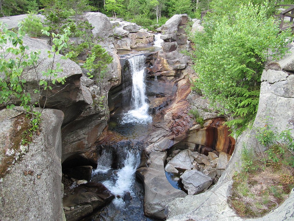
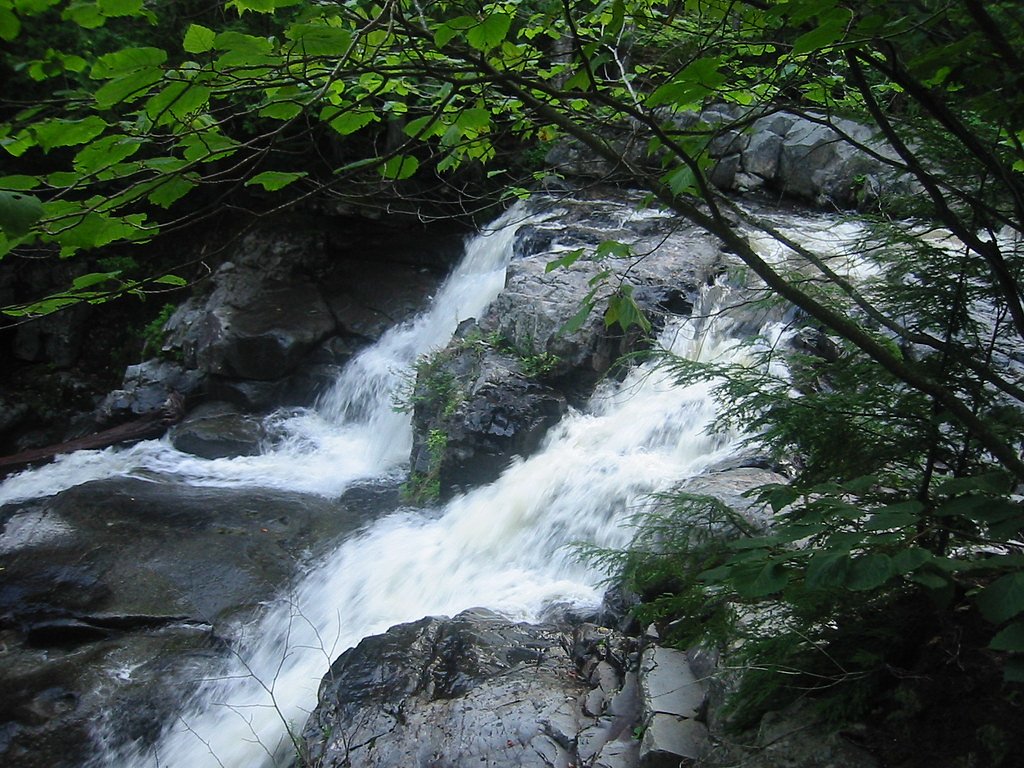
Screw Auger Falls
Maine • 23 ft
By Armen Suny · Last verified Mar 2026
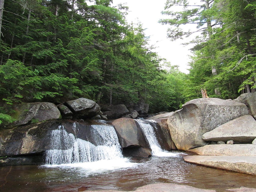
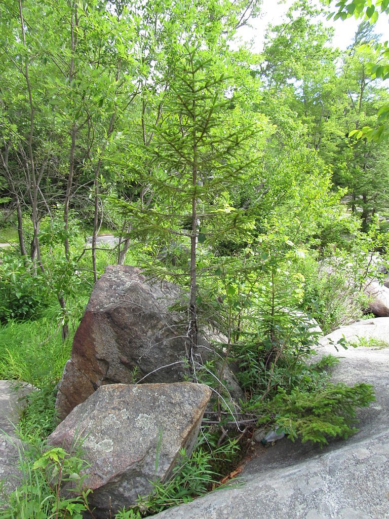
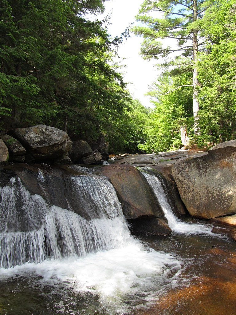

Photo Credits (5)
Difficulty
Moderate
Trail Length
2.4 miles
Trail Type
Out And Back
Elevation Gain
350 ft
About Screw Auger Falls
Screw Auger Falls is a photogenic cascade in western Maine that threads a series of pools and bedrock drops before tumbling roughly 23 feet — a compact but attractive waterfall that rewards a short hike. The falls sit in the Grafton Notch area and are on public lands managed by the National Park Service as part of the Appalachian National Scenic Trail corridor, making them an easy stop for thru-hikers and day visitors alike. Its sculpted channels and plunge pools make for excellent photos and quiet moments beside tumbling water. While modest in scale compared with some of Maine’s more dramatic features, Screw Auger Falls offers striking geology and accessible scenery. For context, other well-known Maine attractions such as Gulf Hagas showcase how varied the state’s river-cut landscapes can be: Gulf Hagas is a three-mile (4.8 km) gorge where the West Branch of the Pleasant River drops 370 feet (110 m), with walls up to 130 feet (40 m) high. Screw Auger’s ease of access and 23-foot drop make it a popular, approachable stop for hikers exploring Maine’s rugged interior.
The Setting
Screw Auger Falls sits at 915 feet within Appalachian National Scenic Trail, fed by the Sebec River, in the foothills of Maine. The falls drop 23 feet.
Height: 23 feet
Trail & Hike Details
The Approach
The moderate 2.4-mile out-and-back trail gains 350 feet of elevation on the way to the falls.
Trail Description
The route to Screw Auger Falls is a 2.4-mile out-and-back trail with about 350 feet of elevation gain, typically rated moderate. The path is well-defined and maintained, providing direct access to the falls and viewpoints of the cascades; the waterfall itself measures about 23 feet in height. Surface, grade, and formal trail class were not specified in the available trail data, but the route is commonly used by day-hikers and visitors traveling the Appalachian National Scenic Trail corridor managed by the National Park Service.
What to Expect
The falls drop a gentle 23 feet. Dogs are welcome.
Accessibility
The trail is not wheelchair accessible. Uneven terrain and elevation changes require steady footing.
Frequently Asked Questions
🐶 Are Dogs Allowed at Screw Auger Falls?
✅ Dogs are allowed
Are There Any Fees or Permits Required?
🆖 No fees required
🏊 Is There Swimming at Screw Auger Falls?
❌ Swimming is not allowed
When to Visit
The best time to visit Screw Auger Falls is during the spring and early summer when water flow is at its peak, or in the fall for vibrant foliage. Winter visits may also be possible, but icy conditions can make access more challenging.
Seasonal Access
The best time to visit is Spring, Summer, and Fall. Winter access may be limited. Check the National Park Service website for current conditions.
Safety Information
Exercise caution near the falls as the rocks can be slippery, especially after rain. Stay on marked trails and avoid getting too close to the edge of the gorge.
Current Water Conditions
Based on a USGS gauge 17.6 miles away
797 ft³/s
Current discharge — how much water is flowing
Higher than usual for this time of year
Based on 71 years of record
3.62 ft
Water depth at gauge
7-Day Discharge Trend
What does this mean for your visit?
The water is flowing higher than usual for this time of year.
About This Gauge
This gauge is on a regional waterway. Conditions at the falls may differ, especially after local rain.
7-Day Flow Outlook
Based on the USGS gauge Sebec River at Sebec, Maine (28 km away).
Today
Barely Flowing
868 cfs
3/10Tomorrow
Low
885 cfs
4/10Sun
Low
965 cfs
3/10Mon
Barely Flowing
957 cfs
5/10Tue
Low
1028 cfs
3/10Wed
Low
975 cfs
4/10Thu
Low
882 cfs
4/10Best window: Mon — barely flowing flow, mostly sunny (trip score 5/10).
Best time of year: this gauge typically runs highest from late March to early June, peaking in April.
How we calculate this
This is a transparent outlook, not a precise forecast. We take the waterfall's current flow strength (how it ranks against its historical normal for today, from the nearest USGS stream gauge), carry that ranking forward along the gauge's seasonal curve, and nudge it for forecast rain. Confidence is highest for the next day or two and falls further out. Always check official conditions and your own judgment before visiting — high flows can be dangerous.
Know when to go.
Get a free email alert when waterfalls near Brownville Junction hit peak flow. We only send when conditions are worth the trip — no weekly newsletters, no spam.
Weather Forecast
Location & Access
Getting There
Screw Auger Falls is located along Route 26 in Grafton Notch State Park, Maine. It is easily accessible by car, with clear signage directing visitors to the parking area.
Get Directions on Google MapsParking
There is a designated parking area near the falls, which is free of charge. The parking lot is typically spacious but may fill up during peak seasons.
Elevation
915 feet above sea level
Coordinates
45.484491° N, -69.306439° W
Land Management
Managed by NPS
Visitor Tips & Gear
Visit early in the day to avoid crowds, especially during summer and fall foliage season. Wear sturdy shoes as the rocks near the falls can be slippery. Bring a camera to capture the beautiful scenery.
As an Amazon Associate, we earn from qualifying purchases.
With 2.4 miles and 350 ft of elevation gain, sturdy boots and trekking poles will help on this moderate trail. Sun exposure on the trail makes good sun protection a must in summer.
America the Beautiful Annual Pass
Covers entrance fees at 2,000+ federal recreation sites — required at most National Parks.

Polarized Sunglasses (Knockaround)
Cuts glare off the water so you actually see the falls — and your photos turn out better too.

Columbia Watertight II Rain Jacket
Packs into its own pocket, seam-sealed, and keeps you dry from spray and surprise rain.

Earth Pak Waterproof Dry Bag
Keeps your phone and gear dry when waterfall mist soaks everything else.

Waterproof Phone Pouch (AiRunTech)
Cheap insurance — take photos right next to the falls without killing your phone.

Timberland Euro Sprint Mid Waterproof
Trusted waterproof boot with premium leather and grippy rubber sole — reliable on rocky, wet trails.

TrailBuddy Trekking Poles
Lightweight aluminum, cork grips, and flip-locks that actually hold — a best-seller for good reason.
Where to Stay

Abbot Trailside Lodging

Waterfront home on Moosehead Lake

Leisure Life

All-Season Sanctuary: Steps to Moosehead Lake
Browse vacation cabins and private rentals nearby
Unique outdoor stays — tents, yurts, and treehouses
Rent a campervan or RV for your waterfall road trip
Some links are affiliate links. We may earn a commission at no extra cost to you.
Additional Information
Nearby Attractions
Other attractions in Grafton Notch State Park include Mother Walker Falls, Moose Cave, and hiking trails such as the Eyebrow Loop Trail and Table Rock Trail.
Wildlife
The area is home to a variety of wildlife, including birds, deer, and small mammals. Visitors may also spot wildflowers and other native plants.
Cities near Screw Auger Falls
Nearby Waterfalls

Other waterfalls named Screw Auger Falls
1 other waterfall shares this name across the U.S.
Writing about Screw Auger Falls? Embed this waterfall on your site for free.