Photo Credits (1)
Difficulty
Moderate
Trail Length
2.4 miles
Trail Type
Out And Back
Elevation Gain
350 ft
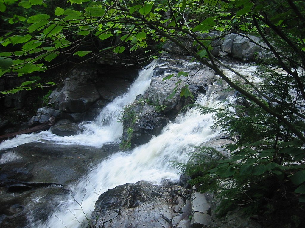
About Slugundy Falls
Slugundy Falls is a tucked-away cascade nestled within the Appalachian Trail Corridor in Maine, overseen and owned by SPR. The falls offer a peaceful, photogenic spot framed by quiet forest — a pleasant destination for hikers and nature lovers looking for a scenic stop without a long backcountry commitment. SPR manages the site under its SP designation, helping preserve the corridor’s natural character. Access to the falls is along a moderate 2.4-mile out-and-back route that gains about 350 feet, making it an attainable outing for most moderately fit hikers. The trail’s wooded setting and the short approach make Slugundy Falls a rewarding half-day excursion; wear sturdy footwear and be prepared for some uneven footing as you approach the water and viewing areas.
The Setting
Slugundy Falls sits at 587 feet within Appalachian Trail Corridor, fed by the Piscataquis River, in the foothills of Maine.
Nearby Falls Worth Visiting
Little Wilson Falls (60 ft) lies 3.7 miles to the southwest.
Trail & Hike Details
The Approach
The moderate 2.4-mile out-and-back trail gains 350 feet of elevation on the way to the falls.
Trail Description
Out-and-back trail, 2.4 miles round-trip with approximately 350 feet of elevation gain. Rated moderate. The route follows wooded terrain through the Appalachian Trail Corridor managed by SPR and leads directly to the falls. Footing may be uneven in places, so sturdy shoes and caution near wet rocks are recommended.
What to Expect
Dogs are welcome.
Accessibility
The trail is not wheelchair accessible. Uneven terrain and elevation changes require steady footing.
Frequently Asked Questions
🐶 Are Dogs Allowed at Slugundy Falls?
✅ Dogs are allowed
Are There Any Fees or Permits Required?
🆖 No fees required
🏊 Is There Swimming at Slugundy Falls?
❌ Swimming is not allowed
When to Visit
Spring and early summer are ideal for visiting Slugundy Falls, as water flow is typically at its peak. Fall offers beautiful foliage, while winter may provide a unique frozen waterfall view.
Seasonal Access
The best time to visit is Spring, Summer, and Fall. Winter access may be limited.
Safety Information
Visitors should exercise caution on wet or slippery rocks near the falls. Cell service may be limited, so plan accordingly and let someone know your itinerary.
Current Water Conditions
119 ft³/s
Current discharge — how much water is flowing
About average for this time of year
Based on 29 years of record
4.41 ft
Water depth at gauge
7-Day Discharge Trend
What does this mean for your visit?
Flow is about average for this time of year.
About This Gauge
This gauge is on a nearby waterway and may not reflect exact conditions at the falls.
7-Day Flow Outlook
Based on the USGS gauge Piscataquis River at Blanchard, Maine (21 km away).
Today
Moderate
129 cfs
5/10Tomorrow
Moderate
135 cfs
4/10Mon
Moderate
119 cfs
8/10Tue
Moderate
187 cfs
4/10Wed
Moderate
218 cfs
5/10Thu
Moderate
214 cfs
4/10Fri
Moderate
144 cfs
5/10Best window: Mon — moderate flow, sunny (trip score 8/10).
Best time of year: this gauge typically runs highest from late March to mid May, peaking in April.
How we calculate this
This is a transparent outlook, not a precise forecast. We take the waterfall's current flow strength (how it ranks against its historical normal for today, from the nearest USGS stream gauge), carry that ranking forward along the gauge's seasonal curve, and nudge it for forecast rain. Confidence is highest for the next day or two and falls further out. Always check official conditions and your own judgment before visiting — high flows can be dangerous.
Know when to go.
Get a free email alert when waterfalls near Brownville Junction hit peak flow. We only send when conditions are worth the trip — no weekly newsletters, no spam.
Weather Forecast
Location & Access
Getting There
Slugundy Falls is located near the town of T9 R5 WELS in Maine. Access typically involves driving on logging roads, which may be rough or unpaved. Visitors should use a reliable map or GPS as signage may be limited.
Get Directions on Google MapsParking
Parking is available near the trailhead, but spaces may be limited. Visitors should ensure they park in designated areas to avoid obstructing logging operations.
Elevation
587 feet above sea level
Coordinates
45.413936° N, -69.420329° W
Land Management
Managed by SPR
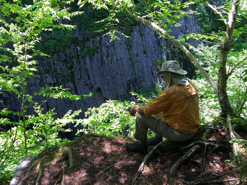
Visitor Tips & Gear
Bring bug spray during the summer months as mosquitoes and black flies can be prevalent. Check road conditions before visiting, especially during the spring thaw or after heavy rains.
As an Amazon Associate, we earn from qualifying purchases.
With 2.4 miles and 350 ft of elevation gain, sturdy boots and trekking poles will help on this moderate trail. Sun exposure on the trail makes good sun protection a must in summer.

Polarized Sunglasses (Knockaround)
Cuts glare off the water so you actually see the falls — and your photos turn out better too.

Columbia Watertight II Rain Jacket
Packs into its own pocket, seam-sealed, and keeps you dry from spray and surprise rain.

Earth Pak Waterproof Dry Bag
Keeps your phone and gear dry when waterfall mist soaks everything else.

Waterproof Phone Pouch (AiRunTech)
Cheap insurance — take photos right next to the falls without killing your phone.

Timberland Euro Sprint Mid Waterproof
Trusted waterproof boot with premium leather and grippy rubber sole — reliable on rocky, wet trails.

TrailBuddy Trekking Poles
Lightweight aluminum, cork grips, and flip-locks that actually hold — a best-seller for good reason.
Where to Stay

Abbot Trailside Lodging

Leisure Life

All-Season Sanctuary: Steps to Moosehead Lake

Waterfront home on Moosehead Lake
Browse vacation cabins and private rentals nearby
Unique outdoor stays — tents, yurts, and treehouses
Rent a campervan or RV for your waterfall road trip
Some links are affiliate links. We may earn a commission at no extra cost to you.
Additional Information
Nearby Attractions
Other nearby natural attractions include the Allagash Wilderness Waterway and Deboullie Public Reserved Land.
Wildlife
The area is home to a variety of wildlife, including birds, deer, and occasionally moose. Visitors should be cautious and respectful of the natural habitat.
Cities near Slugundy Falls
Nearby Waterfalls


Writing about Slugundy Falls? Embed this waterfall on your site for free.