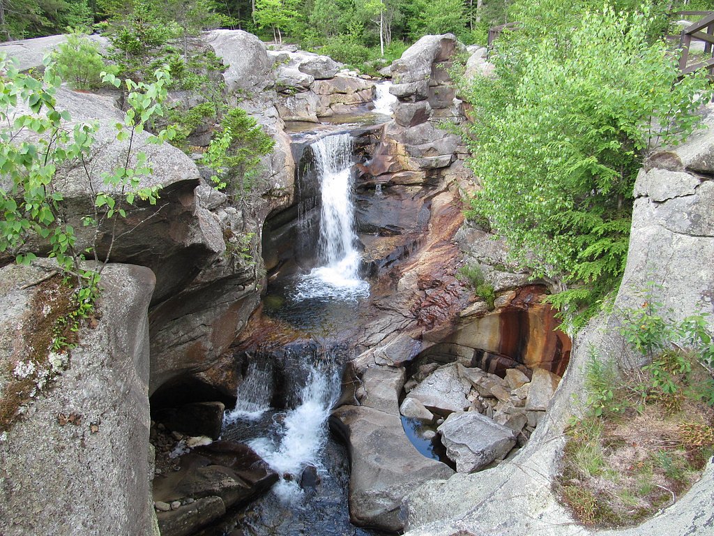
Screw Auger Falls
Maine • 23 ft
By Armen Suny · Last verified Mar 2026
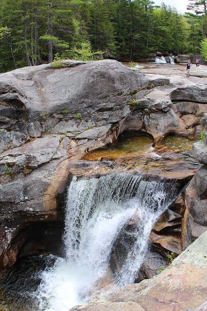


Photo Credits (5)
Difficulty
Moderate
Trail Length
2.4 miles
Trail Type
Out And Back
Elevation Gain
350 ft
About Screw Auger Falls
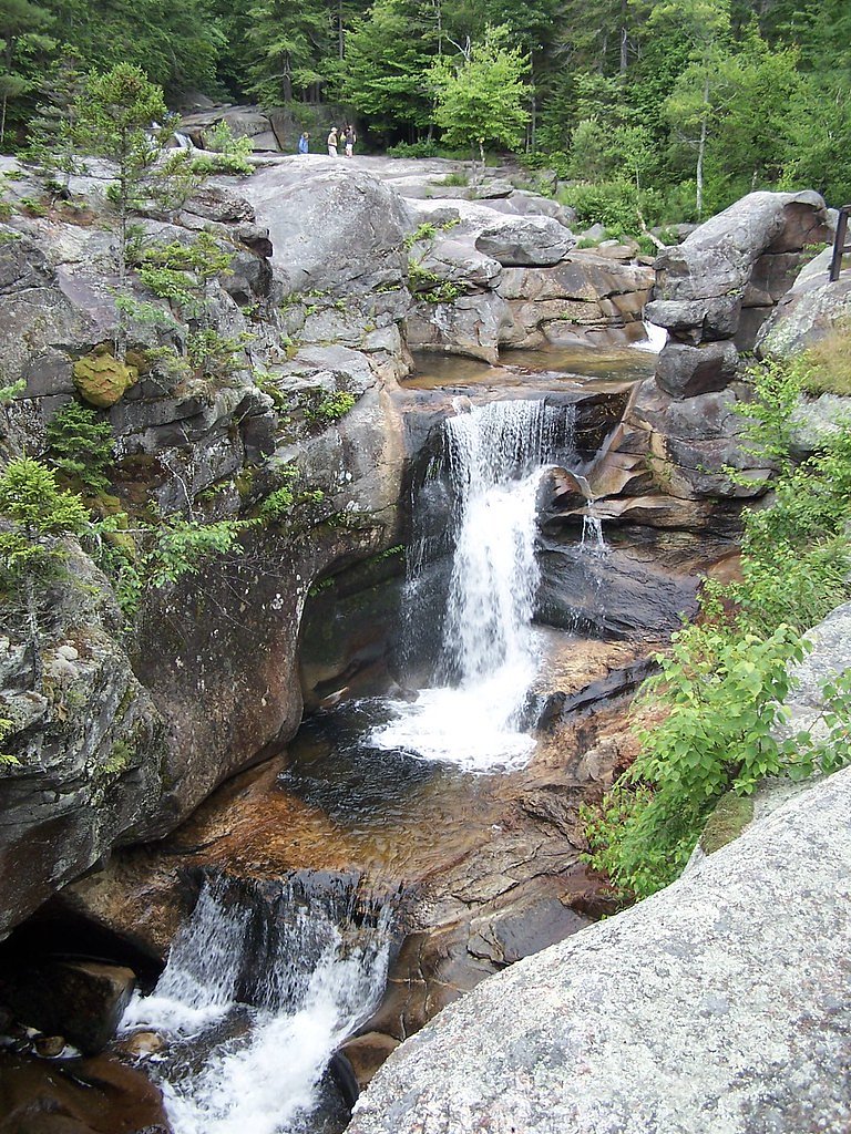
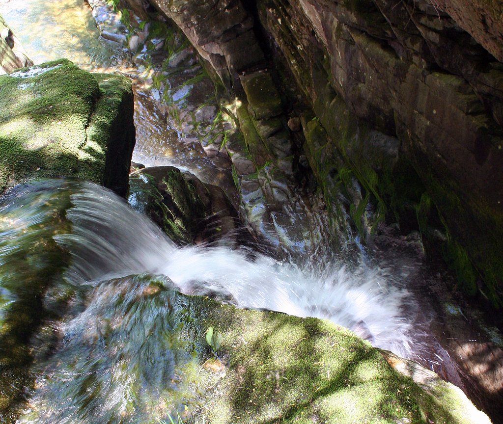
Screw Auger Falls is a picturesque waterfall located in Grafton Notch State Park, Maine. It features a series of cascades and pools carved into the bedrock by the Bear River. The falls are surrounded by lush forest and are a popular destination for visitors seeking a scenic and accessible natural attraction.
The Setting
Screw Auger Falls sits at 1,142 feet within Grafton Notch State Park, fed by the Ellis River, in the foothills of Maine. The falls drop 23 feet.
Height: 23 feet
Nearby Falls Worth Visiting
Dryad Falls, the tallest waterfall in New Hampshire at 300 feet, lies 12.2 miles to the southwest.
Trail & Hike Details
The Approach
The moderate 2.4-mile out-and-back trail gains 350 feet of elevation on the way to the falls.
Trail Description
The trail to Screw Auger Falls is very short and easy, making it accessible to most visitors. It leads directly from the parking area to the falls, with minimal elevation gain. The path is well-maintained and provides excellent views of the cascades and surrounding forest.
What to Expect
The falls drop a gentle 23 feet. Dogs are welcome.
Accessibility
The trail is not wheelchair accessible. Uneven terrain and elevation changes require steady footing.
Frequently Asked Questions
🐶 Are Dogs Allowed at Screw Auger Falls?
✅ Dogs are allowed
Are There Any Fees or Permits Required?
🆖 No fees required
🏊 Is There Swimming at Screw Auger Falls?
❌ Swimming is not allowed
When to Visit
The best time to visit Screw Auger Falls is during the spring and early summer when water flow is at its peak due to snowmelt. Fall is also a great time to visit, as the surrounding foliage provides a stunning backdrop.
Seasonal Access
The best time to visit is Spring, Summer, and Fall. Winter access may be limited.
Safety Information
Exercise caution near the water, as the rocks can be slippery and the currents strong. Keep children and pets under close supervision. Avoid visiting during heavy rain or icy conditions, as the trail and rocks may become hazardous.
Current Water Conditions
370 ft³/s
Current discharge — how much water is flowing
Higher than usual for this time of year
Based on 45 years of record
7.34 ft
Water depth at gauge
7-Day Discharge Trend
What does this mean for your visit?
The water is flowing higher than usual for this time of year.
About This Gauge
This gauge is on a nearby waterway and may not reflect exact conditions at the falls.
7-Day Flow Outlook
Based on the USGS gauge Ellis River at South Andover, Maine (14 km away).
Today
Moderate
422 cfs
6/10Tomorrow
Moderate
406 cfs
6/10Mon
Moderate
359 cfs
8/10Tue
Moderate
402 cfs
6/10Wed
Moderate
417 cfs
6/10Thu
Moderate
386 cfs
6/10Fri
Moderate
337 cfs
6/10Best window: Mon — moderate flow, sunny (trip score 8/10).
Best time of year: this gauge typically runs highest from late March to early June, peaking in April.
How we calculate this
This is a transparent outlook, not a precise forecast. We take the waterfall's current flow strength (how it ranks against its historical normal for today, from the nearest USGS stream gauge), carry that ranking forward along the gauge's seasonal curve, and nudge it for forecast rain. Confidence is highest for the next day or two and falls further out. Always check official conditions and your own judgment before visiting — high flows can be dangerous.
Know when to go.
Get a free email alert when waterfalls near Bethel hit peak flow. We only send when conditions are worth the trip — no weekly newsletters, no spam.
Weather Forecast
Location & Access
Getting There
Screw Auger Falls is located in Grafton Notch State Park, approximately 13.5 miles north of Bethel, Maine, along Route 26. The falls are well-marked with signage, and the parking area is adjacent to the main road.
Get Directions on Google MapsParking
There is a designated parking area near the falls, which is free of charge. The parking lot is relatively small, so it may fill up during peak seasons.
Elevation
1,142 feet above sea level
Coordinates
44.572003° N, -70.910074° W
Land Management
Managed by SPR
Visitor Tips & Gear
Arrive early during peak seasons to secure parking. Wear sturdy footwear, as the rocks near the falls can be slippery. Bring a camera to capture the beautiful scenery. Be cautious near the water, especially with children, as the rocks can be uneven and wet.
As an Amazon Associate, we earn from qualifying purchases.
With 2.4 miles and 350 ft of elevation gain, sturdy boots and trekking poles will help on this moderate trail. Sun exposure on the trail makes good sun protection a must in summer.

Polarized Sunglasses (Knockaround)
Cuts glare off the water so you actually see the falls — and your photos turn out better too.

Columbia Watertight II Rain Jacket
Packs into its own pocket, seam-sealed, and keeps you dry from spray and surprise rain.

Earth Pak Waterproof Dry Bag
Keeps your phone and gear dry when waterfall mist soaks everything else.

Waterproof Phone Pouch (AiRunTech)
Cheap insurance — take photos right next to the falls without killing your phone.

Timberland Euro Sprint Mid Waterproof
Trusted waterproof boot with premium leather and grippy rubber sole — reliable on rocky, wet trails.

TrailBuddy Trekking Poles
Lightweight aluminum, cork grips, and flip-locks that actually hold — a best-seller for good reason.
Where to Stay

Jordan Hotel

Grand Summit Hotel

River View Resort

Town & Country Inn & Resort
Browse vacation cabins and private rentals nearby
Unique outdoor stays — tents, yurts, and treehouses
Rent a campervan or RV for your waterfall road trip
Some links are affiliate links. We may earn a commission at no extra cost to you.
Nearby Campground
HASTINGS CAMPGROUND
15.6 miles away · 25 sites
Overview Hastings Campground is located on Route 113 near the shore of Evans Brook in western Maine. It is situated in a rustic and remote part of White Mountain National Forest, not far from the towns of Gilead Me and Gorham, New Hampshire. Activities include fishing, hiking and mountain biking. The White Mountains boast pristine forests, clear mountain streams and rivers and the tallest peaks in the Northeast. The forest encompasses nearly 800,000 acres in New Hampshire and western Maine, and i
Book on Recreation.govAdditional Information
Nearby Attractions
Other attractions in Grafton Notch State Park include Mother Walker Falls, Moose Cave, and hiking trails such as the Eyebrow Loop Trail and Table Rock Trail.
Wildlife
Visitors may encounter wildlife such as birds, squirrels, and deer in the surrounding forest. Be cautious and respectful of the natural habitat.
Cities near Screw Auger Falls
Nearby Waterfalls
Other waterfalls named Screw Auger Falls
1 other waterfall shares this name across the U.S.
Writing about Screw Auger Falls? Embed this waterfall on your site for free.