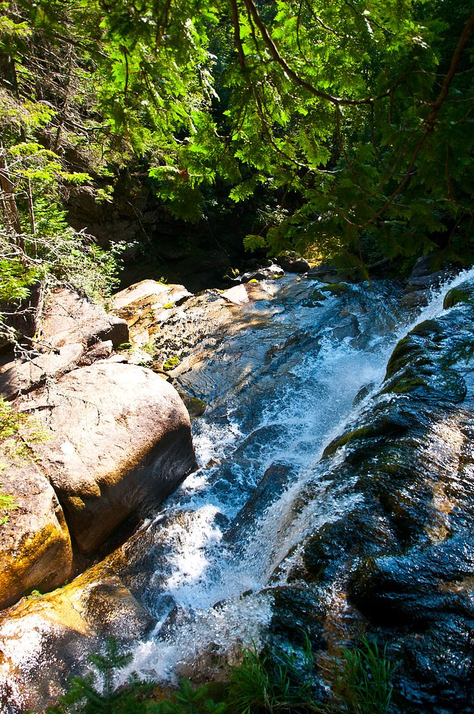
Pockwockamus Falls
By Armen Suny · Last verified May 2026
Difficulty
Moderate
Trail Length
2.4 miles
Trail Type
Out And Back
Elevation Gain
350 ft
About Pockwockamus Falls
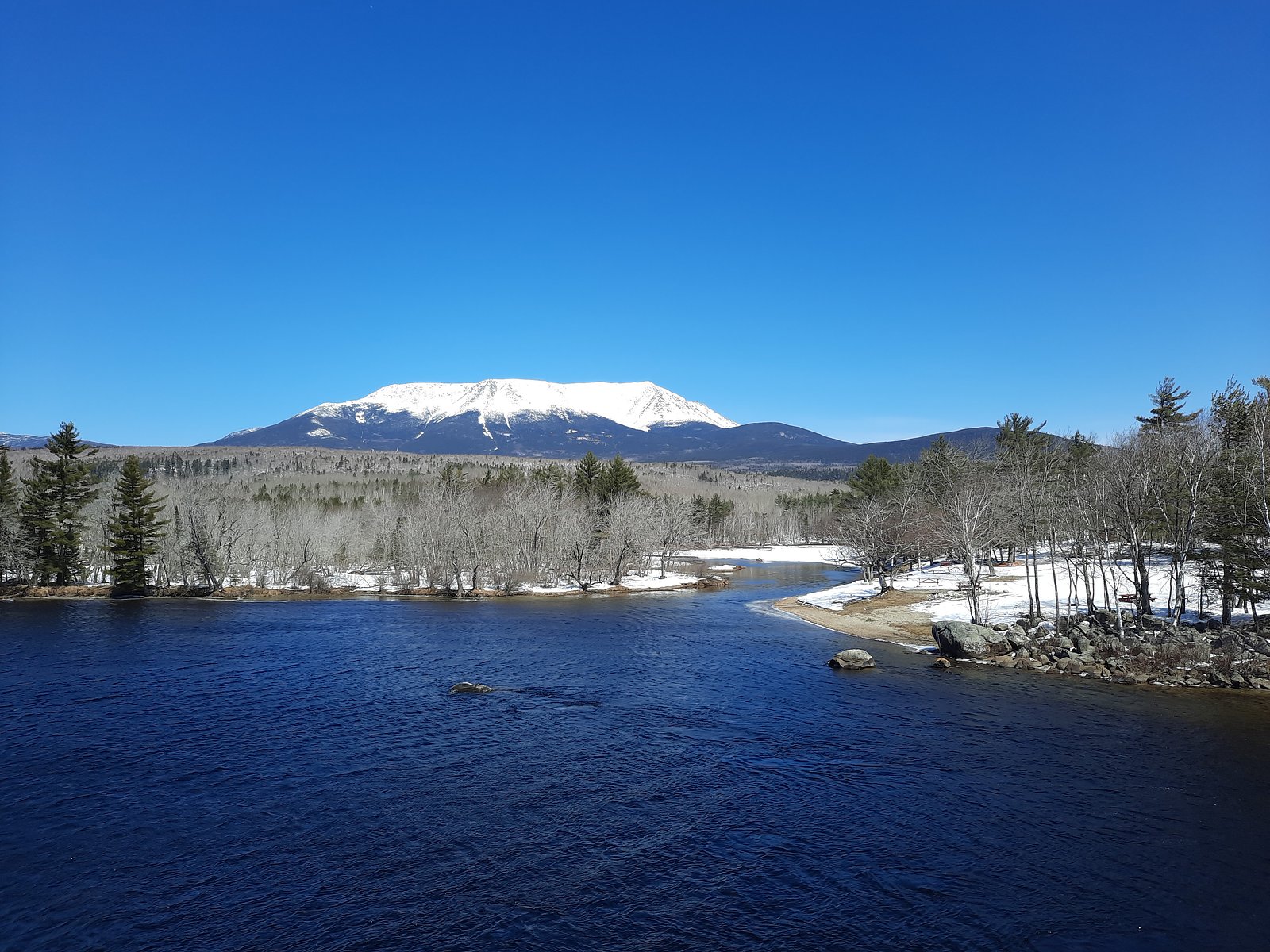
Pockwockamus Falls sits within Maine’s Debsconeag Lakes Wilderness Area on privately conserved land managed by a non‑governmental organization (designation: PCON). Framed by forest and waterside terrain, the falls are a pleasant, more secluded destination for hikers and nature photographers seeking a quieter outing away from busier parklands. Access is via a relatively short hike that rewards visitors with a scenic streamside setting; the nearest formal campground listed in the area is Katahdin Woods and Waters National Monument Camping and Huts, approximately 36.5 km away, so plan overnight stays accordingly.
The Setting
Pockwockamus Falls sits at 545 feet within Debsconeag Lakes Wilderness Area, fed by the East Branch Penobscot River, in the foothills of Maine.
Nearby Falls Worth Visiting
Katahdin Stream Falls (40 ft) lies 5.6 miles to the north.
Trail & Hike Details
The Approach
The moderate 2.4-mile out-and-back trail gains 350 feet of elevation on the way to the falls.
Trail Description
This is an out-and-back route totaling about 2.4 miles with roughly 350 feet of elevation gain and is rated moderate. The path leads through conserved forest within the Debsconeag Lakes Wilderness Area; surface type, grade, and technical trail class are not specified in the provided data, so prepare for uneven footing and typical backcountry conditions.
What to Expect
Dogs are welcome.
Accessibility
The trail is not wheelchair accessible. Uneven terrain and elevation changes require steady footing.
Frequently Asked Questions
🐶 Are Dogs Allowed at Pockwockamus Falls?
✅ Dogs are allowed
Are There Any Fees or Permits Required?
🆖 No fees required
🏊 Is There Swimming at Pockwockamus Falls?
❌ Swimming is not allowed
When to Visit
Spring and early summer are the best times to visit, as the water flow is typically strongest during these seasons. Fall offers beautiful foliage, while winter provides a unique frozen landscape.
Seasonal Access
The best time to visit is Spring, Summer, and Fall. Winter access may be limited.
Safety Information
Be cautious of slippery rocks near the falls. The Golden Road is an active logging road, so watch for large trucks and drive carefully. Cell phone service may be limited in the area.
Current Water Conditions
Based on a USGS gauge 18.9 miles away
1,600 ft³/s
Current discharge — how much water is flowing
About average for this time of year
Based on 104 years of record
5.88 ft
Water depth at gauge
7-Day Discharge Trend
What does this mean for your visit?
Flow is about average for this time of year.
About This Gauge
This gauge is on a regional waterway. Conditions at the falls may differ, especially after local rain.
7-Day Flow Outlook
Based on the USGS gauge East Branch Penobscot River at Grindstone, Maine (30 km away).
Today
Low
1824 cfs
3/10Tomorrow
Moderate
1879 cfs
4/10Mon
Low
1624 cfs
5/10Tue
Low
1757 cfs
3/10Wed
Low
1691 cfs
4/10Thu
Low
1666 cfs
3/10Fri
Low
1637 cfs
4/10Best window: Mon — low flow, patchy fog then sunny (trip score 5/10).
Best time of year: this gauge typically runs highest from late March to late June, peaking in April.
How we calculate this
This is a transparent outlook, not a precise forecast. We take the waterfall's current flow strength (how it ranks against its historical normal for today, from the nearest USGS stream gauge), carry that ranking forward along the gauge's seasonal curve, and nudge it for forecast rain. Confidence is highest for the next day or two and falls further out. Always check official conditions and your own judgment before visiting — high flows can be dangerous.
Know when to go.
Get a free email alert when waterfalls near Brownville Junction hit peak flow. We only send when conditions are worth the trip — no weekly newsletters, no spam.
Weather Forecast
Location & Access
Getting There
Pockwockamus Falls is located near the southern entrance of Baxter State Park, along the Golden Road. The falls are easily accessible by car, and the area is well-marked. Visitors can park nearby and walk a short distance to view the falls.
Get Directions on Google MapsParking
Parking is available along the Golden Road near the falls. There is no designated parking lot, but roadside parking is typically sufficient.
Elevation
545 feet above sea level
Coordinates
45.816435° N, -68.960601° W
Land Management
Managed by NGO
Visitor Tips & Gear
Bring sturdy footwear as the area around the falls can be slippery. Bug spray is recommended during the warmer months. Be cautious of the Golden Road, as it is an active logging road with large trucks.
As an Amazon Associate, we earn from qualifying purchases.
With 2.4 miles and 350 ft of elevation gain, sturdy boots and trekking poles will help on this moderate trail. Sun exposure on the trail makes good sun protection a must in summer.

Columbia Watertight II Rain Jacket
Packs into its own pocket, seam-sealed, and keeps you dry from spray and surprise rain.

Earth Pak Waterproof Dry Bag
Keeps your phone and gear dry when waterfall mist soaks everything else.

Waterproof Phone Pouch (AiRunTech)
Cheap insurance — take photos right next to the falls without killing your phone.

Timberland Euro Sprint Mid Waterproof
Trusted waterproof boot with premium leather and grippy rubber sole — reliable on rocky, wet trails.

TrailBuddy Trekking Poles
Lightweight aluminum, cork grips, and flip-locks that actually hold — a best-seller for good reason.

Polarized Sunglasses (Knockaround)
Cuts glare off the water so you actually see the falls — and your photos turn out better too.
Where to Stay

Waterfront home on Moosehead Lake

Baxter Park Inn

Hotel Terrace

Family Friendly Lakefront Cottage, Ambajejus Lake
Browse vacation cabins and private rentals nearby
Unique outdoor stays — tents, yurts, and treehouses
Rent a campervan or RV for your waterfall road trip
Some links are affiliate links. We may earn a commission at no extra cost to you.
Nearby Campground
Katahdin Woods and Waters National Monument Camping and Huts
22.7 miles away · 27 sites
Overview Katahdin Woods and Waters National Monument is located in Maine’s north woods. Katahdin Woods and Waters protects part of an extraordinary natural and cultural landscape: the mountains, woods, and waters where the East Branch of the Penobscot River and its tributaries, including the Wassataquoik Stream and the Seboeis River, run freely. Campsites, lean-tos and huts located throughout the monument provide opportunities to stay overnight while hiking, biking, paddling and enjoying other re
Book on Recreation.govAdditional Information
Nearby Attractions
Baxter State Park, Mount Katahdin, and the Penobscot River are all nearby attractions worth exploring.
Wildlife
The area is home to a variety of wildlife, including birds, deer, and occasionally moose. Visitors should be cautious and respectful of the local fauna.
Cities near Pockwockamus Falls
Nearby Waterfalls
Writing about Pockwockamus Falls? Embed this waterfall on your site for free.