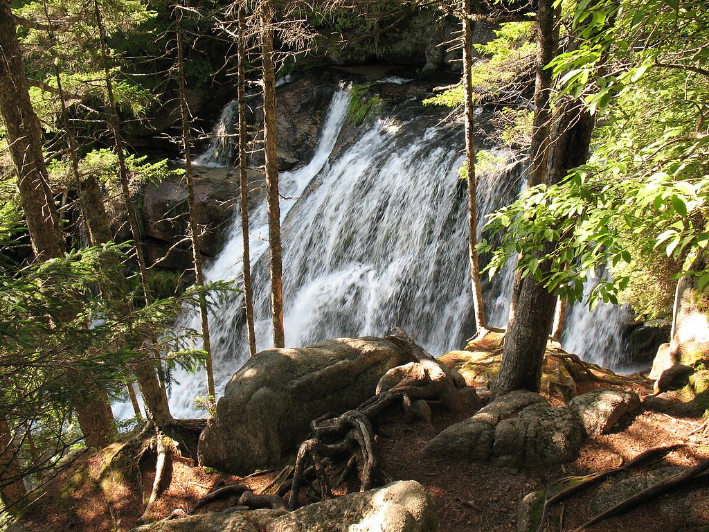
Katahdin Stream Falls
Maine • 40 ft
By Armen Suny · Last verified Mar 2026
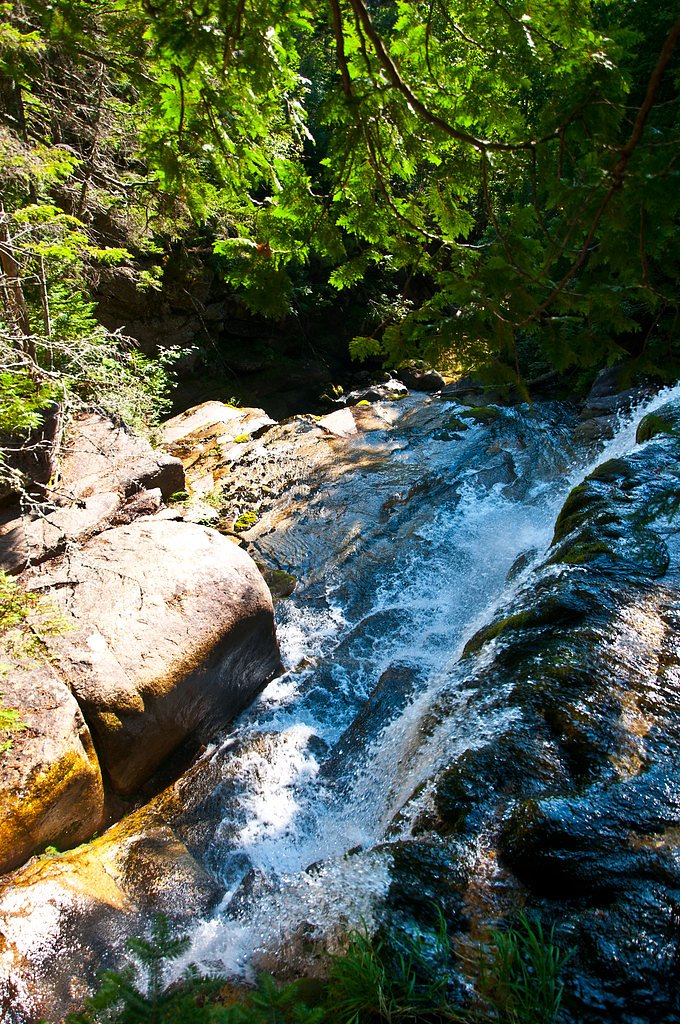
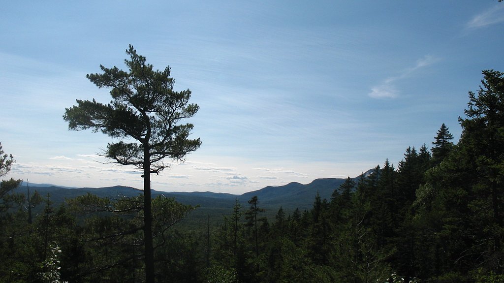
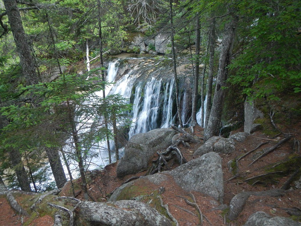
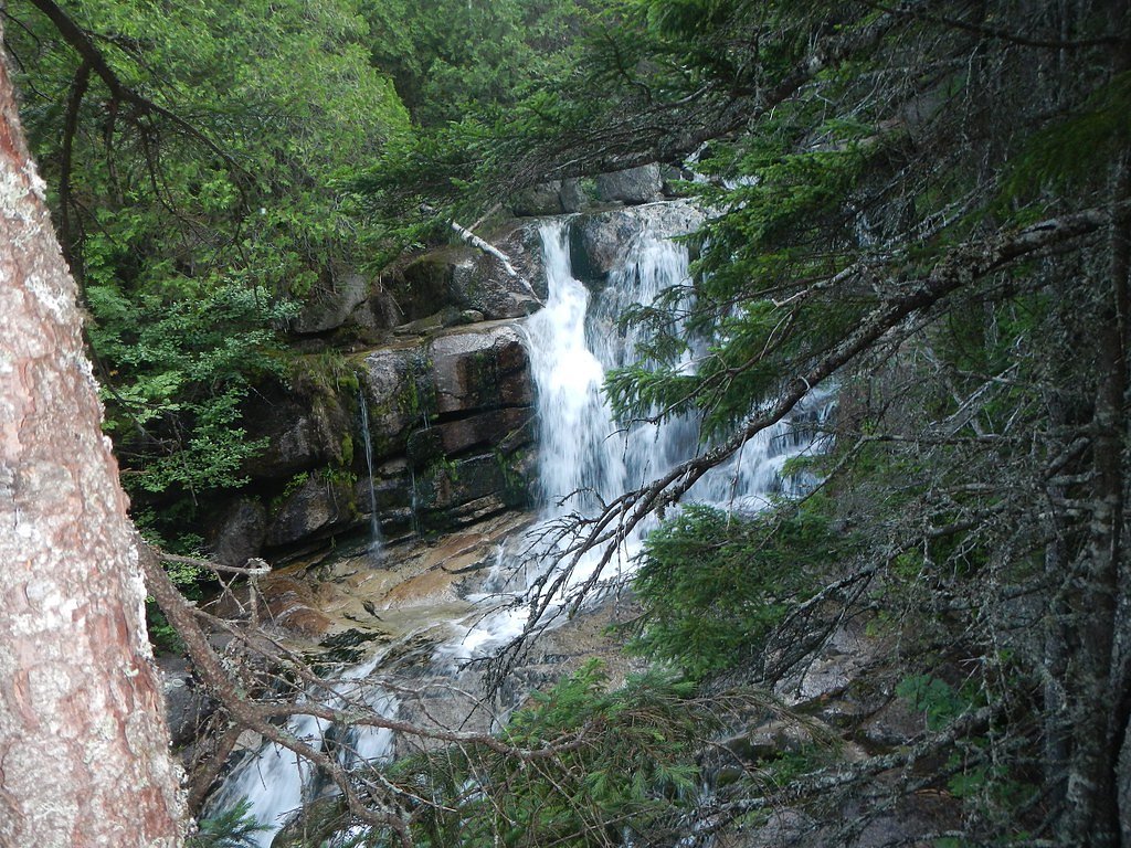

Photo Credits (5)
Difficulty
Moderate
Trail Length
2.4 miles
Trail Type
Out And Back
Elevation Gain
500 ft
About Katahdin Stream Falls
Katahdin Stream Falls is a picturesque waterfall located within Baxter State Park in Maine. It is a popular stop along the Hunt Trail, which is part of the Appalachian Trail, and offers visitors a serene view of cascading water surrounded by lush forest.
The Setting
Katahdin Stream Falls sits at 1,690 feet within Baxter State Park, fed by the E. Br. Penobscot River, in the hills of Maine. The falls drop 40 feet.
Height: 40 feet
Trail & Hike Details
The Approach
The moderate 2.4-mile out-and-back trail gains 500 feet of elevation on the way to the falls.
Trail Description
The trail to Katahdin Stream Falls follows the Hunt Trail, which is part of the Appalachian Trail. It is a well-maintained path with moderate elevation gain, featuring rocky sections and tree roots. The trail is shaded by dense forest and offers scenic views of the stream along the way.
What to Expect
The falls drop 40 feet.
Accessibility
The trail is not wheelchair accessible. Uneven terrain and elevation changes require steady footing.
Frequently Asked Questions
🐶 Are Dogs Allowed at Katahdin Stream Falls?
❌ Dogs are not allowed
Are There Any Fees or Permits Required?
🤑 Fee: $15.00
Permit required
A day-use parking reservation is required for access to Baxter State Park during peak seasons. Overnight camping requires additional permits.
🏊 Is There Swimming at Katahdin Stream Falls?
❌ Swimming is not allowed
When to Visit
The best time to visit Katahdin Stream Falls is during late spring or early summer when the water flow is strongest. Fall is also a great time to visit for stunning foliage.
Seasonal Access
The best time to visit is Spring, Summer, and Fall. Winter access may be limited.
Safety Information
The trail can be slippery, especially after rain. Visitors should wear appropriate footwear and stay on marked trails. Be prepared for changing weather conditions, as the area can experience sudden temperature drops.
Current Water Conditions
Based on a USGS gauge 18.8 miles away
812 ft³/s
Current discharge — how much water is flowing
Lower than usual for this time of year
Based on 2 years of record
3.53 ft
Water depth at gauge
65°F
CoolRefreshing for swimming
7-Day Discharge Trend
What does this mean for your visit?
Flow is lower than usual for this time of year. Water temperature is a refreshing 65 degrees F, good for a quick swim.
About This Gauge
This gauge is on a regional waterway. Conditions at the falls may differ, especially after local rain.
7-Day Flow Outlook
Based on the USGS gauge E. Br. Penobscot River below Grand Lake Matagamon (30 km away).
Today
Moderate
926 cfs
4/10Tomorrow
Moderate
977 cfs
4/10Mon
Moderate
867 cfs
8/10Tue
Moderate
926 cfs
4/10Wed
Moderate
931 cfs
5/10Thu
Moderate
1037 cfs
5/10Fri
Moderate
993 cfs
5/10Best window: Mon — moderate flow, sunny (trip score 8/10).
Best time of year: this gauge typically runs highest from mid March to mid May, peaking in May.
How we calculate this
This is a transparent outlook, not a precise forecast. We take the waterfall's current flow strength (how it ranks against its historical normal for today, from the nearest USGS stream gauge), carry that ranking forward along the gauge's seasonal curve, and nudge it for forecast rain. Confidence is highest for the next day or two and falls further out. Always check official conditions and your own judgment before visiting — high flows can be dangerous.
Know when to go.
Get a free email alert when waterfalls near Patten hit peak flow. We only send when conditions are worth the trip — no weekly newsletters, no spam.
Weather Forecast
Location & Access
Getting There
Katahdin Stream Falls is located within Baxter State Park. Visitors can access the falls via the Hunt Trail, which begins at the Katahdin Stream Campground. The park is accessible by car, and the closest town is Millinocket, Maine.
Get Directions on Google MapsParking
Parking is available at the Katahdin Stream Campground, but spaces are limited, and reservations are required during peak seasons.
Elevation
1,690 feet above sea level
Coordinates
45.895879° N, -68.981435° W
Land Management
Managed by SPR
Visitor Tips & Gear
Arrive early to secure parking and avoid crowds. Wear sturdy hiking shoes, as the trail can be rocky and uneven. Bring insect repellent during summer months to protect against mosquitoes and black flies.
As an Amazon Associate, we earn from qualifying purchases.
With 2.4 miles and 500 ft of elevation gain, sturdy boots and trekking poles will help on this moderate trail. Sun exposure on the trail makes good sun protection a must in summer.

Polarized Sunglasses (Knockaround)
Cuts glare off the water so you actually see the falls — and your photos turn out better too.

Columbia Watertight II Rain Jacket
Packs into its own pocket, seam-sealed, and keeps you dry from spray and surprise rain.

Earth Pak Waterproof Dry Bag
Keeps your phone and gear dry when waterfall mist soaks everything else.

Waterproof Phone Pouch (AiRunTech)
Cheap insurance — take photos right next to the falls without killing your phone.

Timberland Euro Sprint Mid Waterproof
Trusted waterproof boot with premium leather and grippy rubber sole — reliable on rocky, wet trails.

TrailBuddy Trekking Poles
Lightweight aluminum, cork grips, and flip-locks that actually hold — a best-seller for good reason.
Where to Stay

Browse vacation cabins and private rentals nearby
Unique outdoor stays — tents, yurts, and treehouses
Rent a campervan or RV for your waterfall road trip
Some links are affiliate links. We may earn a commission at no extra cost to you.
Nearby Campground
Katahdin Woods and Waters National Monument Camping and Huts
18 miles away · 27 sites
Overview Katahdin Woods and Waters National Monument is located in Maine’s north woods. Katahdin Woods and Waters protects part of an extraordinary natural and cultural landscape: the mountains, woods, and waters where the East Branch of the Penobscot River and its tributaries, including the Wassataquoik Stream and the Seboeis River, run freely. Campsites, lean-tos and huts located throughout the monument provide opportunities to stay overnight while hiking, biking, paddling and enjoying other re
Book on Recreation.govAdditional Information
Nearby Attractions
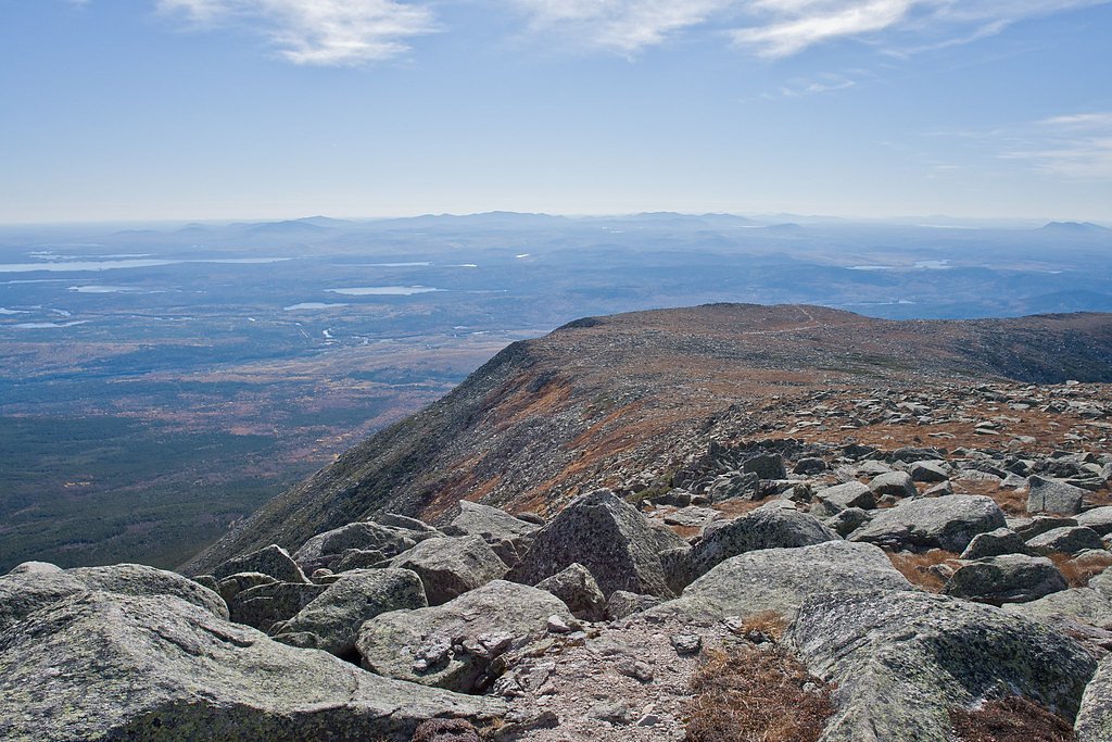
Nearby attractions include Mount Katahdin, the highest peak in Maine, and other trails within Baxter State Park such as the Chimney Pond Trail and South Branch Pond.
Wildlife
The area is home to a variety of wildlife, including moose, black bears, and numerous bird species. Visitors should exercise caution and follow park guidelines for wildlife encounters.
Cities near Katahdin Stream Falls
Nearby Waterfalls

Writing about Katahdin Stream Falls? Embed this waterfall on your site for free.