Big Erick's Falls
By Armen Suny · Last verified May 2026

Photo Credits (1)
Difficulty
Moderate
Trail Length
2.4 miles
Trail Type
Out And Back
Elevation Gain
350 ft
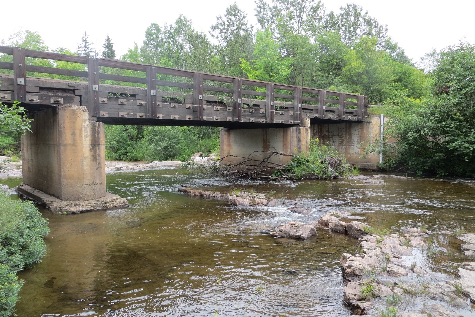
About Big Erick's Falls
Big Erick's Falls is a compact, scenic cascade on Michigan’s Huron River tucked inside the Baraga State Forest Area. Managed by the Michigan Department of Natural Resources (SDNR) as part of the State Forest Campground Area (SCA) lands, the falls tumble over a rocky riverbed and are framed by the dense northern hardwood and conifer forest of the Upper Peninsula. The Huron River here is the 7.6-mile-long (12.2 km) “Big Huron” — a local name used to distinguish it from a nearby Little Huron River and from the much larger Huron River in southeast Michigan. Though the waterfall itself is modest in size, visiting it is a rewarding outing. The river that feeds it has its east and west branches rising in L'Anse Township, southeast of Mount Arvon near the Marquette County boundary, and the falls make a pleasant destination for hikers exploring the Baraga State Forest. Expect a tranquil riverside setting and classic UP forest scenery rather than a developed overlook — it’s a good stop for photographers and day-hikers enjoying remote-feeling water features within state-managed forest lands.
The Setting
Big Erick's Falls sits at 699 feet within Baraga State Forest Area, fed by the Salmon Trout River, in the foothills of Michigan.
Trail & Hike Details
The Approach
The moderate 2.4-mile out-and-back trail gains 350 feet of elevation on the way to the falls.
Trail Description
Trail to Big Erick's Falls: 2.4 miles round-trip (out-and-back) with about 350 feet of elevation gain, rated moderate. The route traverses state forest land managed by the SDNR (Baraga State Forest Area, SCA). Available data do not include a USFS trail number, specific surface type, grade, or class; plan for a typical forest footpath with moderate climbs and bring appropriate footwear and navigation for a 2.4-mile hike.
What to Expect
Dogs are welcome.
Accessibility
The trail is not wheelchair accessible. Uneven terrain and elevation changes require steady footing.
Frequently Asked Questions
🐶 Are Dogs Allowed at Big Erick's Falls?
✅ Dogs are allowed
Are There Any Fees or Permits Required?
🆖 No fees required
🏊 Is There Swimming at Big Erick's Falls?
❌ Swimming is not allowed
When to Visit
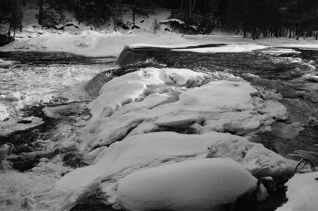
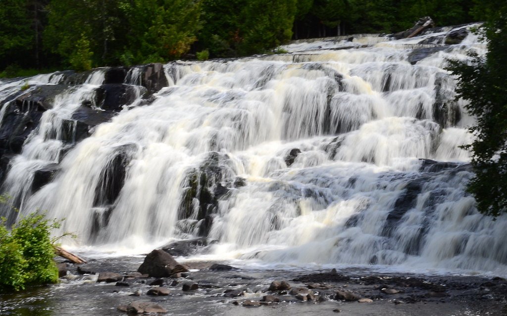
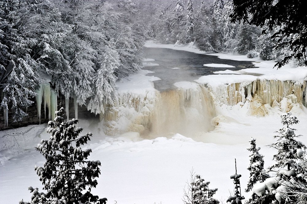
Spring and early summer are ideal for visiting, as the water flow is typically strongest during these seasons. Fall offers beautiful foliage, and winter provides a unique view of the frozen falls.
Seasonal Access
The best time to visit is Spring, Summer, Fall, and Winter.
Safety Information
The rocks around the falls can be slippery, so exercise caution when walking near the water. During winter, icy conditions may make the area hazardous.
Current Water Conditions
7 ft³/s
Current discharge — how much water is flowing
Much higher than usual for this time of year
Based on 21 years of record
0.37 ft
Water depth at gauge
55°F
ColdBracing — limit time in water
7-Day Discharge Trend
What does this mean for your visit?
The water is flowing much higher than usual, expect an impressive display. Water temperature is a bracing 55 degrees F, limit your time in the water.
About This Gauge
This gauge is on a nearby waterway and may not reflect exact conditions at the falls.
7-Day Flow Outlook
Based on the USGS gauge SALMON TROUT RIVER NEAR BIG BAY, MI (18 km away).
Today
Low
7 cfs
6/10Tomorrow
Low
8 cfs
6/10Mon
Moderate
9 cfs
4/10Tue
Moderate
9 cfs
4/10Wed
Moderate
9 cfs
4/10Thu
Moderate
8 cfs
4/10Fri
Moderate
8 cfs
4/10Best window: Today — low flow, sunny (trip score 6/10).
Best time of year: this gauge typically runs highest from mid March to late May, peaking in April.
How we calculate this
This is a transparent outlook, not a precise forecast. We take the waterfall's current flow strength (how it ranks against its historical normal for today, from the nearest USGS stream gauge), carry that ranking forward along the gauge's seasonal curve, and nudge it for forecast rain. Confidence is highest for the next day or two and falls further out. Always check official conditions and your own judgment before visiting — high flows can be dangerous.
Know when to go.
Get a free email alert when waterfalls near Skanee hit peak flow. We only send when conditions are worth the trip — no weekly newsletters, no spam.
Weather Forecast
Location & Access
Getting There
Big Erick's Falls is located near L'Anse, Michigan, in the Upper Peninsula. It can be accessed via Erick's Road, which is off Skanee Road. The falls are close to the Big Erick's Bridge, making them easy to find.
Get Directions on Google MapsParking
There is a small parking area near Big Erick's Bridge, which provides convenient access to the falls.
Elevation
699 feet above sea level
Coordinates
46.865516° N, -88.083750° W
Land Management
Managed by SDNR
Visitor Tips & Gear
Wear sturdy shoes as the area around the falls can be slippery, especially after rain. Bring bug spray during the summer months to protect against mosquitoes.
As an Amazon Associate, we earn from qualifying purchases.
With 2.4 miles and 350 ft of elevation gain, sturdy boots and trekking poles will help on this moderate trail. Icy conditions are common in winter — traction cleats are a smart addition.

Columbia Watertight II Rain Jacket
Packs into its own pocket, seam-sealed, and keeps you dry from spray and surprise rain.

Polarized Sunglasses (Knockaround)
Cuts glare off the water so you actually see the falls — and your photos turn out better too.

Earth Pak Waterproof Dry Bag
Keeps your phone and gear dry when waterfall mist soaks everything else.

Waterproof Phone Pouch (AiRunTech)
Cheap insurance — take photos right next to the falls without killing your phone.

Timberland Euro Sprint Mid Waterproof
Trusted waterproof boot with premium leather and grippy rubber sole — reliable on rocky, wet trails.

TrailBuddy Trekking Poles
Lightweight aluminum, cork grips, and flip-locks that actually hold — a best-seller for good reason.
Where to Stay

Independence Stay Hotel and Long term suites

AC4 Northwoods Getaway w Jetted Tub

UP Escape in the Pines

Lakefront Lookout! Private Sand Beach on Superior
Browse vacation cabins and private rentals nearby
Unique outdoor stays — tents, yurts, and treehouses
Rent a campervan or RV for your waterfall road trip
Some links are affiliate links. We may earn a commission at no extra cost to you.
Additional Information
Nearby Attractions
Nearby attractions include Canyon Falls, Silver Falls, and the town of L'Anse.
Wildlife
The area is home to a variety of wildlife, including deer, birds, and small mammals. Be cautious of mosquitoes and other insects during warmer months.
Cities near Big Erick's Falls
Nearby Waterfalls


Writing about Big Erick's Falls? Embed this waterfall on your site for free.