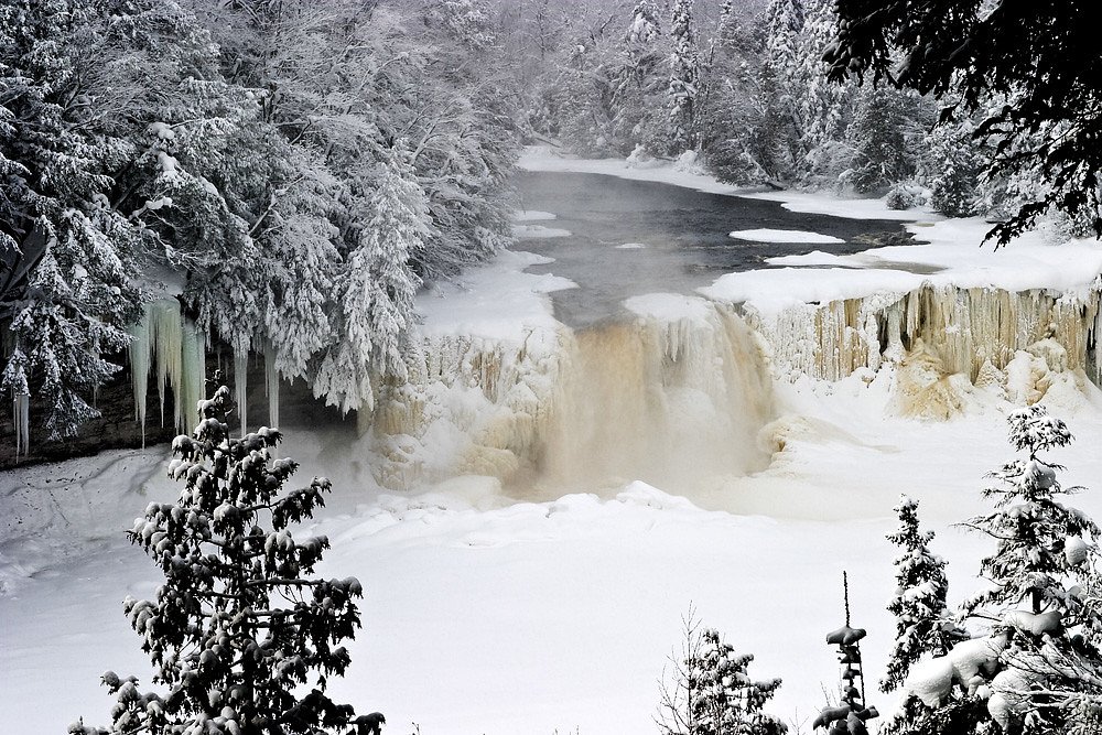
West Branch Falls
By Armen Suny · Last verified Mar 2026
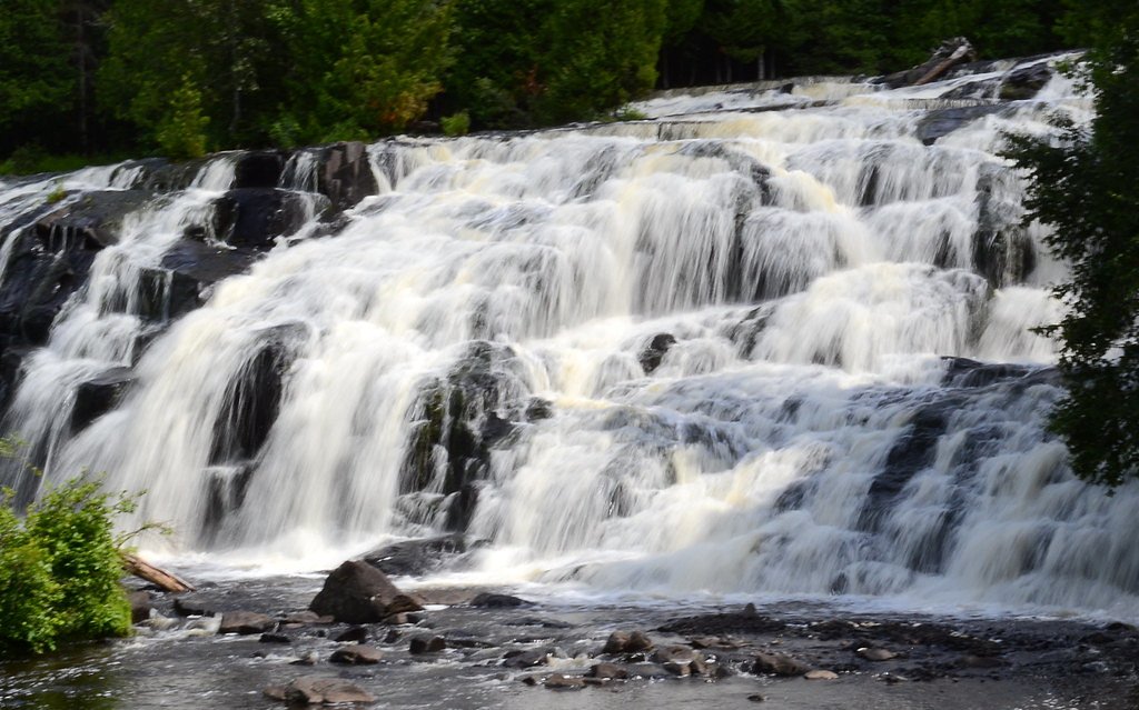
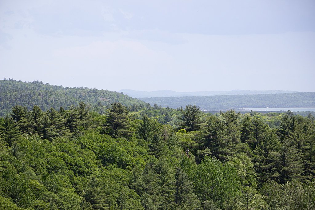

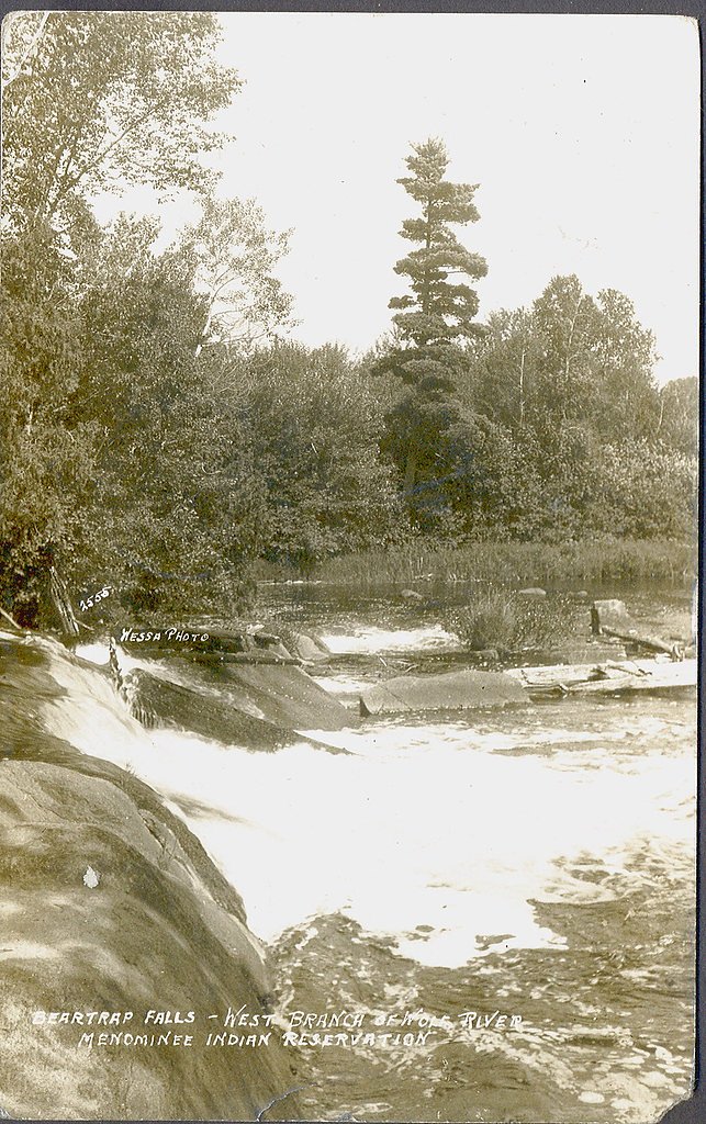
Photo Credits (5)
Difficulty
Easy
Trail Length
1.2 miles
Trail Type
Out And Back
Elevation Gain
150 ft
About West Branch Falls
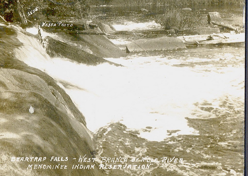
West Branch Falls is a small but scenic waterfall located in Michigan's Upper Peninsula. It is part of the West Branch of the Escanaba River and is surrounded by lush forest, making it a peaceful spot for nature enthusiasts.
The Setting
West Branch Falls sits at 899 feet along the Salmon Trout River, in the foothills of Michigan.
Trail & Hike Details
The Approach
The easy 1.2-mile out-and-back trail gains 150 feet of elevation on the way to the falls.
Trail Description
The trail to West Branch Falls is short and relatively flat, making it suitable for most visitors. It winds through a wooded area and leads directly to the waterfall. The path may be uneven in some places, so sturdy footwear is recommended.
What to Expect
Dogs are welcome.
Accessibility
The trail is not wheelchair accessible. Uneven terrain and elevation changes require steady footing.
Frequently Asked Questions
🐶 Are Dogs Allowed at West Branch Falls?
✅ Dogs are allowed
Are There Any Fees or Permits Required?
🆖 No fees required
🏊 Is There Swimming at West Branch Falls?
❌ Swimming is not allowed
When to Visit
Spring and early summer are ideal for visiting, as the water flow is typically strongest during these seasons.
Seasonal Access
The best time to visit is Spring, Summer, and Fall. Winter access may be limited.
Safety Information
The trail may be slippery after rain, and visitors should exercise caution near the water. Be aware of ticks and other insects in the area.
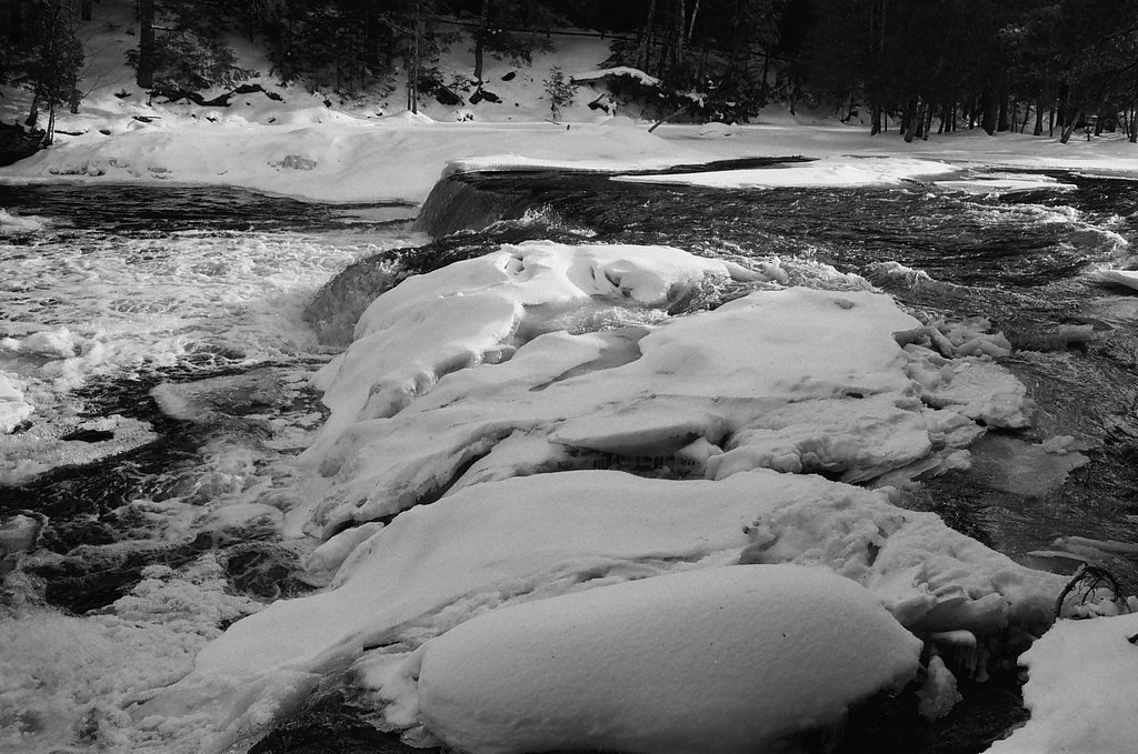
Current Water Conditions
8 ft³/s
Current discharge — how much water is flowing
Much higher than usual for this time of year
Based on 21 years of record
0.39 ft
Water depth at gauge
53°F
ColdBracing — limit time in water
7-Day Discharge Trend
What does this mean for your visit?
The water is flowing much higher than usual, expect an impressive display. Water temperature is a bracing 53 degrees F, limit your time in the water.
About This Gauge
This gauge is on a nearby waterway and may not reflect exact conditions at the falls.
7-Day Flow Outlook
Based on the USGS gauge SALMON TROUT RIVER NEAR BIG BAY, MI (17 km away).
Today
Moderate
8 cfs
9/10Tomorrow
Moderate
8 cfs
9/10Sun
Moderate
9 cfs
6/10Mon
Strong
10 cfs
7/10Tue
Strong
10 cfs
7/10Wed
Strong
10 cfs
7/10Thu
Strong
9 cfs
7/10Best window: Today — moderate flow, mostly sunny (trip score 9/10).
Best time of year: this gauge typically runs highest from mid March to late May, peaking in April.
How we calculate this
This is a transparent outlook, not a precise forecast. We take the waterfall's current flow strength (how it ranks against its historical normal for today, from the nearest USGS stream gauge), carry that ranking forward along the gauge's seasonal curve, and nudge it for forecast rain. Confidence is highest for the next day or two and falls further out. Always check official conditions and your own judgment before visiting — high flows can be dangerous.
Know when to go.
Get a free email alert when waterfalls near Skanee hit peak flow. We only send when conditions are worth the trip — no weekly newsletters, no spam.
Weather Forecast
Location & Access
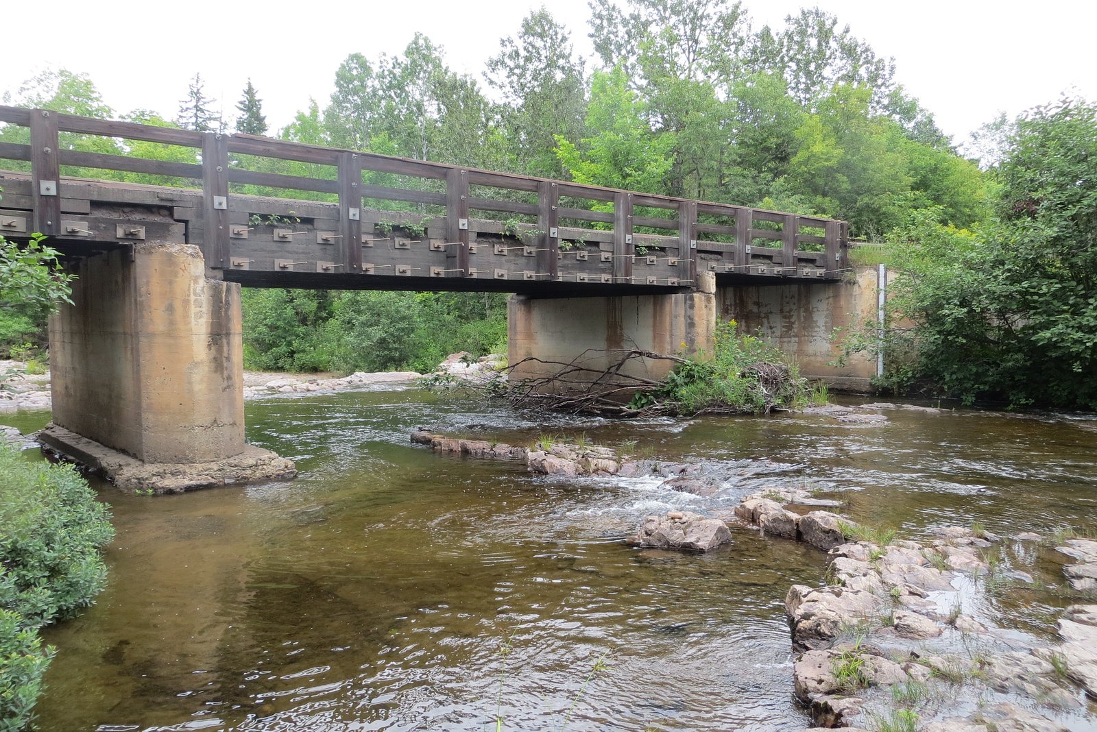
Getting There
West Branch Falls is located near Gwinn, Michigan, in Marquette County. It can be accessed via local roads, but specific directions may vary depending on the starting point. Visitors should consult a reliable map or GPS for guidance.
Get Directions on Google MapsParking
Parking is available near the trailhead, but spaces may be limited. Visitors should plan accordingly.
Elevation
899 feet above sea level
Coordinates
46.838816° N, -88.089849° W
Visitor Tips & Gear
Visit during spring or after heavy rains for the best water flow. Bring bug spray during summer months, as mosquitoes can be prevalent. Wear sturdy shoes, as the trail may be uneven.
As an Amazon Associate, we earn from qualifying purchases.
This easy 1.2 miles hike is straightforward — comfortable trail shoes and plenty of water should do. Sun exposure on the trail makes good sun protection a must in summer.

Polarized Sunglasses (Knockaround)
Cuts glare off the water so you actually see the falls — and your photos turn out better too.

Columbia Watertight II Rain Jacket
Packs into its own pocket, seam-sealed, and keeps you dry from spray and surprise rain.

Earth Pak Waterproof Dry Bag
Keeps your phone and gear dry when waterfall mist soaks everything else.

Waterproof Phone Pouch (AiRunTech)
Cheap insurance — take photos right next to the falls without killing your phone.

JOBY GorillaPod Starter Kit
Wraps around railings and rocks for long-exposure waterfall shots — no flat surface needed.

Osprey Daylite Daypack
Light, organized, and just the right size for a day hike — fits water, snacks, and layers.
Where to Stay

Independence Stay Hotel and Long term suites

AC4 Northwoods Getaway w Jetted Tub

UP Escape in the Pines

Lakefront Lookout! Private Sand Beach on Superior
Browse vacation cabins and private rentals nearby
Unique outdoor stays — tents, yurts, and treehouses
Rent a campervan or RV for your waterfall road trip
Some links are affiliate links. We may earn a commission at no extra cost to you.
Additional Information
Nearby Attractions
Nearby attractions include the Escanaba River and other waterfalls in the Upper Peninsula, such as Dead River Falls and Yellow Dog Falls.
Wildlife
The area is home to a variety of wildlife, including birds, deer, and small mammals. Visitors should be cautious of ticks and other insects.
Cities near West Branch Falls
Nearby Waterfalls

Writing about West Branch Falls? Embed this waterfall on your site for free.