
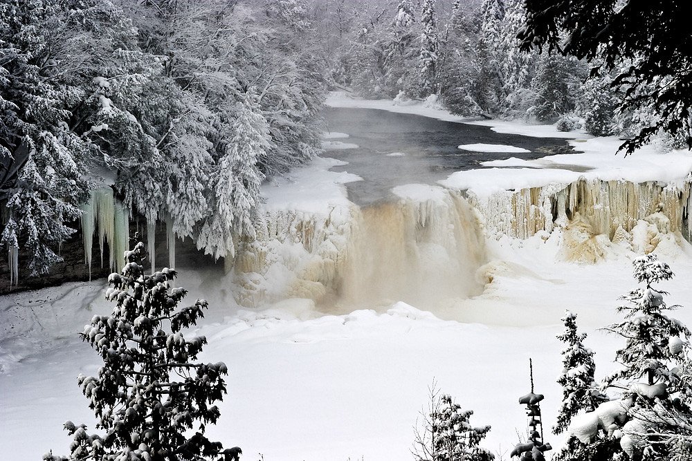
East Branch Falls
By Armen Suny · Last verified Mar 2026

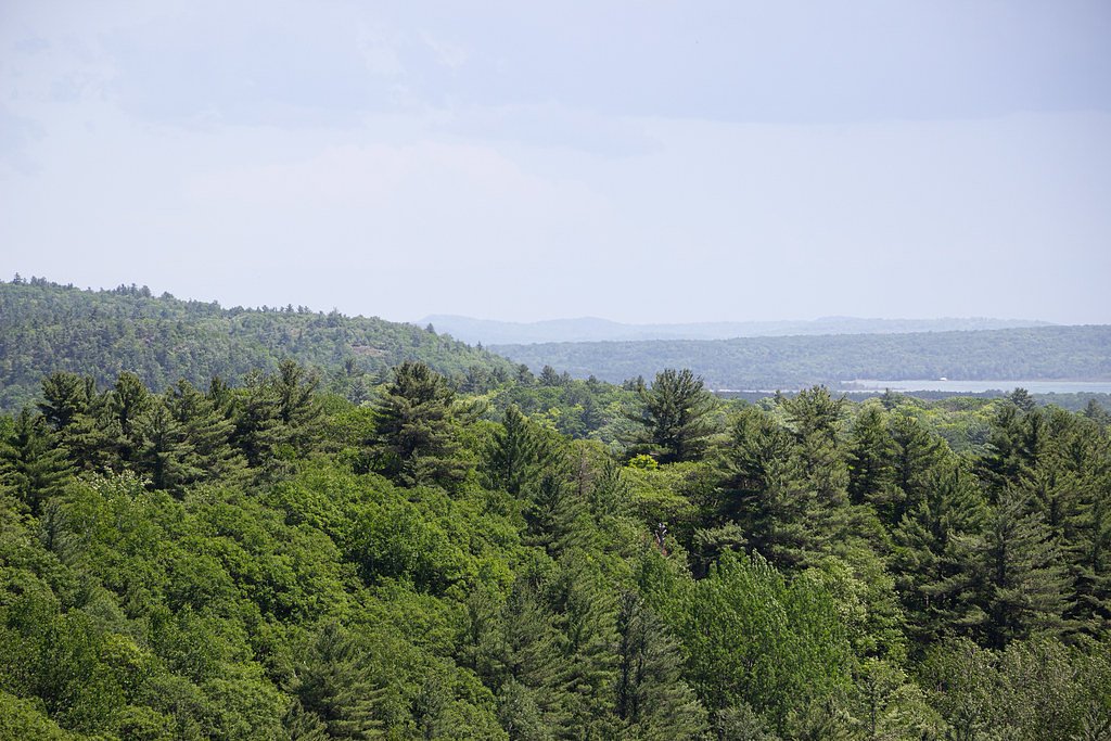


Photo Credits (5)
Difficulty
Moderate
Trail Length
2.4 miles
Trail Type
Out And Back
Elevation Gain
350 ft
About East Branch Falls
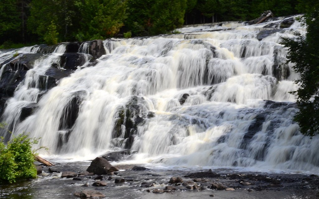
Tucked into Michigan’s Upper Peninsula, East Branch Falls is a small, picturesque drop on the East Branch of the Huron River that rewards hikers with a peaceful, forest-framed setting. The falls feel remote and quiet—a great stop for photographers and anyone looking to escape busier parks—yet are reached by a manageable hike rather than a long backcountry approach. Dense stands of northern hardwoods and mixed conifers surround the stream, giving the site a true northern-Michigan woodland atmosphere. The falls and surrounding lands are managed by the SDNR as part of the Baraga State Forest Area and are designated SCA, so visitors should practice leave-no-trace principles and respect any site protections. Because East Branch Falls is not widely publicized, it tends to stay serene even on summer weekends, making it an inviting destination for a reflective afternoon outdoors or a short nature stop while exploring the western U.P.
The Setting
East Branch Falls sits at 784 feet within Baraga State Forest Area, fed by the Salmon Trout River, in the foothills of Michigan.
Trail & Hike Details
The Approach
The moderate 2.4-mile out-and-back trail gains 350 feet of elevation on the way to the falls.
Trail Description
The approach to East Branch Falls is an out-and-back hike of about 2.4 miles round trip with roughly 350 feet of elevation gain; the route is rated moderate. The path winds through forested terrain and can include uneven footing and muddy stretches after rain, so bring sturdy footwear and be prepared for short sections of slipperiness or rooty tread. The trail may be lightly marked or unmarked in places; follow obvious game or footpaths toward the river and allow extra time for slower footing on wet days.
What to Expect
Dogs are welcome.
Accessibility
The trail is not wheelchair accessible. Uneven terrain and elevation changes require steady footing.
Frequently Asked Questions
🐶 Are Dogs Allowed at East Branch Falls?
✅ Dogs are allowed
Are There Any Fees or Permits Required?
🆖 No fees required
🏊 Is There Swimming at East Branch Falls?
❌ Swimming is not allowed
When to Visit
Spring is the best time to visit, as the waterfall is usually more robust due to snowmelt. Summer and fall are also good options for pleasant weather and colorful foliage.
Seasonal Access
The best time to visit is Spring, Summer, and Fall. Winter access may be limited.
Safety Information
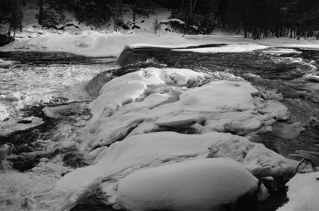
Be cautious of slippery rocks near the waterfall. Cell phone service may be limited in the area, so plan accordingly. Check weather conditions before visiting, as the trail can become muddy or difficult to navigate after rain.
Current Water Conditions
8 ft³/s
Current discharge — how much water is flowing
Much higher than usual for this time of year
Based on 21 years of record
0.39 ft
Water depth at gauge
53°F
ColdBracing — limit time in water
7-Day Discharge Trend
What does this mean for your visit?
The water is flowing much higher than usual, expect an impressive display. Water temperature is a bracing 53 degrees F, limit your time in the water.
About This Gauge
This gauge is on a nearby waterway and may not reflect exact conditions at the falls.
7-Day Flow Outlook
Based on the USGS gauge SALMON TROUT RIVER NEAR BIG BAY, MI (16 km away).
Today
Moderate
8 cfs
9/10Tomorrow
Moderate
8 cfs
9/10Sun
Moderate
9 cfs
6/10Mon
Strong
10 cfs
7/10Tue
Strong
10 cfs
7/10Wed
Strong
10 cfs
7/10Thu
Strong
9 cfs
7/10Best window: Today — moderate flow, mostly sunny (trip score 9/10).
Best time of year: this gauge typically runs highest from mid March to late May, peaking in April.
How we calculate this
This is a transparent outlook, not a precise forecast. We take the waterfall's current flow strength (how it ranks against its historical normal for today, from the nearest USGS stream gauge), carry that ranking forward along the gauge's seasonal curve, and nudge it for forecast rain. Confidence is highest for the next day or two and falls further out. Always check official conditions and your own judgment before visiting — high flows can be dangerous.
Know when to go.
Get a free email alert when waterfalls near Skanee hit peak flow. We only send when conditions are worth the trip — no weekly newsletters, no spam.
Weather Forecast
Location & Access
Getting There
East Branch Falls is located in the Upper Peninsula of Michigan, near the Huron River. Access typically requires driving on unpaved forest roads, which may be rough or muddy depending on the season. A high-clearance vehicle is recommended.
Get Directions on Google MapsParking
Parking is limited and may consist of roadside pull-offs or small clearings near the trailhead.
Elevation
784 feet above sea level
Coordinates
46.849722° N, -88.063333° W
Land Management
Managed by SDNR
Visitor Tips & Gear
Bring bug spray during the summer months, as mosquitoes and other insects can be prevalent. Wear sturdy shoes, as the trail may be uneven or muddy. Consider visiting in the spring when water flow is typically at its peak.
As an Amazon Associate, we earn from qualifying purchases.
With 2.4 miles and 350 ft of elevation gain, sturdy boots and trekking poles will help on this moderate trail. Sun exposure on the trail makes good sun protection a must in summer.

Polarized Sunglasses (Knockaround)
Cuts glare off the water so you actually see the falls — and your photos turn out better too.

Columbia Watertight II Rain Jacket
Packs into its own pocket, seam-sealed, and keeps you dry from spray and surprise rain.

Earth Pak Waterproof Dry Bag
Keeps your phone and gear dry when waterfall mist soaks everything else.

Waterproof Phone Pouch (AiRunTech)
Cheap insurance — take photos right next to the falls without killing your phone.

Timberland Euro Sprint Mid Waterproof
Trusted waterproof boot with premium leather and grippy rubber sole — reliable on rocky, wet trails.

TrailBuddy Trekking Poles
Lightweight aluminum, cork grips, and flip-locks that actually hold — a best-seller for good reason.
Where to Stay

Independence Stay Hotel and Long term suites

AC4 Northwoods Getaway w Jetted Tub

UP Escape in the Pines

Lakefront Lookout! Private Sand Beach on Superior
Browse vacation cabins and private rentals nearby
Unique outdoor stays — tents, yurts, and treehouses
Rent a campervan or RV for your waterfall road trip
Some links are affiliate links. We may earn a commission at no extra cost to you.
Additional Information
Nearby Attractions
Other waterfalls in the Huron River area, such as Big Erick's Falls and Lower Silver Falls.
Wildlife
The area is home to a variety of wildlife, including deer, birds, and small mammals. Be cautious of ticks and other insects.
Cities near East Branch Falls
Nearby Waterfalls

Writing about East Branch Falls? Embed this waterfall on your site for free.