Great Falls
By Armen Suny · Last verified May 2026
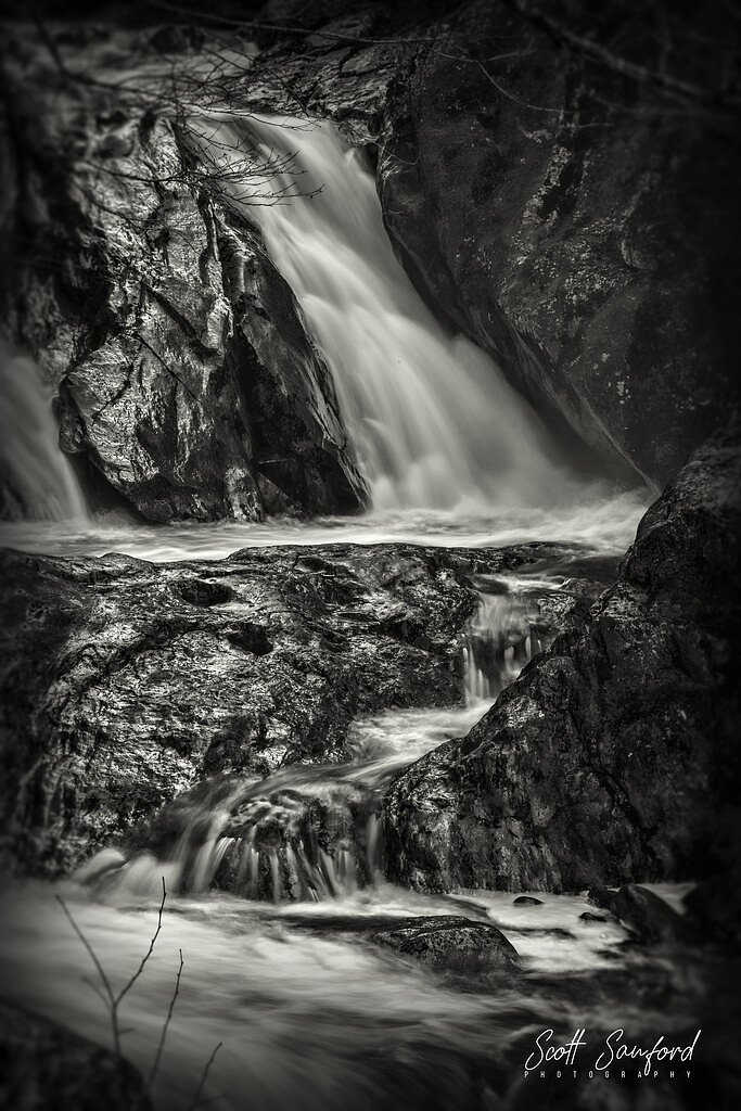
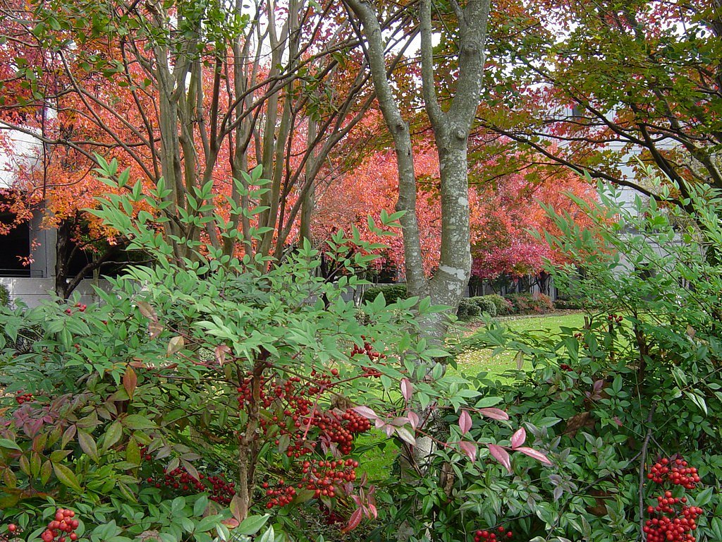
Photo Credits (3)
Difficulty
Moderate
Trail Length
2.5 miles
Trail Type
Out And Back
Elevation Gain
200 ft
About Great Falls
Great Falls sits along the Catawba River, where rocky ledges and cascades create a scenic stretch of water that draws hikers, photographers and history buffs alike. The site’s natural beauty and riverside setting make it an inviting spot for a short day outing; the falls are often enjoyed as part of a relaxed hike and riverside exploration. Most visitors reach the falls via a 2.5-mile out-and-back hike that climbs roughly 200 feet overall. The trail is rated moderate and rewards effort with frequent river views and shaded, wooded stretches—an accessible introduction to the area’s landscape for hikers comfortable on uneven footing.
The Setting
Great Falls sits at 476 feet along the Saluda River, in the coastal lowlands of South Carolina.
Trail & Hike Details
The Approach
The moderate 2.5-mile out-and-back trail gains 200 feet of elevation on the way to the falls.
Trail Description
This is a 2.5-mile out-and-back trail with about 200 feet of elevation gain, rated moderate. The route winds through wooded areas and follows viewpoints of the Catawba River and the falls; the tread is generally well-marked but includes some uneven and rocky sections. Suitable for day hikers looking for a moderately paced outing with scenic river access.
What to Expect
Dogs are welcome.
Accessibility
The trail is not wheelchair accessible. Uneven terrain and elevation changes require steady footing.
Frequently Asked Questions
🐶 Are Dogs Allowed at Great Falls?
✅ Dogs are allowed
Are There Any Fees or Permits Required?
🆖 No fees required
🏊 Is There Swimming at Great Falls?
❌ Swimming is not allowed
When to Visit
Spring and fall are the best times to visit due to mild weather and vibrant foliage. Summer is also popular, but temperatures can be high.
Seasonal Access
The best time to visit is Spring, Summer, and Fall. Winter access may be limited.
Safety Information
Visitors should exercise caution near the water, as currents can be strong and rocks may be slippery. Stay on marked trails to avoid getting lost or encountering hazardous areas.
Current Water Conditions
211 ft³/s
Current discharge — how much water is flowing
Much lower than usual for this time of year
Based on 87 years of record
2.05 ft
Water depth at gauge
7-Day Discharge Trend
What does this mean for your visit?
Flow is well below normal for this time of year, so the waterfall may be a trickle.
About This Gauge
7-Day Flow Outlook
Based on the USGS gauge SALUDA RIVER NEAR WARE SHOALS, SC (2 km away).
Today
Low
241 cfs
3/10Tomorrow
Low
254 cfs
3/10Sun
Low
258 cfs
3/10Mon
Low
262 cfs
3/10Tue
Barely Flowing
233 cfs
5/10Wed
Barely Flowing
208 cfs
5/10Thu
Barely Flowing
194 cfs
5/10Best window: Tue — barely flowing flow, sunny (trip score 5/10).
Best time of year: this gauge typically runs highest from mid February to late April, peaking in March.
How we calculate this
This is a transparent outlook, not a precise forecast. We take the waterfall's current flow strength (how it ranks against its historical normal for today, from the nearest USGS stream gauge), carry that ranking forward along the gauge's seasonal curve, and nudge it for forecast rain. Confidence is highest for the next day or two and falls further out. Always check official conditions and your own judgment before visiting — high flows can be dangerous.
Know when to go.
Get a free email alert when waterfalls near Ware Shoals hit peak flow. We only send when conditions are worth the trip — no weekly newsletters, no spam.
Weather Forecast
Location & Access
Getting There
Great Falls is located near the town of Great Falls, South Carolina. It can be accessed via local roads, with signage directing visitors to the area. The falls are part of the Great Falls Reservoir and the surrounding area is managed by Duke Energy.
Get Directions on Google MapsParking
Parking is available near the falls, but spaces may be limited during peak seasons. Visitors should check for any parking restrictions or fees.
Elevation
476 feet above sea level
Coordinates
34.403451° N, -82.237896° W
Visitor Tips & Gear
Wear sturdy footwear as the trail may have uneven or rocky sections. Bring water and snacks, especially during warmer months. Check weather conditions before visiting, as trails may become slippery after rain.
As an Amazon Associate, we earn from qualifying purchases.
With 2.5 miles and 200 ft of elevation gain, sturdy boots and trekking poles will help on this moderate trail. Sun exposure on the trail makes good sun protection a must in summer.

Polarized Sunglasses (Knockaround)
Cuts glare off the water so you actually see the falls — and your photos turn out better too.

Columbia Watertight II Rain Jacket
Packs into its own pocket, seam-sealed, and keeps you dry from spray and surprise rain.

Earth Pak Waterproof Dry Bag
Keeps your phone and gear dry when waterfall mist soaks everything else.

Waterproof Phone Pouch (AiRunTech)
Cheap insurance — take photos right next to the falls without killing your phone.

Timberland Euro Sprint Mid Waterproof
Trusted waterproof boot with premium leather and grippy rubber sole — reliable on rocky, wet trails.

TrailBuddy Trekking Poles
Lightweight aluminum, cork grips, and flip-locks that actually hold — a best-seller for good reason.
Where to Stay

Holiday Inn Express & Suites Greenwood Mall by IHG

Comfort Inn & Suites Greenwood near University

Comfort Suites Clinton near Presbyterian College

Charming Romantic Lakefront Cottage or Guest Room Depending on Availability Near Golf
Browse vacation cabins and private rentals nearby
Unique outdoor stays — tents, yurts, and treehouses
Rent a campervan or RV for your waterfall road trip
Some links are affiliate links. We may earn a commission at no extra cost to you.
Nearby Campground
POPLAR SPRINGS
11.8 miles away · 1 sites
Overview Poplar Springs Recreation Area is a 24 acre site with moderate slopes with relatively dense stands of pines and mixed hardwoods. The site presently offers day use and boat launching facilities, but is primarily used for boat launching and is one of the more popular launch sites in this area of Hartwell Lake. Facilities include 1 volunteer host campsite, 20 picnic sites, 1 standard picnic shelter with water and electric service, 1 two lane boat ramp, 1 courtesy dock, 2 comfort stations, a
Book on Recreation.govAdditional Information
Nearby Attractions
Nearby attractions include Landsford Canal State Park and the Catawba River Blueway, which offers kayaking and canoeing opportunities.
Wildlife
The area is home to various bird species, deer, and other small wildlife. Visitors may also see fish in the river.
Cities near Great Falls
Other waterfalls named Great Falls
12 other waterfalls share this name across the U.S.
Writing about Great Falls? Embed this waterfall on your site for free.