Difficulty
Moderate
Trail Length
2.4 miles
Trail Type
Out And Back
Elevation Gain
350 ft
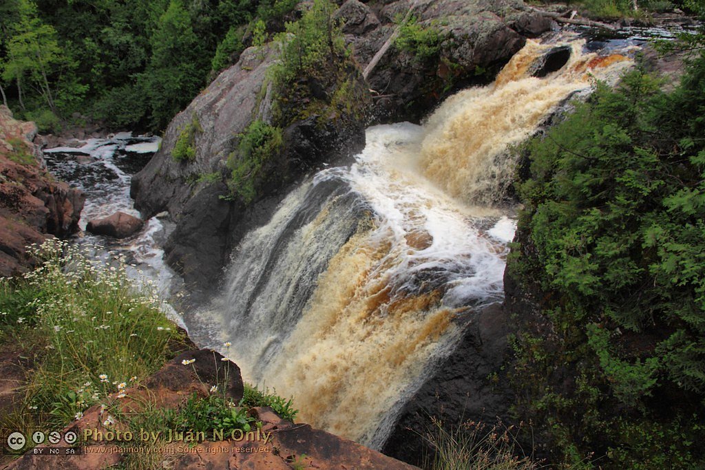
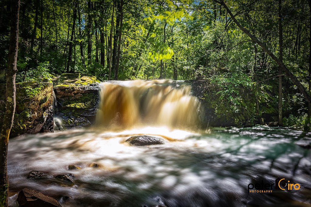
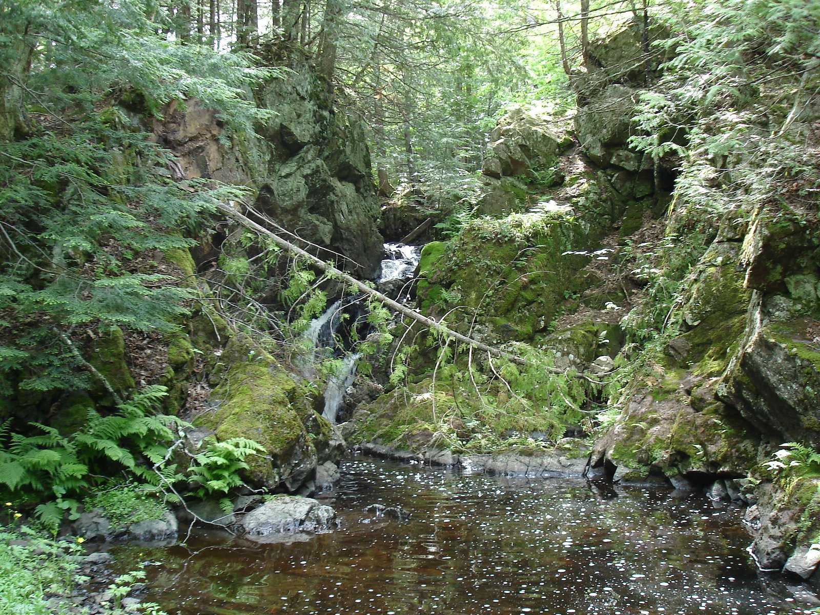
About Neepikon Falls
Neepikon Falls is a scenic, tucked-away waterfall in Michigan that offers a peaceful forest setting and a rewarding payoff for those who make the short trek. As a lesser-known spot, the falls often feel private and tranquil, a good choice for hikers seeking an uncrowded nature escape and a chance to hear the steady rush of water through the trees. Access to the falls is along a moderate 2.4-mile out-and-back route with about 350 feet of elevation gain. Hikers should plan for changing water levels after rain or spring melt and bring sturdy footwear and a camera—this compact hike delivers a pleasant climb and a scenic destination without a long commitment of time.
The Setting
Neepikon Falls sits at 1,309 feet along the Black River, in the foothills of Michigan.
Trail & Hike Details
The Approach
The moderate 2.4-mile out-and-back trail gains 350 feet of elevation on the way to the falls.
Trail Description
Trail metrics: 2.4-mile out-and-back, approximately 350 feet elevation gain, rated moderate. The trail is not well-documented; visitors should expect uneven terrain and natural obstacles. Trail conditions can vary seasonally, so pack appropriate footwear, water, and basic navigation aids, and allow extra time for slower footing. No official USFS trail name or number is provided in the available data.
What to Expect
Visitors can expect a tranquil and picturesque waterfall surrounded by natural forested areas. The falls may be more impressive during spring or after heavy rainfall.
Accessibility
The trail is not wheelchair accessible. Uneven terrain and elevation changes require steady footing.
Frequently Asked Questions
🐶 Are Dogs Allowed at Neepikon Falls?
❌ Dogs are not allowed
Are There Any Fees or Permits Required?
🆖 No fees required
🏊 Is There Swimming at Neepikon Falls?
❌ Swimming is not allowed
When to Visit
Spring and early summer are typically the best times to visit, as water flow is higher due to snowmelt and rainfall.
Seasonal Access
The best time to visit is Spring, Summer, and Fall. Winter access may be limited.
Safety Information
The area is remote, so visitors should inform someone of their plans and carry a fully charged phone or emergency communication device. Be cautious of slippery rocks near the falls.
Current Water Conditions
37 ft³/s
Current discharge — how much water is flowing
Lower than usual for this time of year
Based on 53 years of record
2.09 ft
Water depth at gauge
7-Day Discharge Trend
What does this mean for your visit?
Flow is lower than usual for this time of year.
About This Gauge
7-Day Flow Outlook
Based on the USGS gauge BLACK RIVER NEAR BESSEMER, MI (6 km away).
Today
Moderate
37 cfs
8/10Tomorrow
Moderate
32 cfs
8/10Sun
Moderate
35 cfs
5/10Mon
Moderate
41 cfs
6/10Tue
Moderate
41 cfs
6/10Wed
Moderate
42 cfs
6/10Thu
Moderate
33 cfs
6/10Best window: Today — moderate flow, partly sunny (trip score 8/10).
Best time of year: this gauge typically runs highest from late March to late May, peaking in April.
How we calculate this
This is a transparent outlook, not a precise forecast. We take the waterfall's current flow strength (how it ranks against its historical normal for today, from the nearest USGS stream gauge), carry that ranking forward along the gauge's seasonal curve, and nudge it for forecast rain. Confidence is highest for the next day or two and falls further out. Always check official conditions and your own judgment before visiting — high flows can be dangerous.
Know when to go.
Get a free email alert when waterfalls near Ramsay hit peak flow. We only send when conditions are worth the trip — no weekly newsletters, no spam.
Weather Forecast
Location & Access
Getting There
Neepikon Falls is located in a remote area of Michigan. Access may require navigating unpaved roads or trails. Visitors are advised to use a reliable map or GPS device to locate the falls.
Get Directions on Google MapsParking
Parking availability is unclear, but visitors may need to park along nearby roads or designated areas if available.
Elevation
1,309 feet above sea level
Coordinates
46.491059° N, -89.996283° W
Visitor Tips & Gear
Bring a detailed map or GPS device, as the area is remote and signage may be limited. Check weather conditions before visiting, and be prepared for potential muddy or uneven trails.
As an Amazon Associate, we earn from qualifying purchases.
With 2.4 miles and 350 ft of elevation gain, sturdy boots and trekking poles will help on this moderate trail. Sun exposure on the trail makes good sun protection a must in summer.

Columbia Watertight II Rain Jacket
Packs into its own pocket, seam-sealed, and keeps you dry from spray and surprise rain.

Earth Pak Waterproof Dry Bag
Keeps your phone and gear dry when waterfall mist soaks everything else.

Waterproof Phone Pouch (AiRunTech)
Cheap insurance — take photos right next to the falls without killing your phone.

Timberland Euro Sprint Mid Waterproof
Trusted waterproof boot with premium leather and grippy rubber sole — reliable on rocky, wet trails.

TrailBuddy Trekking Poles
Lightweight aluminum, cork grips, and flip-locks that actually hold — a best-seller for good reason.

Polarized Sunglasses (Knockaround)
Cuts glare off the water so you actually see the falls — and your photos turn out better too.
Where to Stay

Snow Otter Haus - 2

North Ironwood Acres - Black River Lodge

Quality Inn Ironwood

Snow Otter Haus - 1
Browse vacation cabins and private rentals nearby
Unique outdoor stays — tents, yurts, and treehouses
Rent a campervan or RV for your waterfall road trip
Some links are affiliate links. We may earn a commission at no extra cost to you.
Nearby Campground
BLACK RIVER HARBOR PAVILION
12.6 miles away · 1 sites
Overview Planning a visit to the Black River Harbor Pavilion? Watch for Alerts at the top of the page for any Alerts regarding this facility. The Black River Harbor Pavilion is located within the Black Harbor Recreation Area on Lake Superior in Michigans Upper Peninsula. The historic stone and wood pavilion was constructed by the Civilian Conservation Corps in the 1930s. Recreation Lake Superior offers great opportunities for boating, fishing, and swimming. The North Country National Scenic Trail
Book on Recreation.govAdditional Information
Nearby Attractions
The surrounding area may offer additional hiking trails and natural attractions, but specific details are not well-documented.
Wildlife
The area is likely home to typical Michigan wildlife, including deer, birds, and small mammals. Visitors should be aware of potential encounters with insects or other animals.
Cities near Neepikon Falls
Nearby Waterfalls
Writing about Neepikon Falls? Embed this waterfall on your site for free.