Photo Credits (2)
Difficulty
Moderate
Trail Length
2.4 miles
Trail Type
Out And Back
Elevation Gain
350 ft
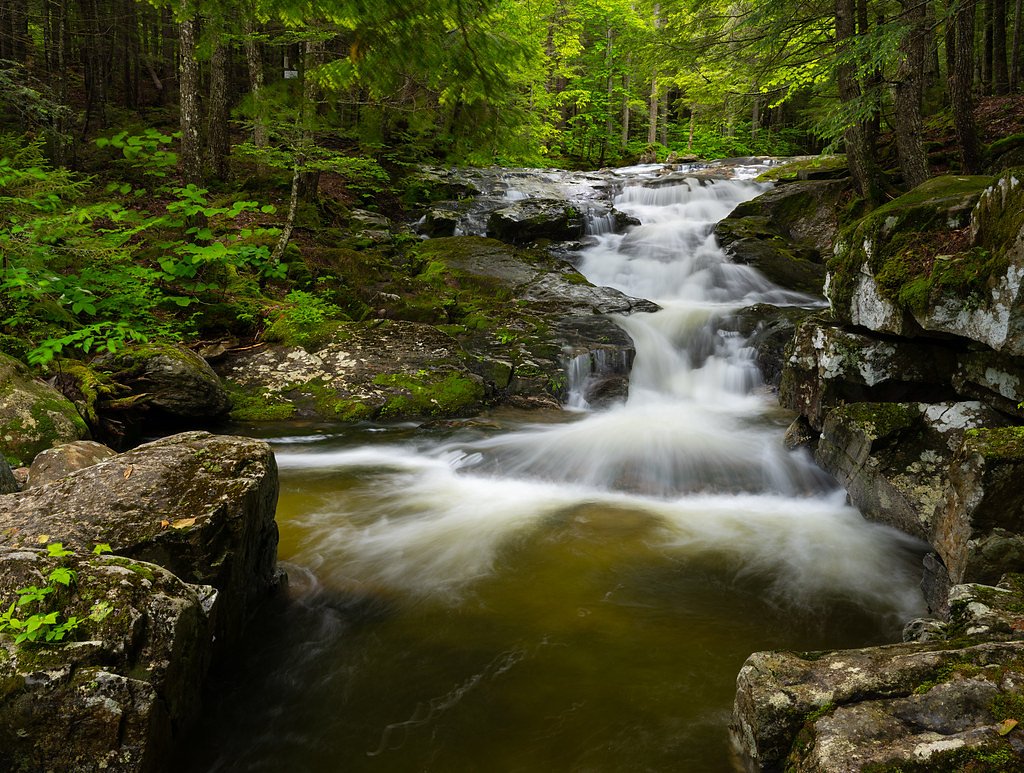
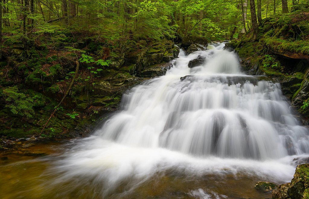
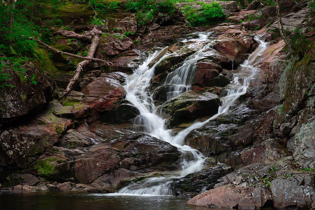
About Gordon Falls
Tucked into the White Mountain National Forest and managed by the U.S. Forest Service, Gordon Falls is a quietly scenic cascade that rewards a short hike with a classic New Hampshire woodland outlook. The falls sit in a peaceful forest setting that makes for easy photography and a restorative day out; the approach follows trails maintained by the USFS and offers a sense of remoteness without a long backcountry commitment. Access to the falls is via the USFS route GORDON POND SNOMO (Trail #97223). The approach is commonly described as a moderate out-and-back hike of roughly 2.4 miles with about 350 feet of elevation gain, and the nearby Wildwood Campground is just 4.33 km away for anyone wanting to turn the visit into an overnight trip. The USFS inventory also notes the trail as having a snow surface (GORDON POND SNOMO), so conditions can vary by season—plan accordingly and consult local Forest Service information before heading out.
The Setting
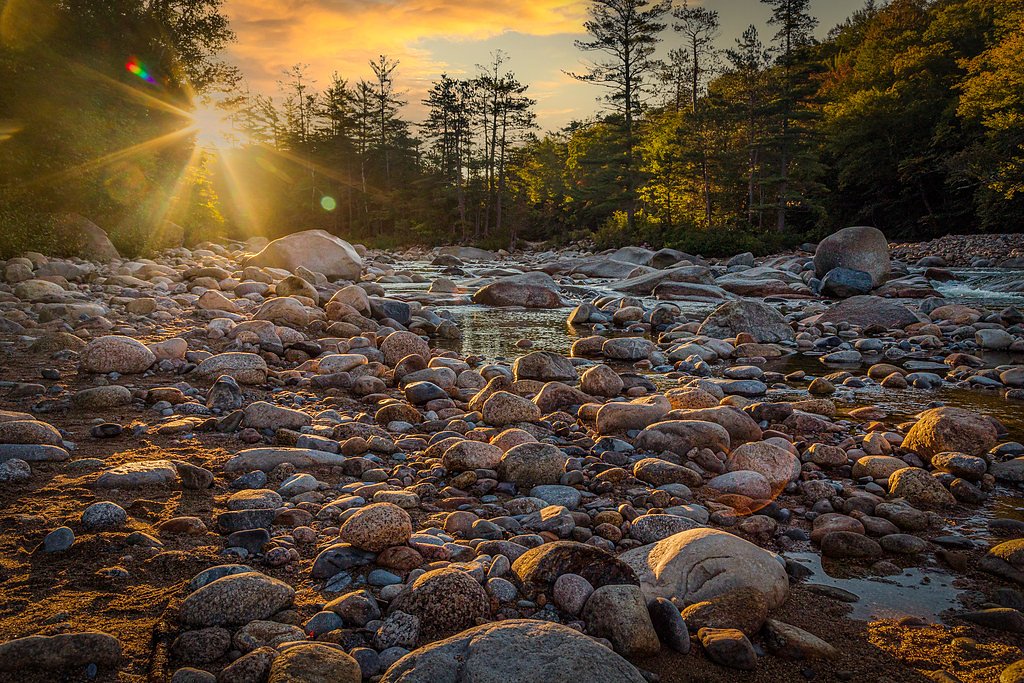
Gordon Falls sits at 2,169 feet within White Mountain National Forest, fed by the East Branch Pemigewasset River, in the hills of New Hampshire.
Trail & Hike Details
The Approach
The moderate hike follows Gordon Pond Snomo (#97223), a 2.4-mile out-and-back trail over snow. Expect 350 feet of elevation gain with grades of 12-20%. The trail is developed (Class 3).
USFS Trail
GORDON POND SNOMO #97223
Trail Class
Developed
Surface
Avg Grade
USFS Segment
2.93 miTrail Description
Trail: GORDON POND SNOMO (USFS Trail #97223). Type: out-and-back; listed trail length 2.4 miles with 350 ft elevation gain and rated moderate. USFS GIS mileage records 2.93 miles. Surface: SNOW (per USFS inventory). Class: 3. Typical grade: 12–20%. Expect a moderately pitched forest track with sustained sections in the 12–20% grade range; the USFS class and surface designation indicate the route can be firmer and snow-covered in colder months. The trail is straightforward in routing but be prepared for seasonal conditions and check White Mountain National Forest notices before you go.
What to Expect
Dogs are welcome.
Accessibility
The trail is not wheelchair accessible. Uneven terrain and elevation changes require steady footing.
Frequently Asked Questions
🐶 Are Dogs Allowed at Gordon Falls?
✅ Dogs are allowed
Are There Any Fees or Permits Required?
🆖 No fees required
🏊 Is There Swimming at Gordon Falls?
❌ Swimming is not allowed
When to Visit
Spring and early summer are the best times to visit, as the waterfall is most active during these seasons. Fall offers beautiful foliage, while winter may provide a unique frozen waterfall view.
Seasonal Access
The best time to visit is Spring, Summer, and Fall. Winter access may be limited. Check with White Mountain National Forest for seasonal road closures.
Safety Information
The trail may be slippery after rain, and visitors should exercise caution near the waterfall's edge. Always stay on marked trails and supervise children closely.
Current Water Conditions
305 ft³/s
Current discharge — how much water is flowing
About average for this time of year
Based on 33 years of record
4.53 ft
Water depth at gauge
7-Day Discharge Trend
What does this mean for your visit?
Flow is about average for this time of year.
About This Gauge
7-Day Flow Outlook
Based on the USGS gauge EAST BRANCH PEMIGEWASSET RIVER AT LINCOLN, NH (7 km away).
Today
Barely Flowing
305 cfs
5/10Tomorrow
Barely Flowing
350 cfs
5/10Tue
Low
528 cfs
3/10Wed
Low
503 cfs
3/10Thu
Low
449 cfs
3/10Fri
Low
394 cfs
3/10Sat
Low
343 cfs
4/10Best window: Today — barely flowing flow, sunny (trip score 5/10).
Best time of year: this gauge typically runs highest from late March to early June, peaking in May.
How we calculate this
This is a transparent outlook, not a precise forecast. We take the waterfall's current flow strength (how it ranks against its historical normal for today, from the nearest USGS stream gauge), carry that ranking forward along the gauge's seasonal curve, and nudge it for forecast rain. Confidence is highest for the next day or two and falls further out. Always check official conditions and your own judgment before visiting — high flows can be dangerous.
Know when to go.
Get a free email alert when waterfalls near North Woodstock hit peak flow. We only send when conditions are worth the trip — no weekly newsletters, no spam.
Weather Forecast
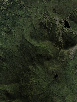
Location & Access
Getting There
Gordon Falls is located near the town of Lincoln, New Hampshire, within the White Mountains National Forest. Access is typically via a short drive from the Kancamagus Highway, a scenic route popular with visitors.
Get Directions on Google MapsParking
Parking is available at a nearby trailhead or designated parking area, though spaces may be limited during peak seasons.
Elevation
2,169 feet above sea level
Coordinates
44.057011° N, -71.745639° W
Land Management
Managed by USFS
Visitor Tips & Gear
Visit early in the day to avoid crowds, especially during weekends and peak foliage season. Wear sturdy footwear as the trail may be muddy or slippery after rain.
As an Amazon Associate, we earn from qualifying purchases.
With 2.4 miles and 350 ft of elevation gain, sturdy boots and trekking poles will help on this moderate trail. Sun exposure on the trail makes good sun protection a must in summer.

Polarized Sunglasses (Knockaround)
Cuts glare off the water so you actually see the falls — and your photos turn out better too.

Columbia Watertight II Rain Jacket
Packs into its own pocket, seam-sealed, and keeps you dry from spray and surprise rain.

Earth Pak Waterproof Dry Bag
Keeps your phone and gear dry when waterfall mist soaks everything else.

Waterproof Phone Pouch (AiRunTech)
Cheap insurance — take photos right next to the falls without killing your phone.

Timberland Euro Sprint Mid Waterproof
Trusted waterproof boot with premium leather and grippy rubber sole — reliable on rocky, wet trails.

TrailBuddy Trekking Poles
Lightweight aluminum, cork grips, and flip-locks that actually hold — a best-seller for good reason.
Where to Stay

Holiday Inn Express & Suites - Lincoln East - White Mountains by IHG

Inn 32

Woodwards White Mountain Resort, BW Signature Collection

Bluegreen Vacations South Mountain, an Ascend Collection Resort
Browse vacation cabins and private rentals nearby
Unique outdoor stays — tents, yurts, and treehouses
Rent a campervan or RV for your waterfall road trip
Some links are affiliate links. We may earn a commission at no extra cost to you.
Nearby Campground
Wildwood
2.7 miles away · 26 sites
Overview There are 26 non-reservable wooded sites with gravel pads, fire rings, and picnic tables. A self-service pay system collects the fees on a first come, first serve basis. TIPS: * Allow no more than 8 people and 2 vehicles per site and keep all equipment (including tents, tables and motor vehicles) on the graveled area. This will minimize compaction, allow low vegetation to grow, and enhance privacy between sites. * Build all fires in the ring provided. “Only YOU can prevent forest fires,
Book on Recreation.govAdditional Information
Nearby Attractions
The Kancamagus Highway, Franconia Notch State Park, and the Flume Gorge are all nearby attractions worth visiting.
Wildlife
The area is home to a variety of wildlife, including birds, deer, and occasionally black bears. Visitors should exercise caution and follow Leave No Trace principles.
Cities near Gordon Falls
Nearby Waterfalls
Other waterfalls named Gordon Falls
2 other waterfalls share this name across the U.S.
Writing about Gordon Falls? Embed this waterfall on your site for free.