Photo Credits (5)
Difficulty
Moderate
Trail Length
3.2 miles
Trail Type
Out And Back
Elevation Gain
700 ft
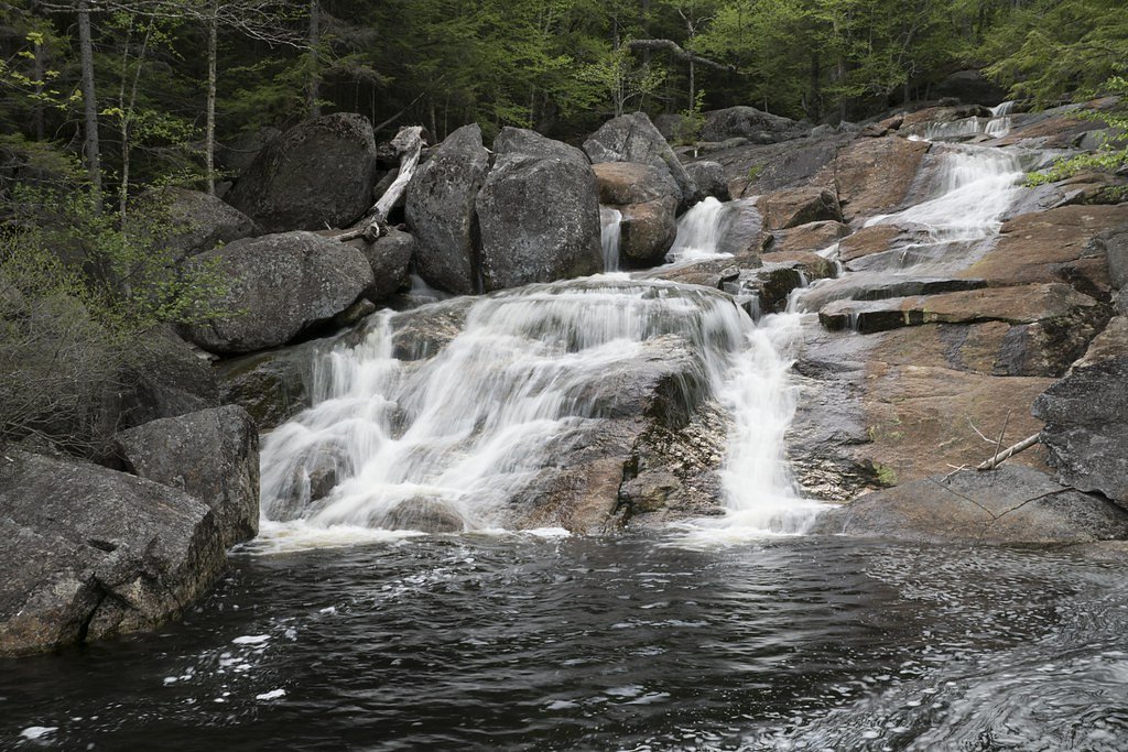
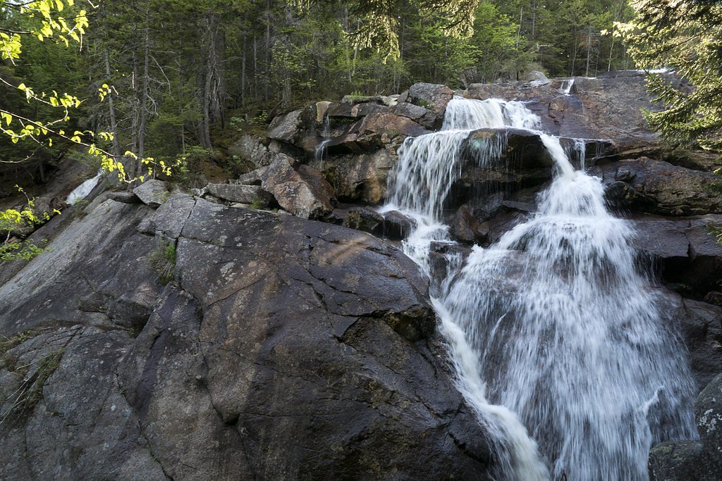
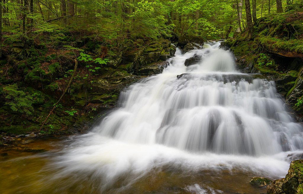
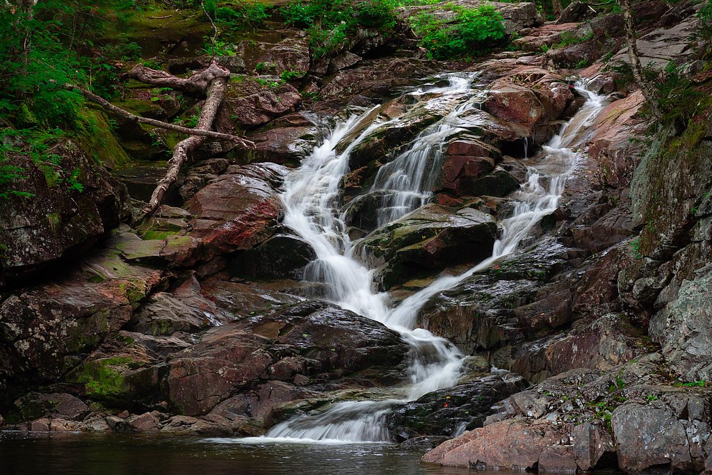
About Georgiana Falls
Georgiana Falls, tucked into the forested hills of Lincoln, New Hampshire, tumbles in two main tiers — Lower Georgiana Falls and Upper Georgiana Falls — along Harvard Brook. The falls sit within the Second Presidential State Forest and are managed as a Special Resource Management Area (SRMA) by the SDNR (manager unknown), giving the route a quiet, protected feel that appeals to hikers and photographers alike. The double-drop cascades and surrounding hardwoods make this a rewarding short destination for anyone exploring the northern White Mountains corridor. The site is a popular moderate outing rather than a long expedition, and camping is available nearby: Wildwood Campground lies about 7.55 km from the trailhead for those wishing to extend an overnight trip. With its forest setting and accessible streamside viewpoints, Georgiana Falls is a great half-day adventure for families and day hikers looking to experience a scenic brook-fed cascade within state-managed forestland.
The Setting
Georgiana Falls sits at 1,631 feet within Second Presidential State Forest, fed by the East Branch Pemigewasset River, in the hills of New Hampshire.
Trail & Hike Details
The Approach
The moderate 3.2-mile out-and-back trail gains 700 feet of elevation on the way to the falls.
Trail Description
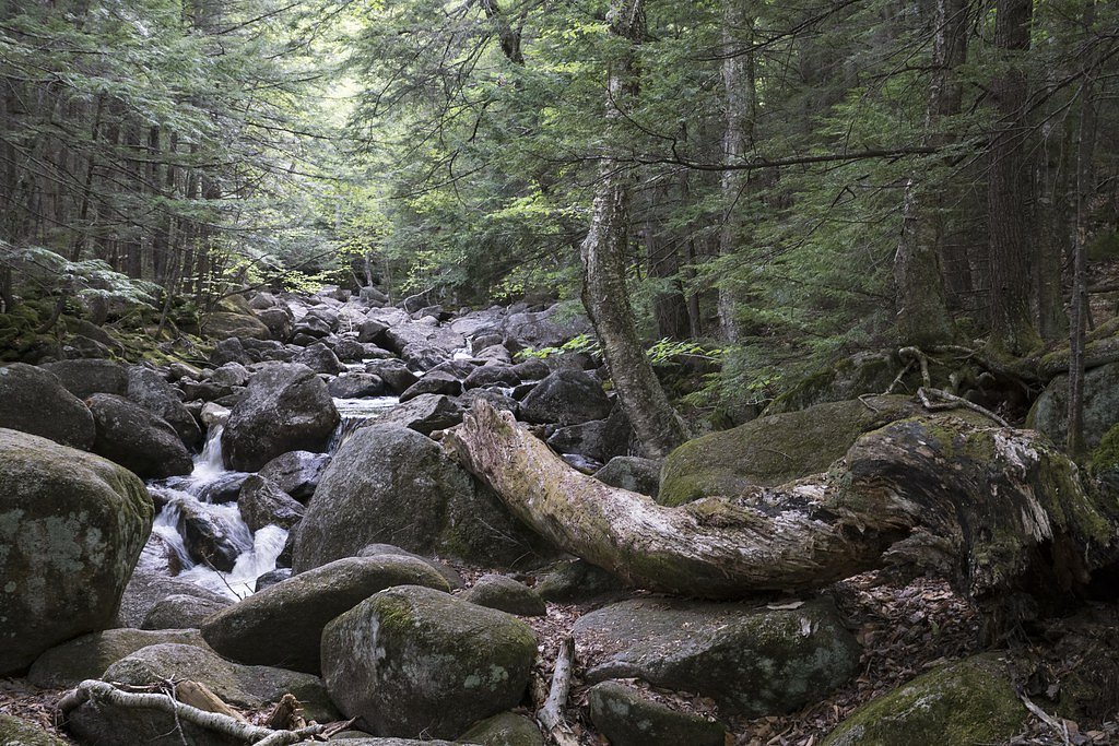
The trail to Georgiana Falls is an out-and-back route totaling about 3.2 miles round trip with roughly 700 feet of elevation gain and a moderate difficulty rating. The path generally follows Harvard Brook and leads to viewpoints for both Lower and Upper Georgiana Falls. Expect a natural tread that is rocky and uneven in sections with a steady incline as you approach the falls; the route is non-technical and suitable for hikers comfortable on uneven terrain.
What to Expect
Dogs are welcome.
Accessibility
The trail is not wheelchair accessible. Uneven terrain and elevation changes require steady footing.
Frequently Asked Questions
🐶 Are Dogs Allowed at Georgiana Falls?
✅ Dogs are allowed
Are There Any Fees or Permits Required?
🆖 No fees required
🏊 Is There Swimming at Georgiana Falls?
❌ Swimming is not allowed
When to Visit
Spring and early summer are ideal for visiting Georgiana Falls, as the water flow is typically stronger due to snowmelt. Fall offers beautiful foliage, while winter may provide a unique view of the frozen falls, though the trail can be icy and challenging.
Seasonal Access
The best time to visit is Spring, Summer, and Fall. Winter access may be limited.
Safety Information
The trail can be slippery, especially after rain or during winter. Use caution near the falls as the rocks can be wet and unstable. Carry a map or GPS as the trail is not always well-marked.
Current Water Conditions
305 ft³/s
Current discharge — how much water is flowing
About average for this time of year
Based on 33 years of record
4.53 ft
Water depth at gauge
7-Day Discharge Trend
What does this mean for your visit?
Flow is about average for this time of year.
About This Gauge
7-Day Flow Outlook
Based on the USGS gauge EAST BRANCH PEMIGEWASSET RIVER AT LINCOLN, NH (5 km away).
Today
Barely Flowing
329 cfs
3/10Tomorrow
Barely Flowing
364 cfs
5/10Tue
Barely Flowing
500 cfs
3/10Wed
Low
491 cfs
3/10Thu
Low
449 cfs
3/10Fri
Low
375 cfs
4/10Sat
Low
334 cfs
4/10Best window: Tomorrow — barely flowing flow, sunny (trip score 5/10).
Best time of year: this gauge typically runs highest from late March to early June, peaking in May.
How we calculate this
This is a transparent outlook, not a precise forecast. We take the waterfall's current flow strength (how it ranks against its historical normal for today, from the nearest USGS stream gauge), carry that ranking forward along the gauge's seasonal curve, and nudge it for forecast rain. Confidence is highest for the next day or two and falls further out. Always check official conditions and your own judgment before visiting — high flows can be dangerous.
Know when to go.
Get a free email alert when waterfalls near North Woodstock hit peak flow. We only send when conditions are worth the trip — no weekly newsletters, no spam.
Weather Forecast
Location & Access
Getting There
Georgiana Falls is located off Hanson Farm Road in Lincoln, New Hampshire. The trailhead can be accessed from a small parking area near the road.
Get Directions on Google MapsParking
Limited parking is available near the trailhead on Hanson Farm Road. Arrive early during peak seasons to secure a spot.
Elevation
1,631 feet above sea level
Coordinates
44.077566° N, -71.699249° W
Land Management
Managed by UNK
Visitor Tips & Gear
Wear sturdy hiking shoes as the trail can be rocky and slippery, especially after rain. Bring bug spray during the summer months. Start early to avoid crowds and ensure you have enough daylight for the hike.
As an Amazon Associate, we earn from qualifying purchases.
With 3.2 miles and 700 ft of elevation gain, sturdy boots and trekking poles will help on this moderate trail. Sun exposure on the trail makes good sun protection a must in summer.

Polarized Sunglasses (Knockaround)
Cuts glare off the water so you actually see the falls — and your photos turn out better too.

Columbia Watertight II Rain Jacket
Packs into its own pocket, seam-sealed, and keeps you dry from spray and surprise rain.

Earth Pak Waterproof Dry Bag
Keeps your phone and gear dry when waterfall mist soaks everything else.

Waterproof Phone Pouch (AiRunTech)
Cheap insurance — take photos right next to the falls without killing your phone.

Timberland Euro Sprint Mid Waterproof
Trusted waterproof boot with premium leather and grippy rubber sole — reliable on rocky, wet trails.

TrailBuddy Trekking Poles
Lightweight aluminum, cork grips, and flip-locks that actually hold — a best-seller for good reason.
Where to Stay

Holiday Inn Express & Suites - Lincoln East - White Mountains by IHG

Inn 32

Woodwards White Mountain Resort, BW Signature Collection

Bluegreen Vacations South Mountain, an Ascend Collection Resort
Browse vacation cabins and private rentals nearby
Unique outdoor stays — tents, yurts, and treehouses
Rent a campervan or RV for your waterfall road trip
Some links are affiliate links. We may earn a commission at no extra cost to you.
Nearby Campground
Wildwood
4.7 miles away · 26 sites
Overview There are 26 non-reservable wooded sites with gravel pads, fire rings, and picnic tables. A self-service pay system collects the fees on a first come, first serve basis. TIPS: * Allow no more than 8 people and 2 vehicles per site and keep all equipment (including tents, tables and motor vehicles) on the graveled area. This will minimize compaction, allow low vegetation to grow, and enhance privacy between sites. * Build all fires in the ring provided. “Only YOU can prevent forest fires,
Book on Recreation.govAdditional Information
Nearby Attractions
Franconia Notch State Park, Flume Gorge, and Loon Mountain Resort are located nearby and offer additional outdoor activities.
Wildlife
The area is home to various wildlife, including birds, squirrels, and occasionally deer. Be cautious of ticks during warmer months.
Cities near Georgiana Falls
Nearby Waterfalls
Writing about Georgiana Falls? Embed this waterfall on your site for free.