Boulder Falls
Colorado • 70 ft
By Armen Suny · Last verified May 2026
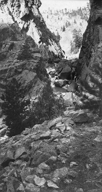
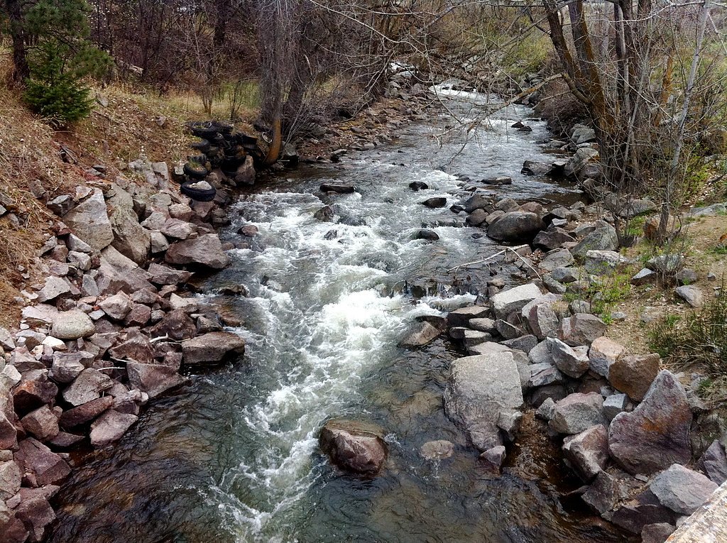
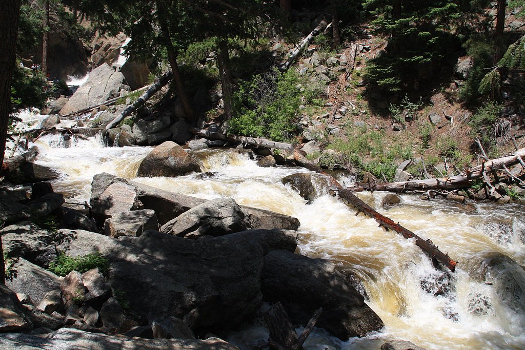
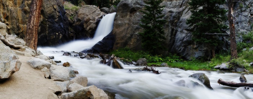

Photo Credits (5)
Difficulty
Easy
Trail Length
0.3 miles
Trail Type
Out And Back
Elevation Gain
50 ft
About Boulder Falls
Boulder Falls plunges about 70 feet in a compact, dramatic cascade tucked into Boulder Canyon. Framed by steep canyon walls, the falls are a very accessible and scenic stop for hikers and sightseers who want a quick taste of Colorado canyon scenery without a long trek. A short 0.3-mile out-and-back trail with roughly 50 feet of elevation gain leads directly to a viewing area at the base of the falls, making this an easy outing for families and day-trippers. The setting feels intimate—powerful water set against narrow canyon rock—and the short approach delivers big visual payoff for minimal effort.
The Setting
Boulder Falls sits at 7,031 feet along the Fourmile Creek, in the high mountains of Colorado. The falls drop 70 feet.
Height: 70 feet
Trail & Hike Details
The Approach
The easy 0.3-mile out and back trail gains 50 feet of elevation on the way to the falls.
Trail Description
Trail length: 0.3 miles (out-and-back). Elevation gain: ~50 feet. Difficulty: Easy. The path is short and well-maintained with a gentle grade that most visitors can negotiate; footing is a mix of packed trail and exposed rock with some rocky sections near the end. The route is non-technical and leads directly to a dedicated viewing spot where you can safely observe the 70-foot cascade. Sturdy footwear is recommended for the rocky sections.
What to Expect
The falls drop 70 feet. Dogs are welcome.
Accessibility
The trail is short and relatively flat, but the surface may be uneven. Contact the managing agency for accessibility details.
Frequently Asked Questions
🐶 Are Dogs Allowed at Boulder Falls?
✅ Dogs are allowed
You can bring dogs to Boulder Falls, but they must be kept on a leash
Are There Any Fees or Permits Required?
🆖 No fees required
🏊 Is There Swimming at Boulder Falls?
❌ Swimming is not allowed
When to Visit
Spring and early summer are ideal times to visit, as snowmelt increases the water flow, making the waterfall more impressive. Fall offers beautiful foliage, while summer provides warm weather for a pleasant hike.
Seasonal Access
The best time to visit is Spring, Summer, and Fall. Access roads and trails may close during winter due to snow.
Safety Information
Stay on the designated trail and behind the safety fences. The rocks near the waterfall can be slippery, and venturing off-trail is dangerous. Be cautious of traffic when parking along the highway.
Current Water Conditions
1 ft³/s
Current discharge — how much water is flowing
About average for this time of year
Based on 8 years of record
9.26 ft
Water depth at gauge
7-Day Discharge Trend
What does this mean for your visit?
Flow is about average for this time of year.
About This Gauge
7-Day Flow Outlook
Based on the USGS gauge FOURMILE CREEK AT LOGAN MILL ROAD NEAR CRISMAN, CO (5 km away).
Today
Barely Flowing
1 cfs
5/10Tomorrow
Barely Flowing
1 cfs
5/10Mon
Barely Flowing
1 cfs
5/10Tue
Barely Flowing
1 cfs
5/10Wed
Barely Flowing
1 cfs
5/10Thu
Barely Flowing
1 cfs
5/10Fri
Barely Flowing
1 cfs
5/10Best window: Today — barely flowing flow, sunny (trip score 5/10).
How we calculate this
This is a transparent outlook, not a precise forecast. We take the waterfall's current flow strength (how it ranks against its historical normal for today, from the nearest USGS stream gauge), carry that ranking forward along the gauge's seasonal curve, and nudge it for forecast rain. Confidence is highest for the next day or two and falls further out. Always check official conditions and your own judgment before visiting — high flows can be dangerous.
Know when to go.
Get a free email alert when waterfalls near Sugarloaf hit peak flow. We only send when conditions are worth the trip — no weekly newsletters, no spam.
Weather Forecast
Location & Access
Getting There
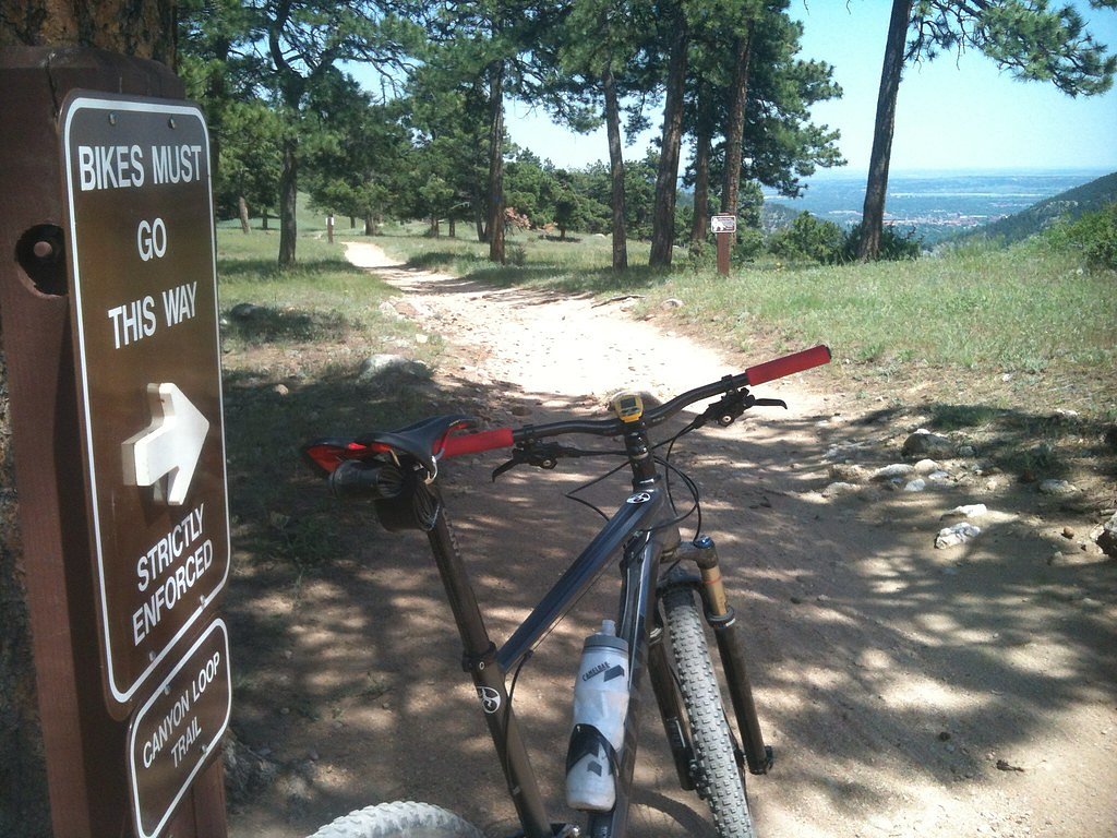
Boulder Falls is located along Colorado State Highway 119 in Boulder Canyon, approximately 11 miles west of downtown Boulder. The trailhead is directly off the highway, with a small parking area nearby.
Get Directions on Google MapsParking
There is a small parking area near the trailhead, but it can fill up quickly, especially on weekends. Parking along the highway may be necessary, but exercise caution as the road is busy.
Hours
Elevation
7,031 feet above sea level
Coordinates
40.006931° N, -105.405828° W
Visitor Tips & Gear
Arrive early to secure parking, especially on weekends. Wear sturdy shoes as the trail can be rocky. Be mindful of weather conditions, as the trail may be closed after heavy rain or snow.
This trail sits at 7,031 ft above sea level
Elevated TrailUV radiation is roughly 28% stronger at this elevation than at sea level, and the dry air accelerates dehydration. Extra sun protection and fluids go a long way.
As an Amazon Associate, we earn from qualifying purchases.

Coppertone Sport SPF 50 Sunscreen
UV intensity jumps ~4% per 1,000 ft — at this elevation you can burn in half the time.

Sun Bum SPF 30 Lip Balm (3-Pack)
Lips have almost no natural UV protection and burn fast in thin, dry mountain air.

Liquid I.V. Electrolyte Packets
You lose moisture ~2x faster at elevation — electrolytes help you absorb water efficiently.

ROCKNIGHT Polarized UV400 Sunglasses
High-altitude glare off rock and water is intense — UV400 lenses block 99%+ of UVA/UVB.
As an Amazon Associate, we earn from qualifying purchases.
For this easy 0.3 miles trail, lightweight trail shoes and a water bottle are usually sufficient. Sun exposure on the trail makes good sun protection a must in summer.

Polarized Sunglasses (Knockaround)
Cuts glare off the water so you actually see the falls — and your photos turn out better too.

Columbia Watertight II Rain Jacket
Packs into its own pocket, seam-sealed, and keeps you dry from spray and surprise rain.

Earth Pak Waterproof Dry Bag
Keeps your phone and gear dry when waterfall mist soaks everything else.

Waterproof Phone Pouch (AiRunTech)
Cheap insurance — take photos right next to the falls without killing your phone.

JOBY GorillaPod Starter Kit
Wraps around railings and rocks for long-exposure waterfall shots — no flat surface needed.

Osprey Daylite Daypack
Light, organized, and just the right size for a day hike — fits water, snacks, and layers.
Where to Stay

A-Lodge Boulder

Basecamp Boulder

BEST VIEWS! Luxury Mountain Home - Saltwater HotTub, Firepit, BBQ- Close to SKI, Red Rocks

Hyatt Place Boulder Pearl Street - Newly Renovated
Browse vacation cabins and private rentals nearby
Unique outdoor stays — tents, yurts, and treehouses
Rent a campervan or RV for your waterfall road trip
Some links are affiliate links. We may earn a commission at no extra cost to you.
Nearby Campground
Rainbow Lakes Campground
8.6 miles away · 0 sites
This campground is open mid-June through mid-September and located at 10000 feet at the end of the Rainbow Lakes Road and adjacent to the Indian Peaks Wilderness. This road is closed for winter and typically reopens in June. Before traveling to this area, check the Road Status Table.There are 18 first-come, first-served campsites that accommodate tents (on 14X16 foot tent pads) and small trailers. A maximum of eight people are allowed per site. Campsite 8 is oversized and accomodates up to 15 peo
Book on Recreation.govNearby Hot Springs
Hot springs near Sugarloaf, Colorado

Eldorado Springs
Eldorado Springs emerges at 79 degrees Fahrenheit in Boulder County's foothills as a low-mineralization thermal seep just 9 met...

Idaho Springs
Idaho Springs surfaces at 115°F in Clear Creek County at 7,682 feet elevation, emerging near Soda Creek Road just 273 feet from...

Hot Sulphur Springs
Hot Sulphur Springs flows at 111°F along Parshall Divide Road in Grand County, emerging just 58 feet from the pavement in the s...
Looking for a soak after your hike? Explore more hot springs near Sugarloaf, Colorado on SoakingSprings.
Explore Colorado springsAdditional Information
Nearby Attractions
Nearby attractions include the town of Boulder, Eldorado Canyon State Park, and the Flatirons hiking area.
Wildlife
Visitors may encounter birds, squirrels, and other small wildlife typical of the area. Be cautious of potential wildlife hazards, such as snakes.
Cities near Boulder Falls
Nearby Waterfalls
Other waterfalls named Boulder Falls
3 other waterfalls share this name across the U.S.
Writing about Boulder Falls? Embed this waterfall on your site for free.