Photo Credits (5)
Difficulty
Moderate
Trail Length
3.2 miles
Trail Type
Out And Back
Elevation Gain
450 ft
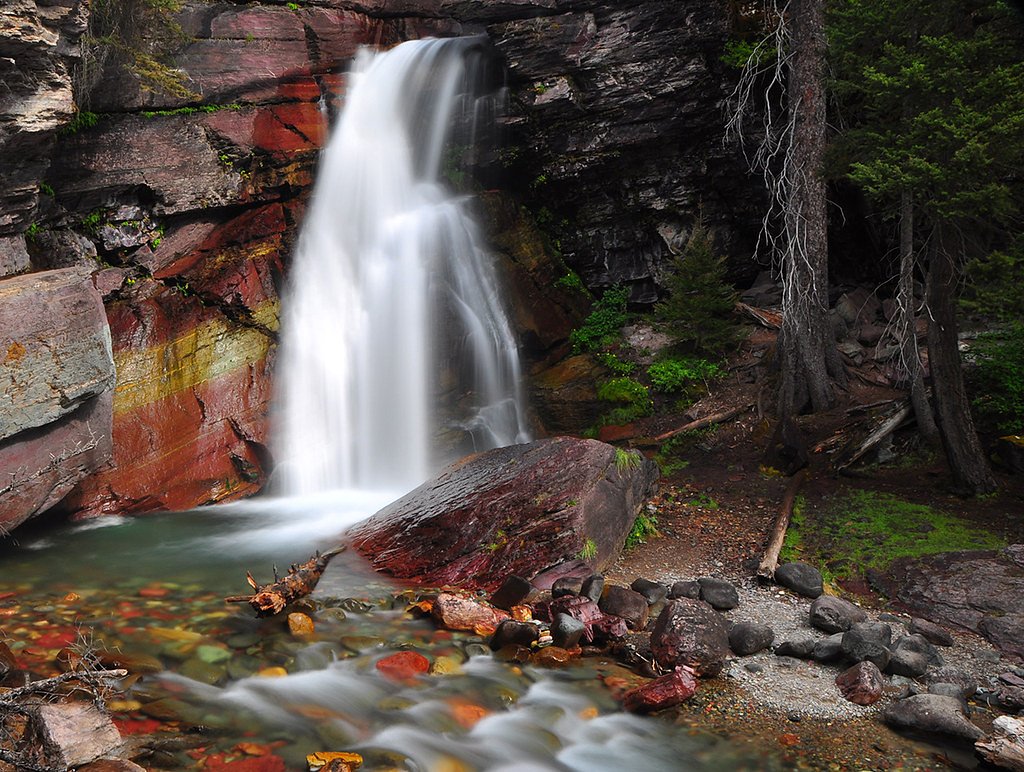
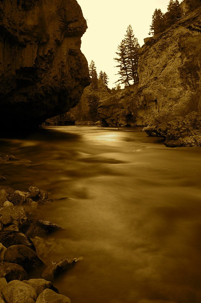
About Boulder Falls
Boulder Falls sits tucked into the Bitterroot National Forest in western Montana and is managed by the U.S. Forest Service. The cascade is framed by dense conifers and granite outcrops, offering a peaceful, picture-ready destination for day hikers and nature lovers. Access to the falls follows the USFS BOULDER CREEK Trail (Trail #617), a route that rewards a moderate effort with close-up views of the rushing water and forested canyon. The hike to the falls is commonly done as a moderate out-and-back of about 3.2 miles with roughly 450 feet of elevation gain, though USFS records also note a GIS route length of 7.07 miles for the Boulder Creek trail system. Expect a native-surface tread with occasional steeper pitches — typical grade is 12–20% and the trail is class 3 in places, so hikers should be comfortable on uneven, sometimes rocky ground. Bring good footwear, be prepared for variable footing, and savor the quiet setting maintained within the Bitterroot National Forest under USFS care.
The Setting
Boulder Falls sits at 5,486 feet within Bitterroot National Forest, fed by the West Fork Bitterroot River, in the high mountains of Montana.
Trail & Hike Details
The Approach
The moderate hike follows Boulder Creek (#617), a 3.2-mile out-and-back trail over natural surface. Expect 450 feet of elevation gain with grades of 12-20%. The trail is developed (Class 3).
USFS Trail
BOULDER CREEK #617
Trail Class
Developed
Surface
Avg Grade
USFS Segment
7.07 miTrail Description
USFS BOULDER CREEK Trail (Trail #617) — class 3, surface: NAT (native material). Typical grade: 12–20%. GIS-recorded route: 7.07 miles; commonly used hiking route to the falls: 3.2 miles out-and-back with ~450 ft elevation gain. Difficulty: moderate. Trail tread is natural (dirt, roots, rock) with variable steep sections; expect uneven footing and short scrambling moves in class 3 portions. Managed by the U.S. Forest Service in Bitterroot National Forest.
What to Expect
Visitors can expect a peaceful natural setting with a waterfall surrounded by Montana's rugged landscape. The area may have uneven terrain and limited facilities.
Accessibility
The trail is not wheelchair accessible. Uneven terrain and elevation changes require steady footing.
Frequently Asked Questions
🐶 Are Dogs Allowed at Boulder Falls?
❌ Dogs are not allowed
Are There Any Fees or Permits Required?
🆖 No fees required
🏊 Is There Swimming at Boulder Falls?
❌ Swimming is not allowed
When to Visit
Spring and summer are typically the best times to visit, as water flow is likely to be higher and the weather more favorable.
Seasonal Access
The best time to visit is Spring, Summer, and Fall. Access roads and trails may close during winter due to snow. Check with Bitterroot National Forest for seasonal road closures.
Safety Information
Visitors should be cautious of slippery rocks, uneven terrain, and potential wildlife encounters. Always check weather conditions before visiting.
Current Water Conditions
175 ft³/s
Current discharge — how much water is flowing
About average for this time of year
Based on 84 years of record
1.65 ft
Water depth at gauge
7-Day Discharge Trend
What does this mean for your visit?
Flow is about average for this time of year.
About This Gauge
This gauge is on a nearby waterway and may not reflect exact conditions at the falls.
7-Day Flow Outlook
Based on the USGS gauge West Fork Bitterroot River nr Conner MT (15 km away).
Today
Moderate
175 cfs
8/10Tomorrow
Moderate
172 cfs
8/10Tue
Moderate
190 cfs
6/10Wed
Moderate
210 cfs
6/10Thu
Moderate
212 cfs
6/10Fri
Moderate
209 cfs
6/10Sat
Moderate
179 cfs
8/10Best window: Today — moderate flow, areas of smoke (trip score 8/10).
Best time of year: this gauge typically runs highest from late April to mid July, peaking in May.
How we calculate this
This is a transparent outlook, not a precise forecast. We take the waterfall's current flow strength (how it ranks against its historical normal for today, from the nearest USGS stream gauge), carry that ranking forward along the gauge's seasonal curve, and nudge it for forecast rain. Confidence is highest for the next day or two and falls further out. Always check official conditions and your own judgment before visiting — high flows can be dangerous.
Know when to go.
Get a free email alert when waterfalls near Conner hit peak flow. We only send when conditions are worth the trip — no weekly newsletters, no spam.
Weather Forecast
Location & Access
Getting There
The exact location of Boulder Falls in Montana is not widely documented. Visitors are advised to consult local maps or guides for directions.
Get Directions on Google MapsParking
Parking availability is unclear. Visitors should plan ahead and check for nearby parking areas or trailheads.
Elevation
5,486 feet above sea level
Coordinates
45.859791° N, -114.307975° W
Land Management
Managed by USFS
Visitor Tips & Gear
Wear sturdy footwear and bring water. Check local conditions before visiting, as access may vary depending on weather or trail maintenance.
This trail sits at 5,486 ft above sea level
Elevated TrailUV radiation is roughly 22% stronger at this elevation than at sea level, and the dry air accelerates dehydration. Extra sun protection and fluids go a long way.
As an Amazon Associate, we earn from qualifying purchases.

Coppertone Sport SPF 50 Sunscreen
UV intensity jumps ~4% per 1,000 ft — at this elevation you can burn in half the time.

Sun Bum SPF 30 Lip Balm (3-Pack)
Lips have almost no natural UV protection and burn fast in thin, dry mountain air.

Liquid I.V. Electrolyte Packets
You lose moisture ~2x faster at elevation — electrolytes help you absorb water efficiently.

ROCKNIGHT Polarized UV400 Sunglasses
High-altitude glare off rock and water is intense — UV400 lenses block 99%+ of UVA/UVB.
As an Amazon Associate, we earn from qualifying purchases.
With 3.2 miles and 450 ft of elevation gain, sturdy boots and trekking poles will help on this moderate trail. Sun exposure on the trail makes good sun protection a must in summer.

Polarized Sunglasses (Knockaround)
Cuts glare off the water so you actually see the falls — and your photos turn out better too.

Columbia Watertight II Rain Jacket
Packs into its own pocket, seam-sealed, and keeps you dry from spray and surprise rain.

Earth Pak Waterproof Dry Bag
Keeps your phone and gear dry when waterfall mist soaks everything else.

Waterproof Phone Pouch (AiRunTech)
Cheap insurance — take photos right next to the falls without killing your phone.

Timberland Euro Sprint Mid Waterproof
Trusted waterproof boot with premium leather and grippy rubber sole — reliable on rocky, wet trails.

TrailBuddy Trekking Poles
Lightweight aluminum, cork grips, and flip-locks that actually hold — a best-seller for good reason.
Where to Stay

Hannon House

SkyWater Cabins

Cozy Cabin Oxen-Le-Fields Montana

Tent 2 Oxen-Le-Fields Montana
Browse vacation cabins and private rentals nearby
Unique outdoor stays — tents, yurts, and treehouses
Rent a campervan or RV for your waterfall road trip
Some links are affiliate links. We may earn a commission at no extra cost to you.
Nearby Campground
MEDICINE POINT LOOKOUT
10.2 miles away · 1 sites
Overview Medicine Point Lookout is a historic tower located on Medicine Point, west of Sula. It has been restored to reflect a lookout of the 1940s, including the stove, furniture, dishes and other small touches. It offers a unique chance for visitors to camp on a mountain peak, near the scenic Bitterroot River in a rustic, old-time setting, while having the enjoyment of recreating on public lands. The tower provides spectacular views of the surrounding western Montana wilderness. Recreation An e
Book on Recreation.govNearby Hot Springs
Hot springs near Conner, Montana
Blue Joint Hot Springs 2
Blue Joint Hot Springs 2 flows at 84°F at 4,936 feet elevation in Bitterroot National Forest, matching the temperature of its c...
Blue Joint Hot Spring 1
Blue Joint Hot Spring 1 reaches 84°F at 5,031 feet elevation in the Bitterroot National Forest, running 42.5 degrees above ambi...
Medicine Hot Springs
Medicine Hot Springs delivers 117°F water on Bitterroot National Forest land in Ravalli County, Montana, with alkaline chemistr...
Gallogly Spring
Gallogly Spring discharges at 100°F on the Bitterroot National Forest in Ravalli County, Montana, at 5,728 feet elevation. The ...
Horse Creek Hot Springs
Horse Creek Hot Springs surfaces at 109°F within the Salmon National Forest at 6,080 feet in Lemhi County, accessible roadside ...

Sleeping Child Hot Springs
Sleeping Child Hot Springs emerges at 122 degrees Fahrenheit within the Bitterroot National Forest, managed by the US Forest Se...
Looking for a soak after your hike? Explore more hot springs near Conner, Montana on SoakingSprings.
Explore Montana springsAdditional Information
Nearby Attractions
Other natural attractions in Montana may be nearby, but specific recommendations are not documented.
Wildlife
The area may feature typical Montana wildlife such as deer, birds, and small mammals. Visitors should be cautious of bears and other larger animals.
Cities near Boulder Falls
Nearby Waterfalls
Other waterfalls named Boulder Falls
3 other waterfalls share this name across the U.S.
Writing about Boulder Falls? Embed this waterfall on your site for free.