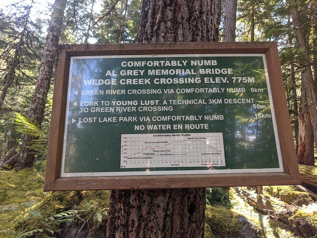
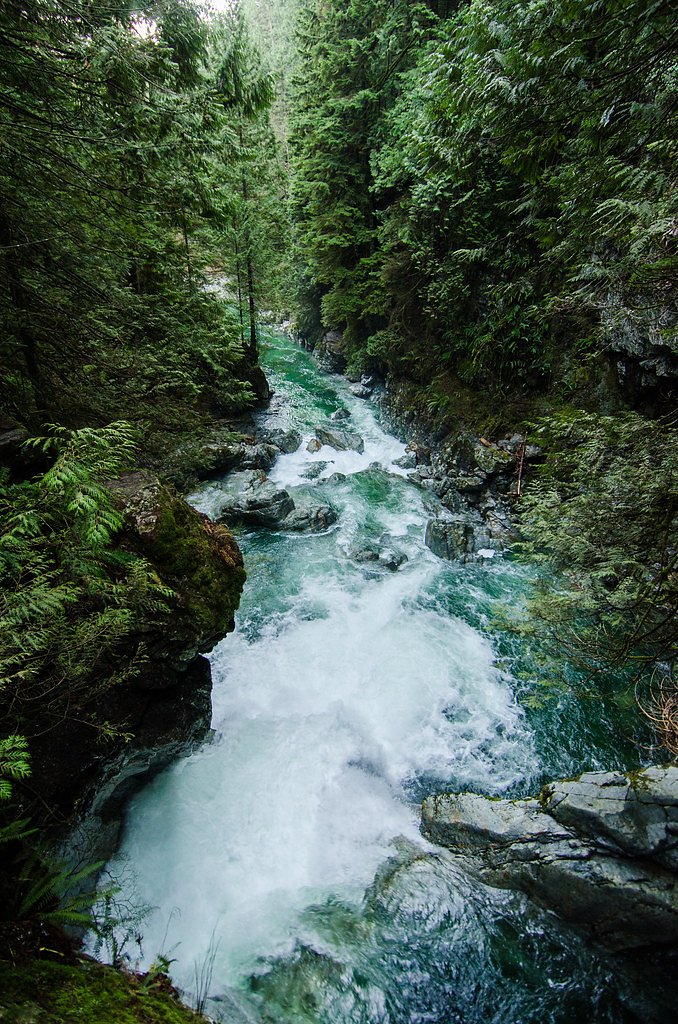
Wedge Creek Falls
By Armen Suny · Last verified Jun 2026
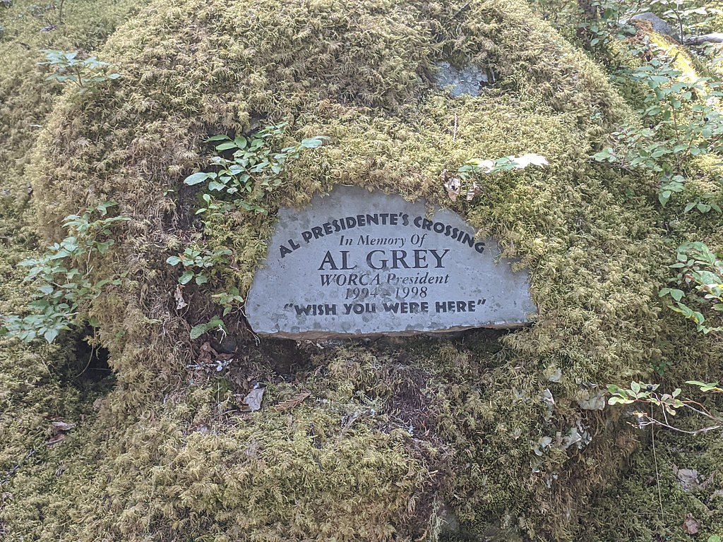
Photo Credits (2)
Difficulty
Drive Up
Trail Length
0.2 km
Trail Type
Out And Back
About Wedge Creek Falls
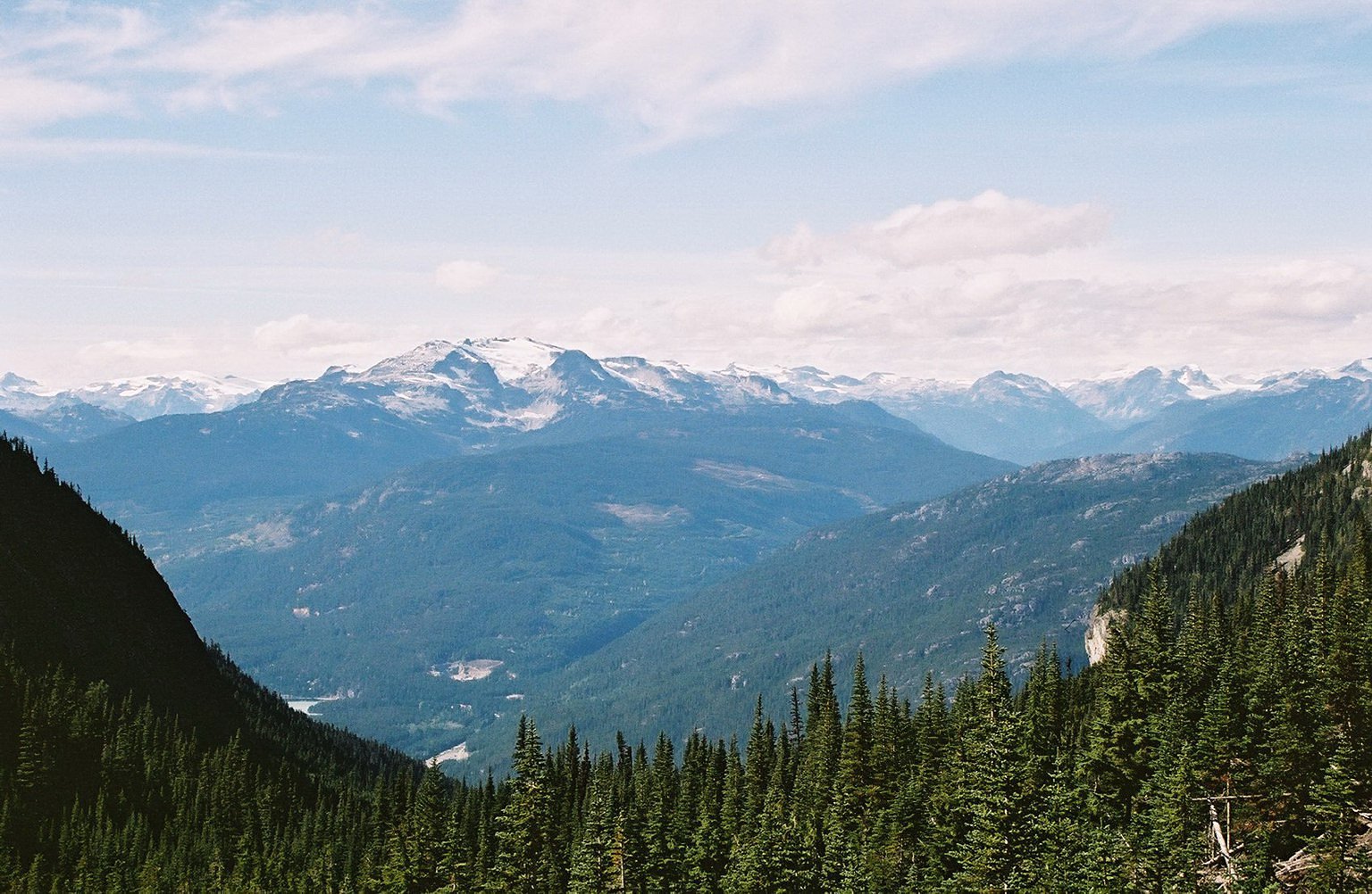
Wedge Creek Falls is a little-documented waterfall in southwestern British Columbia at approximately 50.1602, -122.8996 (user-provided). It appears to be a remote, forested creek falls visited mainly by people comfortable with backcountry travel and route-finding. Official trail information, a measured height, and managed facilities do not appear to be available; the description below is conservative and based on regional access patterns and typical conditions for small forested creeks in this part of BC.
Why This Waterfall Exists
Wedge Creek Falls flows over layered sedimentary rock laid down about 201-252 million years ago. Over time, the stream has worn through these layers at different rates, creating the step that forms the waterfall.
Nearby Falls Worth Visiting
Wedgemount Falls (300 m) lies 5.1 kilometres to the east.
Trail & Hike Details
The Approach
No hiking required. Wedge Creek Falls is accessible by vehicle with a roadside viewing area.
Trail Description
There is no widely published, maintained, or signed trail for Wedge Creek Falls that is documented in mainstream sources. Approaches that reach small forest creeks in this region commonly involve following an old skidder/forestry road or a faint boot path and may include short bushwhacks, stream crossings, and steep or unstable terrain. Expect minimal to no built infrastructure (no boardwalks, railings, or official viewpoints). Route-finding skills and a topographic map/GPS are recommended.
What to Expect
A remote, forested creek waterfall with variable flow (typically higher during spring snowmelt and after heavy rain). Access will likely be primitive: rough roads, faint or non-existent trails, and natural, undeveloped viewpoints. Rocks around the falls are likely to be slippery; there are probably no amenities (restrooms, signage, or trash facilities). Wildlife is present in the area, and cell phone reception may be unreliable.
Accessibility
This waterfall is viewable from a vehicle-accessible area. No hiking is required.
Frequently Asked Questions
🐶 Are Dogs Allowed at Wedge Creek Falls?
❌ Dogs are not allowed
Are There Any Fees or Permits Required?
🆖 No fees required
🏊 Is There Swimming at Wedge Creek Falls?
❌ Swimming is not allowed
When to Visit
Late spring to early summer for highest water flow and scenic conditions; mid-to-late summer may have lower flow but easier road conditions. Winter access is likely to be difficult and hazardous due to snow, ice, and closed roads.
Seasonal Access
The best time to visit is Spring, Summer, and Fall. Winter access may be limited. Check with the managing park or local authority for current conditions.
Safety Information
Hazards include: unstable or steep banks near the creek, slippery wet and mossy rocks, variable stream flows (which can rise rapidly after rain or during spring melt), poor or no cell coverage, seasonal road closures, and active logging operations. Wear appropriate footwear, avoid getting too close to cliff edges, and do not attempt crossings when water is high or fast. Check weather and local road reports before travel and let someone know your plans.
Current Water Conditions
5.6 m³/s
Current discharge — how much water is flowing
Much lower than usual for this time of year
Based on 29 years of record
6.01 m
Water depth at gauge
7-Day Discharge Trend
What does this mean for your visit?
Flow is well below normal for this time of year, so the waterfall may be a trickle.
About This Gauge
7-Day Flow Outlook
Based on the WSC gauge FITZSIMMONS CREEK BELOW BLACKCOMB CREEK (6 km away).
Today
Barely Flowing
5.6 m³/s
4/10Tomorrow
Barely Flowing
5.8 m³/s
4/10Wed
Barely Flowing
5.6 m³/s
4/10Thu
Barely Flowing
5.6 m³/s
4/10Fri
Barely Flowing
5.6 m³/s
3/10Sat
Low
6.1 m³/s
4/10Sun
Low
5.8 m³/s
4/10Best window: Today — barely flowing flow, cloudy (trip score 4/10).
Best time of year: this gauge typically runs highest from late May to mid August, peaking in June.
How we calculate this
This is a transparent outlook, not a precise forecast. We take the waterfall's current flow strength (how it ranks against its historical normal for today, from the nearest WSC stream gauge), carry that ranking forward along the gauge's seasonal curve, and nudge it for forecast rain. Confidence is highest for the next day or two and falls further out. Always check official conditions and your own judgment before visiting — high flows can be dangerous.
Know when to go.
Get a free email alert when waterfalls near Lillooet hit peak flow. We only send when conditions are worth the trip — no weekly newsletters, no spam.
Weather Forecast
Location & Access
Getting There
Coordinates given (50.1602, -122.8996). The falls are in a remote forested area that will likely require driving on unpaved forestry/logging roads and some off-trail travel. Exact vehicle route and road conditions can change seasonally; a high-clearance or 4x4 vehicle may be required. Confirm current conditions and road access with local forest service offices, up-to-date topo maps, or recent visitor trip reports before travel. Cell coverage may be intermittent or absent.
Get Directions on Google MapsParking
No official parking lot is known. Expect informal roadside parking at a pullout or small clearing. Park fully off the travel lane and avoid blocking gates or access roads.
Elevation
679 metres above sea level
Coordinates
50.160235° N, -122.899630° W
Visitor Tips & Gear
1) Verify current road and access conditions before you go (seasonal logging, washouts, or closures are common). 2) Use a topographic map and GPS; do not rely solely on a single-source directions. 3) Wear sturdy footwear and be prepared for a short bushwhack and stream crossings. 4) Avoid getting close to the edge of wet or mossy rocks. 5) Tell someone your route and expected return time; remote rescues can be slow. 6) Pack out all trash and follow Leave No Trace.
Where to Stay
Browse vacation cabins and private rentals nearby
Unique outdoor stays — tents, yurts, and treehouses
Rent a campervan or RV for your waterfall road trip
Some links are affiliate links. We may earn a commission at no extra cost to you.
Nearby Campground
Riverside Dispersed Camping
1.5 km away
Additional Information
Nearby Attractions
The falls are in a remote part of southwestern BC; the nearest notable towns or landmarks should be confirmed on maps. The user-provided context notes the falls are roughly 66 miles from Lillooet, use that as a reference when planning travel and services. Check regional maps for provincial parks, lakes, and other attractions in the wider area.
Wildlife
Black bears, deer, small mammals, and birds are common in forested areas of this region. Cougar and moose may occur in parts of BC; exercise standard wildlife precautions (store food securely, make noise while traveling, carry bear spray where appropriate).
Cities near Wedge Creek Falls
Nearby Waterfalls
Writing about Wedge Creek Falls? Embed this waterfall on your site for free.