Photo Credits (3)
Difficulty
Easy
Trail Length
4.5 km
Trail Type
Out And Back
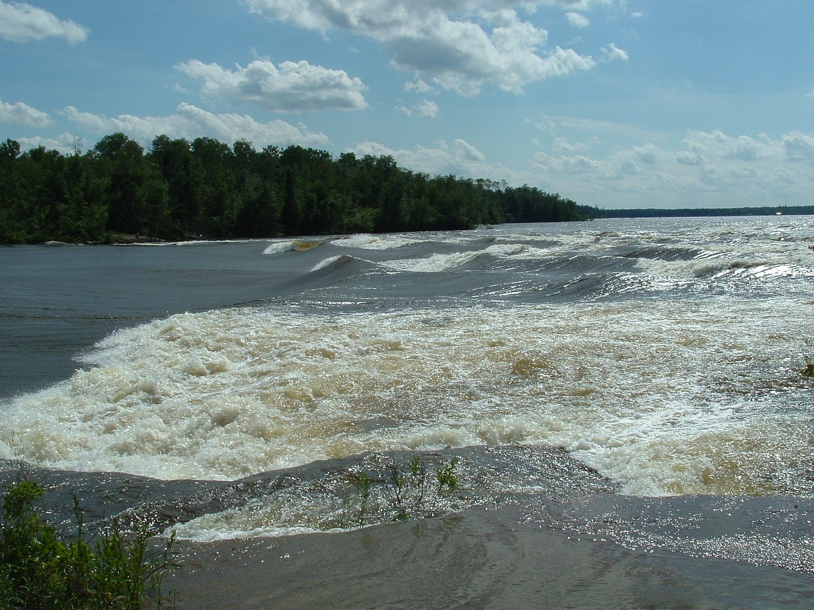
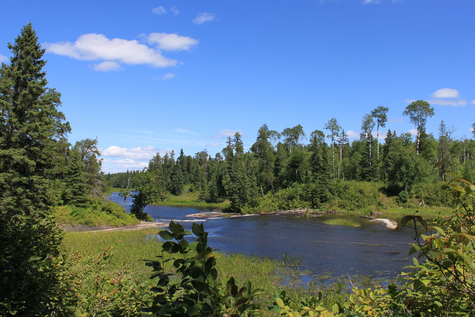
About Sturgeon Falls
Sturgeon Falls (coordinates 50.1572, -95.6544) is a remote waterfall feature in northeastern Manitoba located on or near the Sturgeon River system. It appears to be a natural cascade and drop in a largely forested, boreal landscape. The site is remote and may offer scenic views, strong seasonal flow in spring, and ice/ice-formation features in winter. Specifics about a formal lookout, developed viewpoint, or a single tall vertical drop are not well documented and may vary by exact map feature.
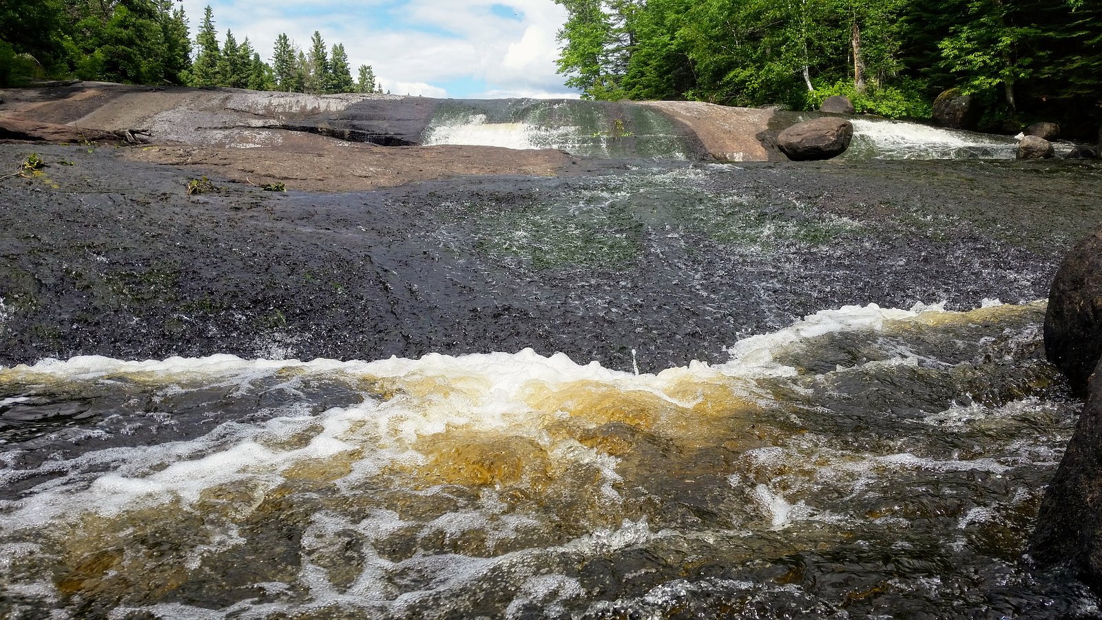
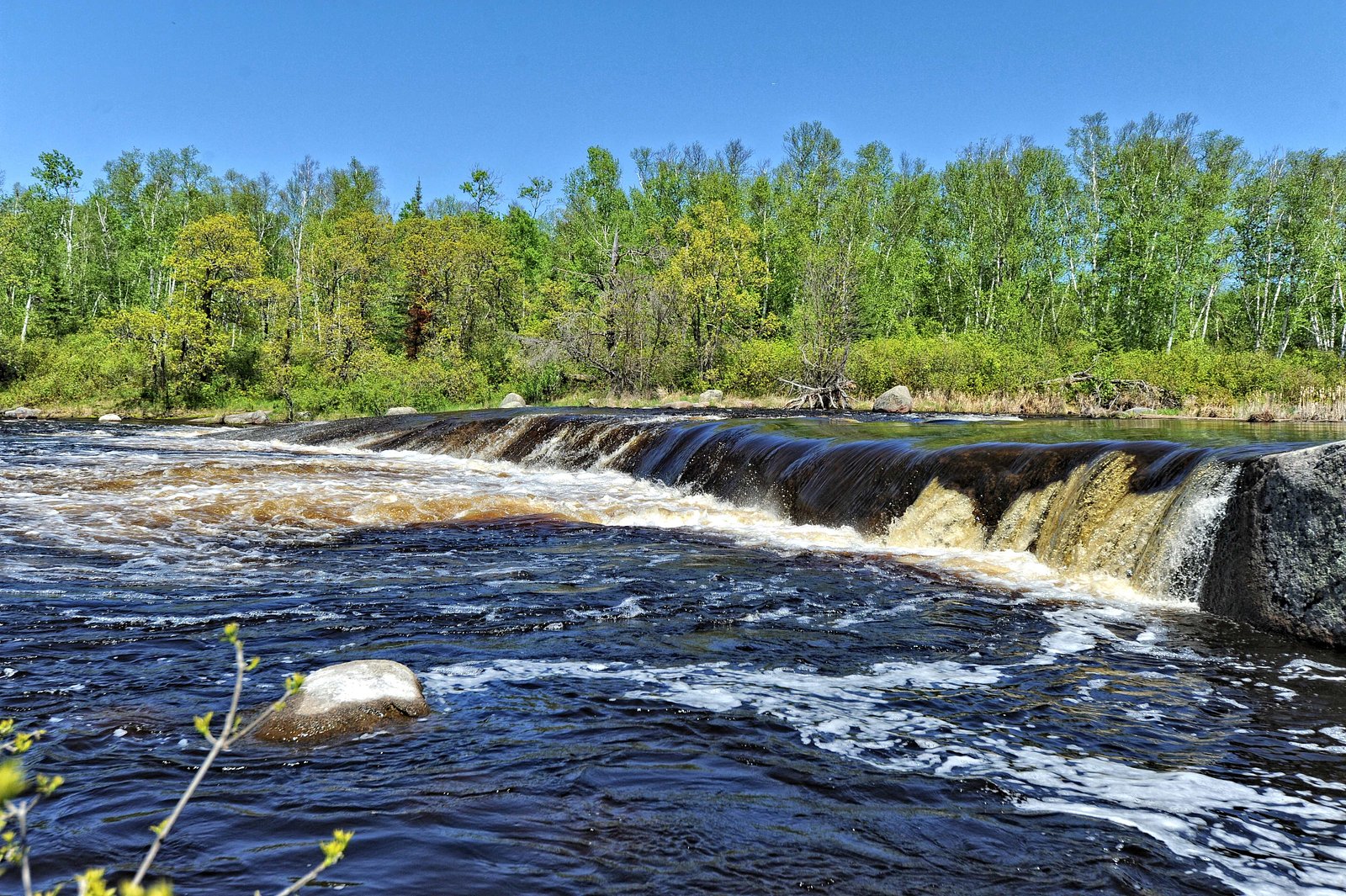
Why This Waterfall Exists
Sturgeon Falls flows over hard intrusive rock, primarily granodiorite and gneiss, laid down over 2.5-4.0 billion years ago. These resistant rocks form a durable ledge that water cannot easily wear away, creating the falls where softer material downstream has already eroded.
Trail & Hike Details
Trail Description
There is limited public documentation of a maintained trail to Sturgeon Falls. Visitors should be prepared for a route that may include an unmaintained footpath, bushwhack, short scramble on rocky terrain, or water approach. Expect uneven footing, roots, and wet/slippery rock near the water. If you require an established trail, check with local park authorities (if the falls are within a park boundary) or recent visitor trip reports before visiting.
What to Expect
Remote, natural setting with limited or no facilities (no restrooms, signage, or trash service). Variable water flow: higher in spring (snowmelt) and after heavy rain, lower in late summer or drought conditions. Mosquitoes and black flies can be numerous in late spring and early summer. Strong currents and slippery rocks near the falls; ice and freeze-thaw hazards in winter and early spring. Little to no cell service is likely; prepare for backcountry conditions.
Accessibility
The trail is not wheelchair accessible. Uneven terrain and elevation changes require steady footing.
Frequently Asked Questions
🐶 Are Dogs Allowed at Sturgeon Falls?
❌ Dogs are not allowed
Are There Any Fees or Permits Required?
🆖 No fees required
🏊 Is There Swimming at Sturgeon Falls?
❌ Swimming is not allowed
When to Visit
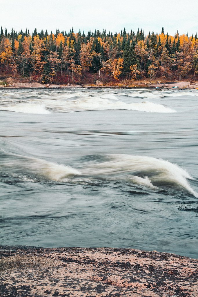
Late spring for highest flows and dramatic water; early fall for fall colors and generally lower insect activity. Summer can offer easier access but potentially lower flow; winter may provide ice-sculpture views but requires winter travel skills and equipment (snowmobile, skis, or snowshoes) and awareness of cold-related hazards.
Seasonal Access
The best time to visit is Spring, Summer, Fall, and Winter. Check with the managing park or local authority for current conditions.
Safety Information
Hazards include remoteness (limited cell service), slippery rocks, strong currents, cold water, sudden weather changes, biting insects in warm months, and potential wildlife encounters. Travel with a partner if possible, carry emergency communication, and be prepared for self-rescue. Check local conditions (road and weather) before travel and heed any advisories from Manitoba provincial authorities.
Current Water Conditions
0.8 m³/s
Current discharge — how much water is flowing
Lower than usual for this time of year
Based on 65 years of record
307.31 m
Water depth at gauge
7-Day Discharge Trend
What does this mean for your visit?
Flow is lower than usual for this time of year.
About This Gauge
This gauge is on a nearby waterway and may not reflect exact conditions at the falls.
7-Day Flow Outlook
Based on the WSC gauge WHITESHELL RIVER AT OUTLET OF JESSICA LAKE (17 km away).
Today
Low
0.8 m³/s
5/10Tomorrow
Moderate
0.9 m³/s
5/10Tue
Low
0.8 m³/s
5/10Wed
Low
0.8 m³/s
5/10Thu
Low
0.8 m³/s
5/10Fri
Moderate
0.8 m³/s
5/10Sat
Moderate
0.8 m³/s
5/10Best window: Today — low flow, cloudy (trip score 5/10).
Best time of year: this gauge typically runs highest from mid April to mid July, peaking in May.
How we calculate this
This is a transparent outlook, not a precise forecast. We take the waterfall's current flow strength (how it ranks against its historical normal for today, from the nearest WSC stream gauge), carry that ranking forward along the gauge's seasonal curve, and nudge it for forecast rain. Confidence is highest for the next day or two and falls further out. Always check official conditions and your own judgment before visiting — high flows can be dangerous.
Weather Forecast
Location & Access
Getting There
This waterfall is in a remote region of Manitoba. Access may require travel on secondary or logging roads, off-road vehicle, or by water (boat or canoe) depending on the approach. Exact turn-by-turn directions are not confirmed; use the provided coordinates (50.1572, -95.6544) in a reliable GPS or topographic map. Expect limited signage. Contact local Manitoba Parks, Crown land offices, or nearby outfitters for the most current access information before you go.
Get Directions on Google MapsParking
There is likely no formal developed parking lot. Parking may be a roadside pull-off on a gravel/forest road or at a boat/canoe landing. High-clearance vehicles are likely recommended. If accessing by water, use established landings where available.
Elevation
274 metres above sea level
Coordinates
50.157169° N, -95.654389° W
Visitor Tips & Gear
1) Use the exact coordinates in a reliable GPS or offline topographic map. 2) Tell someone your route and expected return time; consider carrying a satellite messenger in remote areas. 3) Wear sturdy, waterproof footwear and bring trekking poles for stability. 4) Bring insect repellent and long sleeves in summer. 5) Avoid getting too close to the edge, rocks can be slippery and currents strong. 6) Check local forest, park, or Crown land offices for road and access updates. 7) Pack out everything you pack in. 8) If unsure about access, contact local outfitters or visitor centers for current information.
Where to Stay
Browse vacation cabins and private rentals nearby
Unique outdoor stays — tents, yurts, and treehouses
Rent a campervan or RV for your waterfall road trip
Some links are affiliate links. We may earn a commission at no extra cost to you.
Nearby Campground
Nutimik Lake Campground
1.4 km away
Additional Information
Nearby Attractions
Depending on precise location, nearby regional attractions in northeastern Manitoba may include provincial parks, lakes and canoe routes. Whiteshell Provincial Park and various lake/river systems are regionally notable, but confirm proximity before planning a combined visit.
Wildlife
Typical boreal wildlife may include black bear, moose, white-tailed deer, wolves, beavers, otters, and a variety of songbirds and waterfowl. Use standard wildlife safety practices (store food securely, keep distance, carry bear spray where appropriate).
Nearby Waterfalls
Other waterfalls named Sturgeon Falls
2 other waterfalls share this name across Canada.
Writing about Sturgeon Falls? Embed this waterfall on your site for free.