Acorn Falls
Manitoba • Whiteshell Provincial Park
By Armen Suny · Last verified Jun 2026
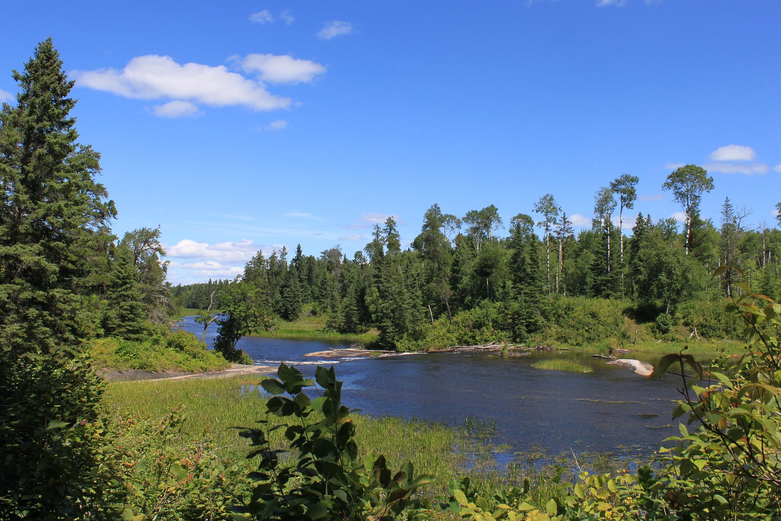
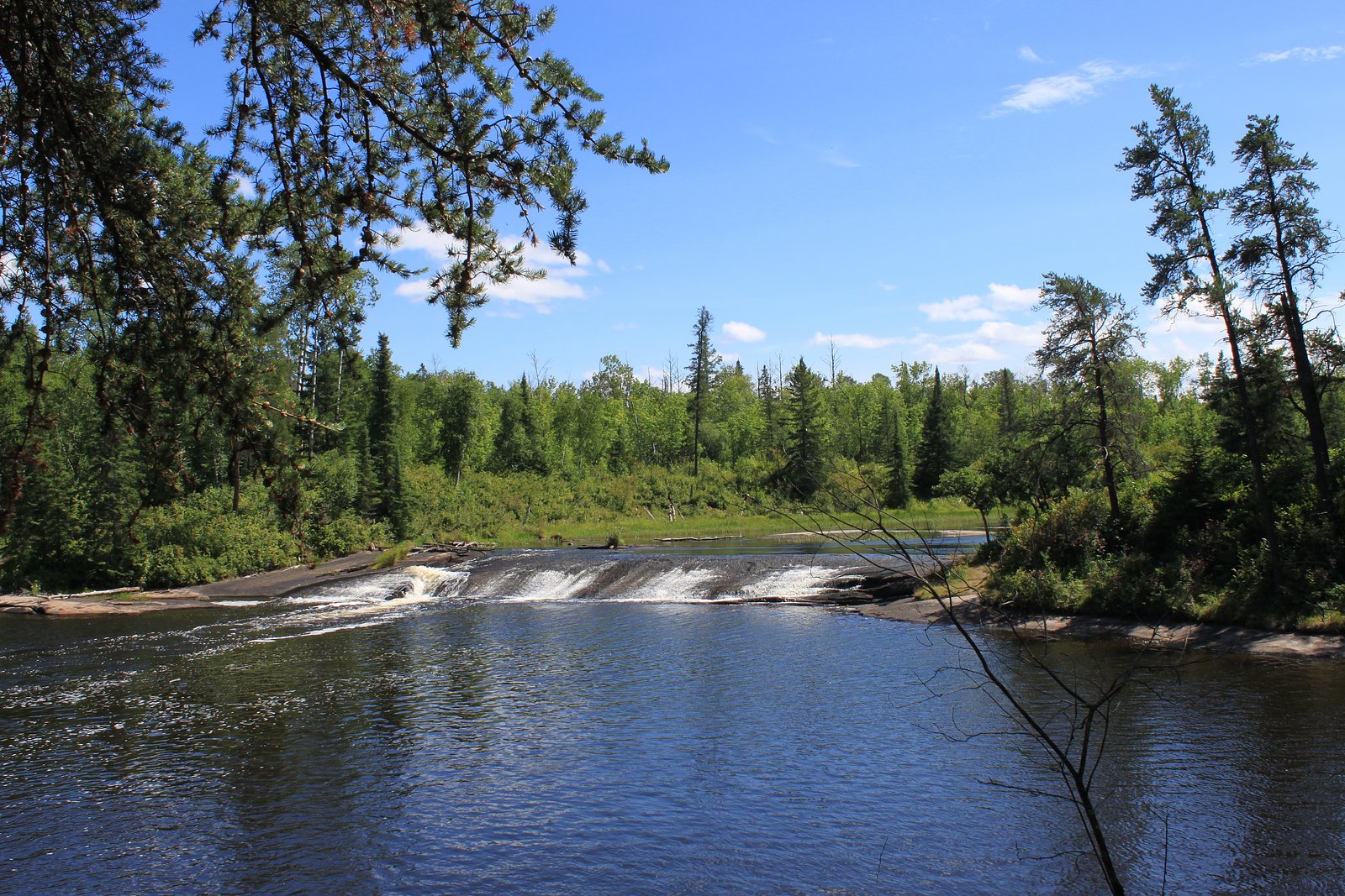
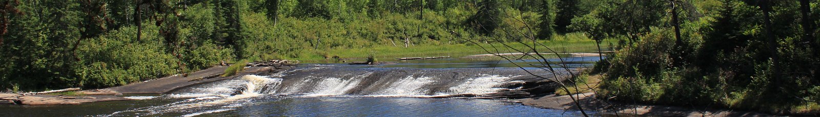
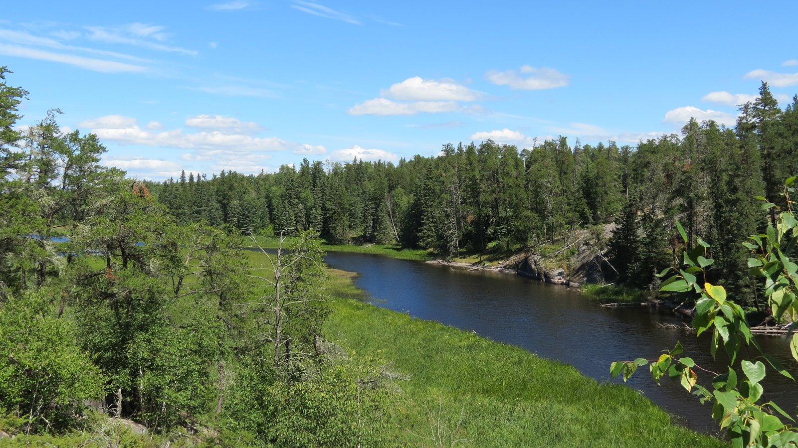
Photo Credits (5)
Difficulty
Moderate
Trail Length
7.9 km
Trail Type
Loop
Elevation Gain
232 m
About Acorn Falls
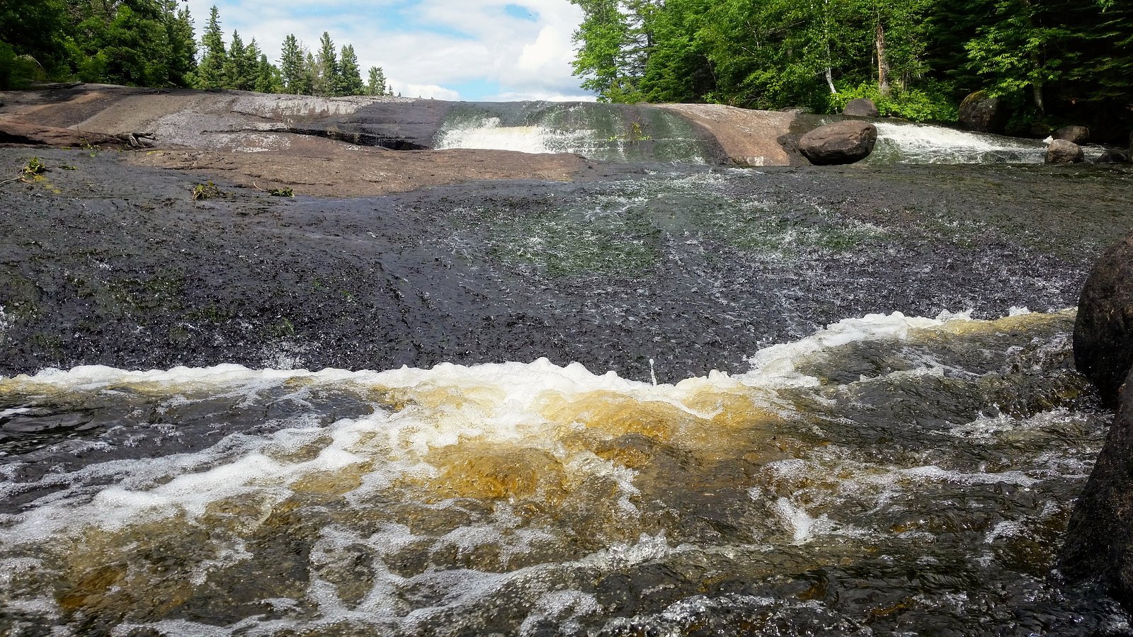
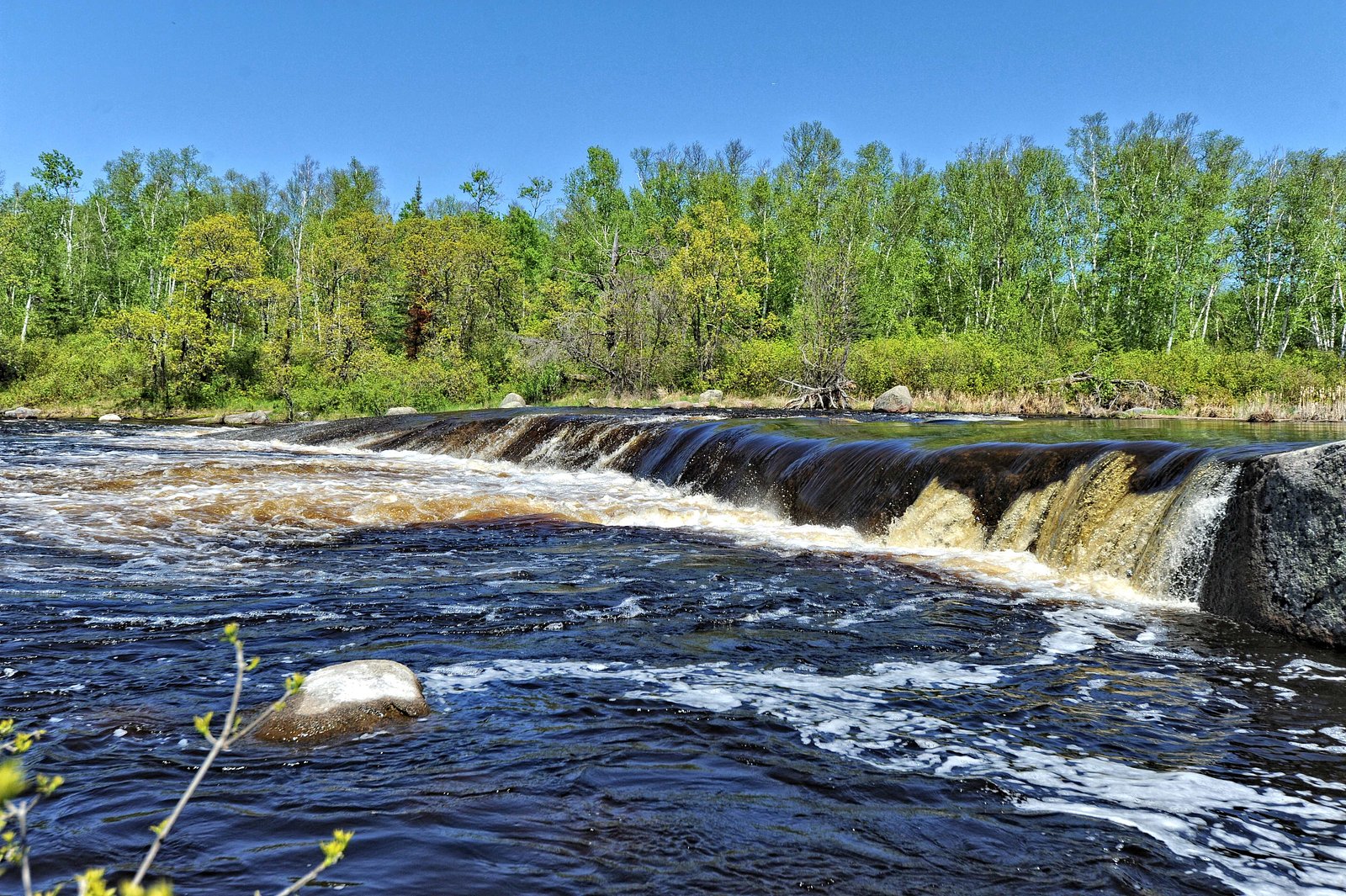
Acorn Falls is a relatively remote waterfall located in northwestern Manitoba, roughly 63.5 miles (about 102 km) from Kenora. The falls sit at coordinates 50.1114, -95.5702. Available public information about the waterfall is limited; reports from visitors suggest a small to medium cascade in a natural forested setting. Flow likely varies seasonally and is typically higher in spring and after heavy rain.
The Setting
Acorn Falls sits at 298 metres within Whiteshell Provincial Park, in the foothills of Manitoba.
Why This Waterfall Exists
Acorn Falls flows over hard intrusive rock, primarily granodiorite and gneiss, laid down over 2.5-4.0 billion years ago. These resistant rocks form a durable ledge that water cannot easily wear away, creating the falls where softer material downstream has already eroded.
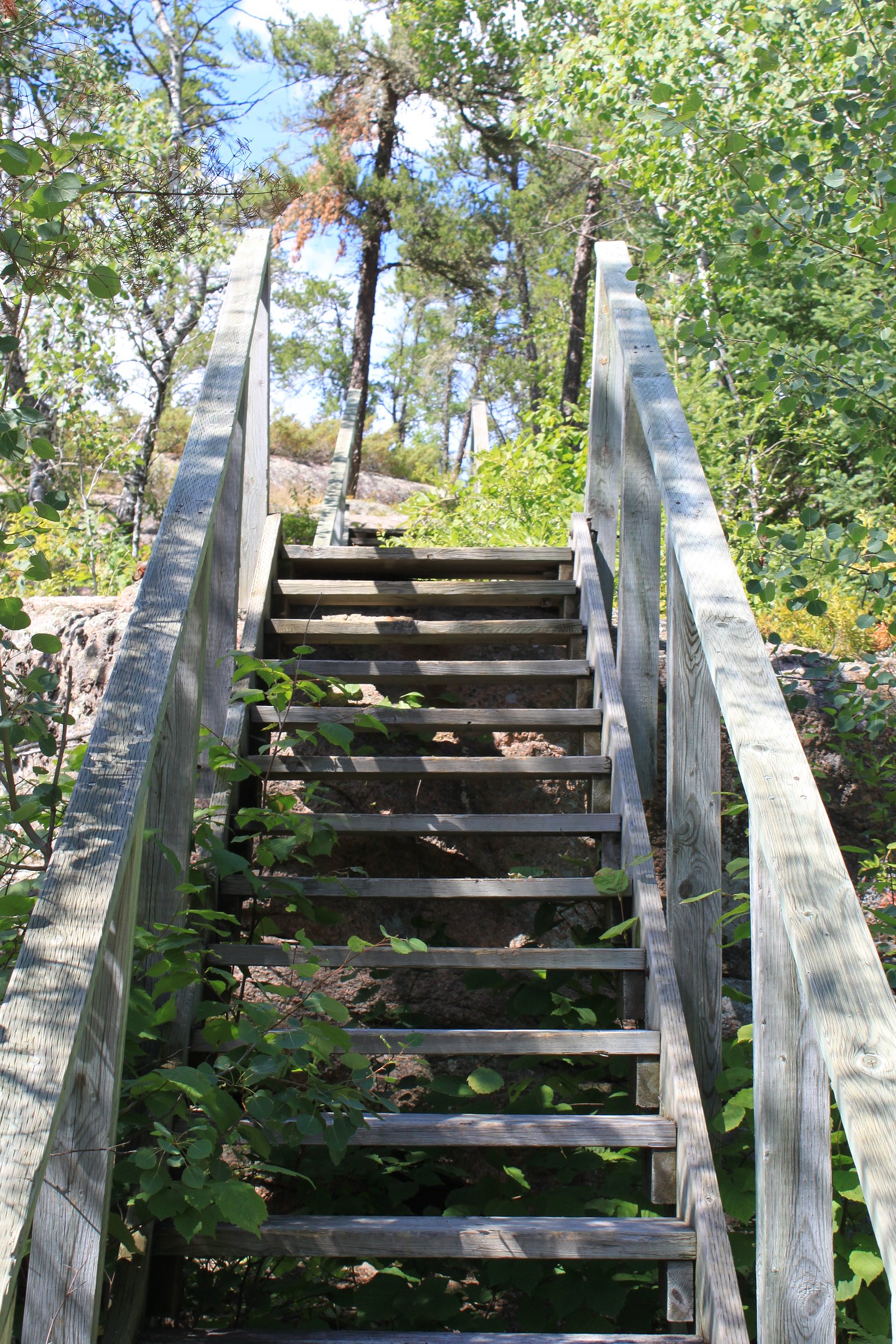
Trail & Hike Details
The Approach
The moderate 7.9-km loop trail gains 232 metres of elevation on the way to the falls.
Trail Description
Detailed trail descriptions are not readily available for Acorn Falls. Expect an informal path or short bushwhack from a forestry road or pullout to reach the stream and falls. Terrain is likely uneven, rocky, and may be slippery near the water. Trails, if present, may be indistinct and not maintained.
What to Expect
A natural, wooded setting with limited facilities (no restrooms, signs, or maintained viewpoints). The waterfall is likely a cascade or multi-step fall on a small river or creek; water flow will vary by season (highest in spring). Cell service may be limited or absent. Expect insects in warmer months and potentially muddy conditions after rain or during spring thaw.
Accessibility
The trail is not wheelchair accessible. Uneven terrain and elevation changes require steady footing.
Frequently Asked Questions
🐶 Are Dogs Allowed at Acorn Falls?
❌ Dogs are not allowed
Are There Any Fees or Permits Required?
🆖 No fees required
🏊 Is There Swimming at Acorn Falls?
❌ Swimming is not allowed
When to Visit
Late spring and early summer typically offer the highest flows and best appearance after snowmelt and spring rains. Fall can provide good color and lower crowds. Winter may form interesting ice features but requires winter travel skills and gear; many access roads may be impassable in winter.
Seasonal Access
The best time to visit is Spring, Summer, and Fall. Winter access may be limited. Check with Whiteshell Provincial Park for current conditions.
Safety Information
• Slippery rocks and unstable banks near the water can lead to falls, exercise extreme caution. • Water levels and currents can change rapidly after heavy rain; avoid getting too close to the edge. • Cell phone coverage is unreliable; carry a map, GPS device, and emergency supplies. • Weather can change quickly, bring appropriate clothing. • Remote location means emergency response may be delayed; plan accordingly and travel with partners when possible.
Current Water Conditions
0.8 m³/s
Current discharge — how much water is flowing
Lower than usual for this time of year
Based on 65 years of record
307.31 m
Water depth at gauge
7-Day Discharge Trend
What does this mean for your visit?
Flow is lower than usual for this time of year.
About This Gauge
This gauge is on a nearby waterway and may not reflect exact conditions at the falls.
7-Day Flow Outlook
Based on the WSC gauge WHITESHELL RIVER AT OUTLET OF JESSICA LAKE (10 km away).
Today
Low
0.8 m³/s
5/10Tomorrow
Moderate
0.9 m³/s
5/10Tue
Low
0.8 m³/s
5/10Wed
Low
0.8 m³/s
5/10Thu
Low
0.8 m³/s
5/10Fri
Moderate
0.8 m³/s
5/10Sat
Moderate
0.8 m³/s
5/10Best window: Today — low flow, cloudy (trip score 5/10).
Best time of year: this gauge typically runs highest from mid April to mid July, peaking in May.
How we calculate this
This is a transparent outlook, not a precise forecast. We take the waterfall's current flow strength (how it ranks against its historical normal for today, from the nearest WSC stream gauge), carry that ranking forward along the gauge's seasonal curve, and nudge it for forecast rain. Confidence is highest for the next day or two and falls further out. Always check official conditions and your own judgment before visiting — high flows can be dangerous.
Know when to go.
Get a free email alert when waterfalls near Kenora hit peak flow. We only send when conditions are worth the trip — no weekly newsletters, no spam.
Weather Forecast
Location & Access
Getting There
From Kenora drive approximately 60–70 miles on regional and forestry roads toward the coordinates 50.1114, -95.5702. Access likely uses secondary/forestry roads and may require a high-clearance or four-wheel-drive vehicle. The final approach may require walking across uneven terrain or a short bushwhack from an informal pullout; exact route information is limited. Check recent local reports or contact Manitoba provincial authorities for current road conditions.
Get Directions on Google MapsParking
Parking is likely informal (roadside pullout) and limited. There is probably no official parking lot, signage, or facilities. Park clear of the travel lane and avoid blocking gates or private driveways. Expect no-maintenance surfaces and possibly soft / muddy conditions during wet seasons.
Elevation
298 metres above sea level
Coordinates
50.111370° N, -95.570157° W
Land Management
Managed by Manitoba Environment and Climate Change
Visitor Tips & Gear
• Tell someone your plans and expected return time, area is remote and cell coverage may be limited. • Use a high-clearance vehicle if accessing by forestry roads; check road conditions before travel. • Wear sturdy, waterproof footwear and take care on wet rocks and banks, surfaces can be slippery. • Practice Leave No Trace: pack out what you bring, and avoid damaging vegetation or fragile moss/lichen near the falls. • Check for local advisories (forestry operations, seasonal road closures, or wildlife alerts) before you go.
As an Amazon Associate, we earn from qualifying purchases.
With 7.9 km and 232 m of elevation gain, sturdy boots and trekking poles will help on this moderate trail. Sun exposure on the trail makes good sun protection a must in summer.

Polarized Sunglasses (Knockaround)
Cuts glare off the water so you actually see the falls — and your photos turn out better too.

Columbia Watertight II Rain Jacket
Packs into its own pocket, seam-sealed, and keeps you dry from spray and surprise rain.

Earth Pak Waterproof Dry Bag
Keeps your phone and gear dry when waterfall mist soaks everything else.

Waterproof Phone Pouch (AiRunTech)
Cheap insurance — take photos right next to the falls without killing your phone.

Timberland Euro Sprint Mid Waterproof
Trusted waterproof boot with premium leather and grippy rubber sole — reliable on rocky, wet trails.

TrailBuddy Trekking Poles
Lightweight aluminum, cork grips, and flip-locks that actually hold — a best-seller for good reason.
Where to Stay
Browse vacation cabins and private rentals nearby
Unique outdoor stays — tents, yurts, and treehouses
Rent a campervan or RV for your waterfall road trip
Some links are affiliate links. We may earn a commission at no extra cost to you.
Nearby Campground
Nutimik Lake Campground
7.6 km away
Additional Information
Nearby Attractions
Kenora and Lake of the Woods are the nearest well-known destinations (approximately 60–70 miles away). There are numerous lakes, provincial parks, and backcountry recreation opportunities in the broader region; check local tourism resources for specifics.
Wildlife
Typical boreal wildlife may be present, including moose, white-tailed deer, black bears, coyotes, and a variety of birds. Ticks can be present in warmer months. Observe wildlife from a distance and store food securely.
Cities near Acorn Falls
Nearby Waterfalls
Writing about Acorn Falls? Embed this waterfall on your site for free.