Silver Peak Falls
By Armen Suny · Last verified Jun 2026
About Silver Peak Falls
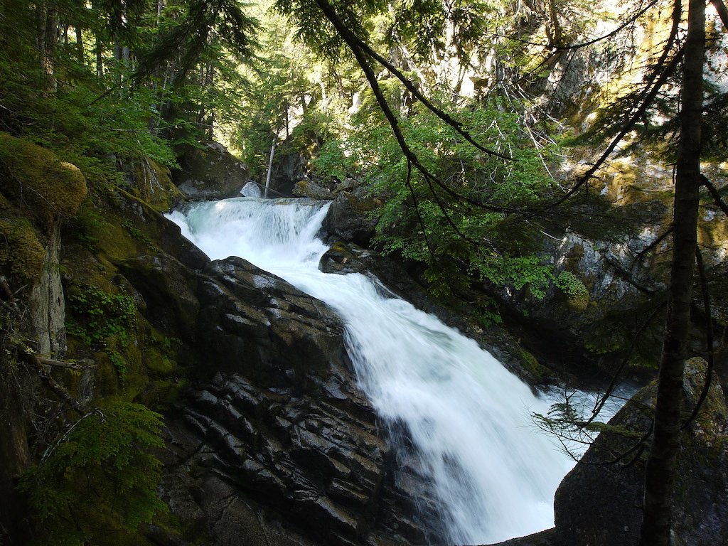
Silver Peak Falls (coordinates: 49.3281, -121.4328) is a lesser-known waterfall in southwestern British Columbia, located in the general region northeast of Chilliwack. The falls sit in a forested, mountainous setting and likely have the strongest flow in spring and early summer from snowmelt and seasonal rains. Detailed, published information about the falls (official trailhead, measured height, or formal management) is scarce; the description below reflects consolidated guidance and conservative assumptions based on regional trail and waterfall reporting.
Why This Waterfall Exists
Silver Peak Falls flows over hard crystalline rock, primarily gneiss, laid down about 66-101 million years ago. These resistant rocks form a durable ledge that water cannot easily wear away, creating the falls where softer material downstream has already eroded.
Nearby Falls Worth Visiting
Chawuthen Creek Falls (20 m) lies 6.1 kilometres to the west.
Trail & Hike Details
Trail Description
There are no widely published, maintained trail descriptions for Silver Peak Falls. Approaches to small, remote waterfalls in this region commonly involve hiking on unmarked or lightly used forest trails, singletrack or game paths, and potentially short bushwhacks to reach the base or viewpoints. Expect forested terrain, uneven footing, roots, and possibly steep or muddy sections near the creek. Because authoritative route descriptions are not readily available, treat the approach as route-finding rather than a developed hike.
What to Expect
Expect a forested, mountainous setting with typical coastal-interior vegetation (conifers, ferns, moss). Flow at the falls is likely seasonal: highest in spring and early summer during snowmelt and after heavy rains, lower in late summer and early fall. There are probable slippery rocks and steep banks near the water. Facilities such as restrooms, trash service, signage, and maintained viewpoints are unlikely. Cell coverage may be intermittent.
Accessibility
There is no documented accessible trail or facilities for Silver Peak Falls. Approaches are likely not wheelchair- or stroller-accessible and may include uneven, steep, or muddy terrain.
Frequently Asked Questions
🐶 Are Dogs Allowed at Silver Peak Falls?
❌ Dogs are not allowed
Are There Any Fees or Permits Required?
🆖 No fees required
🏊 Is There Swimming at Silver Peak Falls?
❌ Swimming is not allowed
When to Visit
Spring to early summer for peak flow and fullest views (snowmelt/rain-fed). Late summer and early fall may have reduced flow. Winter visits may be possible but can involve icy, snowy, or hazardous trail and road conditions, check conditions and local advisories.
Seasonal Access
The best time to visit is Spring, Summer, Fall, and Winter. Check with the managing park or local authority for current conditions.
Safety Information
Hazards may include: slippery rocks and wet surfaces, steep and unstable banks near the water, fast or cold water (risk of hypothermia or drowning), poor or no cell service, rapidly changing weather, and possible wildlife encounters. If roads to the area include forestry or logging roads, they may be rough, gated, or seasonally closed. Always tell someone your plan, carry navigation and emergency supplies, and avoid visiting alone in remote areas if possible.
Current Water Conditions
1.4 m³/s
Current discharge — how much water is flowing
Much lower than usual for this time of year
Based on 37 years of record
1.50 m
Water depth at gauge
7-Day Discharge Trend
What does this mean for your visit?
Flow is well below normal for this time of year, so the waterfall may be a trickle.
About This Gauge
7-Day Flow Outlook
Based on the WSC gauge COQUIHALLA RIVER ABOVE ALEXANDER CREEK (6 km away).
Today
Barely Flowing
1.5 m³/s
5/10Tomorrow
Barely Flowing
1.4 m³/s
4/10Tue
Barely Flowing
1.3 m³/s
4/10Wed
Barely Flowing
1.2 m³/s
4/10Thu
Barely Flowing
1.2 m³/s
4/10Fri
Barely Flowing
1.2 m³/s
5/10Sat
Barely Flowing
1.3 m³/s
3/10Best window: Today — barely flowing flow, sunny (trip score 5/10).
Best time of year: this gauge typically runs highest from early April to early July, peaking in May.
How we calculate this
This is a transparent outlook, not a precise forecast. We take the waterfall's current flow strength (how it ranks against its historical normal for today, from the nearest WSC stream gauge), carry that ranking forward along the gauge's seasonal curve, and nudge it for forecast rain. Confidence is highest for the next day or two and falls further out. Always check official conditions and your own judgment before visiting — high flows can be dangerous.
Know when to go.
Get a free email alert when waterfalls near Chilliwack hit peak flow. We only send when conditions are worth the trip — no weekly newsletters, no spam.
Weather Forecast
Location & Access
Getting There
The waterfall is located at latitude 49.3281 N, longitude -121.4328. It lies in a rural/forested area of southwestern BC northeast of Chilliwack. There does not appear to be widely published, formal access (e.g., a provincial-park trailhead) in major guidebooks. Access may require driving on local or forestry roads and then hiking off of a secondary trail or informal path. Visitors should consult local land/forest service maps and recent trip reports before attempting access and confirm land ownership (public vs. private).
Get Directions on Google MapsParking
No confirmed, maintained parking lot is documented for this specific waterfall. Park only in designated areas where permitted. If using a forestry or roadside pullout, expect minimal facilities and uneven surfaces. If you cannot confirm an established parking area from recent local sources, consider contacting regional authorities or local hiking groups.
Elevation
288 metres above sea level
Coordinates
49.328066° N, -121.432826° W
Visitor Tips & Gear
• Check recent trip reports or local forums (hiking groups, AllTrails, regional parks) for up-to-date access and road conditions before you go. • Respect private property, confirm land ownership and obtain permission if access crosses private land. • Wear sturdy, waterproof footwear with good traction; approaches may be muddy, steep, or slippery near the falls. • Bring a map, GPS or offline maps, and a charged phone; cell signal may be poor. • Leave no trace: pack out all trash, stay on durable surfaces where possible, and avoid creating new social trails. • If visiting in spring or after heavy rain, be cautious of high water, strong currents, and unstable banks.
Where to Stay
Browse vacation cabins and private rentals nearby
Unique outdoor stays — tents, yurts, and treehouses
Rent a campervan or RV for your waterfall road trip
Some links are affiliate links. We may earn a commission at no extra cost to you.
Nearby Campground
Silver Lake Provinical Campground
1.6 km away
Nearby Hot Springs
Hot springs near Chilliwack, British Columbia
Baker Hot Spring
Baker Hot Spring emerges at 108 degrees Fahrenheit on US Forest Service land in Mt. Baker National Forest, flowing 59.5 degrees...
Dorr Fumarole Field
Dorr Fumarole Field reaches 194 degrees at 8,168 feet elevation on Mount Baker's active volcanic slopes, producing superheated ...

Sherman Crater Fumaroles
Sherman Crater Fumaroles register 266 degrees Fahrenheit at 9,463 feet elevation within the active volcanic crater atop Mount B...
Looking for a soak after your hike? Explore more hot springs near Chilliwack, British Columbia on SoakingSprings.
Explore British Columbia springsAdditional Information
Nearby Attractions
Nearest population centers include Chilliwack (approx. 30 miles away). The broader area offers hiking, provincial parks, mountain viewpoints, and recreational opportunities common to southwestern BC. For specific nearby attractions, consult regional tourism resources for up-to-date recommendations.
Wildlife
Typical regional wildlife may include black bears, deer, cougars, raccoons, and a variety of birds and small mammals. Expect insects such as mosquitoes and ticks in warmer months. Practice standard wildlife safety precautions.
Cities near Silver Peak Falls
Nearby Waterfalls
Writing about Silver Peak Falls? Embed this waterfall on your site for free.