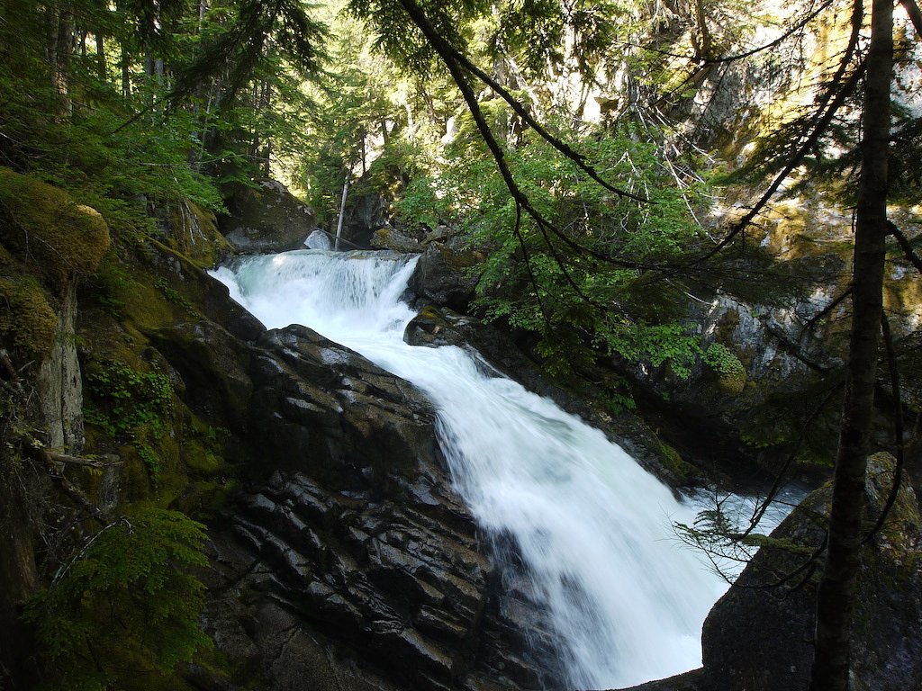
Flood Falls
By Armen Suny · Last verified Jun 2026
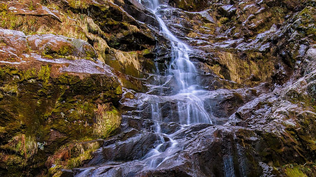
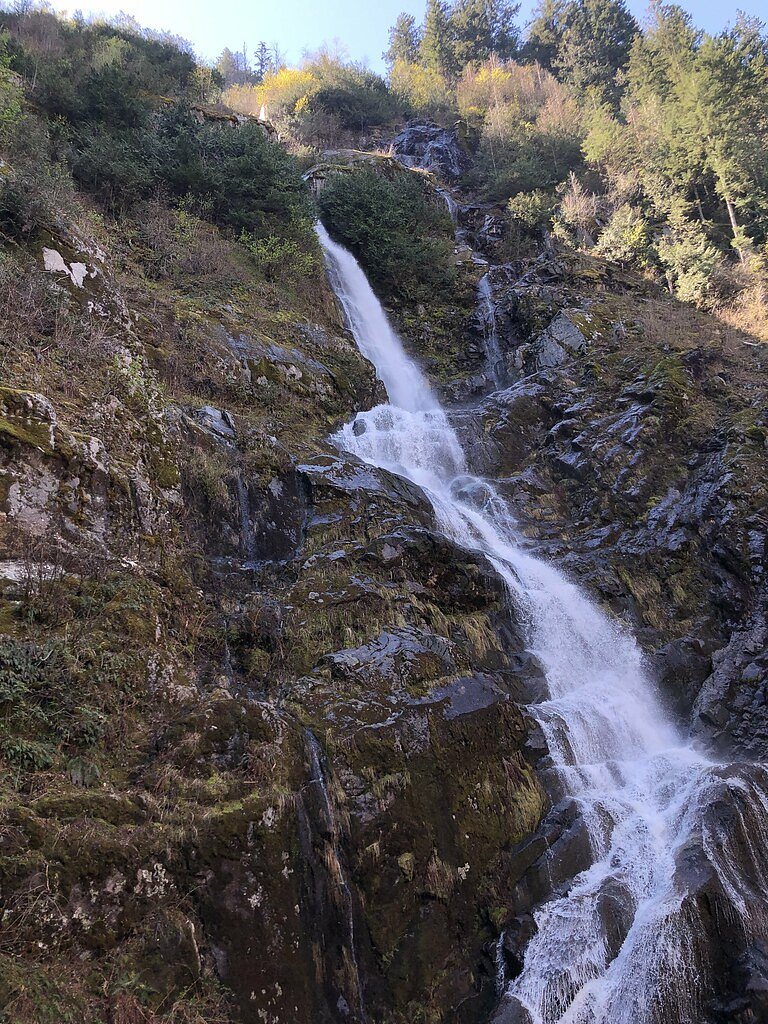
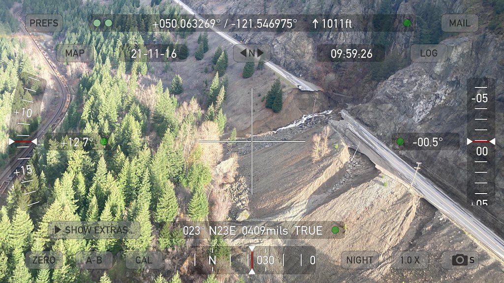
Photo Credits (5)
Difficulty
Easy
Trail Length
1.0 km
Trail Type
Out And Back
Elevation Gain
61 m
About Flood Falls
Flood Falls is a forested, seasonal waterfall located in the Lower Mainland region of British Columbia near Chilliwack (approximate coordinates 49.3566, -121.5212). The falls typically have their highest flows during spring snowmelt and after heavy rains. Access is generally via forest/secondary roads with a short to moderate hike; signage and facilities are limited. Exact published details on height and official access points are scarce, so some local route knowledge or up-to-date trip reports are recommended.
Why This Waterfall Exists
Flood Falls flows over hard intrusive rock laid down about 66-145 million years ago. These resistant rocks form a durable ledge that water cannot easily wear away, creating the falls where softer material downstream has already eroded.
Nearby Falls Worth Visiting
Chawuthen Creek Falls (20 m) lies 1.1 kilometres to the east.
Trail & Hike Details
The Approach
The easy 1.0-km out-and-back trail gains 61 metres of elevation on the way to the falls.
Trail Description
The approach to Flood Falls is through second-growth and mixed forest on an unmaintained or lightly maintained trail. Expect muddy or rooty sections, some short steep pitches, and possibly one or more small stream crossings. Near the falls the trail may descend to viewpoints with uneven, slippery rock and limited guardrails or established viewing platforms. Trail signage may be minimal, so a map, GPS coordinates, or a recent trip report is helpful for navigation.
What to Expect
A forested canyon setting with a waterfall that is most impressive in spring and after heavy rain. There are informal viewpoints; climbing on rocks near the base is hazardous. Little to no formal infrastructure (no restrooms, signage, or maintained viewpoints). Cell coverage may be intermittent in parts. Expect muddy trails, possible blowdown or route-finding challenges, and seasonal road gates.
Accessibility
The trail is not wheelchair accessible. Uneven terrain and elevation changes require steady footing.
Frequently Asked Questions
🐶 Are Dogs Allowed at Flood Falls?
❌ Dogs are not allowed
Are There Any Fees or Permits Required?
🆖 No fees required
🏊 Is There Swimming at Flood Falls?
❌ Swimming is not allowed
When to Visit
Late spring (snowmelt) through early summer for highest flow and pleasant weather. Early fall after rains can also produce good flow. Winter visits may be icy and roads may be closed or gated, exercise extra caution.
Seasonal Access
The best time to visit is Spring, Summer, and Fall. Winter access may be limited. Check with the managing park or local authority for current conditions.
Safety Information
Hazards include slippery and unstable rock near the falls, fast-moving water, steep drop-offs, variable road conditions (unpaved or gated forest roads), limited cell coverage, and seasonal river/creek flooding. Always tell someone your plans, carry navigation tools, and avoid cliff edges. Use extra caution after heavy rain when flows and currents are stronger.
Current Water Conditions
3,670.0 m³/s
Current discharge — how much water is flowing
Much lower than usual for this time of year
Based on 113 years of record
5.65 m
Water depth at gauge
7-Day Discharge Trend
What does this mean for your visit?
Flow is well below normal for this time of year, so the waterfall may be a trickle.
About This Gauge
7-Day Flow Outlook
Based on the WSC gauge FRASER RIVER AT HOPE (6 km away).
Today
Barely Flowing
3670 m³/s
5/10Tomorrow
Barely Flowing
3584 m³/s
4/10Tue
Barely Flowing
3562 m³/s
4/10Wed
Barely Flowing
3504 m³/s
4/10Thu
Barely Flowing
3425 m³/s
4/10Fri
Barely Flowing
3382 m³/s
5/10Sat
Barely Flowing
3567 m³/s
3/10Best window: Today — barely flowing flow, sunny (trip score 5/10).
Best time of year: this gauge typically runs highest from early May to early August, peaking in June.
How we calculate this
This is a transparent outlook, not a precise forecast. We take the waterfall's current flow strength (how it ranks against its historical normal for today, from the nearest WSC stream gauge), carry that ranking forward along the gauge's seasonal curve, and nudge it for forecast rain. Confidence is highest for the next day or two and falls further out. Always check official conditions and your own judgment before visiting — high flows can be dangerous.
Know when to go.
Get a free email alert when waterfalls near Chilliwack hit peak flow. We only send when conditions are worth the trip — no weekly newsletters, no spam.
Weather Forecast
Location & Access
Getting There
General access is from the Chilliwack/Maple Falls area via local and forest service roads. The final approach may be on unpaved roads that can be rough or gated seasonally; a high-clearance vehicle may be helpful. Visitors should consult recent trip reports or local sources for current road and gate status before attempting access.
Get Directions on Google MapsParking
Parking is likely an informal pullout or small trailhead area off a forest service or secondary road. Expect limited space and no formal facilities (toilets or potable water). Park well off the road and avoid blocking gates or driveways.
Elevation
335 metres above sea level
Coordinates
49.356625° N, -121.521227° W
Visitor Tips & Gear
• Check recent trip reports or local forums for gate and road conditions before you go. • Use a high-clearance vehicle if you must drive on unpaved forest roads; be prepared to park and walk. • Wear sturdy, waterproof footwear, rocks near the falls are slippery. • Bring a map, GPS coordinates, and a charged phone; do not rely solely on mobile reception. • Avoid getting close to the edge of the falls or standing under overhangs, rocks can be unstable and water flow unpredictable. • Pack out everything you bring; there may be no garbage service.
As an Amazon Associate, we earn from qualifying purchases.
For this easy 1.0 km trail, lightweight trail shoes and a water bottle are usually sufficient. Sun exposure on the trail makes good sun protection a must in summer.

Polarized Sunglasses (Knockaround)
Cuts glare off the water so you actually see the falls — and your photos turn out better too.

Columbia Watertight II Rain Jacket
Packs into its own pocket, seam-sealed, and keeps you dry from spray and surprise rain.

Earth Pak Waterproof Dry Bag
Keeps your phone and gear dry when waterfall mist soaks everything else.

Waterproof Phone Pouch (AiRunTech)
Cheap insurance — take photos right next to the falls without killing your phone.

JOBY GorillaPod Starter Kit
Wraps around railings and rocks for long-exposure waterfall shots — no flat surface needed.

Osprey Daylite Daypack
Light, organized, and just the right size for a day hike — fits water, snacks, and layers.
Where to Stay
Browse vacation cabins and private rentals nearby
Unique outdoor stays — tents, yurts, and treehouses
Rent a campervan or RV for your waterfall road trip
Some links are affiliate links. We may earn a commission at no extra cost to you.
Nearby Campground
Wild Rose Camping and RV Park
1.2 km away
Nearby Hot Springs
Hot springs near Chilliwack, British Columbia
Baker Hot Spring
Baker Hot Spring emerges at 108 degrees Fahrenheit on US Forest Service land in Mt. Baker National Forest, flowing 59.5 degrees...
Dorr Fumarole Field
Dorr Fumarole Field reaches 194 degrees at 8,168 feet elevation on Mount Baker's active volcanic slopes, producing superheated ...

Sherman Crater Fumaroles
Sherman Crater Fumaroles register 266 degrees Fahrenheit at 9,463 feet elevation within the active volcanic crater atop Mount B...
Looking for a soak after your hike? Explore more hot springs near Chilliwack, British Columbia on SoakingSprings.
Explore British Columbia springsAdditional Information
Nearby Attractions
Chilliwack (town services), Vedder River area, Slesse (Mount) area trails, other Lower Mainland waterfalls and viewpoints. Bridal Veil/Bridal Falls and various hiking routes in the Fraser Valley are within driving distance for day trips.
Wildlife
Typical Lower Mainland wildlife: black bear, cougar (rare but possible), deer, small mammals, and birdlife. Ticks and mosquitoes can be seasonally abundant. Practice bear-aware and wildlife-safe behaviors.
Cities near Flood Falls
Nearby Waterfalls
Writing about Flood Falls? Embed this waterfall on your site for free.