Photo Credits (5)
Difficulty
Moderate
Trail Length
2.3 km
Trail Type
Out And Back
Elevation Gain
170 m
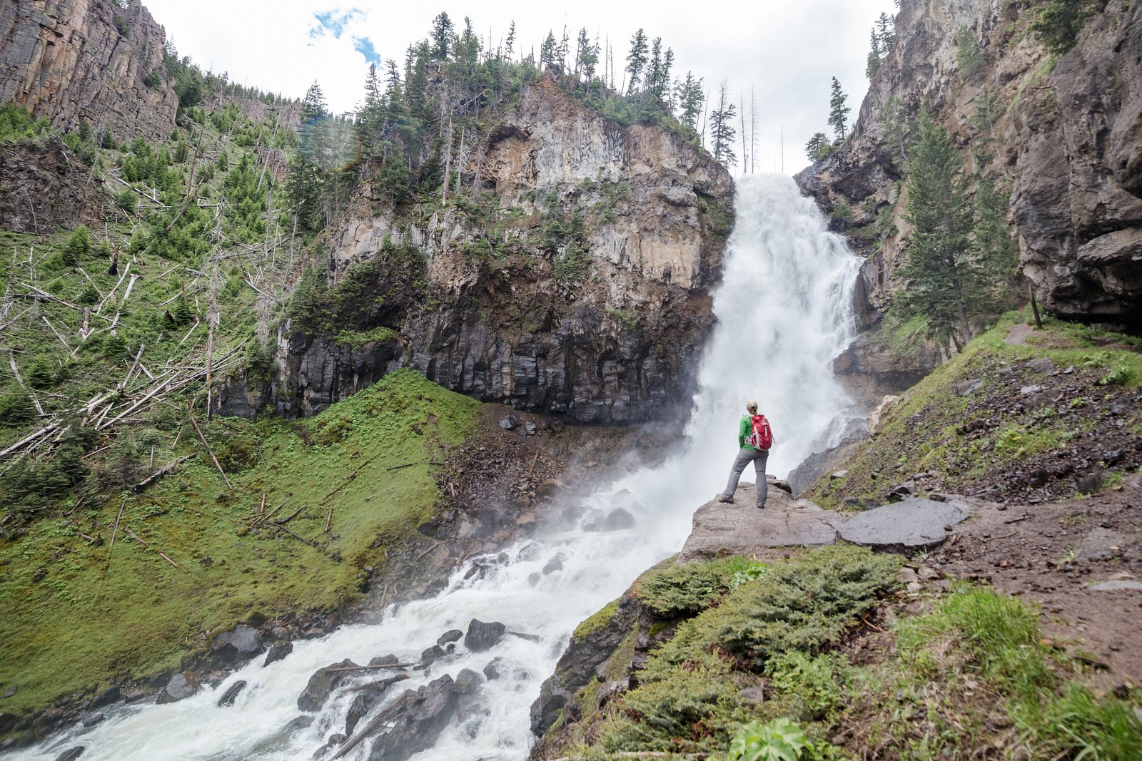
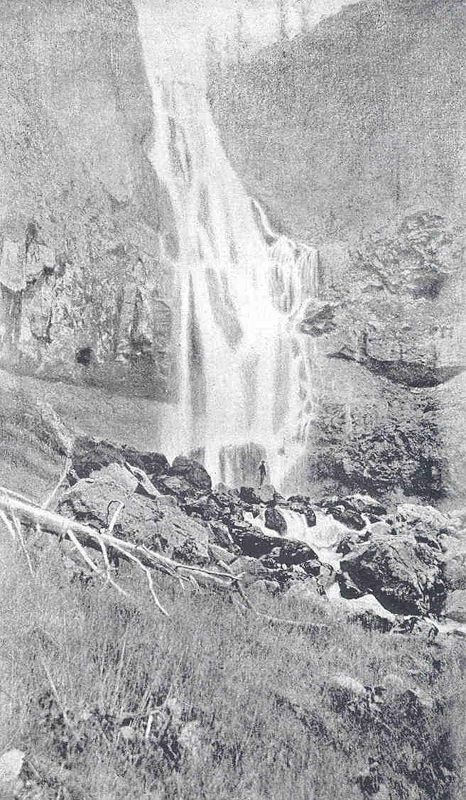
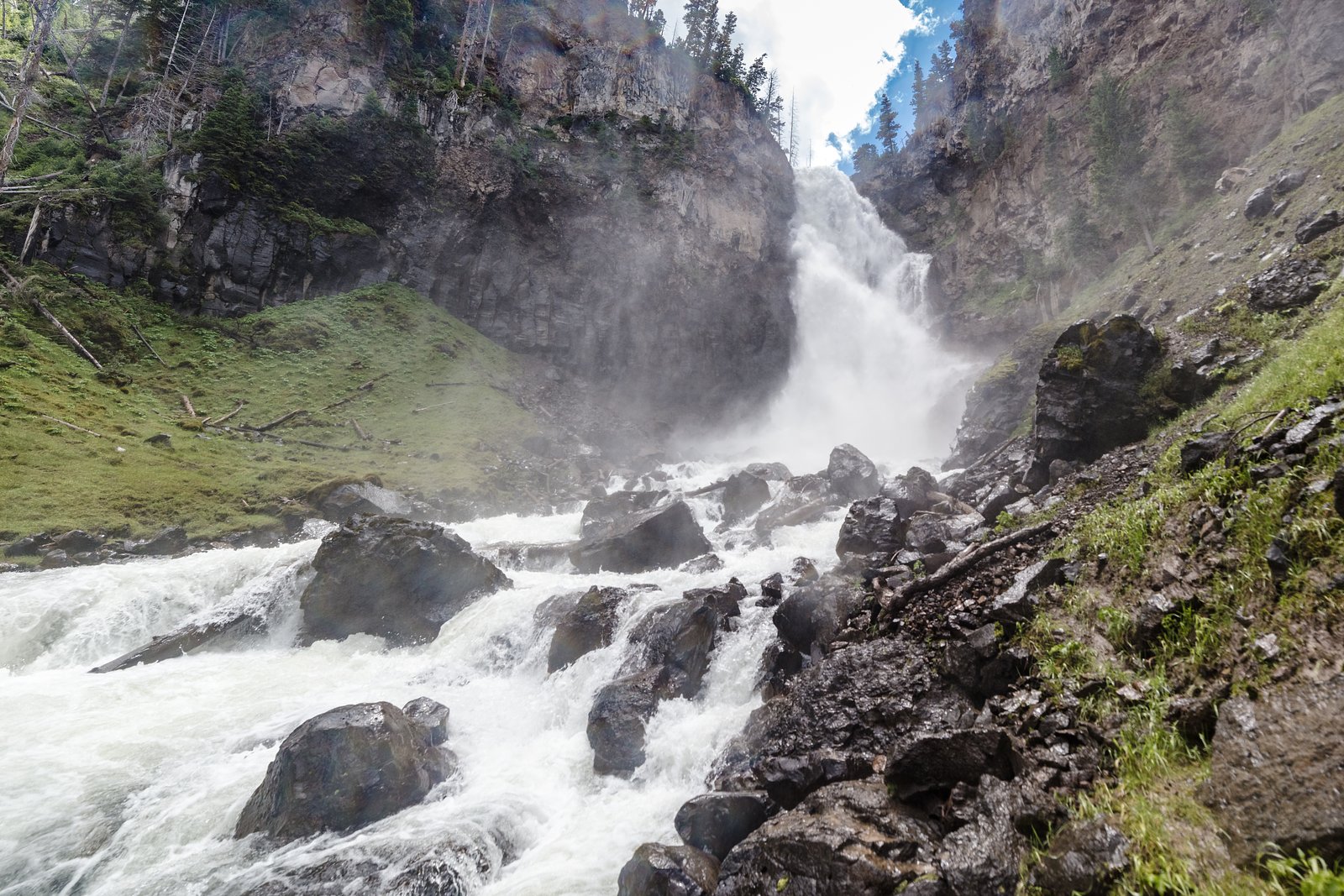
About Osprey Falls
Osprey Falls is a relatively remote waterfall in central British Columbia near coordinates 52.1406, -120.1954. There is limited published, widely verified information about developed facilities or an official maintained trail to the falls. It appears to be a cascade/tiered fall on a tributary stream and is likely seasonal, with highest flows in spring and early summer. Visitors should verify local access conditions before travelling as details here are based on limited public sources and typical backcountry conditions in the region.
The Setting
Osprey Falls sits at 679 metres within Wells Gray Park, in the hills of British Columbia. The falls drop 5 metres.
Why This Waterfall Exists
Osprey Falls flows over hard volcanic rock, primarily basalt, laid down about 3 million years ago. These resistant rocks form a durable ledge that water cannot easily wear away, creating a 15-foot drop where softer material downstream has already eroded.
Nearby Falls Worth Visiting
Bailey's Chute (10 m) lies 7.7 kilometres to the south. Also nearby: Marcus Falls (5 m, 7.4 km) and Falls Creek (3 m, 0.5 km).
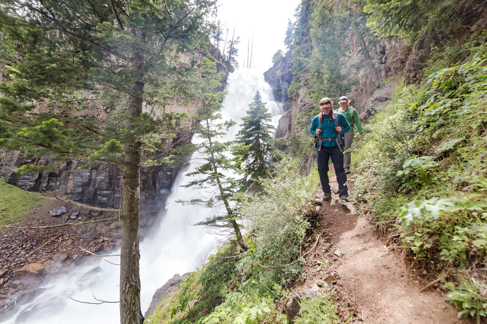
Trail & Hike Details
The Approach
The moderate 2.3-km out-and-back trail gains 170 metres of elevation on the way to the falls.
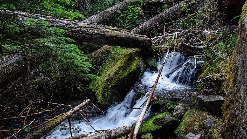
Trail Description
There is no widely documented maintained trail to Osprey Falls. Access may involve a short but unmarked descent from a roadside turnout via informal paths, bushwhacking, or route-finding on steep, uneven ground. Expect roots, loose rock, muddy sections, and potentially a short scramble to reach viewing points. Because information is sparse, treat on-the-ground conditions as the authoritative source and proceed cautiously.
What to Expect
The falls drop a gentle 5 metres over hard volcanic rock.
Accessibility
The trail is not wheelchair accessible. Uneven terrain and elevation changes require steady footing.
Frequently Asked Questions
🐶 Are Dogs Allowed at Osprey Falls?
❌ Dogs are not allowed
Are There Any Fees or Permits Required?
🆖 No fees required
🏊 Is There Swimming at Osprey Falls?
❌ Swimming is not allowed
When to Visit
Late spring to early summer for strongest flows; early fall for lower crowds and fall colours. Avoid visiting during or immediately after heavy rain or during spring freshet when currents and banks can be hazardous.
Seasonal Access
The best time to visit is Spring, Summer, and Fall. Winter access may be limited. Check with Wells Gray Park for current conditions.
Safety Information
Hazards include slippery wet rocks, steep or unstable banks, cold water and strong currents during high flow, loose rock, and unstable footing. Forest service roads can be rough, flooded, or seasonally impassable. Cell phone service may be unreliable; carry navigation and emergency gear. Follow bear-safety practices and be prepared for rapid weather changes. If uncertain about conditions or route, consult local authorities or refrain from attempting a visit.
Weather Forecast
Location & Access
Getting There
The falls are located in remote forested terrain and access is likely via unpaved forest service or logging roads off nearby highways. Expect rough roads that may require a high-clearance or 4x4 vehicle. There may be no official signage or a maintained trailhead; bring a map/GPS and plan for limited or no cell coverage. Verify route and road conditions locally before departing.
Get Directions on Google MapsParking
Parking is likely informal (roadside pullout or lay-by on a forestry road). There does not appear to be a developed parking lot, restrooms, or visitor facilities.
Elevation
679 metres above sea level
Coordinates
52.140553° N, -120.195442° W
Land Management
Managed by Government of British Columbia
Visitor Tips & Gear
Confirm current road and trail conditions locally before travelling; forestry roads can be seasonally closed or wash out. Use a high-clearance vehicle and carry a detailed map or GPS track. Wear sturdy waterproof boots and bring trekking poles for stability. Practice Leave No Trace, pack out all trash. Tell someone your route and expected return time. Be bear-aware: carry bear spray and know how to use it. Avoid standing on wet rocks near the edge, surfaces are slippery and falls can be serious.
As an Amazon Associate, we earn from qualifying purchases.
With 2.3 km and 170 m of elevation gain, sturdy boots and trekking poles will help on this moderate trail. Sun exposure on the trail makes good sun protection a must in summer.

Polarized Sunglasses (Knockaround)
Cuts glare off the water so you actually see the falls — and your photos turn out better too.

Columbia Watertight II Rain Jacket
Packs into its own pocket, seam-sealed, and keeps you dry from spray and surprise rain.

Earth Pak Waterproof Dry Bag
Keeps your phone and gear dry when waterfall mist soaks everything else.

Waterproof Phone Pouch (AiRunTech)
Cheap insurance — take photos right next to the falls without killing your phone.

Timberland Euro Sprint Mid Waterproof
Trusted waterproof boot with premium leather and grippy rubber sole — reliable on rocky, wet trails.

TrailBuddy Trekking Poles
Lightweight aluminum, cork grips, and flip-locks that actually hold — a best-seller for good reason.
Where to Stay
Browse vacation cabins and private rentals nearby
Unique outdoor stays — tents, yurts, and treehouses
Rent a campervan or RV for your waterfall road trip
Some links are affiliate links. We may earn a commission at no extra cost to you.
Nearby Campground
Clearwater Lake Campground
0.3 km away
Additional Information
Nearby Attractions
There may be other backcountry waterfalls, provincial parks, and forest recreation opportunities in the broader region. Check local visitor centres or park/forest service resources for verified nearby attractions.
Wildlife
Typical central-B.C. wildlife may include black bears, cougars, deer, moose, small mammals, and seasonal insects such as mosquitoes. Be bear-aware and follow local wildlife safety guidance.
Nearby Waterfalls

Other waterfalls named Osprey Falls
1 other waterfall shares this name across Canada.
Writing about Osprey Falls? Embed this waterfall on your site for free.