Osprey Falls
Wyoming • 150 ft
By Armen Suny · Last verified Mar 2026
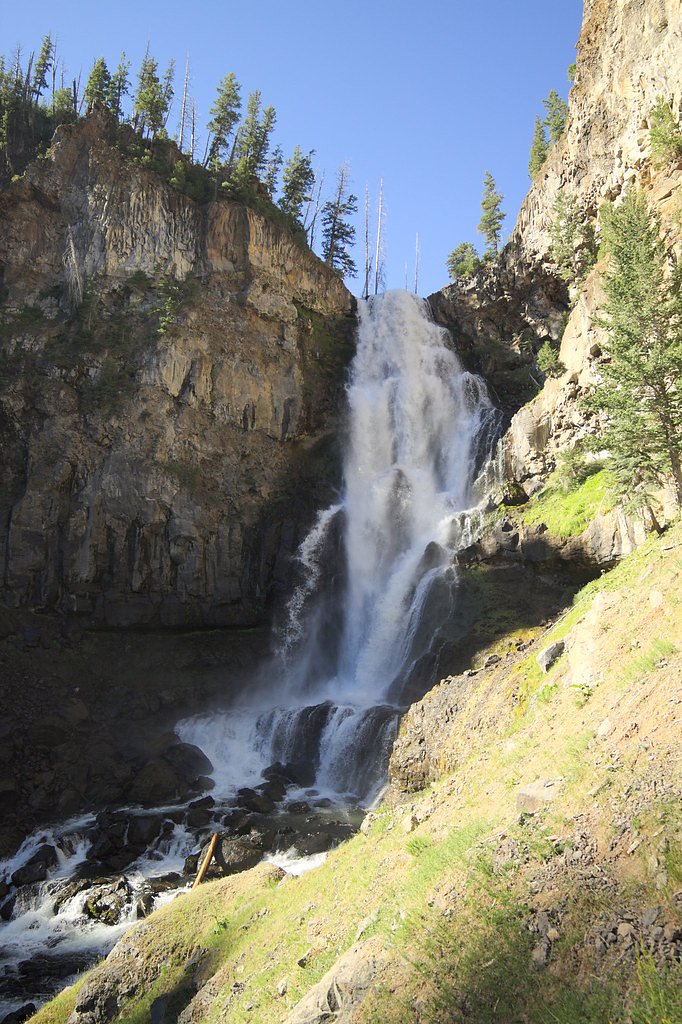
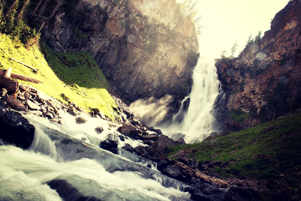
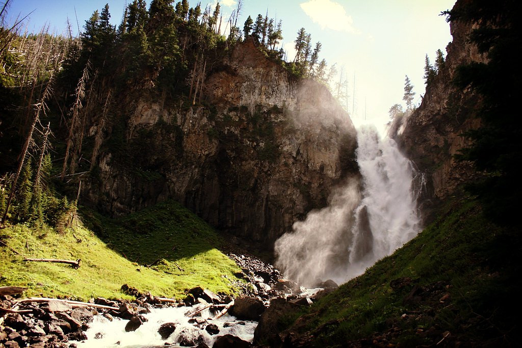
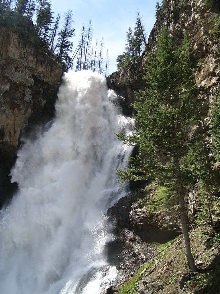
Photo Credits (5)
Difficulty
Moderate
Trail Length
8.0 miles
Trail Type
Out And Back
Elevation Gain
800 ft
About Osprey Falls
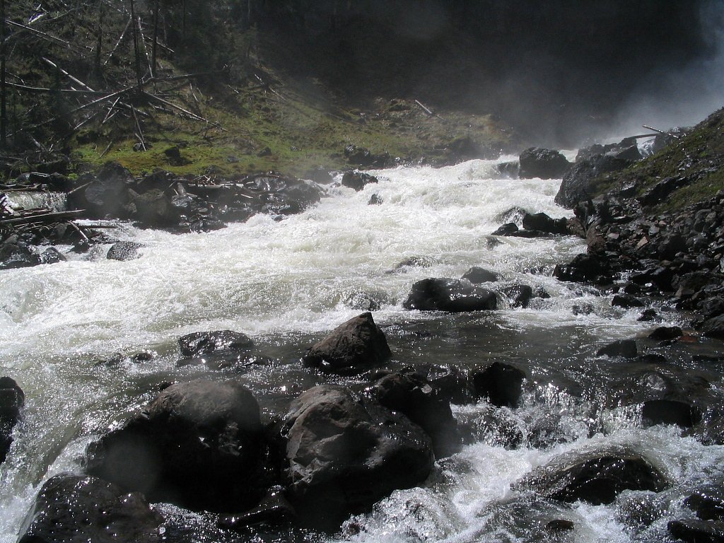
Osprey Falls is a stunning waterfall located in Yellowstone National Park, Wyoming. It cascades approximately 150 feet into the Sheepeater Canyon, offering breathtaking views and a rewarding experience for hikers.
The Setting
Osprey Falls sits at 6,565 feet within Yellowstone National Park, fed by the Boiling River, in the high mountains of Wyoming. At 150 feet, it is among the taller waterfalls in Wyoming.
Height: 150 feet
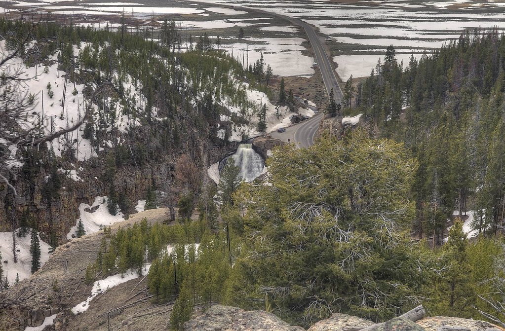
Nearby Falls Worth Visiting
Wraith Falls (79 ft) lies 2.9 miles to the east. Also nearby: Undine Falls (60 ft, 2.3 mi) and Rustic Falls (47 ft, 2.2 mi).
Trail & Hike Details
The Approach
The moderate 8.0-mile out-and-back trail gains 800 feet of elevation on the way to the falls.
Trail Description
The trail to Osprey Falls begins at the Bunsen Peak Trailhead and follows a relatively flat path for the first few miles. It then descends steeply into Sheepeater Canyon, where the waterfall is located. The descent can be challenging due to loose rocks and steep terrain, so proper footwear is essential.
What to Expect
The falls cascade 150 feet.
Accessibility
The trail is not wheelchair accessible. Uneven terrain and elevation changes require steady footing.
Frequently Asked Questions
🐶 Are Dogs Allowed at Osprey Falls?
❌ Dogs are not allowed
Are There Any Fees or Permits Required?
🤑 Fee: $35.00
🏊 Is There Swimming at Osprey Falls?
❌ Swimming is not allowed
When to Visit
The best time to visit Osprey Falls is during late spring through early fall, when the trail is free of snow and the waterfall is at its most impressive due to snowmelt.
Seasonal Access
The best time to visit is Spring, Summer, and Fall. Access roads and trails may close during winter due to snow. Check the National Park Service website for current conditions.
Safety Information
The descent into Sheepeater Canyon is steep and can be slippery. Hikers should wear sturdy footwear and exercise caution. Carry bear spray and be aware of wildlife in the area. Weather can change rapidly, so be prepared for rain or cold temperatures.
Current Water Conditions
25 ft³/s
Current discharge — how much water is flowing
About average for this time of year
Based on 28 years of record
1.21 ft
Water depth at gauge
118°F
WarmVery comfortable
7-Day Discharge Trend
What does this mean for your visit?
Flow is about average for this time of year. The water is warm at 118 degrees F, very comfortable for swimming.
About This Gauge
7-Day Flow Outlook
Based on the USGS gauge Boiling River at Mammoth,YNP (6 km away).
Today
Moderate
29 cfs
6/10Tomorrow
Strong
30 cfs
7/10Fri
Strong
30 cfs
7/10Sat
Strong
30 cfs
7/10Sun
Moderate
29 cfs
6/10Mon
Moderate
30 cfs
6/10Tue
Moderate
27 cfs
9/10Best window: Tue — moderate flow, mostly sunny (trip score 9/10).
Best time of year: this gauge typically runs highest from early May to late July, peaking in June.
How we calculate this
This is a transparent outlook, not a precise forecast. We take the waterfall's current flow strength (how it ranks against its historical normal for today, from the nearest USGS stream gauge), carry that ranking forward along the gauge's seasonal curve, and nudge it for forecast rain. Confidence is highest for the next day or two and falls further out. Always check official conditions and your own judgment before visiting — high flows can be dangerous.
Know when to go.
Get a free email alert when waterfalls near Mammoth hit peak flow. We only send when conditions are worth the trip — no weekly newsletters, no spam.
Weather Forecast
Location & Access
Getting There
Osprey Falls is accessed via the Bunsen Peak Trailhead, located near Mammoth Hot Springs in Yellowstone National Park. The trailhead is easily reachable by car, and signs for the trail are clearly marked.
Get Directions on Google MapsParking
Parking is available at the Bunsen Peak Trailhead. However, during peak seasons, parking may be limited, so arriving early is recommended.
Elevation
6,565 feet above sea level
Coordinates
44.928563° N, -110.680996° W
Land Management
Managed by NPS
Visitor Tips & Gear
Start your hike early in the day to avoid crowds and ensure you have enough time to complete the trail. Bring plenty of water, as the trail can be strenuous, especially during warmer months. Be prepared for sudden weather changes, as conditions in Yellowstone can vary rapidly.
This trail sits at 6,565 ft above sea level
Elevated TrailUV radiation is roughly 26% stronger at this elevation than at sea level, and the dry air accelerates dehydration. Extra sun protection and fluids go a long way.
As an Amazon Associate, we earn from qualifying purchases.

Coppertone Sport SPF 50 Sunscreen
UV intensity jumps ~4% per 1,000 ft — at this elevation you can burn in half the time.

Sun Bum SPF 30 Lip Balm (3-Pack)
Lips have almost no natural UV protection and burn fast in thin, dry mountain air.

Liquid I.V. Electrolyte Packets
You lose moisture ~2x faster at elevation — electrolytes help you absorb water efficiently.

ROCKNIGHT Polarized UV400 Sunglasses
High-altitude glare off rock and water is intense — UV400 lenses block 99%+ of UVA/UVB.
As an Amazon Associate, we earn from qualifying purchases.
With 8.0 miles and 800 ft of elevation gain, sturdy boots and trekking poles will help on this moderate trail. Sun exposure on the trail makes good sun protection a must in summer.
America the Beautiful Annual Pass
Covers entrance fees at 2,000+ federal recreation sites — required at most National Parks.

Polarized Sunglasses (Knockaround)
Cuts glare off the water so you actually see the falls — and your photos turn out better too.

Columbia Watertight II Rain Jacket
Packs into its own pocket, seam-sealed, and keeps you dry from spray and surprise rain.

Earth Pak Waterproof Dry Bag
Keeps your phone and gear dry when waterfall mist soaks everything else.

Waterproof Phone Pouch (AiRunTech)
Cheap insurance — take photos right next to the falls without killing your phone.

Timberland Euro Sprint Mid Waterproof
Trusted waterproof boot with premium leather and grippy rubber sole — reliable on rocky, wet trails.

TrailBuddy Trekking Poles
Lightweight aluminum, cork grips, and flip-locks that actually hold — a best-seller for good reason.
Where to Stay

Ridgeline Hotel at Yellowstone, an Ascend Collection Hotel

Yellowstone Village Inn and Suites

Corral Villas Yellowstone

Roosevelt Hotel & Cabins - Yellowstone
Browse vacation cabins and private rentals nearby
Unique outdoor stays — tents, yurts, and treehouses
Rent a campervan or RV for your waterfall road trip
Some links are affiliate links. We may earn a commission at no extra cost to you.
Nearby Campground
Mammoth Campground (Yellowstone)
3.2 miles away · 87 sites
Overview Starting Tuesday April 15th, the Mammoth Campground is open and reservations are required. For reservations at the campgrounds managed by Yellowstone National Park Lodges (Fishing Bridge RV Park, Bridge Bay, Canyon, Madison, and Grant Village campgrounds), please visit the Yellowstone National Park Lodges Camping website. Recreation There are many recreational opportunities in the Mammoth Hot Springs and the North area. Visit these pages to learn more:Boating Fishing Hiking Photograp
Book on Recreation.govNearby Hot Springs
Hot springs near Mammoth, Wyoming

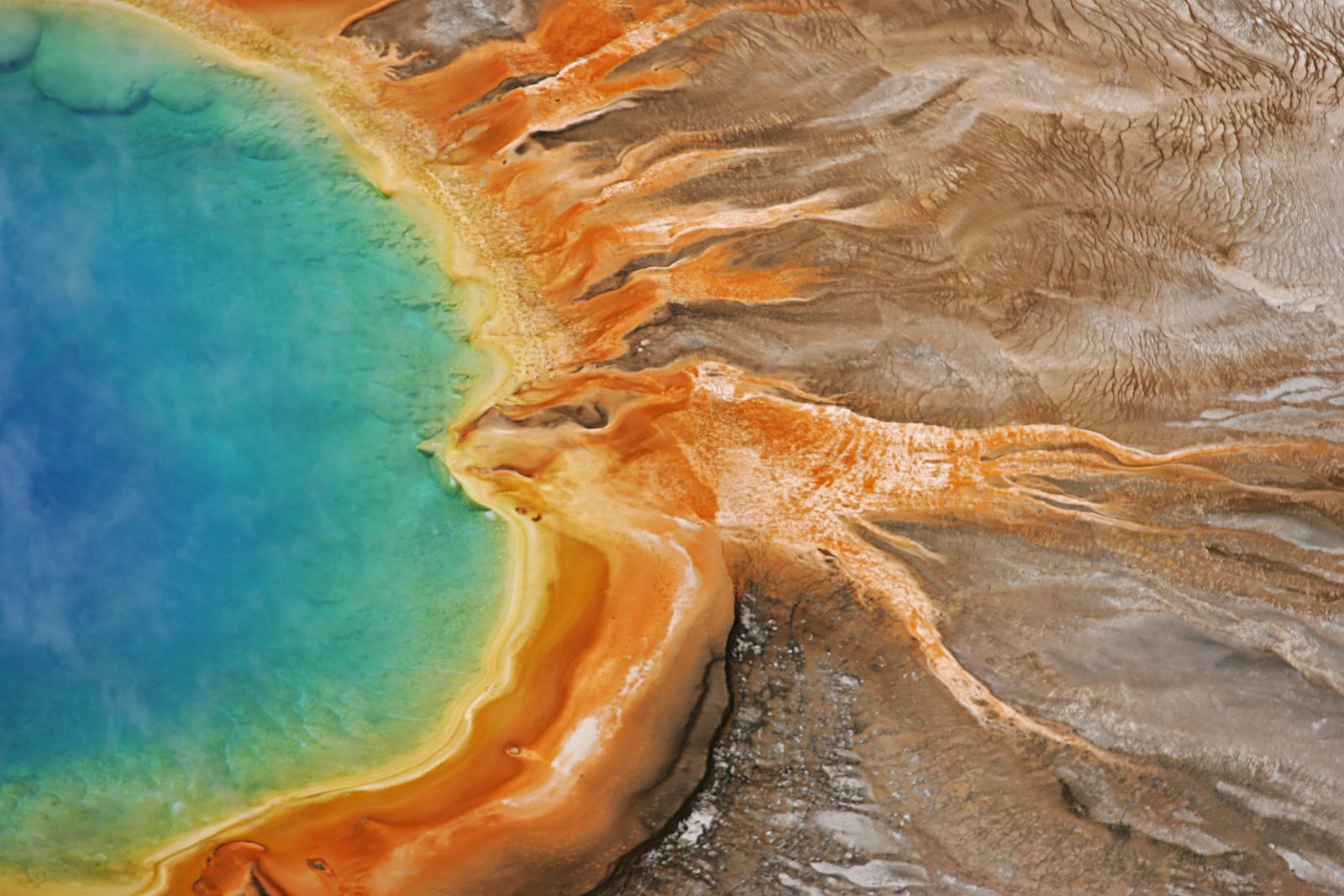
Mammoth Hot Springs
Mammoth Hot Springs discharges at 163 degrees Fahrenheit just 6 meters from Upper Terrace Drive at 6,589 feet elevation, deposi...

Hot River
Hot River forms where thermal springs mix with cold stream water at 5,685 feet elevation near Mammoth Hot Springs in Yellowston...
Gas Vents At Horseshoe Hill
This thermal feature produces 97-degree Fahrenheit water at 7,640 feet elevation, accessible via 2.6-mile hike from Grand Loop ...

Bear Creek Springs
Bear Creek Springs discharges at 72°F -- only 31 degrees above ambient -- within Gallatin National Forest at 5,423 feet elevati...

Apollinaris Spring
Apollinaris Spring emerges in Yellowstone National Park just 95.2 meters from Grand Loop Road at 7,580 feet elevation near Norr...
Whiterock Springs
Whiterock Springs flows at 144°F in Yellowstone National Park at 7,610 feet elevation, creating a moderately hot feature locate...
Looking for a soak after your hike? Explore more hot springs near Mammoth, Wyoming on SoakingSprings.
Explore Wyoming springsAdditional Information
Nearby Attractions
Nearby attractions include Mammoth Hot Springs, Bunsen Peak, and the Norris Geyser Basin.
Wildlife
Wildlife in the area includes elk, bison, bears, and various bird species. Visitors should carry bear spray and remain vigilant.
Cities near Osprey Falls
Nearby Waterfalls
Other waterfalls named Osprey Falls
1 other waterfall shares this name across the U.S.
Writing about Osprey Falls? Embed this waterfall on your site for free.