Photo Credits (5)
About Falls Creek
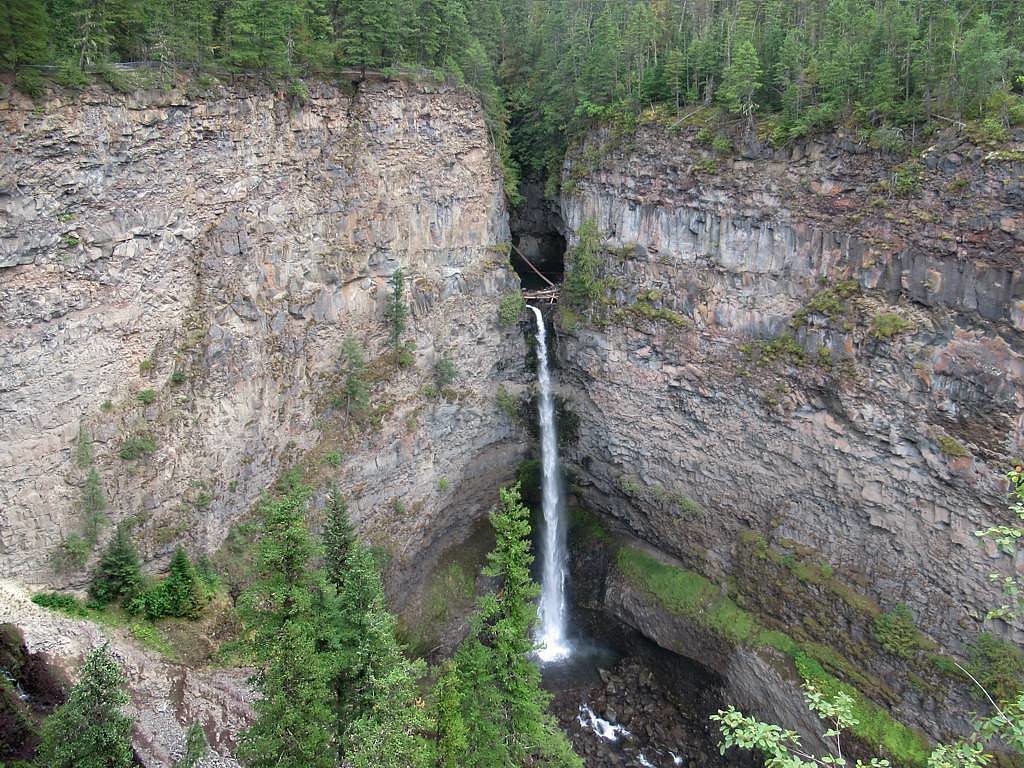
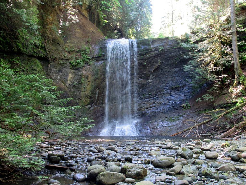
Falls Creek is a small, likely cascading waterfall on a creek in the interior of British Columbia near the Clearwater / Wells Gray area (coordinates 52.1372, -120.1909). This feature appears to be a relatively remote, lightly developed waterfall rather than a major park attraction. Visitor reports and mapping indicate it may be reached by a combination of paved highway, secondary forestry/logging roads and a short hike. Flow is typically highest in spring during snowmelt and after heavy rain; late summer flows may be reduced. Specific official information (maintained viewpoint, formal trailhead, exact height) is limited or not widely published.
The Setting
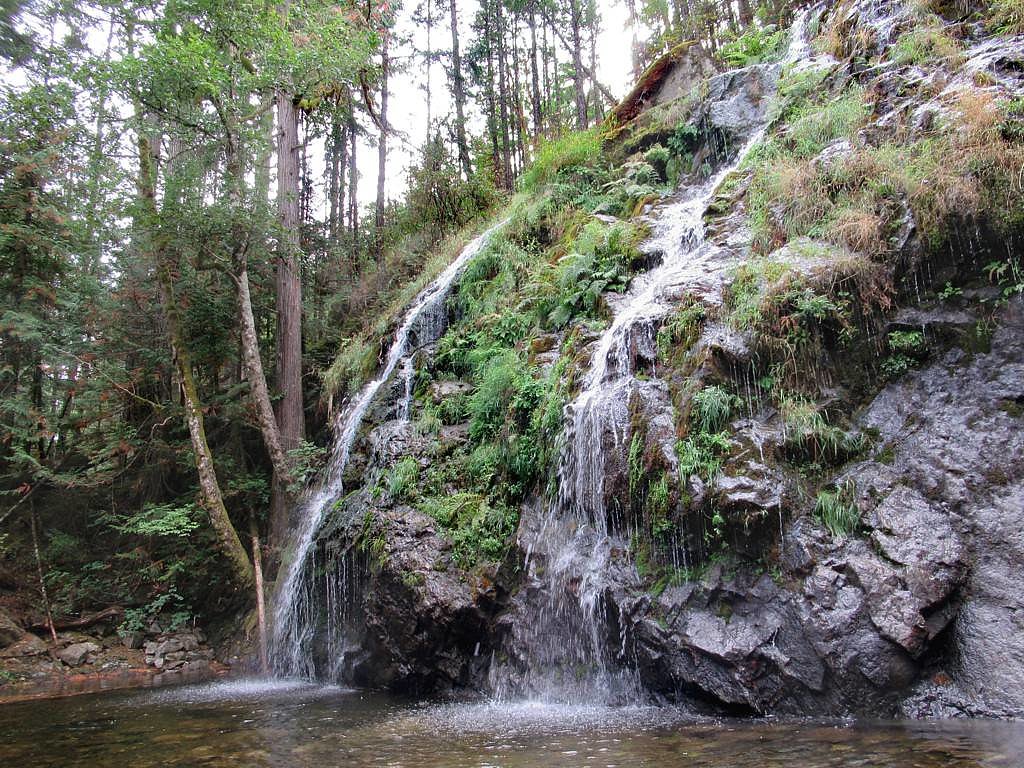
Falls Creek sits at 677 metres within Wells Gray Park, in the hills of British Columbia. The falls drop 3 metres.
Why This Waterfall Exists
Falls Creek flows over hard volcanic rock, primarily basalt, laid down about 3 million years ago. These resistant rocks form a durable ledge that water cannot easily wear away, creating a 10-foot drop where softer material downstream has already eroded.
Nearby Falls Worth Visiting
Bailey's Chute (10 m) lies 7.4 kilometres to the south. Also nearby: Osprey Falls (5 m, 0.5 km) and Marcus Falls (5 m, 7.1 km).
Trail & Hike Details
Trail Description
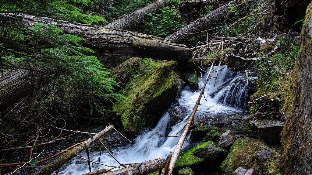
There does not appear to be a widely maintained or signed trail at this specific Falls Creek location. Visitors typically use a short cross-country approach from a nearby forestry road or a minimally maintained spur trail. Expect uneven footing, roots, rocks and potentially wet or muddy ground near the creek. Trail conditions and exact route may vary by season and recent logging activity.
What to Expect
The falls drop a gentle 3 metres over hard volcanic rock.
Accessibility
Accessibility is very limited. Expect rough surfaces, natural terrain, and no formal accessibility features. Not suitable for wheelchairs or strollers.
Frequently Asked Questions
🐶 Are Dogs Allowed at Falls Creek?
❌ Dogs are not allowed
Are There Any Fees or Permits Required?
🆖 No fees required
🏊 Is There Swimming at Falls Creek?
❌ Swimming is not allowed
When to Visit
Late spring to early summer for highest flows and more dramatic water volume. Mid-to-late summer offers easier road and trail access with lower flows. Avoid periods immediately after heavy rain if concerned about road washouts; in winter and early spring some forestry roads may be impassable without winter equipment.
Seasonal Access
The best time to visit is Spring, Summer, and Fall. Winter access may be limited. Check with Wells Gray Park for current conditions.
Safety Information
Hazards include slick rocks and steep banks near the creek and falls, fast or deceptively strong currents (especially in spring runoff), unstable or eroding edges, limited or no cell coverage, and variable forestry road quality. Bear encounters are possible, carry bear spray and follow bear-safety protocols. Roads and trails may be closed or unsafe after heavy rain, during spring thaw or in winter; check current conditions. Do not attempt to climb near the lip of the falls, and keep a safe distance from edges and plunge pools.
Weather Forecast
Location & Access
Getting There
Access likely begins from the Clearwater area to the south or from secondary forestry roads off the main highway. Expect a mix of paved and unpaved (possibly rough) logging roads; a high-clearance or 4x4 vehicle may be required seasonally. Final approach may be a short unmaintained trail or roadside scramble. Because official signage and maintained access are limited, consult local maps, current forestry road status, and recent trip reports before attempting.
Get Directions on Google MapsParking
No confirmed formal parking lot. Parking may be a roadside pullout on a forestry road or a small informal turnout. Park clear of private gates and avoid blocking access roads. If unsure, park in a safe, well-graded spot away from the travel lane.
Elevation
677 metres above sea level
Coordinates
52.137245° N, -120.190936° W
Land Management
Managed by Government of British Columbia
Visitor Tips & Gear
1) Check recent trip reports or local park/forest service notices and forestry-road conditions before you go. 2) Use a high-clearance vehicle if traveling forestry roads; avoid low-clearance cars when roads are wet. 3) Wear sturdy footwear, rocks can be slippery near the creek and falls. 4) Carry bear spray and know how to use it; this is bear country. 5) Leave no trace: pack out all garbage and avoid disturbing vegetation. 6) If unsure about access, contact local visitor centres (e.g., Clearwater) for local advice.
Where to Stay
Browse vacation cabins and private rentals nearby
Unique outdoor stays — tents, yurts, and treehouses
Rent a campervan or RV for your waterfall road trip
Some links are affiliate links. We may earn a commission at no extra cost to you.
Nearby Campground
Clearwater Lake Campground
0.3 km away
Additional Information
Nearby Attractions
Wells Gray Provincial Park features many well-known waterfalls (for example Helmcken Falls, Spahats Falls, Dawson Falls and Moul Falls) and scenic hiking routes; Clearwater is the nearest service town. If you are exploring this region, consider established park attractions for maintained trails and infrastructure.
Wildlife
Typical interior BC wildlife: black bear (and possible grizzly in some areas), deer, moose, small mammals and a variety of birds. Be alert for wildlife and store food properly. Spring and summer see higher wildlife activity.
Nearby Waterfalls

Writing about Falls Creek? Embed this waterfall on your site for free.