Sunshine Falls
British Columbia • 12 m
By Armen Suny · Last verified Jun 2026
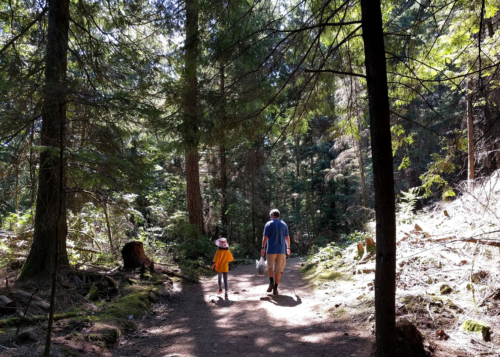
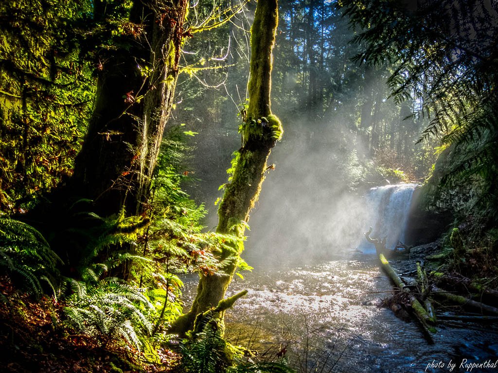
Photo Credits (5)
About Sunshine Falls
Sunshine Falls is a small, local waterfall located near the southern edge of Metro Vancouver at approximately 49.3453, -122.9154. It appears to be a lesser-known, informal site rather than a developed park attraction. Water flow is likely seasonal (highest in spring/snowmelt and after heavy rain) and access may be via short, informal trails or forested/brushy approaches. Details on official management, signage, or developed viewpoints are limited; visitors should expect a rustic experience and variable conditions.
The Setting
Sunshine Falls sits at 76 metres in the coastal lowlands of British Columbia. The falls drop 12 metres.
Why This Waterfall Exists
Sunshine Falls flows over hard intrusive rock laid down about 66-101 million years ago. These resistant rocks form a durable ledge that water cannot easily wear away, creating a 39-foot drop where softer material downstream has already eroded.
Trail & Hike Details
Trail Description
There is no widely documented official trail to Sunshine Falls. Reports for similar small/locally known falls in the region indicate short, informal paths through second-growth forest or brush, possibly with uneven terrain, roots, and muddy sections after rain. Trails may be unmarked and require route-finding. Expect a short bushwhack or footpath rather than a developed, signed trail.
What to Expect
The falls drop 12 metres over hard intrusive rock.
Accessibility
Access is likely not wheelchair accessible. Expect uneven, narrow, and possibly muddy trails; limited to no developed infrastructure for people with mobility impairments.
Frequently Asked Questions
🐶 Are Dogs Allowed at Sunshine Falls?
❌ Dogs are not allowed
Are There Any Fees or Permits Required?
🆖 No fees required
🏊 Is There Swimming at Sunshine Falls?
❌ Swimming is not allowed
When to Visit
Spring for strongest water flow (snowmelt and rainy season). Late spring/early summer offers milder weather with good flows. Summer often has reduced flow but warmer weather. Fall can have good flows after rain; winter visits may be wet and slippery. Visit during daylight hours.
Seasonal Access
The best time to visit is Spring, Summer, Fall, and Winter. Check with the managing park or local authority for current conditions.
Safety Information
Hazards may include: slippery wet rocks and muddy banks, unstable or eroded stream edges, seasonal high flows and strong currents after rain, poisonous plants and thorny brush, ticks and biting insects, and the possibility of crossing private land. There may be no cellphone reception or rescue access in some spots. Always wear appropriate footwear, avoid getting too close to the water's edge, and do not attempt risky scrambles. If uncertain about access, consult local land managers or community sources before visiting.
Current Water Conditions
2.1 m³/s
Current discharge — how much water is flowing
Lower than usual for this time of year
Based on 95 years of record
0.85 m
Water depth at gauge
7-Day Discharge Trend
What does this mean for your visit?
Flow is lower than usual for this time of year.
About This Gauge
7-Day Flow Outlook
Based on the WSC gauge SEYMOUR RIVER NEAR NORTH VANCOUVER (6 km away).
Today
Low
2.1 m³/s
5/10Tomorrow
Low
1.9 m³/s
5/10Tue
Low
1.8 m³/s
5/10Wed
Low
1.7 m³/s
5/10Thu
Low
1.7 m³/s
5/10Fri
Low
1.6 m³/s
5/10Sat
Moderate
1.7 m³/s
5/10Best window: Today — low flow, cloudy (trip score 5/10).
Best time of year: this gauge typically runs highest from late April to late June, peaking in May.
How we calculate this
This is a transparent outlook, not a precise forecast. We take the waterfall's current flow strength (how it ranks against its historical normal for today, from the nearest WSC stream gauge), carry that ranking forward along the gauge's seasonal curve, and nudge it for forecast rain. Confidence is highest for the next day or two and falls further out. Always check official conditions and your own judgment before visiting — high flows can be dangerous.
Know when to go.
Get a free email alert when waterfalls near Vancouver hit peak flow. We only send when conditions are worth the trip — no weekly newsletters, no spam.
Weather Forecast
Location & Access
Getting There
Sunshine Falls is located at approx. 49.3453, -122.9154 on the southern mainland coast near Delta/Tsawwassen. From Vancouver (about 14 miles), drive south on Hwy 99 / Hwy 17 toward Tsawwassen/Boundary Bay and follow local roads toward the shoreline and nearby forested areas. Coordinates: 49.3453, -122.9154, use these in your GPS. The waterfall is also roughly 23–25 miles from Point Roberts and Blaine (WA). Access likely involves turning off paved roads onto minor/local roads and then following an unmarked footpath; exact public trailheads are not well documented.
Get Directions on Google MapsParking
Parking is likely informal and limited (roadside parking or a small unofficial pullout). Expect no formal parking lot, toilets, or facilities. Park legally and avoid blocking driveways or gates. If access requires crossing private property, do not trespass, look for established public access points or local signage.
Elevation
76 metres above sea level
Coordinates
49.345312° N, -122.915427° W
Visitor Tips & Gear
1) Use the provided GPS coordinates and do not rely on formal signage. 2) Wear sturdy, waterproof footwear, stream crossings and muddy slopes possible. 3) Bring a map or offline GPS, cellphone reception may be spotty. 4) Leave no trace: pack out all trash and avoid disturbing vegetation or streambanks. 5) Respect private property and posted closures. 6) Tell someone your plan and expected return time for safety.
Where to Stay
Browse vacation cabins and private rentals nearby
Unique outdoor stays — tents, yurts, and treehouses
Rent a campervan or RV for your waterfall road trip
Some links are affiliate links. We may earn a commission at no extra cost to you.
Nearby Campground
North Twin Campground
1.8 km away
Nearby Hot Springs
Hot springs near Vancouver, British Columbia

Looking for a soak after your hike? Explore more hot springs near Vancouver, British Columbia on SoakingSprings.
Explore British Columbia springsAdditional Information
Nearby Attractions
Boundary Bay / Centennial Beach (birdwatching and beaches), Burns Bog Regional Park, Tsawwassen ferry terminal (to Southern Gulf Islands and Vancouver Island), other local coastal parks in Delta/Tsawwassen and Surrey. Vancouver is about 14 miles north.
Wildlife
Typical Lower Mainland coastal species: shore and wetland birds, songbirds, small mammals (rabbits, squirrels), and possibly deer or coyote. Ticks and biting insects may be present in warm months. Be respectful of wildlife and keep distance.
Cities near Sunshine Falls
Nearby Waterfalls
Writing about Sunshine Falls? Embed this waterfall on your site for free.