Photo Credits (5)
Difficulty
Moderate
Trail Length
3.2 km
Trail Type
Loop
Elevation Gain
55 m
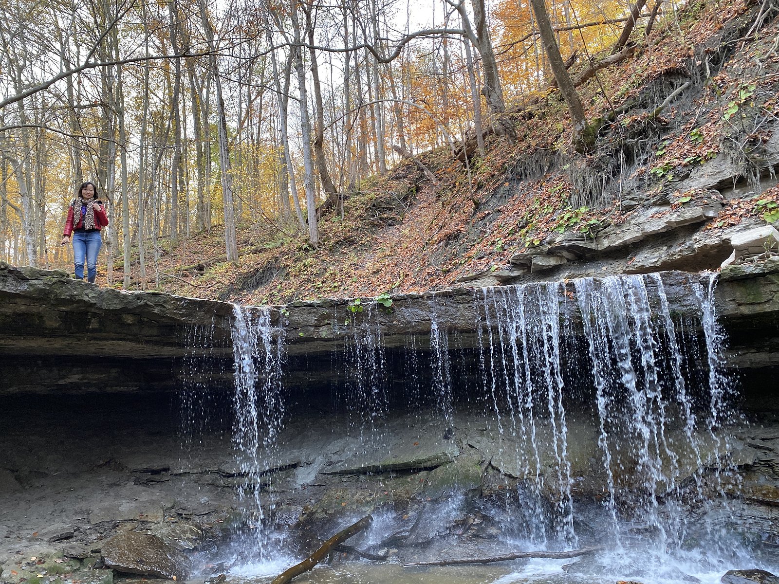
About Mystery Falls
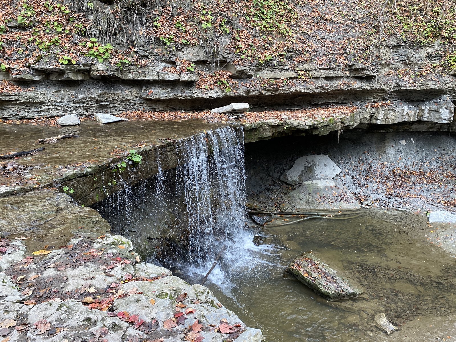
Mystery Falls is a small waterfall feature located near coordinates 43.1073, -81.8107 in southwestern Ontario, roughly equidistant from Lakeport, London, and Sarnia. Local reports suggest it is a modest cascade in a rural/wooded setting rather than a large, developed park attraction. Precise, officially published information about the falls (height, formal trail, or park boundaries) is limited; visitors should expect a natural, possibly informal site that may sit close to rural roads or private land. Spring melt typically produces the highest flows; summer flows can be lower.
Trail & Hike Details
The Approach
The moderate 3.2-km loop trail gains 55 metres of elevation on the way to the falls.
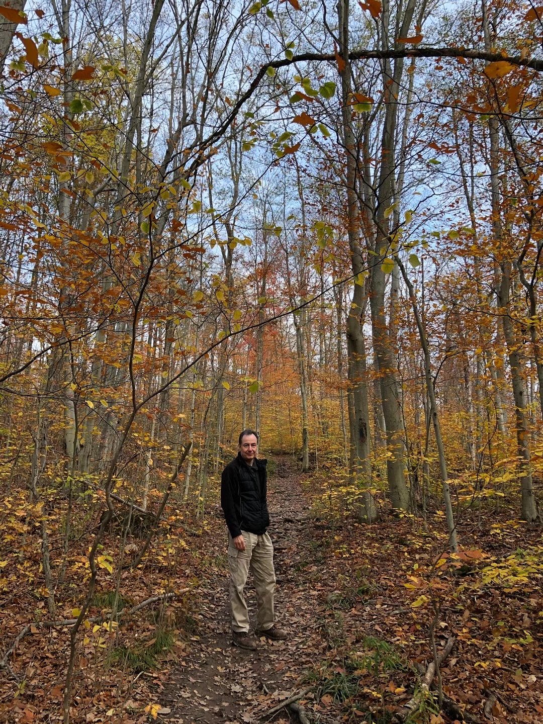
Trail Description
There is no widely published, maintained trail description for Mystery Falls. Based on the site's rural character, access may involve a short, unmaintained footpath, streamside scramble, or an approach from a nearby road. Trails could be muddy, steep in places, and not waymarked. If you are not comfortable with route-finding or light scrambling, plan conservatively and avoid attempting steep or wet approaches.
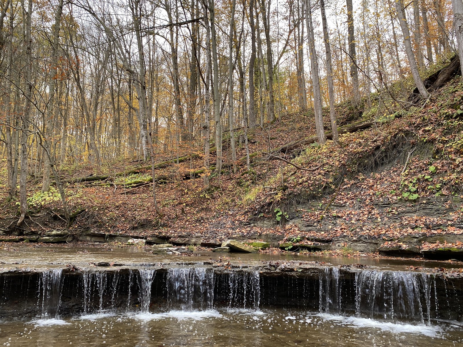
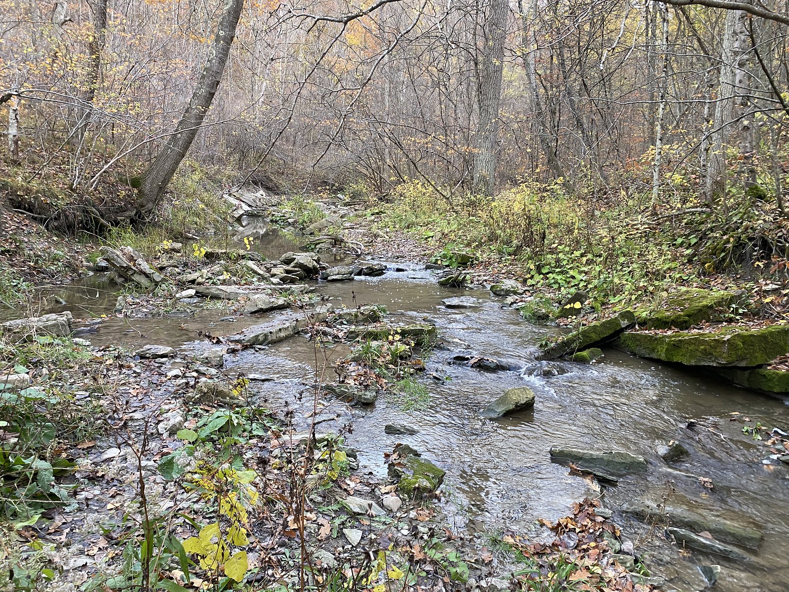
What to Expect
Expect a small, natural waterfall in a wooded/rural landscape. Flow is typically highest in spring (snowmelt and rains) and lower in late summer. Terrain near the falls can be uneven, with rocks, roots, and slick surfaces. Facilities (restrooms, signage, formal viewpoints) are likely absent. Nearby lands may include working farms, private properties, and secondary roads.
Accessibility
The trail is not wheelchair accessible. Uneven terrain and elevation changes require steady footing.
Frequently Asked Questions
🐶 Are Dogs Allowed at Mystery Falls?
❌ Dogs are not allowed
Are There Any Fees or Permits Required?
🆖 No fees required
🏊 Is There Swimming at Mystery Falls?
❌ Swimming is not allowed
When to Visit
Spring for highest water flow and more dramatic appearance; early morning on any day for fewer visitors and calmer light for photography. Avoid high-water conditions immediately after heavy rain due to flashier flows and slippery banks.
Seasonal Access
The best time to visit is Spring, Summer, Fall, and Winter. Check with the managing park or local authority for current conditions.
Safety Information
Hazards may include slippery and unstable rocks, steep or eroding banks, fast-flowing water after rains, cold water temperatures, and limited or no cell coverage. There may be private property in the immediate area, do not trespass. In winter, ice near falls is unpredictable and can be brittle; do not walk on frozen waterfalls or over-iced streams. Bring a companion when possible and tell someone your plans.
7-Day Flow Outlook
Based on the WSC gauge SOUTH PARKHILL CREEK NEAR PARKHILL (9 km away).
Best time of year: this gauge typically runs highest from early March to mid April, peaking in April.
How we calculate this
This is a transparent outlook, not a precise forecast. We take the waterfall's current flow strength (how it ranks against its historical normal for today, from the nearest WSC stream gauge), carry that ranking forward along the gauge's seasonal curve, and nudge it for forecast rain. Confidence is highest for the next day or two and falls further out. Always check official conditions and your own judgment before visiting — high flows can be dangerous.
Know when to go.
Get a free email alert when waterfalls near London hit peak flow. We only send when conditions are worth the trip — no weekly newsletters, no spam.
Weather Forecast
Location & Access
Getting There
Use the provided coordinates (43.1073, -81.8107) as the primary guide. The falls are in a rural area of southwestern Ontario, approach by car via local roads from the nearest towns (Lakeport, London, Sarnia). Cell coverage may be spotty in some rural sections. Exact public access points are not clearly documented; some approach routes may be on informal footpaths or across private property. Confirm access with local landowners or municipal resources if a marked trail or parking area is not obvious.
Get Directions on Google MapsParking
No verified formal parking lot is documented. Expect limited parking: possible roadside pullouts or a small informal lot if one has been created by local users. Do not block driveways, gates, or farm access roads. If you find only roadside parking, ensure it is safe and legal.
Elevation
226 metres above sea level
Coordinates
43.107290° N, -81.810682° W
Visitor Tips & Gear
1) Verify access before you go, the falls may be on or adjacent to private land. 2) Wear sturdy, water-resistant footwear with good traction. 3) Expect slippery rocks and steep banks; keep a safe distance from edges. 4) Bring a map or download offline maps; GPS coordinates will help. 5) Carry insect repellent (ticks and mosquitoes are possible in warmer months). 6) Pack out all trash and respect private property and local signage.
As an Amazon Associate, we earn from qualifying purchases.
With 3.2 km and 55 m of elevation gain, sturdy boots and trekking poles will help on this moderate trail. Icy conditions are common in winter — traction cleats are a smart addition.

Columbia Watertight II Rain Jacket
Packs into its own pocket, seam-sealed, and keeps you dry from spray and surprise rain.

Polarized Sunglasses (Knockaround)
Cuts glare off the water so you actually see the falls — and your photos turn out better too.

Earth Pak Waterproof Dry Bag
Keeps your phone and gear dry when waterfall mist soaks everything else.

Waterproof Phone Pouch (AiRunTech)
Cheap insurance — take photos right next to the falls without killing your phone.

Timberland Euro Sprint Mid Waterproof
Trusted waterproof boot with premium leather and grippy rubber sole — reliable on rocky, wet trails.

TrailBuddy Trekking Poles
Lightweight aluminum, cork grips, and flip-locks that actually hold — a best-seller for good reason.
Where to Stay
Browse vacation cabins and private rentals nearby
Unique outdoor stays — tents, yurts, and treehouses
Rent a campervan or RV for your waterfall road trip
Some links are affiliate links. We may earn a commission at no extra cost to you.
Nearby Campground
Oakridge Family Campground
13.6 km away
Additional Information
Nearby Attractions
Nearest towns: Lakeport, London, and Sarnia (each roughly 29–31 miles by general road distance). Regional attractions in southwestern Ontario may include provincial parks, lake beaches, and local conservation areas, check Ontario Parks and local tourism resources for specific nearby parks. Exact nearby named attractions to Mystery Falls are not reliably documented here.
Wildlife
Typical southern Ontario wildlife: white-tailed deer, raccoons, squirrels, songbirds, and small mammals. Reptiles such as garter snakes may be present. Ticks (including black-legged/deer tick) can be a hazard in warmer months; take precautions.
Cities near Mystery Falls
Other waterfalls named Mystery Falls
2 other waterfalls share this name across Canada.
Writing about Mystery Falls? Embed this waterfall on your site for free.