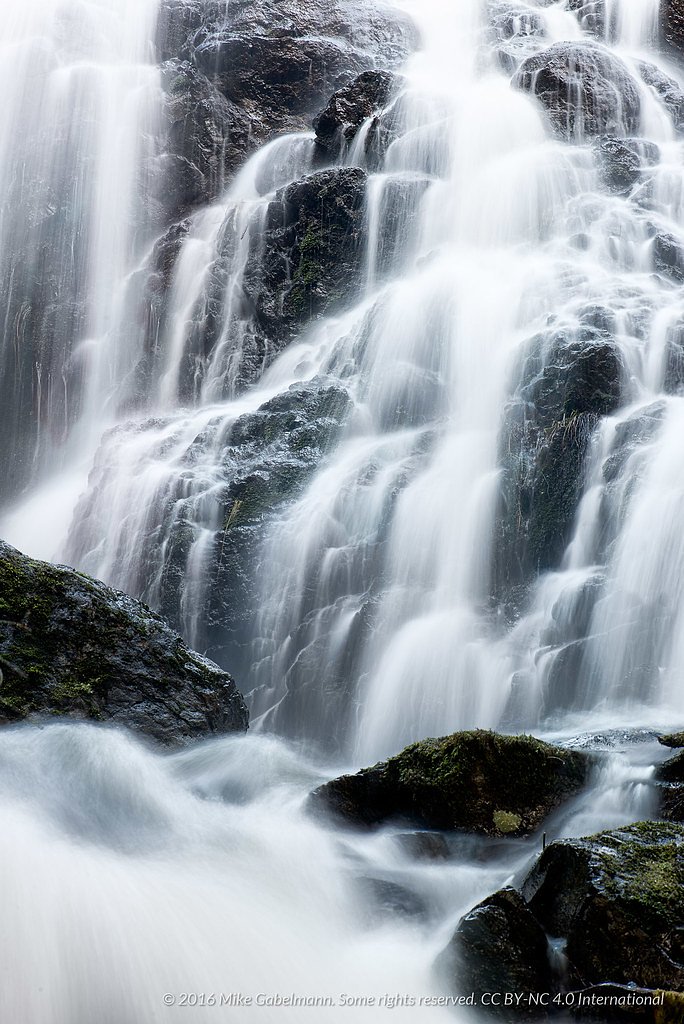
About West Leech Falls
West Leech Falls is a little-documented coastal/forested waterfall located near the western Olympic Peninsula coast (coordinates provided: 48.5095, -123.8126). The falls appear to be on or near a small tributary/creek and are relatively remote. Public trip reports and major trail databases provide limited information; access likely involves forest or logging roads followed by an unmaintained trail or bushwhack. Visitors should expect a natural, undeveloped site rather than a formal park facility. Ownership of access routes may include National Forest land and/or adjacent private lands, confirm current access before visiting.
The Setting
West Leech Falls sits at 484 metres within Greater Victoria Water Supply Area, in the hills of British Columbia.
Why This Waterfall Exists
West Leech Falls flows over Leech River Complex, a metamorphic volcanic rock layer deposited about 66-201 million years ago. Over time, the stream has worn through these layers at different rates, creating the step that forms the waterfall.
Nearby Falls Worth Visiting
Mary Vine Falls (21 m) lies 10.0 kilometres to the southeast.
Trail & Hike Details
Trail Description
There is little to no reliable, maintained trail information for West Leech Falls in major trail guides. Access appears to require travel on unpaved forest or logging roads followed by an unmarked footpath or off-trail scramble through coastal forest. Expect roots, brush, wet/muddy ground, and potentially steep sections near the creek. Navigation tools (GPS with the provided coordinates, paper topo map, compass) and route-finding experience are recommended.
What to Expect
A remote, natural waterfall setting without facilities (no restrooms, signage, or developed viewpoints). Terrain will typically be coastal temperate rainforest: mossy logs, ferns, steep creek banks, and slippery rock. Water flow may be seasonal, higher in late fall through spring and lower in late summer. Cellular coverage may be limited or absent. Wildlife typical of the northwest coastal forests (deer, small mammals, birds) may be present; black bears and cougars are possible in the region.
Accessibility
Not accessible for wheelchairs or those needing improved trails or handrails. Access likely involves uneven, steep, or muddy terrain and may require scrambling.
Frequently Asked Questions
🐶 Are Dogs Allowed at West Leech Falls?
❌ Dogs are not allowed
Are There Any Fees or Permits Required?
🆖 No fees required
🏊 Is There Swimming at West Leech Falls?
❌ Swimming is not allowed
When to Visit
Late spring through early summer or after rainy periods for stronger flow. Summer may offer easier road and trail conditions but lower flows. Avoid peak winter storms which can make forest roads impassable and increase hazards.
Seasonal Access
The best time to visit is Spring, Summer, and Fall. Winter access may be limited. Check with the managing park or local authority for current conditions.
Safety Information
Visitors should be prepared for slippery rock, steep or unstable creek banks, and sudden changes in water flow. Cell service may be limited, carry navigation and emergency equipment. Watch for logging or gated roads and respect private property. If traveling alone, tell someone your route and expected return time. In winter and storm seasons, forest roads may be impassable and conditions hazardous. Be bear-aware and follow local wildlife safety practices.
Current Water Conditions
0.0 m³/s
Current discharge — how much water is flowing
About average for this time of year
Based on 29 years of record
0.30 m
Water depth at gauge
7-Day Discharge Trend
What does this mean for your visit?
Flow is about average for this time of year.
About This Gauge
This gauge is on a nearby waterway and may not reflect exact conditions at the falls.
7-Day Flow Outlook
Based on the WSC gauge GARBAGE CREEK NEAR THE MOUTH (23 km away).
Today
Moderate
0.0 m³/s
6/10Tomorrow
Moderate
0.0 m³/s
6/10Tue
Moderate
0.0 m³/s
6/10Wed
Moderate
0.0 m³/s
6/10Thu
Moderate
0.0 m³/s
6/10Fri
Moderate
0.0 m³/s
6/10Sat
Moderate
0.0 m³/s
6/10Best window: Today — moderate flow, cloudy (trip score 6/10).
Best time of year: this gauge typically runs highest from mid November to early December, peaking in January.
How we calculate this
This is a transparent outlook, not a precise forecast. We take the waterfall's current flow strength (how it ranks against its historical normal for today, from the nearest WSC stream gauge), carry that ranking forward along the gauge's seasonal curve, and nudge it for forecast rain. Confidence is highest for the next day or two and falls further out. Always check official conditions and your own judgment before visiting — high flows can be dangerous.
Know when to go.
Get a free email alert when waterfalls near Victoria hit peak flow. We only send when conditions are worth the trip — no weekly newsletters, no spam.
Weather Forecast
Location & Access
Getting There
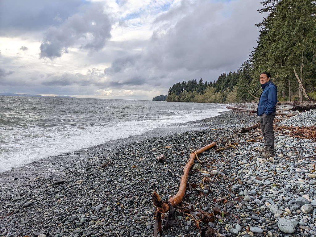
Coordinates place the falls on the northwestern portion of the Olympic Peninsula, within driving distance of Sekiu and Clallam Bay and across the Strait of Juan de Fuca from Victoria. Reaching the site likely requires driving on secondary/forest roads and then hiking. Road conditions may be rough; a high-clearance vehicle may be useful. There is limited published or maintained trail information; expect navigation via GPS and topographic maps and possible bushwhack from the nearest drivable access point.
Get Directions on Google MapsParking
No official parking lot is documented. Parking may be available on a widened shoulder or at an informal pullout on a forest/secondary road; visitors should avoid blocking gates or driveways and be prepared for limited space. If a gated or private road is encountered, verify access permissions before parking.
Elevation
484 metres above sea level
Coordinates
48.509514° N, -123.812575° W
Land Management
Managed by Capital Region District
Visitor Tips & Gear
• Confirm access and road conditions before you go, some access roads in the area may be gated, rough, or seasonally closed. • Use the provided coordinates and a topo map/GPS; do not rely solely on phone maps if coverage is poor. • Wear sturdy, grippy footwear for wet, slippery rock and muddy trails. • Expect minimal signage and no formal viewpoint; maintain a safe distance from cliff edges and unstable banks. • Leave no trace: pack out all trash and avoid creating new trails. • If unsure about private property boundaries, seek local information (county or forest service) before crossing private land.
Where to Stay
Browse vacation cabins and private rentals nearby
Unique outdoor stays — tents, yurts, and treehouses
Rent a campervan or RV for your waterfall road trip
Some links are affiliate links. We may earn a commission at no extra cost to you.
Nearby Campground
Sunny Daze Campground
13.9 km away
Nearby Hot Springs
Hot springs near Victoria, British Columbia

Sol Duc Hot Springs
Sol Duc Hot Springs flows at 122 degrees Fahrenheit in Olympic National Park with permanently protected Class 1 status under Na...

Olympic Hot Springs
Olympic Hot Springs flows at 118 degrees within Olympic National Park at 2,000 feet elevation, emerging 72 degrees above ambien...
Looking for a soak after your hike? Explore more hot springs near Victoria, British Columbia on SoakingSprings.
Explore British Columbia springsAdditional Information
Nearby Attractions
Nearby points of interest in the broader region may include Sekiu and Clallam Bay communities, the Strait of Juan de Fuca coastline, and coastal viewpoints. Cape Flattery, Neah Bay, and portions of the Olympic National Park coastline are within driving distance of the general area (verify exact distances and routes).
Wildlife
Typical coastal Olympic Peninsula fauna: black-tailed deer, black bear, cougars (rare), raccoons, small mammals, and many coastal/forest bird species. Insect hazards (mosquitoes, ticks) may be seasonal. Use standard outdoor wildlife precautions.
Cities near West Leech Falls
Nearby Waterfalls
Writing about West Leech Falls? Embed this waterfall on your site for free.