Photo Credits (2)
Difficulty
Easy
Trail Length
2.9 km
Trail Type
Out And Back
Elevation Gain
13 m
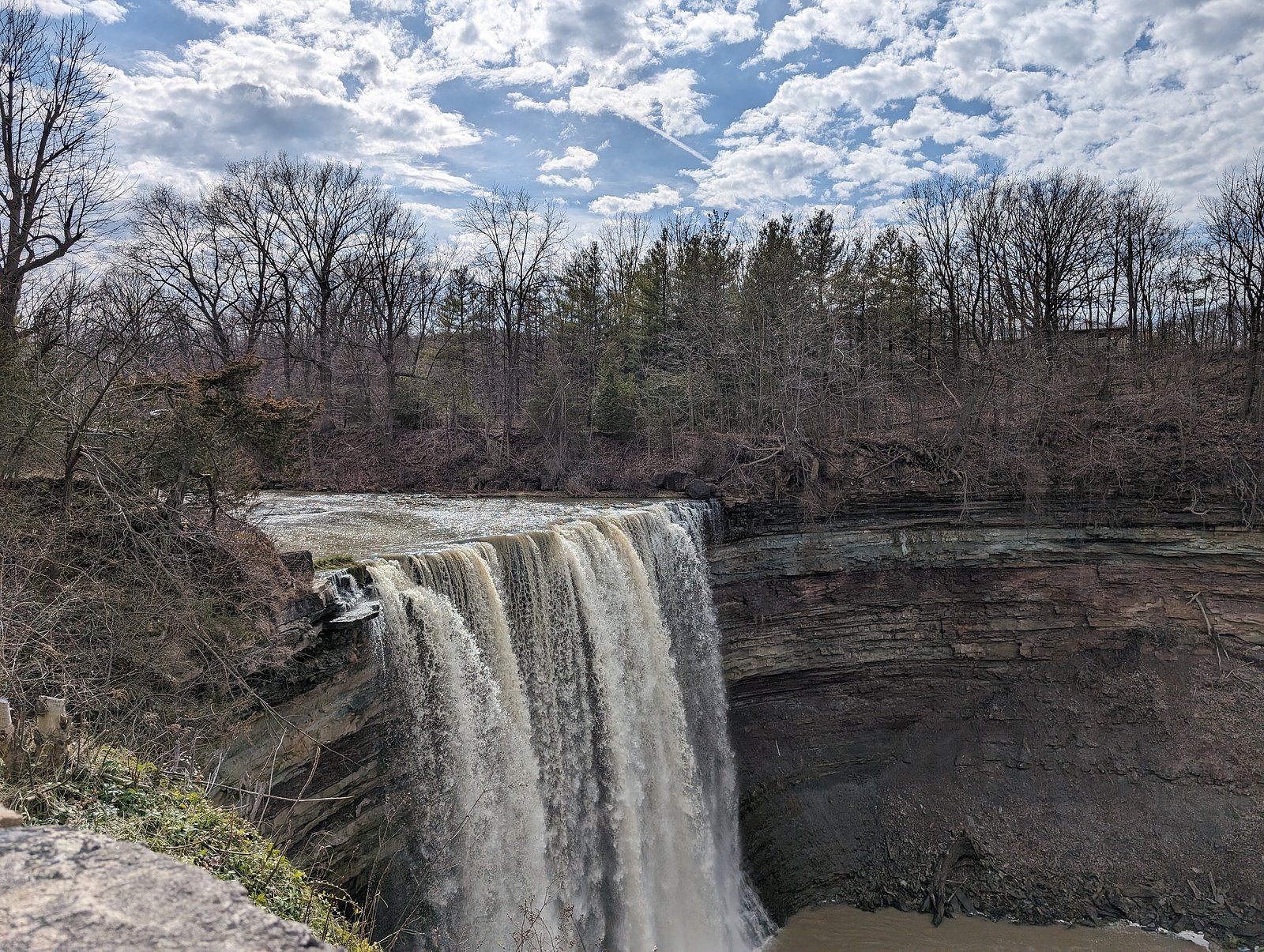
About Konkle Falls
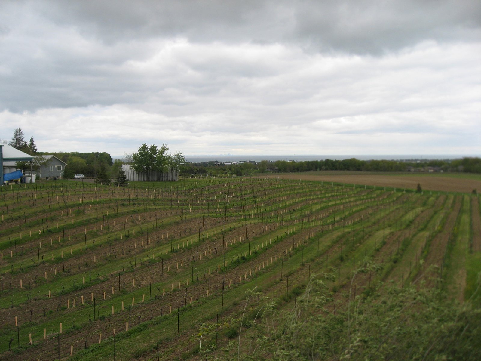
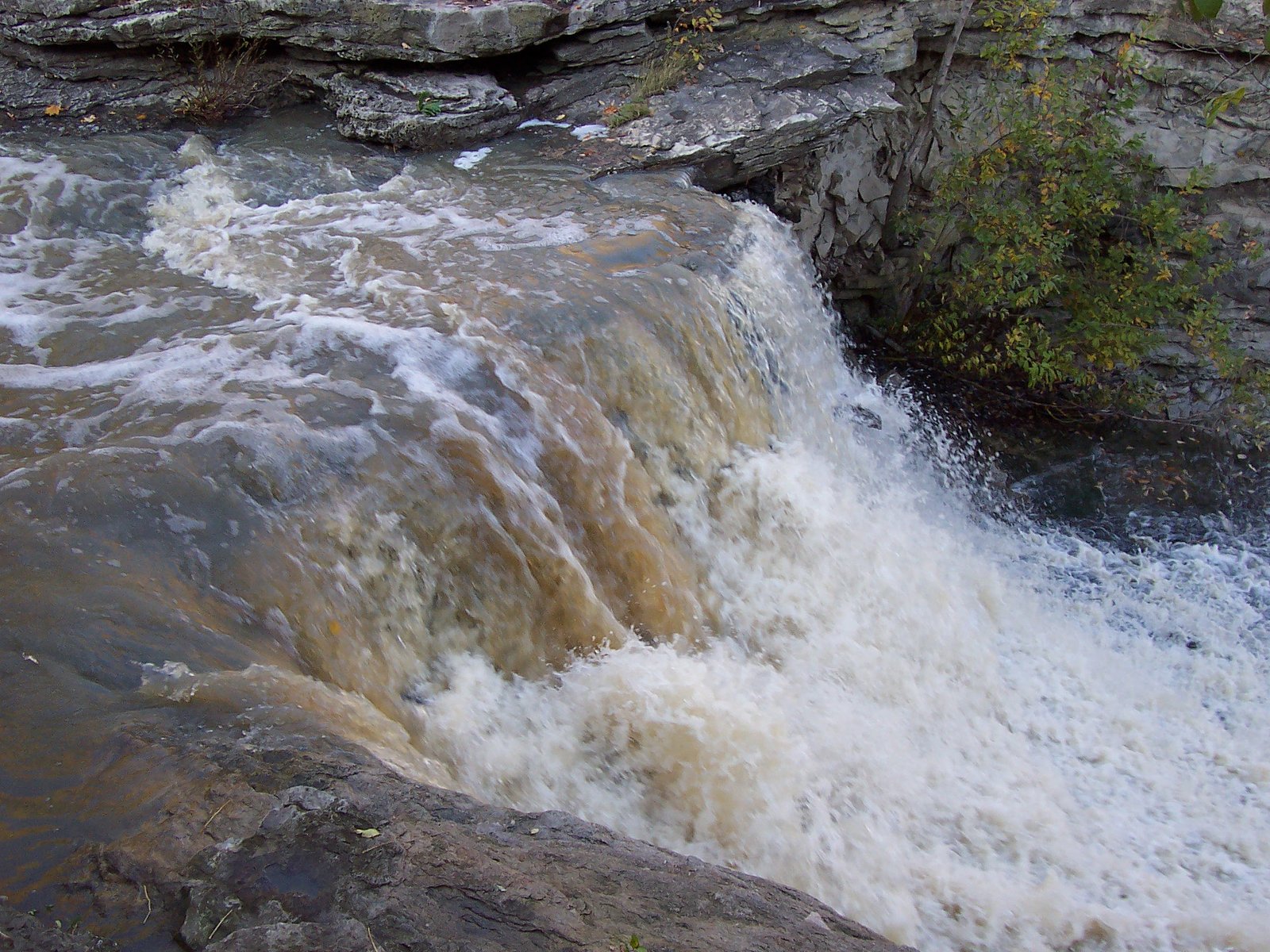
Konkle Falls (sometimes written Konkle's Falls) is a small, local cascade in the Niagara/Hamilton region of southern Ontario at approximately 43.1532, -79.4907. It is often described by visitors as a quiet, wooded roadside/gorge waterfall rather than a large tourist attraction. Flow and appearance can vary seasonally (higher in spring and after heavy rain). Access typically involves a short walk from a nearby road or small parking area and may pass through uneven or rocky terrain.
Nearby Falls Worth Visiting
Lower Ball's Falls (27 m) lies 8.9 kilometres to the east. Also nearby: Beamer's Falls (14 m, 7.6 km) and Thirty Road Falls (8 m, 2.4 km).
Trail & Hike Details
The Approach
The easy 2.9-km out-and-back trail gains 13 metres of elevation on the way to the falls.
Trail Description
Trail access to Konkle Falls is typically a short, informal walk from a nearby parking/pullout. The route may descend into a small gorge and include uneven, rocky footing, roots, and possible short sections of loose stone. Trails at small local falls in this region are often unpaved and not heavily maintained; there may be informal viewpoints rather than constructed platforms.
What to Expect
A modest, scenic cascade in a wooded setting, quieter and far smaller than major regional attractions like Niagara Falls. Expect variable water flow (high in spring/rainy periods, lower in late summer/dry spells). Terrain to the falls is likely rocky and uneven; there may be viewpoints from the rim and possibly near-stream access in places where footing allows. Facilities (restrooms, trash cans, signage) may be minimal or absent.
Accessibility
The trail is not wheelchair accessible. Uneven terrain and elevation changes require steady footing.
Frequently Asked Questions
🐶 Are Dogs Allowed at Konkle Falls?
❌ Dogs are not allowed
Are There Any Fees or Permits Required?
🆖 No fees required
🏊 Is There Swimming at Konkle Falls?
❌ Swimming is not allowed
When to Visit
Spring for the strongest flow; early morning or weekdays for the fewest visitors; fall for foliage. Avoid periods immediately after heavy rain if you are uncomfortable with slippery/muddy trails.
Seasonal Access
The best time to visit is Spring, Summer, Fall, and Winter. Check with the managing park or local authority for current conditions.
Safety Information
Hazards may include slippery rocks and edges, steep or unstable cliff sections, loose stone, sudden changes in stream flow after heavy rain, winter ice, limited cell service, and ticks. Stay on established paths, keep a safe distance from the edge, avoid climbing on wet rocks, and supervise children closely. Check local conditions before visiting and tell someone your plans if exploring remote areas.
Current Water Conditions
0.1 m³/s
Current discharge — how much water is flowing
About average for this time of year
Based on 34 years of record
2.96 m
Water depth at gauge
7-Day Discharge Trend
What does this mean for your visit?
Flow is about average for this time of year.
About This Gauge
7-Day Flow Outlook
Based on the WSC gauge TWENTY MILE CREEK ABOVE SMITHVILLE (7 km away).
Today
Moderate
0.1 m³/s
8/10Tomorrow
Moderate
0.1 m³/s
8/10Tue
Moderate
0.1 m³/s
6/10Wed
Moderate
0.3 m³/s
6/10Thu
Moderate
0.2 m³/s
8/10Fri
Moderate
0.2 m³/s
6/10Sat
Moderate
0.1 m³/s
6/10Best window: Today — moderate flow, cloudy (trip score 8/10).
Best time of year: this gauge typically runs highest from mid February to mid April, peaking in April.
How we calculate this
This is a transparent outlook, not a precise forecast. We take the waterfall's current flow strength (how it ranks against its historical normal for today, from the nearest WSC stream gauge), carry that ranking forward along the gauge's seasonal curve, and nudge it for forecast rain. Confidence is highest for the next day or two and falls further out. Always check official conditions and your own judgment before visiting — high flows can be dangerous.
Know when to go.
Get a free email alert when waterfalls near Hamilton hit peak flow. We only send when conditions are worth the trip — no weekly newsletters, no spam.
Weather Forecast
Location & Access
Getting There
Located in the Niagara/Hamilton region of southern Ontario (GPS: 43.1532, -79.4907). The falls are roughly 20–23 miles from nearby reference cities (Niagara University ~20.1 mi, Hamilton ~20.5 mi, Niagara Falls ~23.1 mi). Expect local rural/conservation-area roads; final access is usually from a small pullout or conservation-area parking and a short walk. Confirm exact public access points and any parking restrictions with the local conservation authority or municipal maps before you go.
Get Directions on Google MapsParking
Parking is likely limited to a small roadside pullout or a small parking area near the trailhead. Visitors report limited formal parking; avoid blocking driveways or gates. If unsure, park legally at a marked lot and walk in.
Elevation
169 metres above sea level
Coordinates
43.153236° N, -79.490738° W
Visitor Tips & Gear
• Wear sturdy, grippy footwear, rocks near falls are slippery. • Check recent trip reports or local conservation authority pages for access updates and parking notes. • Do not climb on wet rocks or venture close to the edge of cliffs. • Respect private property and posted signs; some access routes to smaller falls use land adjacent to private parcels. • Bring insect repellent in warmer months (ticks can be present). • Pack out what you bring in; there may be no trash facilities.
As an Amazon Associate, we earn from qualifying purchases.
This easy 2.9 km hike is straightforward — comfortable trail shoes and plenty of water should do. Icy conditions are common in winter — traction cleats are a smart addition.

Columbia Watertight II Rain Jacket
Packs into its own pocket, seam-sealed, and keeps you dry from spray and surprise rain.

Polarized Sunglasses (Knockaround)
Cuts glare off the water so you actually see the falls — and your photos turn out better too.

Earth Pak Waterproof Dry Bag
Keeps your phone and gear dry when waterfall mist soaks everything else.

Waterproof Phone Pouch (AiRunTech)
Cheap insurance — take photos right next to the falls without killing your phone.

Kahtoola MICROspikes
Cult-favorite traction cleats that grip ice and wet rock — essential for winter waterfall hikes.

JOBY GorillaPod Starter Kit
Wraps around railings and rocks for long-exposure waterfall shots — no flat surface needed.
Where to Stay
Browse vacation cabins and private rentals nearby
Unique outdoor stays — tents, yurts, and treehouses
Rent a campervan or RV for your waterfall road trip
Some links are affiliate links. We may earn a commission at no extra cost to you.
Nearby Campground
Cave Springs Camp
3.9 km away
Additional Information
Nearby Attractions
Major nearby attractions include Niagara Falls (~23 miles) and the waterfalls and conservation areas in the Hamilton/Dundas region (~20–21 miles depending on exact location). Local conservation areas, scenic drives, and small community parks are common in the region.
Wildlife
Typical southern Ontario wildlife, white-tailed deer, raccoons, various songbirds and waterfowl, small mammals. Be aware of ticks (Lyme disease risk in some areas) and use precautions in brushy or grassy sections.
Cities near Konkle Falls
Nearby Waterfalls

Writing about Konkle Falls? Embed this waterfall on your site for free.