Cheakamus River Waterfalls
By Armen Suny · Last verified Jun 2026
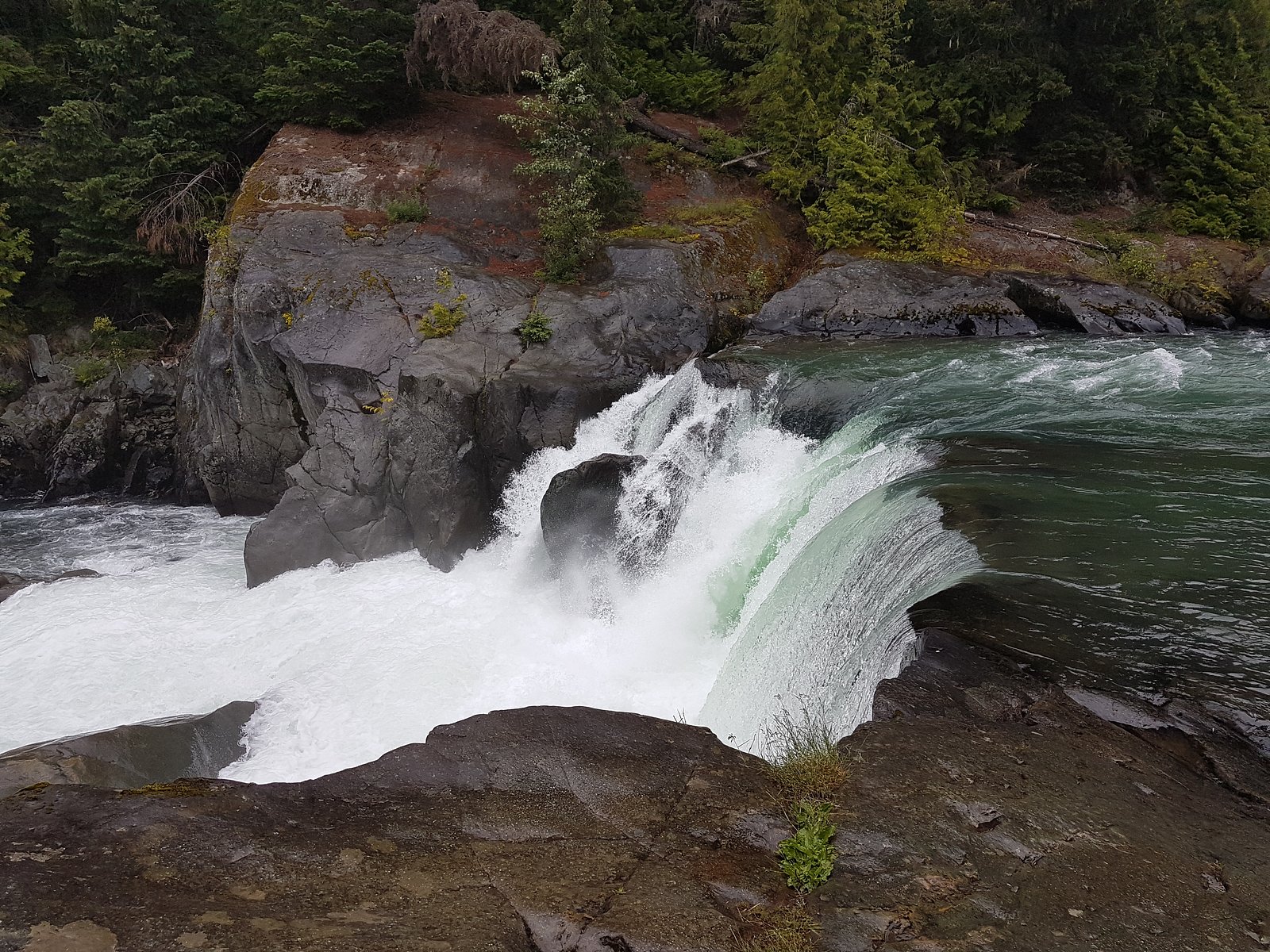
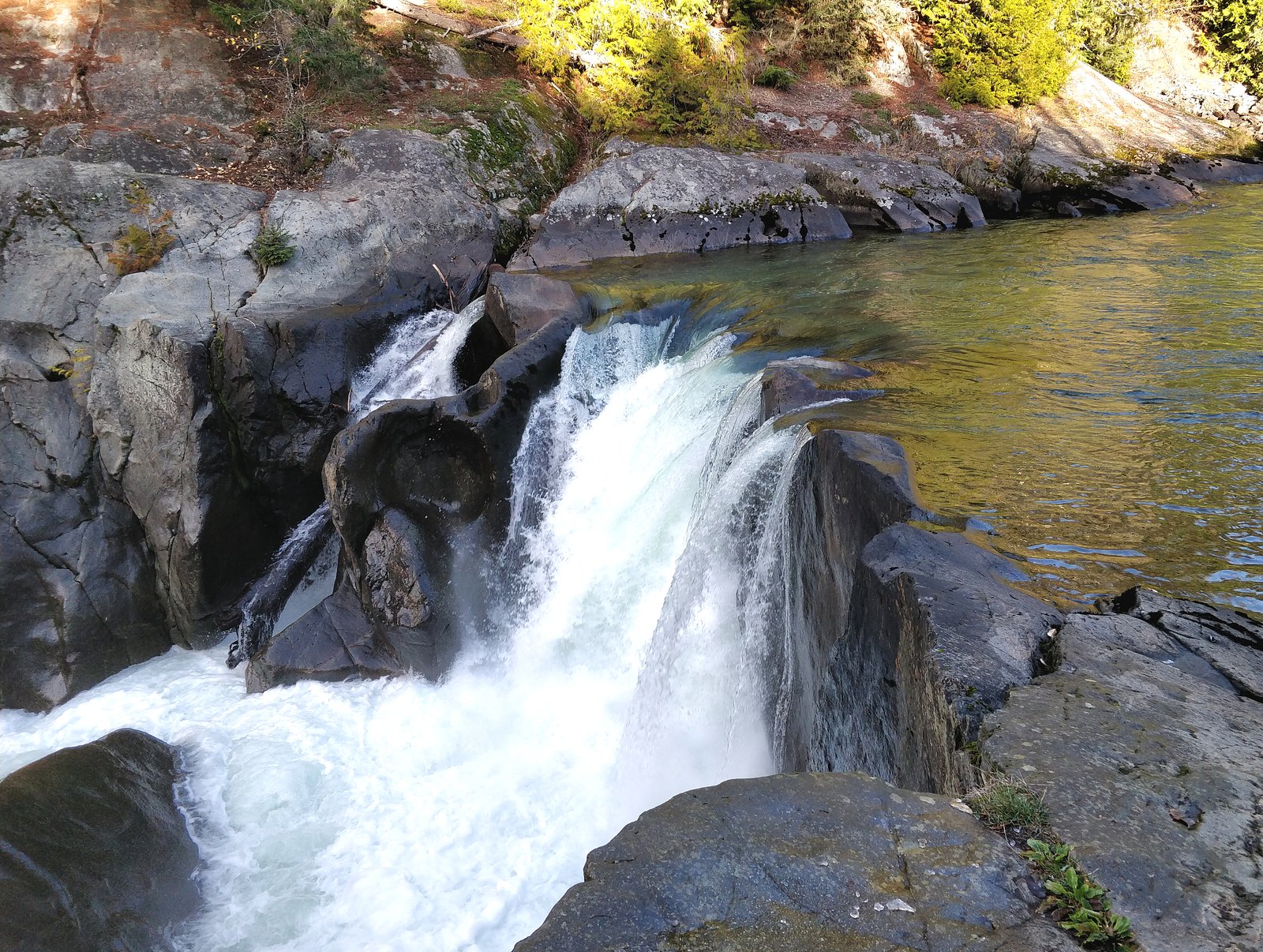
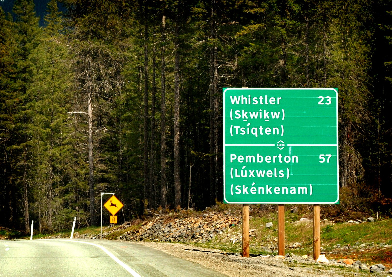
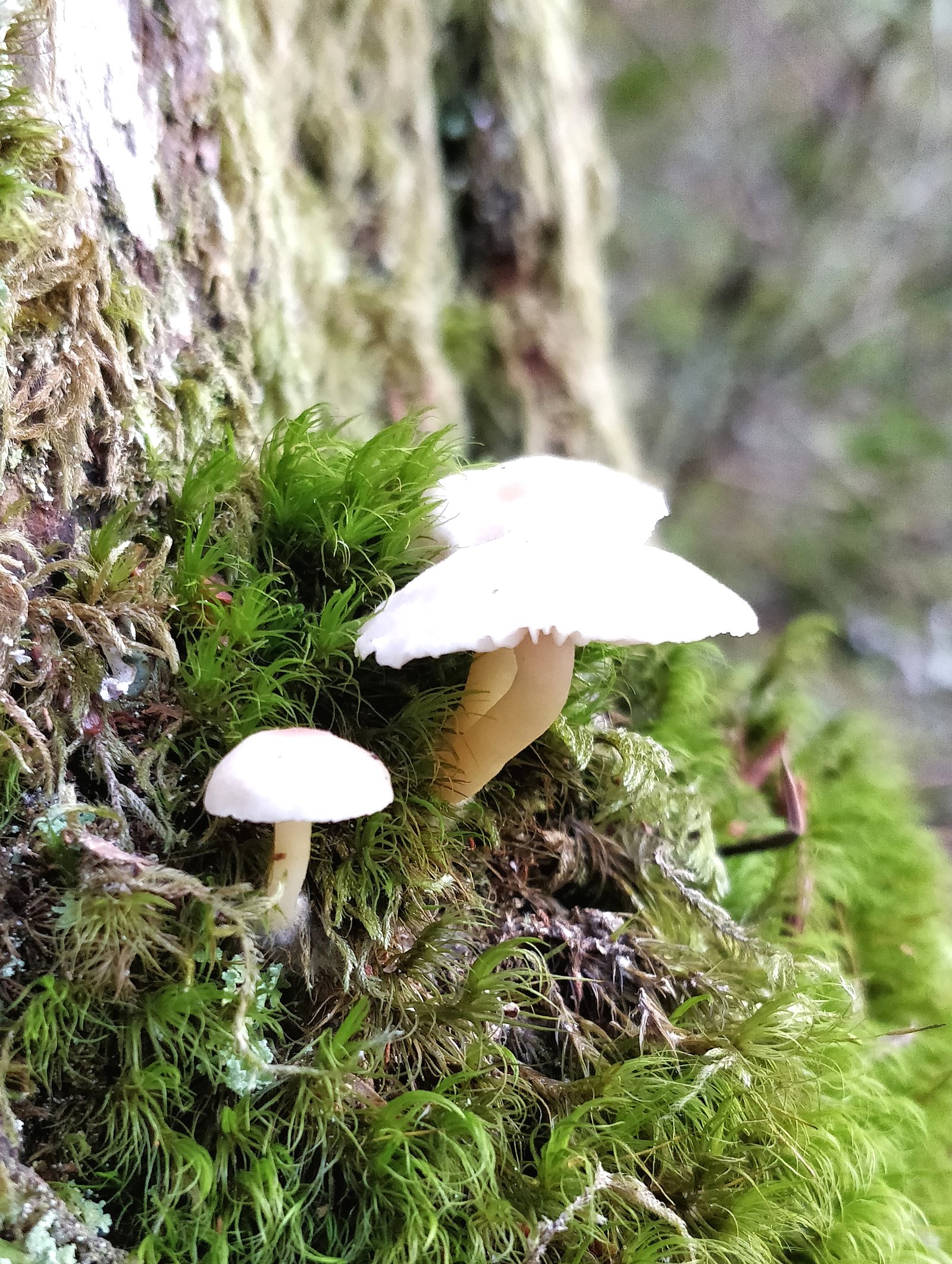
Photo Credits (5)
Difficulty
Easy
Trail Length
2.4 km
Trail Type
Loop
Elevation Gain
30 m
About Cheakamus River Waterfalls
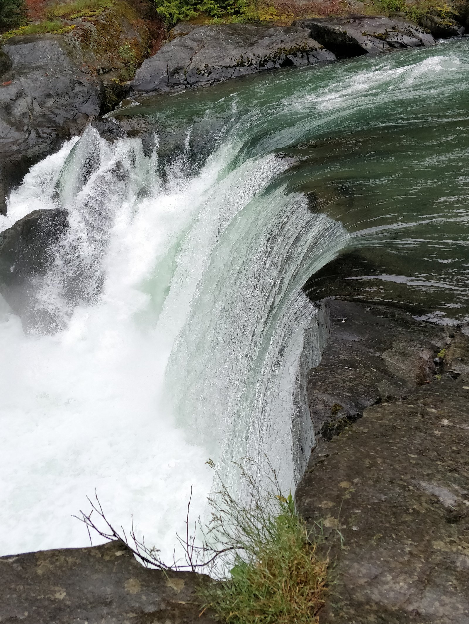
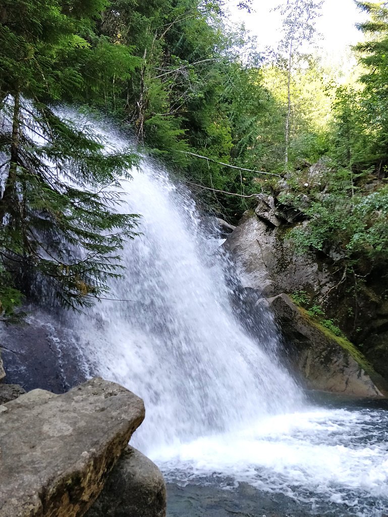
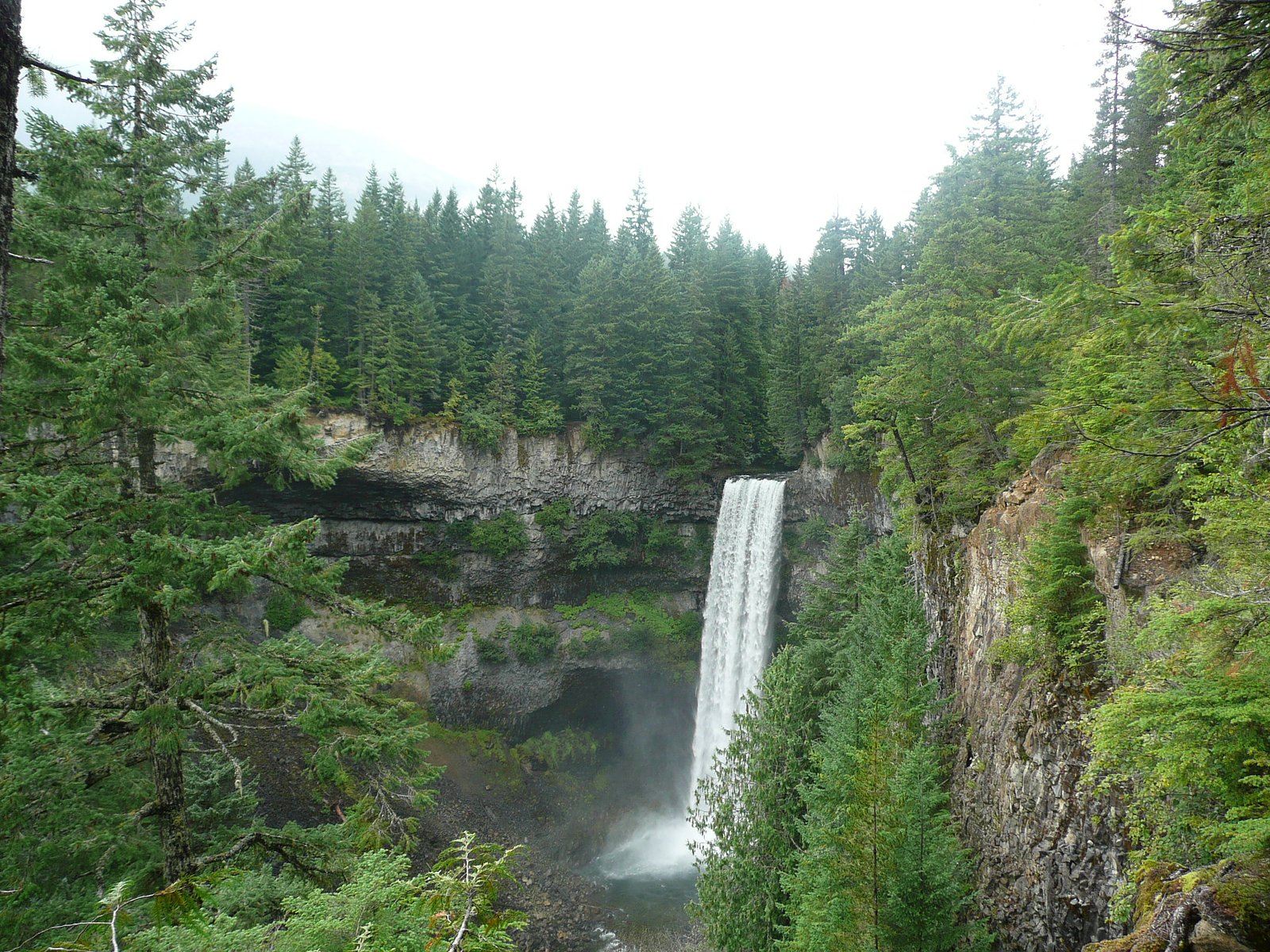
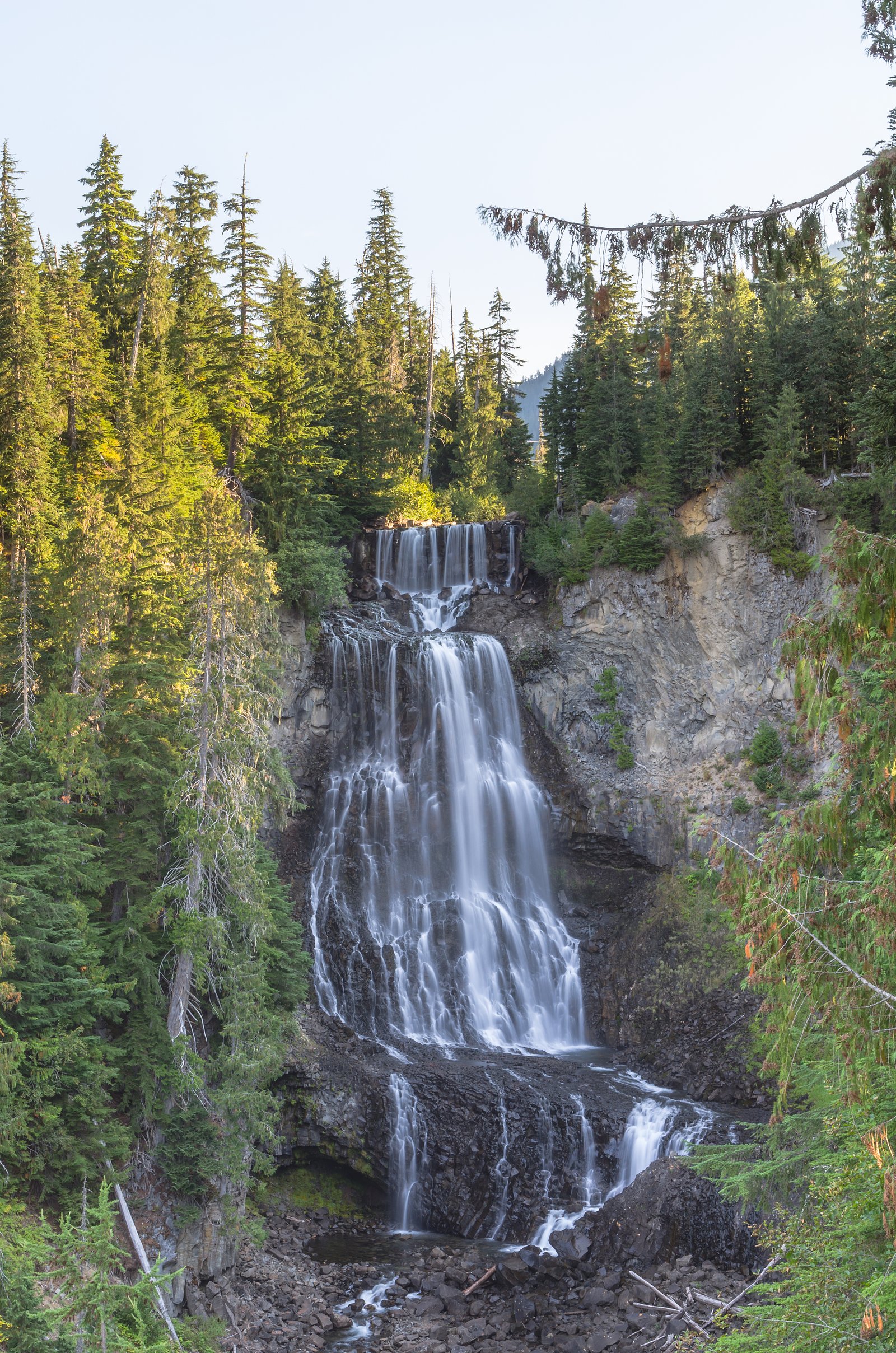
Cheakamus River waterfalls (general name for cascades and falls along the Cheakamus River corridor) are a series of forested river cascades and larger drops located on the Cheakamus River watershed in southwestern British Columbia. The falls at the provided coordinates (50.0842, -123.0491) sit in a rugged, forested river canyon. Access and infrastructure vary by site, some cascades are visible from short roadside pullouts while others require travel on logging/forest service roads and rough trails. Visitor reports often note dense coastal temperate rainforest, steep canyon walls, and strong river currents. Exact height and formal name for the specific fall at these coordinates are not confirmed and may be listed under local/indigenous place names or as an unnamed cascade.
Why This Waterfall Exists
Cheakamus River Waterfalls flows over hard intrusive rock laid down about 145-162 million years ago. These resistant rocks form a durable ledge that water cannot easily wear away, creating the falls where softer material downstream has already eroded.
Nearby Falls Worth Visiting
Brandywine falls (70 m) lies 7.4 kilometres to the southwest. Also nearby: Alexander Falls (43 m, 8.0 km) and Rainbow Falls (29 m, 6.6 km).
Trail & Hike Details
The Approach
The easy 2.4-km loop trail gains 30 metres of elevation on the way to the falls.
Trail Description
Trail infrastructure at Cheakamus River waterfalls is highly variable. Some cascades along the river are visible from short, maintained viewpoints or short boardwalks in provincial parks; other falls require travel over rough, unmaintained forest trails, steep scrambles, or along riverbanks. Expect roots, mud, rocky steps, and possibly steep dropoffs near viewpoints. Trails may be unmarked in places; carry a map, GPS, or downloaded offline directions and be prepared for navigation in forested terrain.
What to Expect
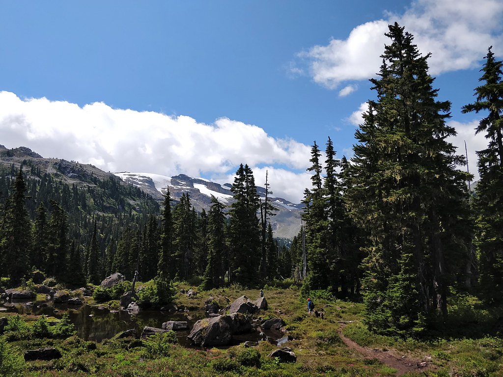
Expect dense coastal temperate rainforest, moss-covered rocks, steep canyon edges, and fast-flowing water. Water flow is highest in spring (snowmelt) and after heavy rains. Rocks near the river and cliff edges are slippery; there are limited facilities (no toilets, no potable water) at many non‑park locations. Cell coverage may be poor. Wildlife in the area can include black bear, cougar, deer, waterfowl, and fish runs in season. Roads and trails may be closed or in poor condition after storms or during winter snow.
Accessibility
The trail is not wheelchair accessible. Uneven terrain and elevation changes require steady footing.
Frequently Asked Questions
🐶 Are Dogs Allowed at Cheakamus River Waterfalls?
❌ Dogs are not allowed
Are There Any Fees or Permits Required?
🆖 No fees required
🏊 Is There Swimming at Cheakamus River Waterfalls?
❌ Swimming is not allowed
When to Visit
Late spring (peak snowmelt) for highest flows and dramatic waterfalls; early summer for accessible trails and strong flows; fall can offer lower flows and good foliage colors. Winter visits are possible but may involve snow, icy conditions, and restricted road access, exercise caution and check road/closure reports.
Seasonal Access
The best time to visit is Spring, Summer, Fall, and Winter. Check with the managing park or local authority for current conditions.
Safety Information
Hazards include very slippery rocks, steep dropoffs, fast and cold river currents, hypothermia risk, poor cell coverage, and changing weather. Riverbanks and trails may be unstable; do not approach cliff edges. Seasonal logging, road washouts, and gates may restrict access. Always tell someone your itinerary and expected return time. For river activities, use appropriate personal flotation devices and local guidance.
Current Water Conditions
31.9 m³/s
Current discharge — how much water is flowing
Much lower than usual for this time of year
Based on 43 years of record
2.43 m
Water depth at gauge
7-Day Discharge Trend
What does this mean for your visit?
Flow is well below normal for this time of year, so the waterfall may be a trickle.
About This Gauge
7-Day Flow Outlook
Based on the WSC gauge CHEAKAMUS RIVER ABOVE MILLAR CREEK (1 km away).
Today
Barely Flowing
32 m³/s
4/10Tomorrow
Barely Flowing
33 m³/s
4/10Tue
Barely Flowing
34 m³/s
4/10Wed
Barely Flowing
36 m³/s
4/10Thu
Barely Flowing
34 m³/s
4/10Fri
Barely Flowing
36 m³/s
3/10Sat
Low
36 m³/s
4/10Best window: Today — barely flowing flow, cloudy (trip score 4/10).
Best time of year: this gauge typically runs highest from late May to late August, peaking in July.
How we calculate this
This is a transparent outlook, not a precise forecast. We take the waterfall's current flow strength (how it ranks against its historical normal for today, from the nearest WSC stream gauge), carry that ranking forward along the gauge's seasonal curve, and nudge it for forecast rain. Confidence is highest for the next day or two and falls further out. Always check official conditions and your own judgment before visiting — high flows can be dangerous.
Know when to go.
Get a free email alert when waterfalls near Lillooet hit peak flow. We only send when conditions are worth the trip — no weekly newsletters, no spam.
Weather Forecast
Location & Access
Getting There
The site is in the Cheakamus River watershed in southwestern British Columbia. Access commonly involves traveling on provincial highways and then onto local or forest service/logging roads; some points are closest via roads off the Sea-to-Sky corridor (Highway 99) between Squamish and Whistler. The provided location is roughly 76.5 miles (by road) from Lillooet per the user note; confirm driving directions with up‑to‑date maps and local authorities before traveling. Some access routes may be gated, seasonal, or require a high-clearance vehicle.
Get Directions on Google MapsParking
Parking conditions vary from marked provincial/park lots at established viewpoints to informal roadside pullouts or small gravel turnouts. There may be no formal parking at the exact coordinates; expect limited, rough parking and no services. Do not block gates or private driveways.
Elevation
609 metres above sea level
Coordinates
50.084163° N, -123.049084° W
Visitor Tips & Gear
• Check current road and trail conditions with local park/forest authorities before you go. • Use a high-clearance vehicle if accessing forest service/logging roads; expect gravel and potholes. • Wear sturdy, waterproof footwear and expect muddy, slippery sections. • Stay well back from cliff edges and fast water, river currents are powerful. • Pack out all waste and follow Leave No Trace. • Carry bear spray where appropriate and know how to use it. • If unsure about land ownership, do not trespass, some access routes cross private land or active logging areas. • Bring a physical map or download offline maps; don't rely solely on cell service.
As an Amazon Associate, we earn from qualifying purchases.
This easy 2.4 km hike is straightforward — comfortable trail shoes and plenty of water should do. Icy conditions are common in winter — traction cleats are a smart addition.

Columbia Watertight II Rain Jacket
Packs into its own pocket, seam-sealed, and keeps you dry from spray and surprise rain.

Polarized Sunglasses (Knockaround)
Cuts glare off the water so you actually see the falls — and your photos turn out better too.

Earth Pak Waterproof Dry Bag
Keeps your phone and gear dry when waterfall mist soaks everything else.

Waterproof Phone Pouch (AiRunTech)
Cheap insurance — take photos right next to the falls without killing your phone.

Kahtoola MICROspikes
Cult-favorite traction cleats that grip ice and wet rock — essential for winter waterfall hikes.

JOBY GorillaPod Starter Kit
Wraps around railings and rocks for long-exposure waterfall shots — no flat surface needed.
Where to Stay
Browse vacation cabins and private rentals nearby
Unique outdoor stays — tents, yurts, and treehouses
Rent a campervan or RV for your waterfall road trip
Some links are affiliate links. We may earn a commission at no extra cost to you.
Nearby Campground
Cal Cheak North Camp
3.9 km away
Additional Information
Nearby Attractions
Depending on where along the Cheakamus River you visit, nearby attractions may include Brandywine Falls Provincial Park, Daisy Lake, Rainbow Falls, Whistler-area parks and trails, and access to broader Squamish–Whistler recreational areas. Confirm proximity for the exact coordinates before planning side trips.
Wildlife
Black bears, cougars (rare), deer, eagles, osprey, and seasonal salmon runs in parts of the watershed. Insects (including biting flies and mosquitoes) can be abundant in summer. Practice wildlife safety and keep a respectful distance.
Cities near Cheakamus River Waterfalls
Nearby Waterfalls
Writing about Cheakamus River Waterfalls? Embed this waterfall on your site for free.