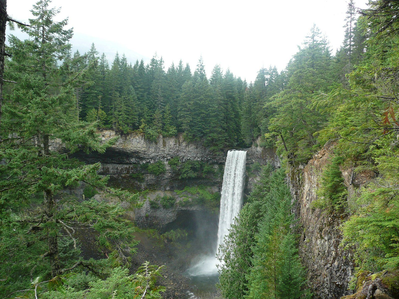
Callaghan Falls
By Armen Suny · Last verified Jun 2026
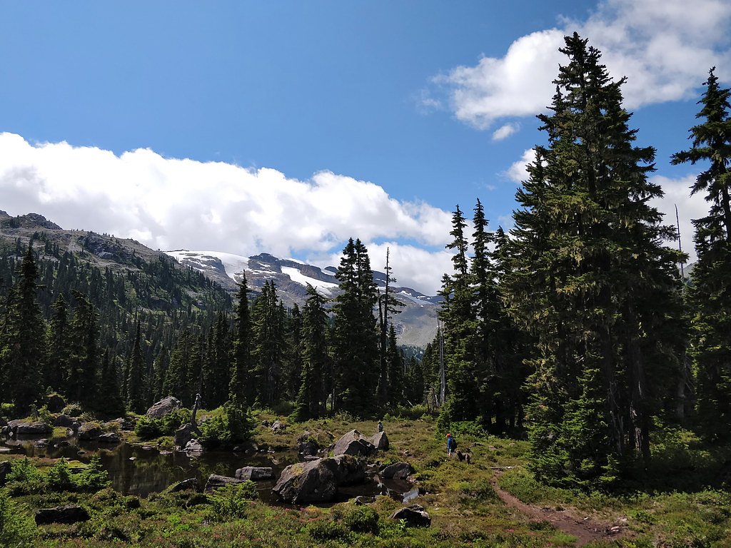
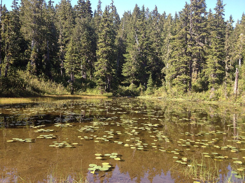
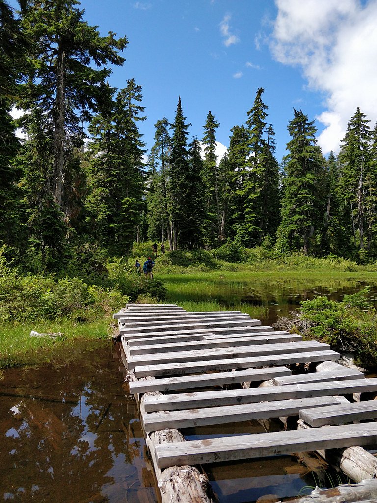
Photo Credits (5)
Difficulty
Moderate
Trail Length
0.6 km
Trail Type
Out And Back
Elevation Gain
42 m
About Callaghan Falls
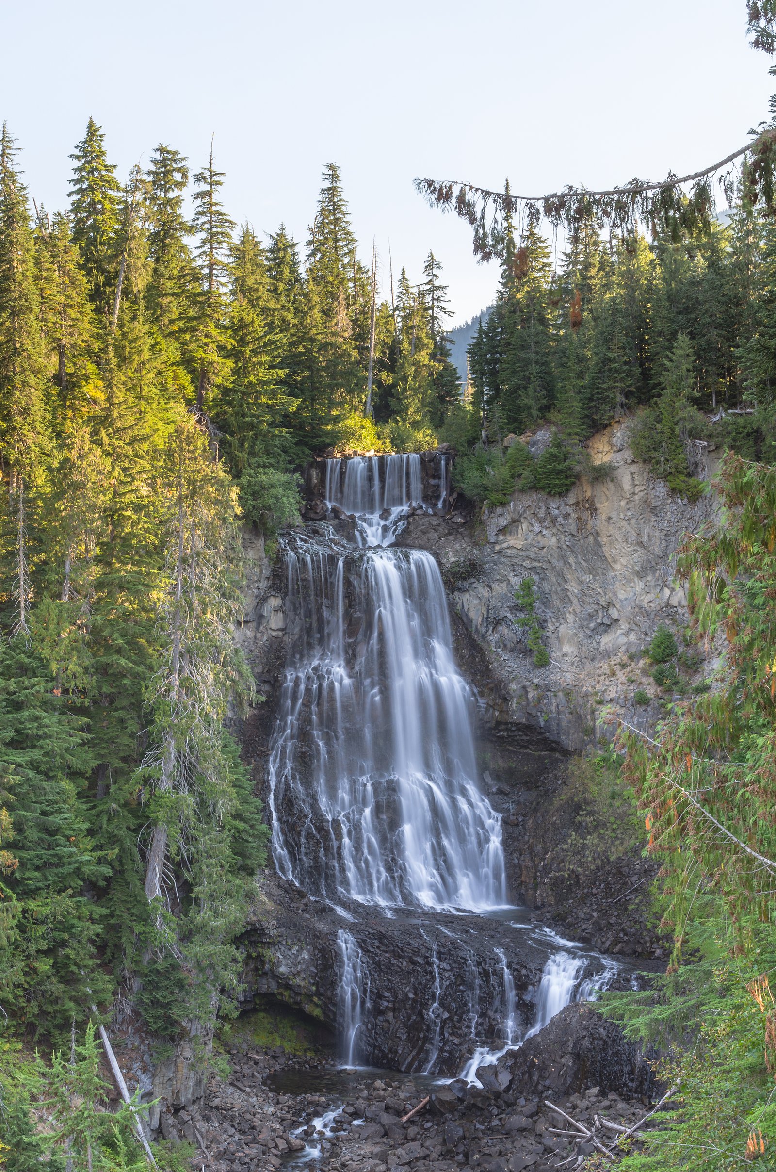
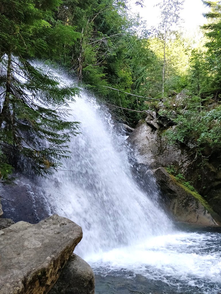
Callaghan Falls appears to be a small, relatively remote waterfall on watercourses in the Callaghan Valley area north of Vancouver / west of Whistler, British Columbia. Exact published information on the falls is limited; reports suggest a forested, mountainous setting with mossy rock and cascades rather than a single tall plunge. Access may require travel on secondary/forestry roads and a short hike or scramble from the road. Visitors should treat information below as conservative guidance and verify local conditions before traveling.
Why This Waterfall Exists
Callaghan Falls flows over hard volcanic rock laid down about 101-145 million years ago. These resistant rocks form a durable ledge that water cannot easily wear away, creating the falls where softer material downstream has already eroded.
Nearby Falls Worth Visiting
Brandywine falls (70 m) lies 5.5 kilometres to the south. Also nearby: Alexander Falls (43 m, 5.5 km) and Rainbow Falls (29 m, 10.5 km).
Trail & Hike Details
The Approach
The moderate 0.6-km out-and-back trail gains 42 metres of elevation on the way to the falls.
Trail Description
There is limited formal trail documentation for Callaghan Falls. Reaching the falls may involve driving on secondary/forestry roads and then hiking or scrambling cross-country through forest and talus. Expect unmarked routes, potential bushwhack sections, and variable footing; groups with route-finding experience and topographic maps/GPS are best prepared. If a short marked trail exists, it is not widely documented in major trail databases.
What to Expect
A forested mountain environment with streams, cascades, wet rock, and likely moss-covered banks. Water flow will be highest in spring snowmelt and after heavy rain; summer flows may be reduced. Remote feel with limited or no facilities (toilets, trash receptacles). Cell service may be intermittent or absent. Seasonal conditions: snow and ice at higher elevations in late fall–spring; muddy or washboarded forestry roads after rain.
Accessibility
The trail is not wheelchair accessible. Uneven terrain and elevation changes require steady footing.
Frequently Asked Questions
🐶 Are Dogs Allowed at Callaghan Falls?
❌ Dogs are not allowed
Are There Any Fees or Permits Required?
🆖 No fees required
🏊 Is There Swimming at Callaghan Falls?
❌ Swimming is not allowed
When to Visit
Late spring (snowmelt) for highest flows and accessible routes; summer for more reliable road access and drier conditions; early fall for fall colors and lower visitor density. Winter access may be difficult or require winter travel skills/equipment (snow, avalanche risk in some areas).
Seasonal Access
The best time to visit is Spring, Summer, Fall, and Winter. Check with the managing park or local authority for current conditions.
Safety Information
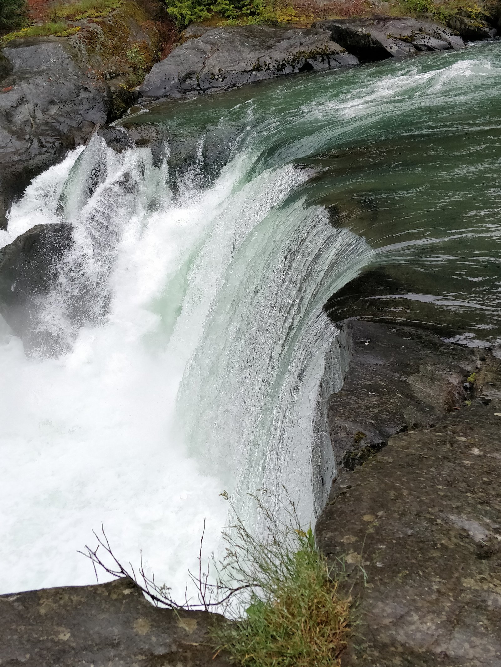
Hazards may include: slippery wet rock near the falls, fast or cold water currents, steep unstable terrain, limited cell service, unpredictable weather, and wildlife encounters. Forestry roads can be rough, gated, or seasonally closed; do not rely on roadside signs alone. Always tell someone your plans, carry navigation tools, and be prepared for self-rescue. During winter and shoulder seasons, avalanche risk or deep snow may make approach hazardous. Use conservative judgment and local advisories.
Current Water Conditions
31.9 m³/s
Current discharge — how much water is flowing
Much lower than usual for this time of year
Based on 43 years of record
2.43 m
Water depth at gauge
7-Day Discharge Trend
What does this mean for your visit?
Flow is well below normal for this time of year, so the waterfall may be a trickle.
About This Gauge
7-Day Flow Outlook
Based on the WSC gauge CHEAKAMUS RIVER ABOVE MILLAR CREEK (6 km away).
Today
Barely Flowing
32 m³/s
4/10Tomorrow
Barely Flowing
33 m³/s
4/10Tue
Barely Flowing
34 m³/s
4/10Wed
Barely Flowing
36 m³/s
4/10Thu
Barely Flowing
34 m³/s
4/10Fri
Barely Flowing
36 m³/s
3/10Sat
Low
36 m³/s
4/10Best window: Today — barely flowing flow, cloudy (trip score 4/10).
Best time of year: this gauge typically runs highest from late May to late August, peaking in July.
How we calculate this
This is a transparent outlook, not a precise forecast. We take the waterfall's current flow strength (how it ranks against its historical normal for today, from the nearest WSC stream gauge), carry that ranking forward along the gauge's seasonal curve, and nudge it for forecast rain. Confidence is highest for the next day or two and falls further out. Always check official conditions and your own judgment before visiting — high flows can be dangerous.
Weather Forecast
Location & Access
Getting There
General access: drive from Vancouver or Whistler toward the Callaghan Valley / Callaghan Lake area. From Highway 99, take the Callaghan Lake Road or other access roads toward Callaghan Valley (conditions and routings may vary). Final approach may use rough logging/forestry roads; high-clearance or 4x4 vehicles may be advisable. Exact trailhead coordinates and signed trail access for 'Callaghan Falls' are not documented in widely available official sources; land managers to check include BC Parks (Callaghan Lake Provincial Park) and local municipal/forest service offices.
Get Directions on Google MapsParking
Likely limited: small pullouts or informal parking at trailheads or road pullouts. No guaranteed developed parking lot or facilities. Use caution when parking on narrow forestry roads; follow local signage and avoid blocking gates or private driveways.
Elevation
613 metres above sea level
Coordinates
50.085549° N, -123.121204° W
Visitor Tips & Gear
• Verify road and trail conditions with BC Parks or local authorities before travel. • Use a map or GPS and carry a physical topo map; routes may be unmarked. • High-clearance vehicle recommended for forestry/secondary roads; watch for washouts and gates. • Bring bear spray and know how to store food; this is wildlife country. • Wear sturdy, waterproof footwear; wet slippery rocks near the falls are hazardous. • Pack out all garbage; there may be no facilities. • If uncertain about access or route, consider hiring a local guide or asking locally at Whistler information centers.
As an Amazon Associate, we earn from qualifying purchases.
With 0.6 km and 42 m of elevation gain, sturdy boots and trekking poles will help on this moderate trail. Icy conditions are common in winter — traction cleats are a smart addition.

Columbia Watertight II Rain Jacket
Packs into its own pocket, seam-sealed, and keeps you dry from spray and surprise rain.

Polarized Sunglasses (Knockaround)
Cuts glare off the water so you actually see the falls — and your photos turn out better too.

Earth Pak Waterproof Dry Bag
Keeps your phone and gear dry when waterfall mist soaks everything else.

Waterproof Phone Pouch (AiRunTech)
Cheap insurance — take photos right next to the falls without killing your phone.

Timberland Euro Sprint Mid Waterproof
Trusted waterproof boot with premium leather and grippy rubber sole — reliable on rocky, wet trails.

TrailBuddy Trekking Poles
Lightweight aluminum, cork grips, and flip-locks that actually hold — a best-seller for good reason.
Where to Stay
Browse vacation cabins and private rentals nearby
Unique outdoor stays — tents, yurts, and treehouses
Rent a campervan or RV for your waterfall road trip
Some links are affiliate links. We may earn a commission at no extra cost to you.
Nearby Campground
Cal Cheak Callaghan Camp
2.8 km away
Additional Information
Nearby Attractions
Callaghan Lake Provincial Park (general area), Whistler (tourist services and information), Brandywine Falls and Daisy Lake (other notable waterfalls and scenic areas are in the broader region).
Wildlife
Typical coastal mountain wildlife: black bears, cougars (less commonly seen), deer/elk, small mammals, and a variety of birds. Take precautions for bears and other large mammals.
Nearby Waterfalls
Writing about Callaghan Falls? Embed this waterfall on your site for free.