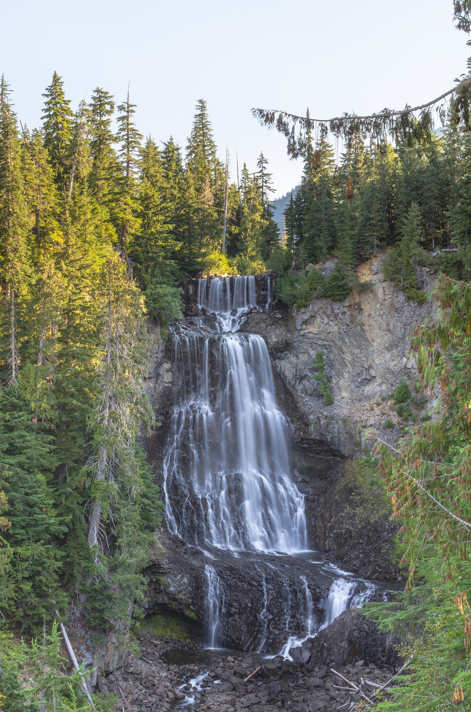
Alexander Falls
British Columbia • 43 m
By Armen Suny · Last verified Oct 2026


Photo Credits (3)
Difficulty
Drive Up
Trail Type
Out And Back
About Alexander Falls
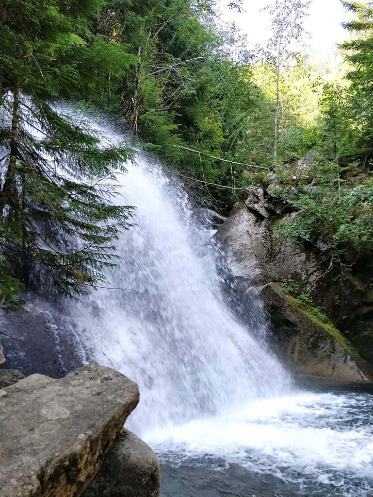
Alexander Falls is a waterfall on Madeley Creek, a tributary of Callaghan Creek in the Callaghan Valley area of the Sea to Sky Country of southwestern British Columbia, Canada. The falls are located just below a bridge on the access road to Callaghan Lake Provincial Park, at the head of the valley, which lies to the west of the resort town of Whistler.
The Setting
Alexander Falls sits at 813 metres in the hills of British Columbia. At 43 metres, it is among the taller waterfalls in British Columbia.
Why This Waterfall Exists
Alexander Falls flows over hard intrusive rock laid down about 66-101 million years ago. These resistant rocks form a durable ledge that water cannot easily wear away, creating a 141-foot drop where softer material downstream has already eroded.
Nearby Falls Worth Visiting
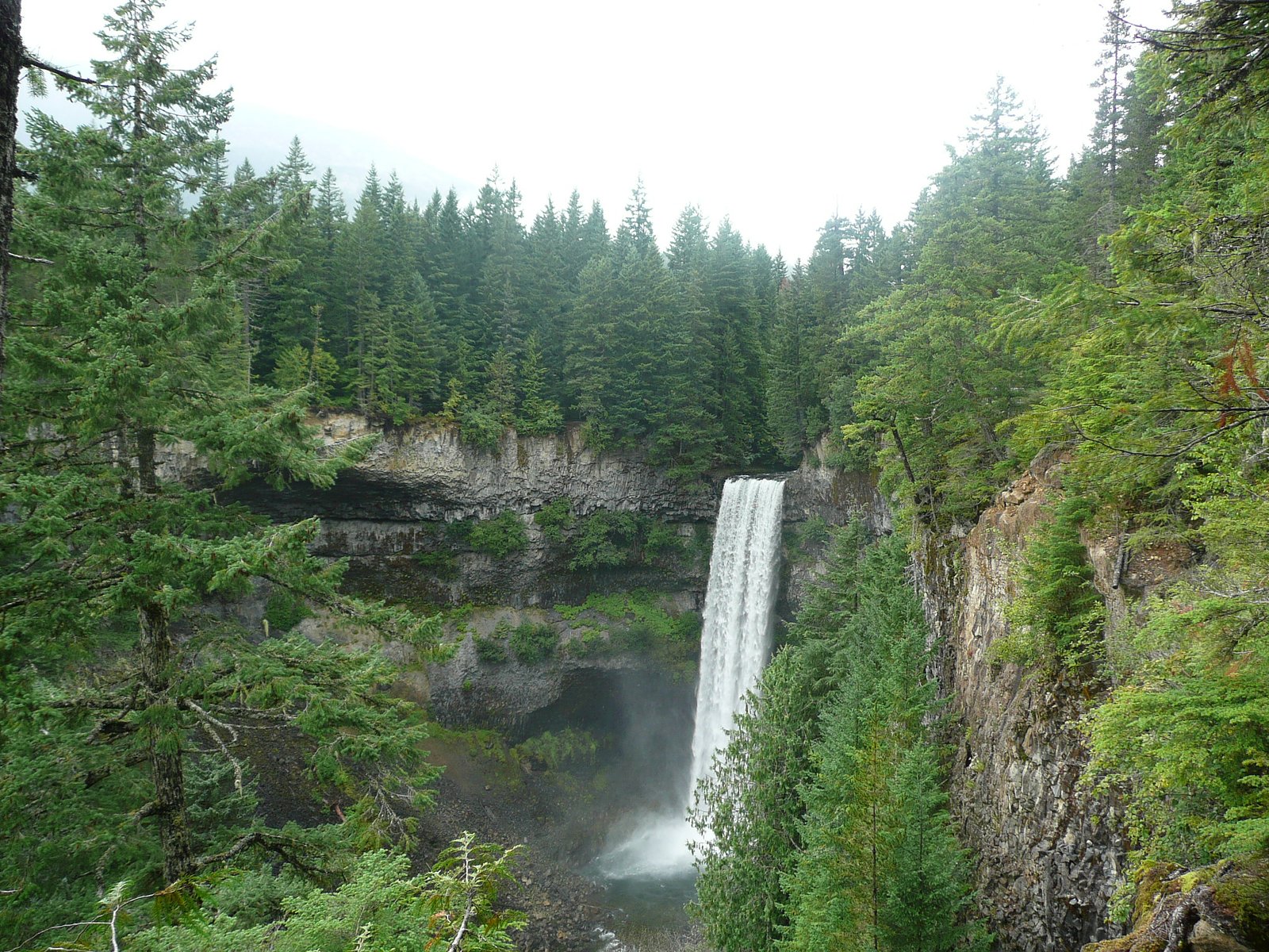
Brandywine falls (70 m) lies 10.9 kilometres to the south. Also nearby: Rainbow Falls (29 m, 9.7 km).
Trail & Hike Details
The Approach
No hiking required. Alexander Falls is accessible by vehicle with a roadside viewing area.
Trail Description
No hike is needed. The falls are seen from a wooden viewing platform at the corner of the parking lot.
What to Expect
The falls cascade 43 metres over hard intrusive rock.
Accessibility
This waterfall is viewable from a vehicle-accessible area. No hiking is required.
Frequently Asked Questions
🐶 Are Dogs Allowed at Alexander Falls?
❌ Dogs are not allowed
Are There Any Fees or Permits Required?
🆖 No fees required
🏊 Is There Swimming at Alexander Falls?
❌ Swimming is not allowed
When to Visit
Spring for the strongest flows (snowmelt). Summer and fall offer reliable access and nicer weather; fall can offer good color in the valley. Winter can show icy/frozen falls but access and parking may be impacted by snow, only visit if prepared for winter conditions.
Seasonal Access
The best time to visit is Spring, Summer, Fall, and Winter. Check with the managing park or local authority for current conditions.
Safety Information
Hazards include slippery and muddy trails, steep drop-offs near viewpoints, rapidly changing mountain weather, cold water and strong currents, and winter ice or snow conditions. Stay on designated paths and viewing platforms, supervise children closely, wear appropriate footwear, and avoid getting close to cliff edges. In winter, consider traction devices and be prepared for limited emergency services in remote valley areas.
Current Water Conditions
These readings come from the Water Survey of Canada gauge on Cheakamus River, 9 km away, not on Alexander Falls's own stream. Use them as a sign of whether the area is running wet or dry.
6.6 m³/s
Current discharge — how much water is flowing
Lower than usual for this time of year
Based on 43 years of record
1.85 m
Water depth at gauge
7-Day Discharge Trend
What does this mean for your visit?
Flow is lower than usual for this time of year.
About This Gauge
This gauge is on a nearby waterway and may not reflect exact conditions at the falls.
7-Day Flow Outlook
Based on the WSC gauge CHEAKAMUS RIVER ABOVE MILLAR CREEK (9 km away).
Today
Low
6.6 m³/s
5/10Tomorrow
Low
6.3 m³/s
5/10Sat
Low
6.3 m³/s
4/10Sun
Moderate
6.5 m³/s
5/10Mon
Moderate
7.2 m³/s
5/10Tue
Low
6.1 m³/s
5/10Wed
Low
6.1 m³/s
6/10Best window: Wed — low flow, sunny (trip score 6/10).
Best time of year: this gauge typically runs highest from late May to late August, peaking in July.
How we calculate this
This is a transparent outlook, not a precise forecast. We take the waterfall's current flow strength (how it ranks against its historical normal for today, from the nearest WSC stream gauge), carry that ranking forward along the gauge's seasonal curve, and nudge it for forecast rain. Confidence is highest for the next day or two and falls further out. Always check official conditions and your own judgment before visiting — high flows can be dangerous.
Weather Forecast
Location & Access
Getting There
From Whistler, drive south on Highway 99 for about 10 km and turn right at the Callaghan Valley sign onto Callaghan Valley Road. Follow the paved road about 10 km and turn left at the Alexander Falls sign into the gravel parking lot.
Get Directions on Google MapsParking
A large gravel parking lot, with the viewing platform at one corner.
Elevation
813 metres above sea level
Coordinates
50.135078° N, -123.128495° W
Visitor Tips & Gear
Arrive early on busy days to secure parking. Wear sturdy footwear, rocks and paths can be muddy or icy. Keep to signed/viewpoint areas and stay back from cliff edges. There are limited or no services at the turnout, so bring water and layers. Check local road reports in winter; chains or winter tires may be required. If you bring a dog, keep it leashed and under control (see local regulations).
Where to Stay
Browse vacation cabins and private rentals nearby
Unique outdoor stays — tents, yurts, and treehouses
Rent a campervan or RV for your waterfall road trip
Some links are affiliate links. We may earn a commission at no extra cost to you.
Nearby Campground
Madeley Lake Campsite
5.4 km away
Additional Information
Nearby Attractions
Whistler Olympic Park (Cross-country skiing, biathlon), Callaghan Valley recreational areas, Brandywine Falls Provincial Park (a separate waterfall attraction nearby), Whistler Village (services and accommodations).
Wildlife
Typical coastal-mountain wildlife may be present: black bears, deer, small mammals, and birds. Observe wildlife from a distance and store food securely. Bear activity can increase in spring/summer, carry bear spray where appropriate and know local guidance.
Nearby Waterfalls
Writing about Alexander Falls? Embed this waterfall on your site for free.