Cataract Falls
Ontario • 14 m
By Armen Suny · Last verified Jun 2026
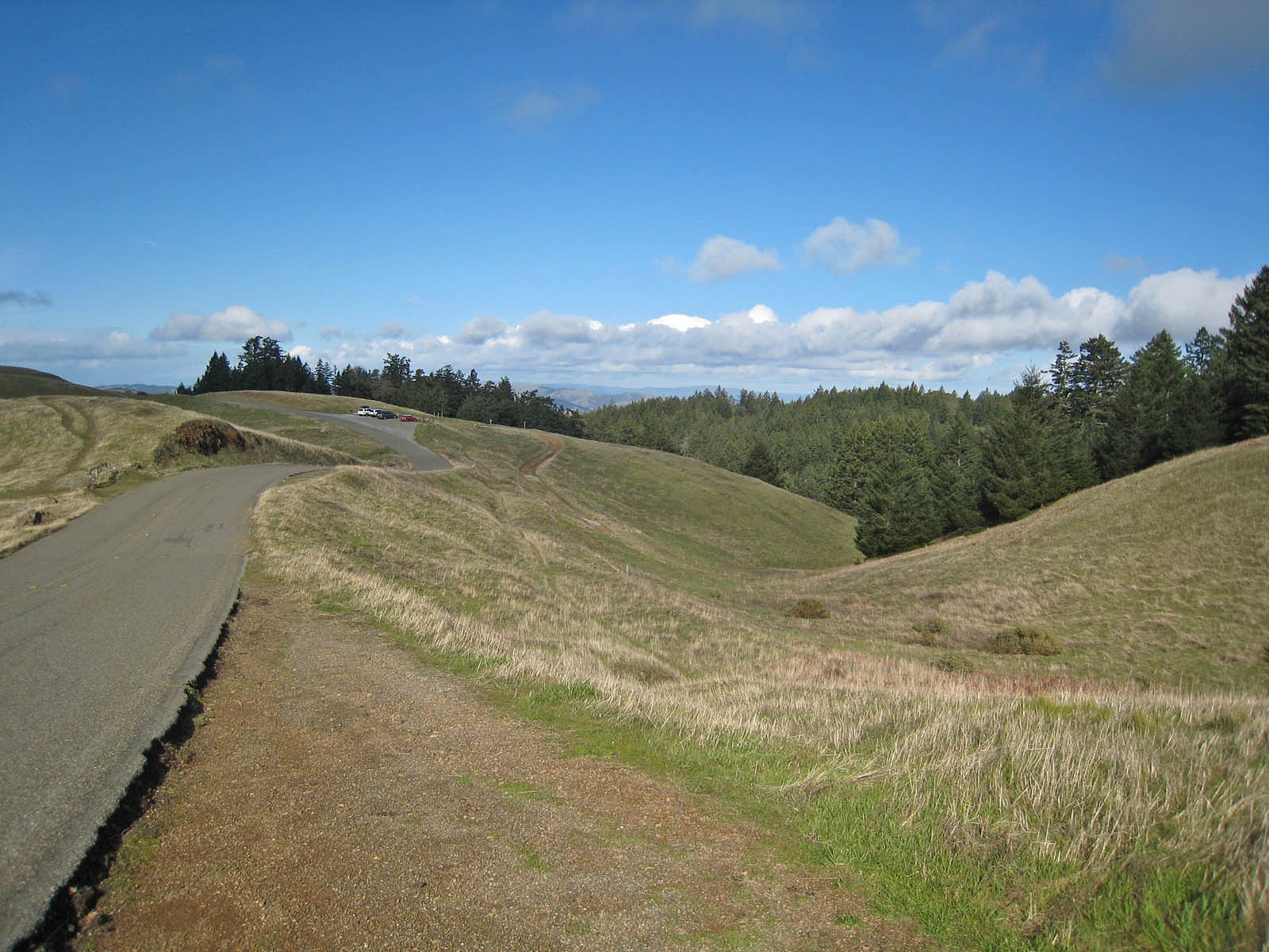
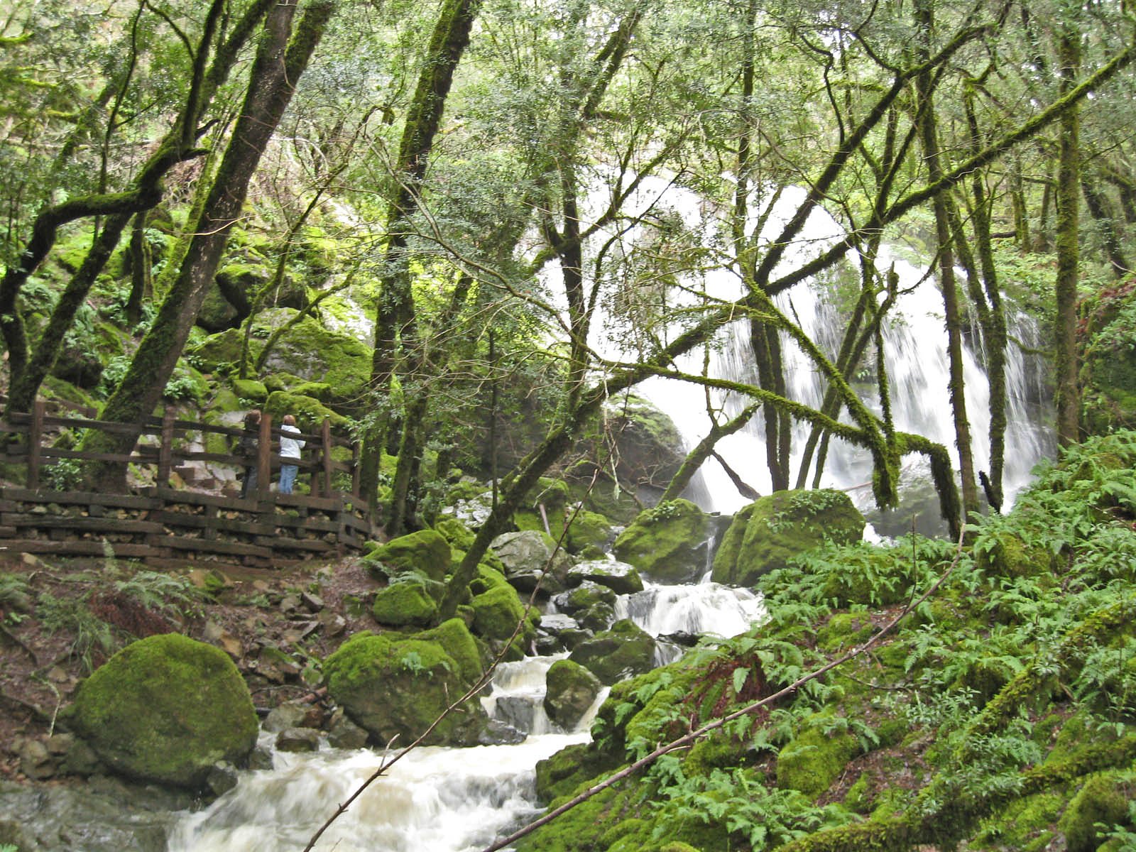
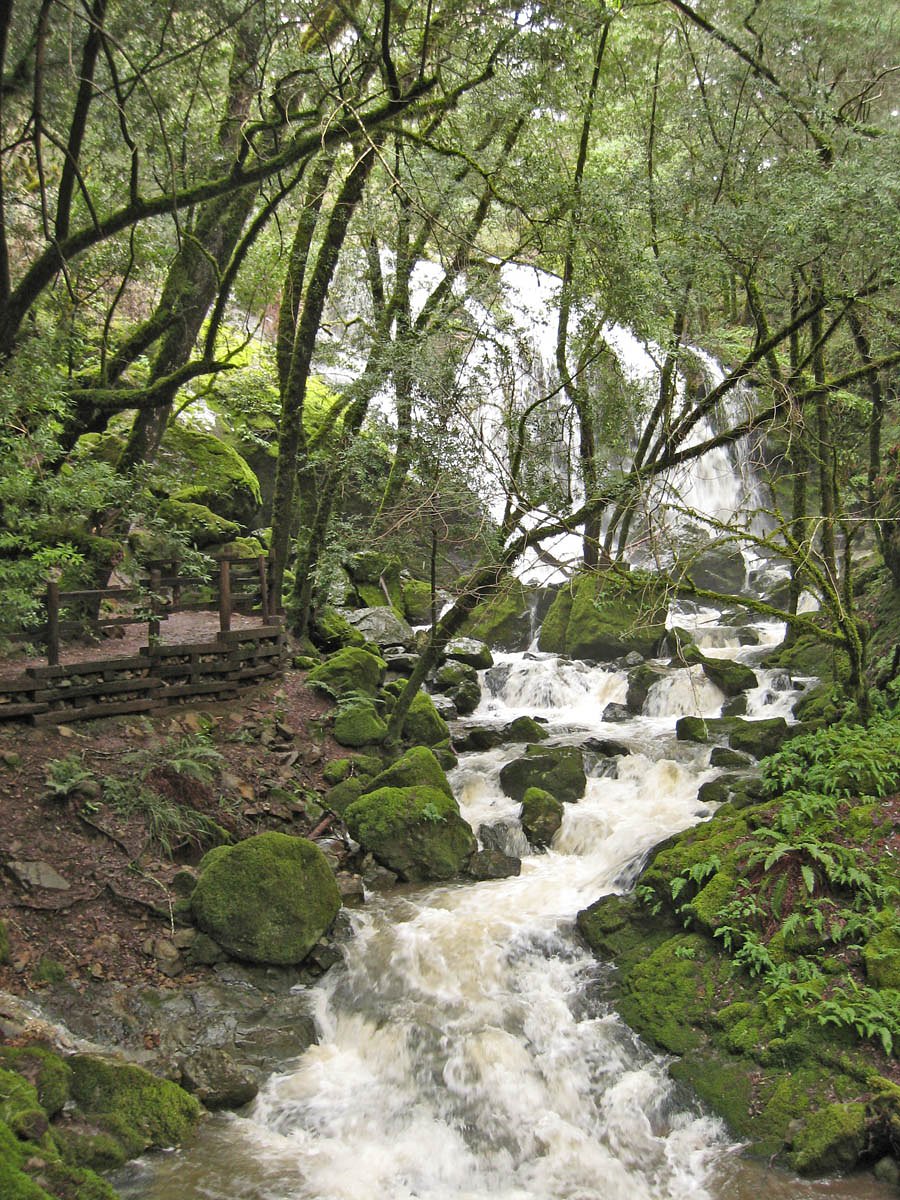
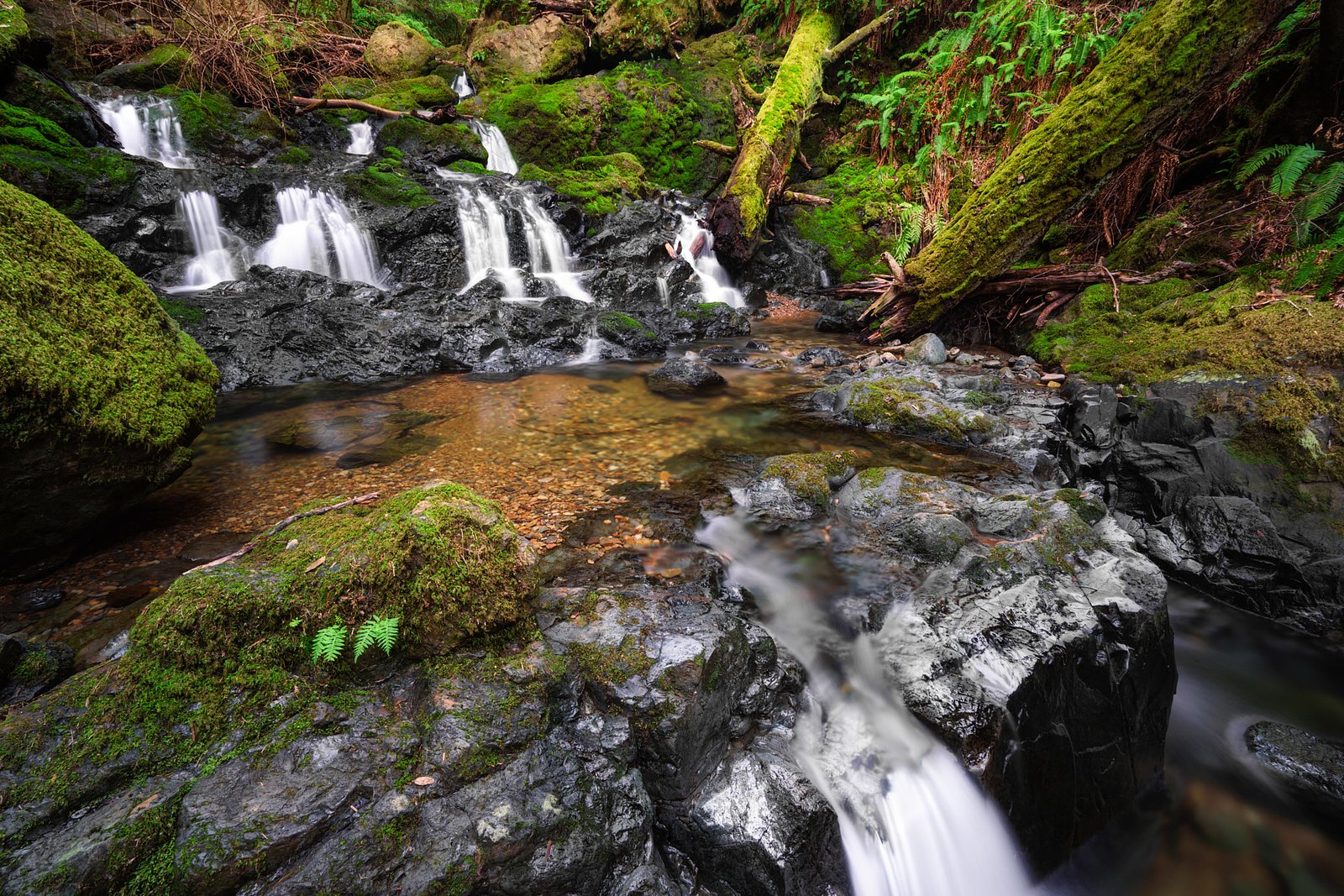
Photo Credits (5)
Difficulty
Easy
Trail Length
1.6 km
Trail Type
Out And Back
Elevation Gain
30 m
About Cataract Falls
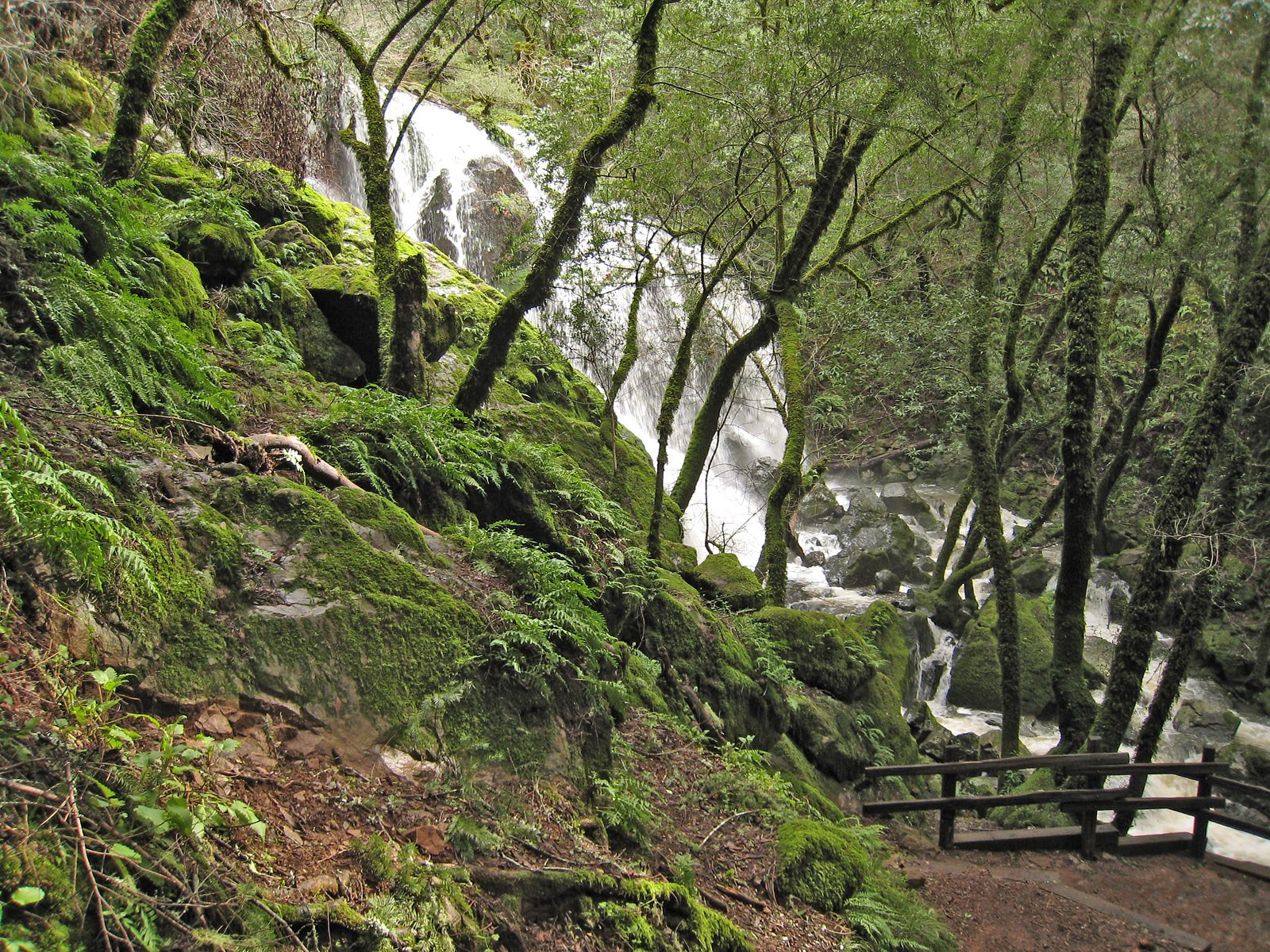
Cataract Falls (near Orangeville, Ontario) is a small multi-tiered cascade on a local stream set in mixed hardwood forest. The site is popular for short hikes and photography; water flow is highest in spring and after heavy rain. Exact metrics for the drop vary by source; some visitor reports describe a series of ledges rather than a single high plunge.
The Setting
Cataract Falls sits at 382 metres within Forks Of The Credit Provincial Park (Natural Environment Class), in the foothills of Ontario. The falls drop 14 metres.
Why This Waterfall Exists
Cataract Falls flows over layered sedimentary rock laid down about 252-539 million years ago. Over time, the stream has worn through these layers at different rates, creating a 46-foot drop that forms the waterfall.
Trail & Hike Details
The Approach
The easy 1.6-km out-and-back trail gains 30 metres of elevation on the way to the falls.
Trail Description
A short out-and-back trail leads from the parking area to viewpoints for the cascades. Trails are usually narrow, with roots and rocks underfoot and short sections of boardwalk or gravel in wetter spots. There are informal vantage points close to the water; some visitors scramble down to lower rock ledges (slippery when wet). Expect a mostly gentle grade with a few short steeper sections near the creek.
What to Expect
The falls drop 14 metres over layered sedimentary rock.
Accessibility
The trail is not wheelchair accessible. Uneven terrain and elevation changes require steady footing.
Frequently Asked Questions
🐶 Are Dogs Allowed at Cataract Falls?
❌ Dogs are not allowed
Are There Any Fees or Permits Required?
🆖 No fees required
🏊 Is There Swimming at Cataract Falls?
❌ Swimming is not allowed
When to Visit
Late winter/early spring for strongest flows (spring runoff). Fall for foliage color. Weekdays or early mornings to avoid crowds. Winter visits offer icy scenery but are more hazardous, only attempt with appropriate footwear and caution.
Seasonal Access
The best time to visit is Spring, Summer, Fall, and Winter. Check with the managing park or local authority for current conditions.
Safety Information
Hazards include slippery wet rock, steep and eroding banks, cold water and strong currents during high flow, falling from ledges, ticks and biting insects, and variable weather. Do not attempt to climb on wet ledges or jump into pools. Let someone know your plans and expected return time if heading to more remote sections.
Current Water Conditions
3.3 m³/s
Current discharge — how much water is flowing
Much higher than usual for this time of year
Based on 111 years of record
1.50 m
Water depth at gauge
7-Day Discharge Trend
What does this mean for your visit?
The water is flowing much higher than usual, expect an impressive display.
About This Gauge
7-Day Flow Outlook
Based on the WSC gauge CREDIT RIVER NEAR CATARACT (2 km away).
Today
Roaring
3.3 m³/s
9/10Tomorrow
Roaring
3.1 m³/s
8/10Tue
Roaring
3.5 m³/s
6/10Wed
Roaring
3.4 m³/s
8/10Thu
Roaring
3.2 m³/s
8/10Fri
Roaring
3.4 m³/s
6/10Sat
Roaring
3.3 m³/s
8/10Best window: Today — roaring flow, mainly sunny (trip score 9/10).
Best time of year: this gauge typically runs highest from early March to late May, peaking in April.
How we calculate this
This is a transparent outlook, not a precise forecast. We take the waterfall's current flow strength (how it ranks against its historical normal for today, from the nearest WSC stream gauge), carry that ranking forward along the gauge's seasonal curve, and nudge it for forecast rain. Confidence is highest for the next day or two and falls further out. Always check official conditions and your own judgment before visiting — high flows can be dangerous.
Know when to go.
Get a free email alert when waterfalls near Orangeville hit peak flow. We only send when conditions are worth the trip — no weekly newsletters, no spam.
Weather Forecast
Location & Access
Getting There
The falls lie west of Orangeville (approx. 7–8 miles), roughly a 45–60 minute drive from Toronto depending on route and traffic. Use the provided coordinates (43.8213, -80.0224) in a mapping app. Access is from local conservation-area or roadside parking and short hiking trails / paths; the final approach is typically on unpaved/rocky surfaces.
Get Directions on Google MapsParking
Small parking area or roadside parking is typical; spaces may be limited on weekends and holidays. Some nearby conservation areas charge for parking or require a day pass, check the local conservation authority for the exact parking situation before you go.
Elevation
382 metres above sea level
Coordinates
43.821311° N, -80.022379° W
Land Management
Managed by Ontario Parks
Visitor Tips & Gear
• Wear sturdy, grippy footwear, rocks around the falls are frequently wet and slippery. • Check recent trip reports or the local conservation authority for parking/closures before you go. • Respect private property and posted signs; some access points cross private land. • Avoid approaching the edge of cliffs and steep banks; do not climb on wet ledges. • Bring insect repellent (ticks and mosquitoes can be present in warmer months). • If visiting in winter, be prepared for icy conditions and shortened daylight.
As an Amazon Associate, we earn from qualifying purchases.
This easy 1.6 km hike is straightforward — comfortable trail shoes and plenty of water should do. Icy conditions are common in winter — traction cleats are a smart addition.

Columbia Watertight II Rain Jacket
Packs into its own pocket, seam-sealed, and keeps you dry from spray and surprise rain.

Polarized Sunglasses (Knockaround)
Cuts glare off the water so you actually see the falls — and your photos turn out better too.

Earth Pak Waterproof Dry Bag
Keeps your phone and gear dry when waterfall mist soaks everything else.

Waterproof Phone Pouch (AiRunTech)
Cheap insurance — take photos right next to the falls without killing your phone.

Kahtoola MICROspikes
Cult-favorite traction cleats that grip ice and wet rock — essential for winter waterfall hikes.

JOBY GorillaPod Starter Kit
Wraps around railings and rocks for long-exposure waterfall shots — no flat surface needed.
Where to Stay
Browse vacation cabins and private rentals nearby
Unique outdoor stays — tents, yurts, and treehouses
Rent a campervan or RV for your waterfall road trip
Some links are affiliate links. We may earn a commission at no extra cost to you.
Nearby Campground
Scott Mission Camp and Retreat Centre
8.1 km away
Additional Information
Nearby Attractions
Forks of the Credit Provincial Park, Mono Cliffs Conservation Area, Island Lake Conservation Area, local Orangeville trails and parks. (Distances and access vary; check each site for directions and conditions.)
Wildlife
Typical southern Ontario woodland species: white-tailed deer, raccoons, squirrels, various songbirds, and waterfowl. Ticks (Lyme disease risk) and black flies/mosquitoes can be present seasonally.
Cities near Cataract Falls
Nearby Waterfalls
Other waterfalls named Cataract Falls
4 other waterfalls share this name across Canada.
Writing about Cataract Falls? Embed this waterfall on your site for free.