

Photo Credits (5)
Difficulty
Easy
Trail Length
1.5 miles
Trail Type
Out And Back
Elevation Gain
200 ft
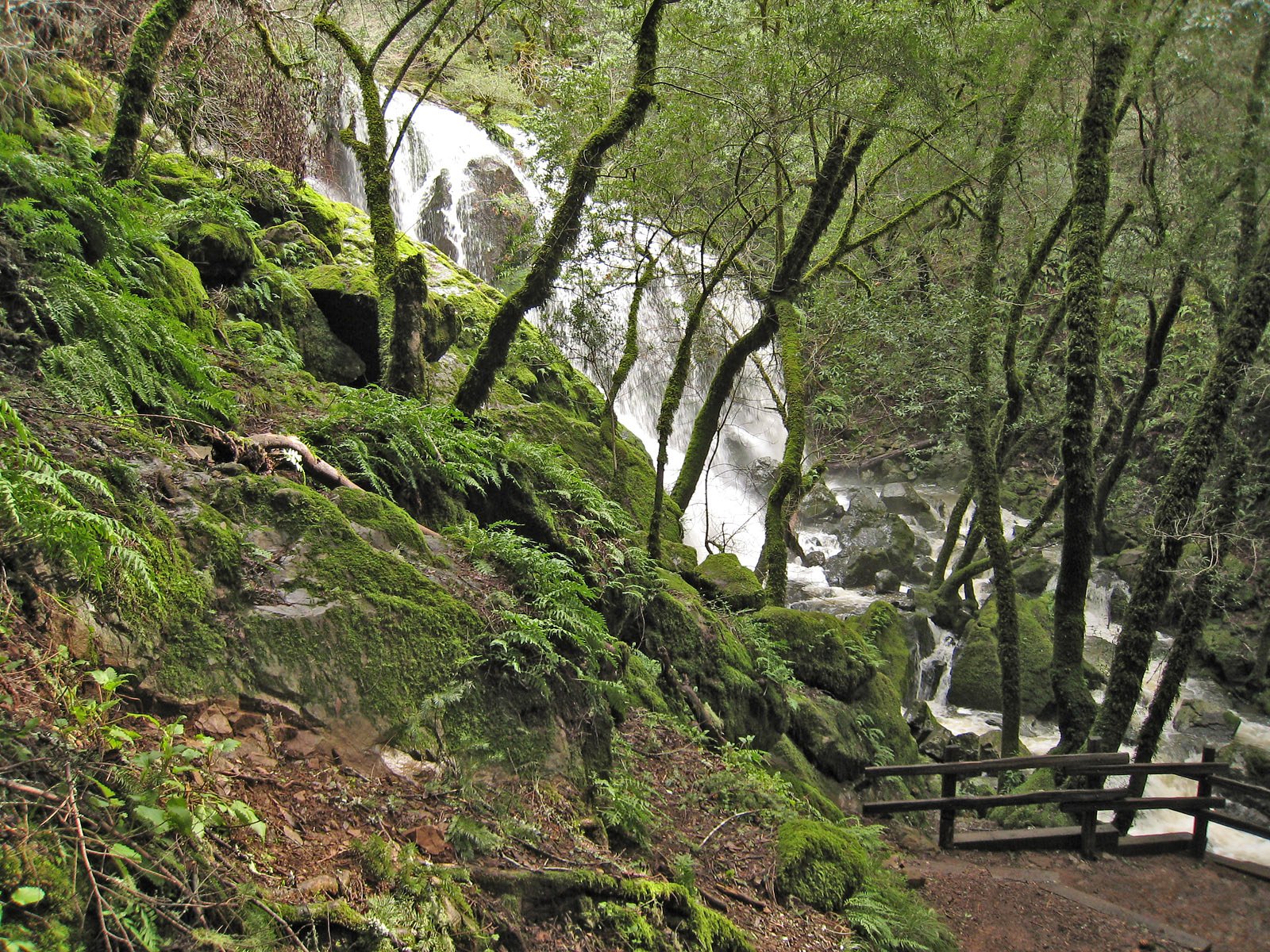
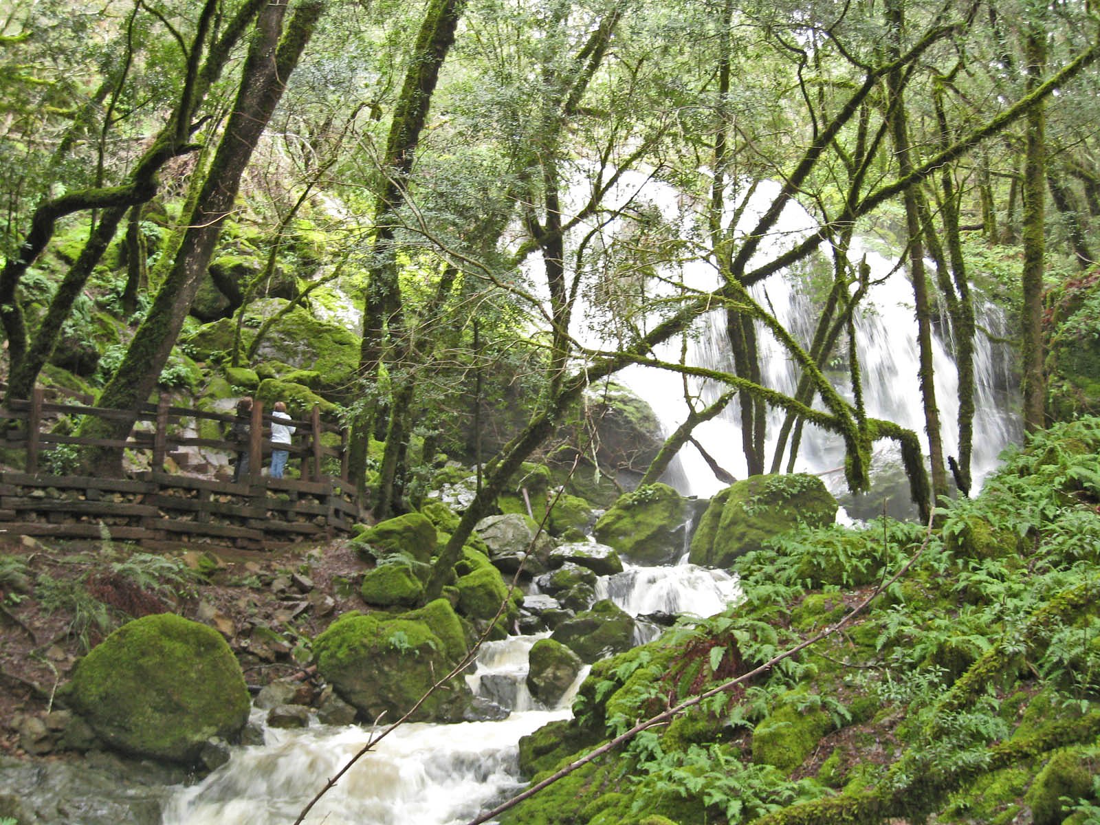
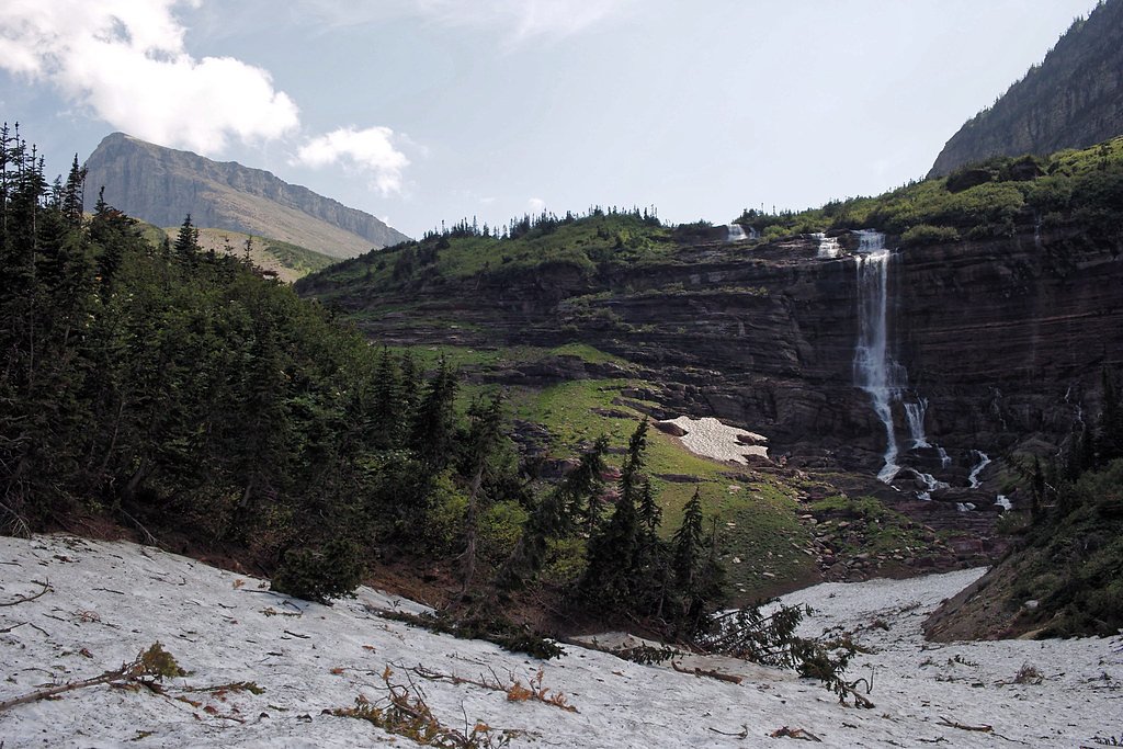
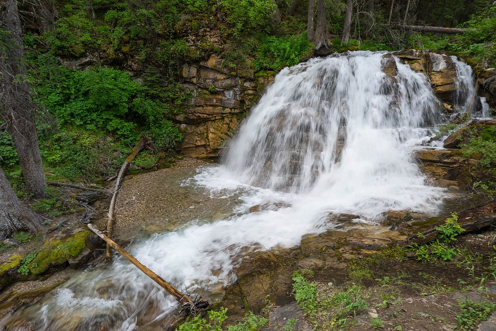
About Cataract Falls
Tucked into the forested slopes of the Little Belt Mountains, Cataract Falls is an easy, scenic destination managed by the U.S. Forest Service within the Lewis & Clark National Forest. A short, well-marked spur—the USFS CATARACT FALLS TIE (Trail #237A)—brings you close to the cascade, making this a great stop for families and casual hikers who want a rewarding view without a long approach. The outing is commonly done as an out-and-back that totals about 1.5 miles with roughly 200 feet of elevation gain, so you can enjoy the surrounding pines and creekside ambiance on a relaxed walk. The path to the falls is straightforward and friendly to most abilities (rated easy), and the short USFS-maintained tie trail is built on native material and rated Class 2 for hiking. Because the route is compact and accessible, Cataract Falls is ideal for a quick nature break or pairing with other nearby Little Belt Mountain hikes when you're exploring this quieter corner of the Lewis & Clark National Forest.
The Setting
Cataract Falls sits at 5,272 feet within Lewis & Clark National Forest, fed by the Sun River Bl Willow Cr, in the high mountains of Montana.
Trail & Hike Details
The Approach
The easy hike follows Cataract Falls Tie (#237A), a 1.5-mile out-and-back trail over natural surface. Expect 200 feet of elevation gain. The trail is moderately developed (Class 2).
USFS Trail
CATARACT FALLS TIE #237A
Trail Class
Moderately Developed
Surface
USFS Segment
0.10 miTrail Description
Trail: CATARACT FALLS TIE (USFS Trail #237A). This is a short, native-surfaced spur maintained by the U.S. Forest Service; the USFS GIS length for the tie trail is 0.1 miles and it is classified as Class 2. The typical outing to view the falls is an out-and-back of about 1.5 miles total with approximately 200 feet of elevation gain. Grade and terrain are easy and well-suited to most hikers; the surface is natural soil/forest floor rather than paved.
What to Expect
Dogs are welcome.
Accessibility
The trail is not wheelchair accessible. Uneven terrain and elevation changes require steady footing.
Frequently Asked Questions
🐶 Are Dogs Allowed at Cataract Falls?
✅ Dogs are allowed
Are There Any Fees or Permits Required?
🆖 No fees required
🏊 Is There Swimming at Cataract Falls?
❌ Swimming is not allowed
When to Visit
The best time to visit Cataract Falls is in late spring or early summer when the water flow is strongest. Fall is also a great time to visit for colorful foliage.
Seasonal Access
The best time to visit is Spring, Summer, and Fall. Access roads and trails may close during winter due to snow. Check with Lewis & Clark National Forest for seasonal road closures.
Safety Information
Be cautious of slippery rocks near the waterfall. Always stay on the designated trail to avoid accidents. Carry bear spray and be aware of wildlife in the area.
Current Water Conditions
Based on a USGS gauge 19.1 miles away
257 ft³/s
Current discharge — how much water is flowing
About average for this time of year
Based on 20 years of record
2.31 ft
Water depth at gauge
7-Day Discharge Trend
What does this mean for your visit?
Flow is about average for this time of year.
About This Gauge
This gauge is on a regional waterway. Conditions at the falls may differ, especially after local rain.
7-Day Flow Outlook
Based on the USGS gauge Sun River bl Willow Cr nr Augusta MT (31 km away).
Today
Roaring
293 cfs
6/10Tomorrow
Roaring
312 cfs
6/10Sun
Roaring
285 cfs
6/10Mon
Roaring
349 cfs
6/10Tue
Roaring
306 cfs
9/10Wed
Roaring
308 cfs
6/10Thu
Roaring
294 cfs
6/10Best window: Tue — roaring flow, partly sunny (trip score 9/10).
Best time of year: this gauge typically runs highest from late April to late July, peaking in May.
How we calculate this
This is a transparent outlook, not a precise forecast. We take the waterfall's current flow strength (how it ranks against its historical normal for today, from the nearest USGS stream gauge), carry that ranking forward along the gauge's seasonal curve, and nudge it for forecast rain. Confidence is highest for the next day or two and falls further out. Always check official conditions and your own judgment before visiting — high flows can be dangerous.
Know when to go.
Get a free email alert when waterfalls near Augusta hit peak flow. We only send when conditions are worth the trip — no weekly newsletters, no spam.
Weather Forecast
Location & Access
Getting There
Cataract Falls is located near the town of Neihart, Montana, along US Highway 89. From Neihart, follow signs for the trailhead, which is accessible via a short drive on a gravel road.
Get Directions on Google MapsParking
There is a small parking area near the trailhead. Parking may be limited during peak seasons.
Elevation
5,272 feet above sea level
Coordinates
47.322054° N, -112.603680° W
Land Management
Managed by USFS
Visitor Tips & Gear
Arrive early during weekends or holidays to secure parking. Wear sturdy shoes, as the trail may be muddy or slippery in some sections. Bring insect repellent during the summer months.
As an Amazon Associate, we earn from qualifying purchases.
This easy 1.5 miles hike is straightforward — comfortable trail shoes and plenty of water should do. Sun exposure on the trail makes good sun protection a must in summer.

Polarized Sunglasses (Knockaround)
Cuts glare off the water so you actually see the falls — and your photos turn out better too.

Columbia Watertight II Rain Jacket
Packs into its own pocket, seam-sealed, and keeps you dry from spray and surprise rain.

Earth Pak Waterproof Dry Bag
Keeps your phone and gear dry when waterfall mist soaks everything else.

Waterproof Phone Pouch (AiRunTech)
Cheap insurance — take photos right next to the falls without killing your phone.

JOBY GorillaPod Starter Kit
Wraps around railings and rocks for long-exposure waterfall shots — no flat surface needed.

Osprey Daylite Daypack
Light, organized, and just the right size for a day hike — fits water, snacks, and layers.
Where to Stay

Remote Wolf Creek Cabin - Wide Open Spaces!

Pet-Friendly Augusta Cabin - Walk to Main Street!

Cozy Augusta Cabin with Grill - Walk to Main St

Cozy Augusta Cabin w/ Furnished Deck & Grill!
Browse vacation cabins and private rentals nearby
Unique outdoor stays — tents, yurts, and treehouses
Rent a campervan or RV for your waterfall road trip
Some links are affiliate links. We may earn a commission at no extra cost to you.
Nearby Campground
Double Falls Campground
8.1 miles away · 0 sites
CampgroundBears may frequent the area; keep all food out of sight in approved containers and remove all food from area after eating. Mandatory food storage is required.
Book on Recreation.govNearby Hot Springs
Hot springs near Augusta, Montana
Medicine (Sun River) Springs
Medicine Springs, also called Sun River Springs, flows at 86°F at 4,816 feet elevation in Teton County, Montana, near the bound...
Avon Warm Spring
Avon Warm Spring flows at 79°F in Powell County, Montana, at 4,876 feet elevation near Deer Lodge. At just 3.3 feet from the ro...
Garrison Warm Springs
Garrison Warm Springs emerges at 77°F in Powell County, Montana, at 5,124 feet elevation, placing it in the warm-spring categor...
Bearmouth Warm Spring 2
Bearmouth Warm Spring 2 flows at 68°F in Granite County, Montana, at 3,977 feet elevation -- about 170 feet higher than its com...
Bearmouth Warm Spring 1
Bearmouth Warm Spring 1 surfaces at 68°F directly beside a road in Granite County, Montana, at 3,807 feet elevation. With only ...
Nimrod Springs
Nimrod Springs flows at 70°F with hard, sulfate-rich water carrying 323 mg/L sulfate and 137 mg/L calcium at near-neutral pH 7....
Looking for a soak after your hike? Explore more hot springs near Augusta, Montana on SoakingSprings.
Explore Montana springsAdditional Information
Nearby Attractions
Nearby attractions include the town of Neihart, Kings Hill Scenic Byway, and Showdown Montana Ski Area.
Wildlife
The area is home to various wildlife, including deer, birds, and small mammals. Be cautious of bears and carry bear spray if hiking during the warmer months.
Cities near Cataract Falls
Nearby Waterfalls
Other waterfalls named Cataract Falls
4 other waterfalls share this name across the U.S.
Writing about Cataract Falls? Embed this waterfall on your site for free.