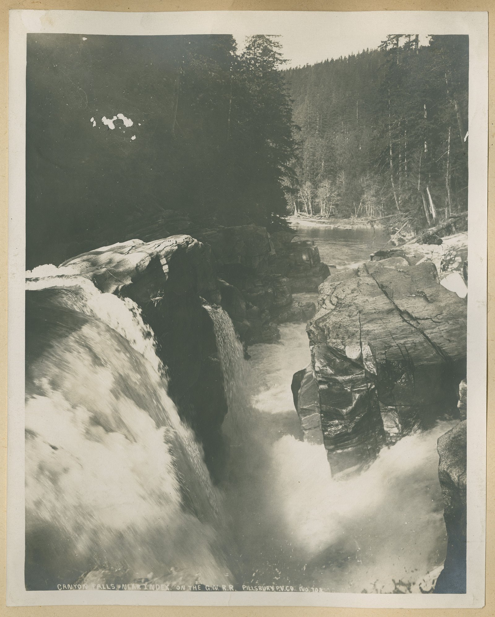
Canyon Falls
Ontario • Little Current River Provincial Park
By Armen Suny · Last verified Jun 2026
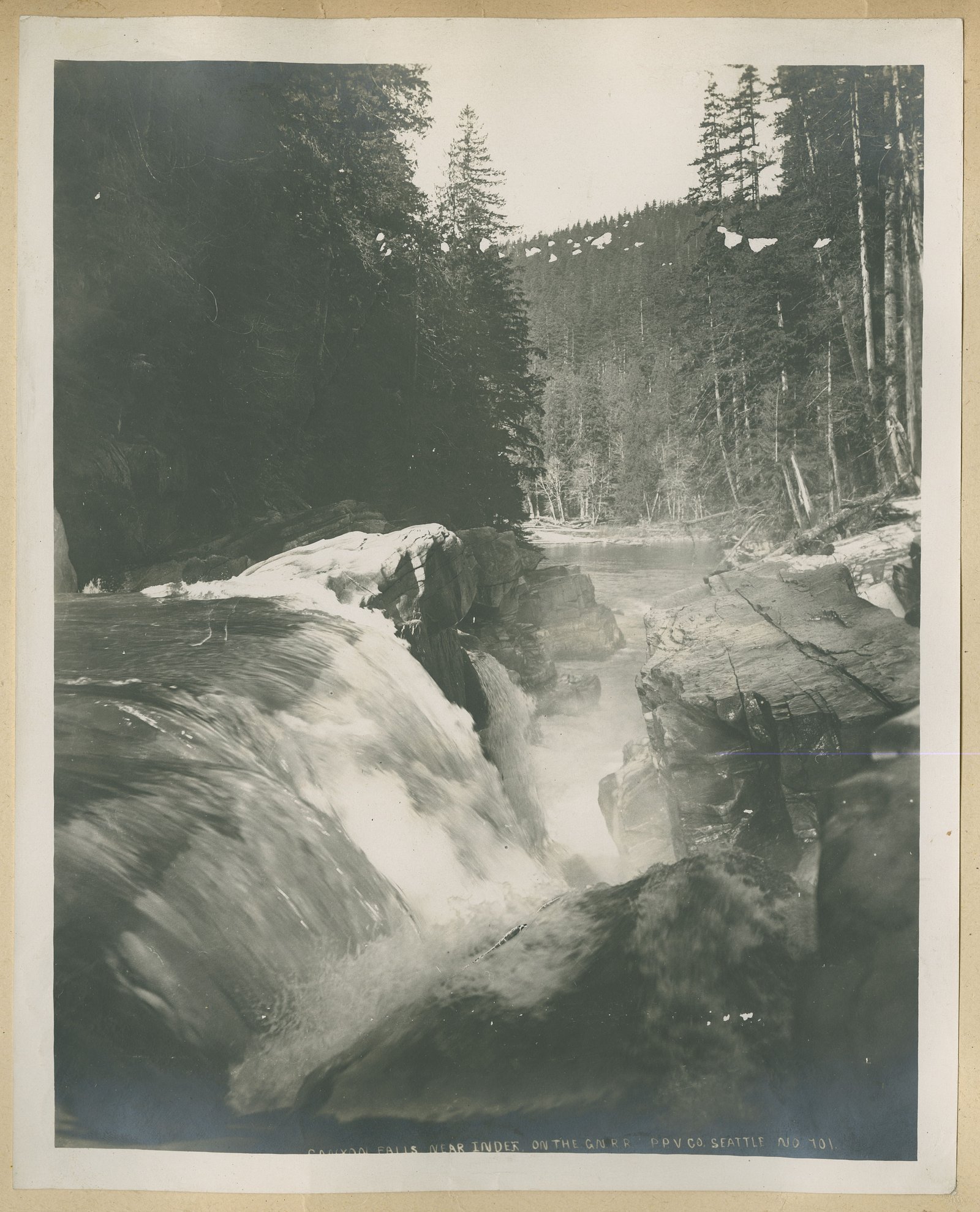
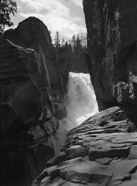
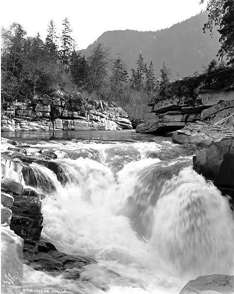
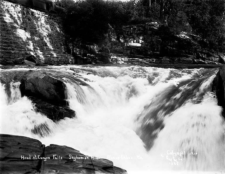
Photo Credits (5)
About Canyon Falls
Canyon Falls is located in a remote part of northern Ontario at coordinates 50.6995, -86.2461. The waterfall appears to flow through a narrow bedrock canyon and is likely most impressive during spring runoff or after heavy rains. Published, detailed trail and official measurement data for this exact feature are not readily available; the description below uses conservative language where specifics are uncertain.
The Setting
Canyon Falls sits at 232 metres within Little Current River Provincial Park, in the foothills of Ontario.
Why This Waterfall Exists
Canyon Falls flows over hard crystalline rock laid down over 2.5-2.8 billion years ago. These resistant rocks form a durable ledge that water cannot easily wear away, creating the falls where softer material downstream has already eroded.
Trail & Hike Details
Trail Description
There is no well-documented maintained trail to Canyon Falls available in common public sources. Reaching viewpoints may require walking on unmarked paths, short bushwhacking sections, or scrambling over bedrock and roots along the canyon rim. Trails, if present, are likely informal and lightly used. Exercise caution on loose rock and near cliff edges.
What to Expect
A narrow river canyon with bedrock walls and at least one drop; rocky ledges and possibly a small plunge pool. Flow volumes will vary seasonally and can be much higher in spring or after heavy rainfall. There are likely limited or no developed viewing platforms, restrooms, or signage. Expect typical northern Ontario boreal forest vegetation and potentially wet, muddy sections on approach.
Accessibility
Likely not accessible for mobility-impaired visitors. Terrain near the falls is expected to be uneven, rocky, and potentially steep with no developed trails, ramps, or boardwalks.
Frequently Asked Questions
🐶 Are Dogs Allowed at Canyon Falls?
❌ Dogs are not allowed
Are There Any Fees or Permits Required?
🆖 No fees required
🏊 Is There Swimming at Canyon Falls?
❌ Swimming is not allowed
When to Visit
Late spring (snowmelt and higher flows) offers the most dramatic water volume. Early fall provides cooler weather and fall color. Summer offers easier road conditions for many visitors. Winter access is likely difficult and icy and should only be attempted with appropriate winter travel experience and equipment.
Seasonal Access
The best time to visit is Spring, Summer, and Fall. Winter access may be limited. Check with Little Current River Provincial Park for current conditions.
Safety Information
Hazards include steep cliffs and unstable edges, slippery wet rock, sudden rises in water level after rain, cold water and undercut rocks in plunge pools, limited or no cell coverage, and wildlife encounters (including bears and moose). Travel prepared with navigation tools, appropriate footwear, warm/dry clothing, and emergency supplies. If unfamiliar with remote backcountry travel, consider going with someone experienced.
Current Water Conditions
42.8 m³/s
Current discharge — how much water is flowing
Lower than usual for this time of year
Based on 44 years of record
28.12 m
Water depth at gauge
7-Day Discharge Trend
What does this mean for your visit?
Flow is lower than usual for this time of year.
About This Gauge
This gauge is on a nearby waterway and may not reflect exact conditions at the falls.
7-Day Flow Outlook
Based on the WSC gauge LITTLE CURRENT RIVER AT PERCY LAKE (21 km away).
Today
Low
43 m³/s
5/10Tomorrow
Moderate
46 m³/s
5/10Tue
Moderate
47 m³/s
5/10Wed
Moderate
48 m³/s
5/10Thu
Moderate
48 m³/s
5/10Fri
Low
45 m³/s
5/10Sat
Moderate
46 m³/s
5/10Best window: Today — low flow, cloudy (trip score 5/10).
Best time of year: this gauge typically runs highest from early May to early August, peaking in May.
How we calculate this
This is a transparent outlook, not a precise forecast. We take the waterfall's current flow strength (how it ranks against its historical normal for today, from the nearest WSC stream gauge), carry that ranking forward along the gauge's seasonal curve, and nudge it for forecast rain. Confidence is highest for the next day or two and falls further out. Always check official conditions and your own judgment before visiting — high flows can be dangerous.
Weather Forecast
Location & Access
Getting There
The falls are in a remote northern-Ontario setting (50.6995, -86.2461). Access may require driving on secondary or logging roads and then hiking cross-country or on an unmaintained path. Exact approach routes and signage are not confirmed; plan using topographic maps (NTS), offline GPS, and local/municipal resources. Expect limited or no cellular signal in the area.
Get Directions on Google MapsParking
No formal parking lot is documented. Visitors should expect a small informal pullout on a nearby road or roadside parking where safe and legal. Exact parking location is not confirmed, park well clear of traffic and avoid blocking gates or private driveways.
Elevation
232 metres above sea level
Coordinates
50.699526° N, -86.246128° W
Land Management
Managed by Ontario Parks
Visitor Tips & Gear
• Treat this as a remote visit: tell someone your route and expected return time. • Wear sturdy hiking boots with good traction, rock surfaces near the falls can be slippery. • Bring a map, GPS device, or offline mapping; do not rely on cell service. • Pack insect repellent and wear long clothing in summer (ticks and mosquitoes possible). • Keep a safe distance from canyon edges and avoid climbing on wet rocks. • Pack out all trash and follow Leave No Trace principles. • Check local forestry/municipal resources before driving logging roads; some may be seasonally closed or gated.
Where to Stay
Browse vacation cabins and private rentals nearby
Unique outdoor stays — tents, yurts, and treehouses
Rent a campervan or RV for your waterfall road trip
Some links are affiliate links. We may earn a commission at no extra cost to you.
Additional Information
Nearby Attractions
No specific nearby parks or developed attractions are confirmed for these coordinates in common public sources. The area is typical of northern Ontario boreal forest with rivers and lakes; consult local tourism or municipal resources for identified nearby highlights.
Wildlife
Typical northern Ontario wildlife may be present, including black bear, moose, deer, wolves, foxes, and numerous bird species. Ticks and mosquitoes can be prevalent in warmer months.
Nearby Waterfalls
Other waterfalls named Canyon Falls
4 other waterfalls share this name across Canada.
Writing about Canyon Falls? Embed this waterfall on your site for free.