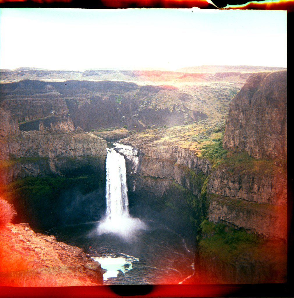
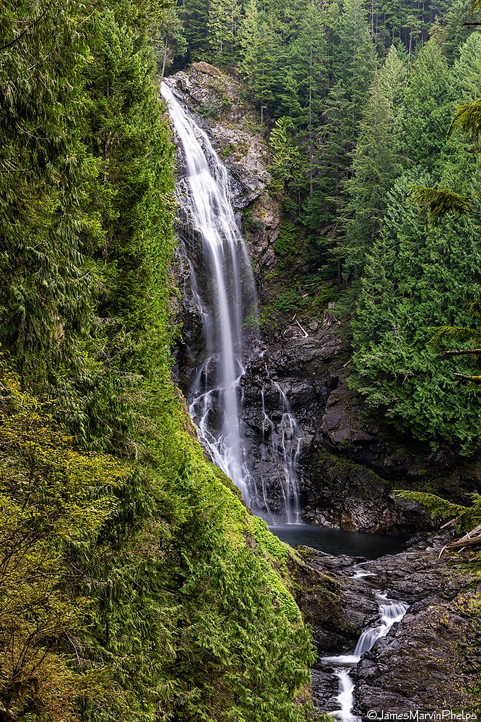
Canyon Falls
By Armen Suny · Last verified Mar 2026
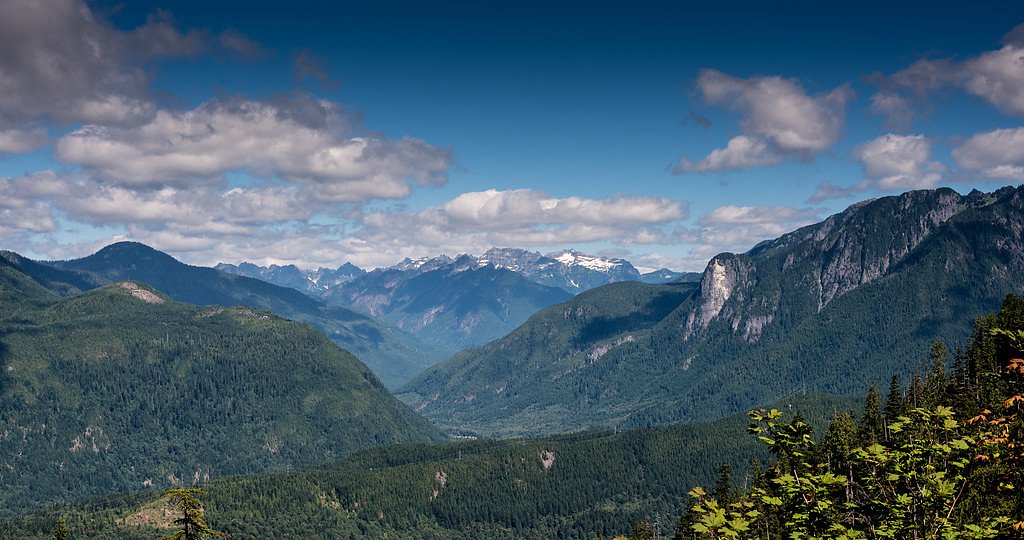
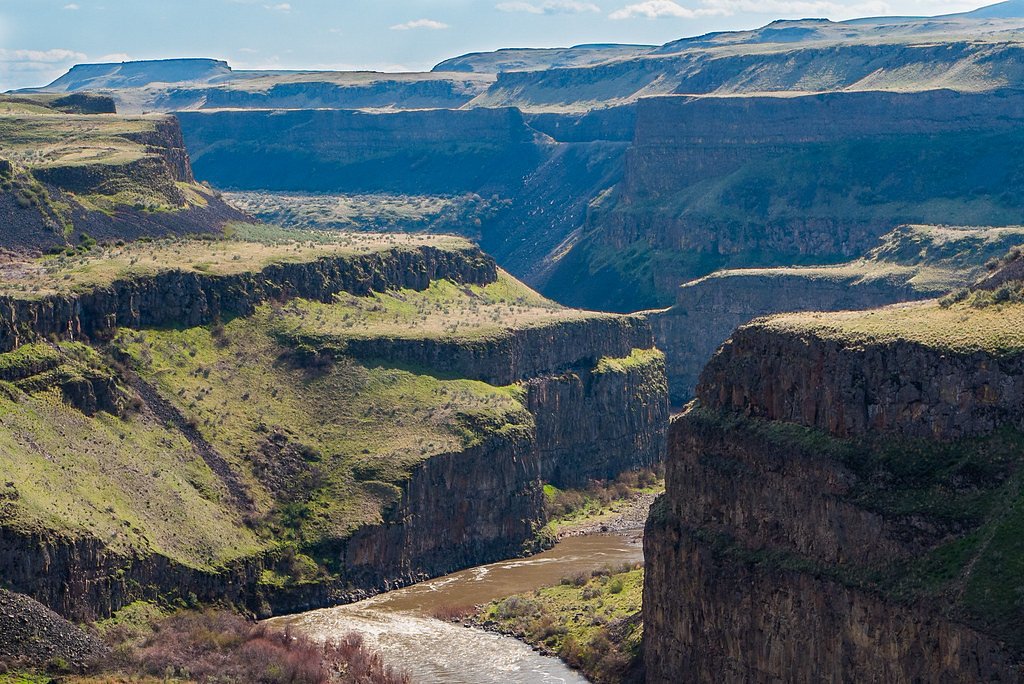
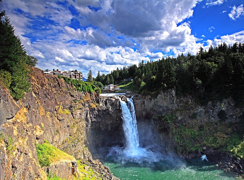
Photo Credits (5)
Difficulty
Moderate
Trail Length
2.0 miles
Trail Type
Out And Back
Elevation Gain
500 ft
About Canyon Falls
Canyon Falls is a scenic waterfall tucked into verdant forest, where cascading water and mossy canyon walls reward a relatively short hike. The falls are typically reached via a roughly 2.0-mile out-and-back route that gains about 500 feet, making the approach a moderately paced outing that suits hikers who enjoy a bit of climbing for a big payoff. The trail threads through dense woodland with occasional views of nearby ridgelines before opening to the rushing cascade; it’s a popular spot for day hikers and nature photographers seeking a compact, rewarding outing. Expect some rocky or uneven footing in places and be prepared for wet surfaces near the falls—sturdy footwear and basic caution will help you make the most of the visit.
The Setting
Canyon Falls sits at 640 feet along the Skykomish River, in the foothills of Washington.
Nearby Falls Worth Visiting
Wallace Falls (265 ft) lies 7.1 miles to the northwest. Also nearby: Bridal Veil Falls (100 ft, 1.8 mi).
Trail & Hike Details
The Approach
The moderate 2.0-mile out-and-back trail gains 500 feet of elevation on the way to the falls.
Trail Description
Approximately a 2.0-mile out-and-back route with about 500 feet of elevation gain, rated moderate. The trail winds through forested terrain with occasional mountain views and includes rocky or uneven sections—short, steady climbs are typical. Footwear with good traction is recommended, and hikers should be prepared for damp or slippery surfaces near the falls.
What to Expect
Visitors can expect a serene hike through lush greenery, leading to a picturesque waterfall. The area around the falls may be slippery, so caution is advised.
Accessibility
The trail is not wheelchair accessible. Uneven terrain and elevation changes require steady footing.
Frequently Asked Questions
🐶 Are Dogs Allowed at Canyon Falls?
❌ Dogs are not allowed
Are There Any Fees or Permits Required?
🆖 No fees required
🏊 Is There Swimming at Canyon Falls?
❌ Swimming is not allowed
When to Visit
Spring and early summer are ideal for visiting Canyon Falls, as the waterfall is typically at its fullest due to snowmelt. Fall offers beautiful foliage, while summer provides warmer weather for hiking.
Seasonal Access
The best time to visit is Spring, Summer, and Fall. Winter access may be limited.
Safety Information
Visitors should exercise caution near the waterfall, as rocks can be slippery and the water currents strong. Always stay on marked trails and avoid venturing too close to the edge.
Current Water Conditions
1,460 ft³/s
Current discharge — how much water is flowing
Much lower than usual for this time of year
Based on 97 years of record
5.50 ft
Water depth at gauge
58°F
ColdBracing — limit time in water
7-Day Discharge Trend
What does this mean for your visit?
Flow is well below normal for this time of year, so the waterfall may be a trickle. Water temperature is a bracing 58 degrees F, limit your time in the water.
About This Gauge
This gauge is on a nearby waterway and may not reflect exact conditions at the falls.
7-Day Flow Outlook
Based on the USGS gauge SKYKOMISH RIVER NEAR GOLD BAR, WA (10 km away).
Today
Low
1664 cfs
3/10Tomorrow
Low
1616 cfs
4/10Mon
Low
1479 cfs
4/10Tue
Low
1417 cfs
4/10Wed
Low
1397 cfs
4/10Thu
Low
1479 cfs
4/10Fri
Low
1342 cfs
4/10Best window: Tomorrow — low flow, light rain likely (trip score 4/10).
Best time of year: this gauge typically runs highest from mid April to early July, peaking in June.
How we calculate this
This is a transparent outlook, not a precise forecast. We take the waterfall's current flow strength (how it ranks against its historical normal for today, from the nearest USGS stream gauge), carry that ranking forward along the gauge's seasonal curve, and nudge it for forecast rain. Confidence is highest for the next day or two and falls further out. Always check official conditions and your own judgment before visiting — high flows can be dangerous.
Know when to go.
Get a free email alert when waterfalls near Baring hit peak flow. We only send when conditions are worth the trip — no weekly newsletters, no spam.
Weather Forecast
Location & Access
Getting There
Canyon Falls is located in the Cascade Mountains of Washington. The exact trailhead and access details may vary, so it is recommended to consult local hiking resources or maps for precise directions.
Get Directions on Google MapsParking
Parking availability may vary depending on the trailhead used to access Canyon Falls. Visitors should check for designated parking areas and arrive early during peak seasons.
Elevation
640 feet above sea level
Coordinates
47.804272° N, -121.535940° W
Visitor Tips & Gear
Arrive early to secure parking and avoid crowds. Bring plenty of water, snacks, and appropriate footwear. Check weather conditions before heading out, as trails may become muddy or slippery after rain.
As an Amazon Associate, we earn from qualifying purchases.
With 2.0 miles and 500 ft of elevation gain, sturdy boots and trekking poles will help on this moderate trail. Sun exposure on the trail makes good sun protection a must in summer.

Polarized Sunglasses (Knockaround)
Cuts glare off the water so you actually see the falls — and your photos turn out better too.

Columbia Watertight II Rain Jacket
Packs into its own pocket, seam-sealed, and keeps you dry from spray and surprise rain.

Earth Pak Waterproof Dry Bag
Keeps your phone and gear dry when waterfall mist soaks everything else.

Waterproof Phone Pouch (AiRunTech)
Cheap insurance — take photos right next to the falls without killing your phone.

Timberland Euro Sprint Mid Waterproof
Trusted waterproof boot with premium leather and grippy rubber sole — reliable on rocky, wet trails.

TrailBuddy Trekking Poles
Lightweight aluminum, cork grips, and flip-locks that actually hold — a best-seller for good reason.
Where to Stay

Moon River Suites #5

Walk to Skykomish River: Wooded Escape w/ Fire Pit

Dutch Cup Motel

Luxury A-Frame with Hot Tub, Fireplace & Firepit
Browse vacation cabins and private rentals nearby
Unique outdoor stays — tents, yurts, and treehouses
Rent a campervan or RV for your waterfall road trip
Some links are affiliate links. We may earn a commission at no extra cost to you.
Nearby Campground
Money Creek Campground
7.9 miles away · 24 sites
Overview Situated on the banks of the South Fork Skykomish River in Mt. Baker-Snoqualmie National Forest, Money Creek campground offers some of the most stunning scenery in the northern Cascade Range in Washington. Scattered beneath a towering canopy of old-growth forest, the sites in this campground are widely spaced and several are at the river's edge, making it an ideal setting for visitors wanting to camp in a private, rustic setting.Recreation In addition to being a prime location for hiking
Book on Recreation.govNearby Hot Springs
Hot springs near Baring, Washington
Garland Mineral Springs
Garland Mineral Springs flows at 84 degrees in the Snoqualmie National Forest, producing water 39.6 degrees above ambient tempe...
Scenic Hot Springs
Scenic Hot Springs delivers genuinely hot water at 122 degrees Fahrenheit at 2,246 feet elevation in the Cascade Mountains near...
Goldmeyer Hot Springs
Goldmeyer Hot Springs emerges at 127 degrees in the central Cascades, producing water 78.9 degrees above ambient temperature at...
Lester Hot Springs
This 120-degree spring sits within the City of Tacoma Watershed at 1,582 feet elevation, emerging 72.3 degrees above ambient in...
Kennedy Hot Spring
Kennedy Hot Spring flows at 100 degrees at 3,520 feet elevation in the Mt. Baker National Forest, emerging 58.7 degrees above a...
Gamma Hot Springs
Gamma Hot Springs produces 140-degree water at 5,397 feet elevation in the Mt. Baker National Forest, emerging 104.6 degrees ab...
Looking for a soak after your hike? Explore more hot springs near Baring, Washington on SoakingSprings.
Explore Washington springsAdditional Information
Nearby Attractions
Nearby attractions may include other hiking trails in the Cascade Mountains and scenic viewpoints.
Wildlife
The area is home to a variety of wildlife, including birds, deer, and small mammals. Visitors should be cautious of bears and other larger animals in the region.
Cities near Canyon Falls
Nearby Waterfalls
Other waterfalls named Canyon Falls
4 other waterfalls share this name across the U.S.
Writing about Canyon Falls? Embed this waterfall on your site for free.