Photo Credits (5)
Difficulty
Moderate
Trail Length
2.0 miles
Trail Type
Out And Back
Elevation Gain
300 ft
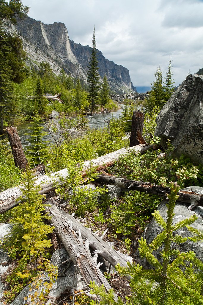
About Canyon Falls
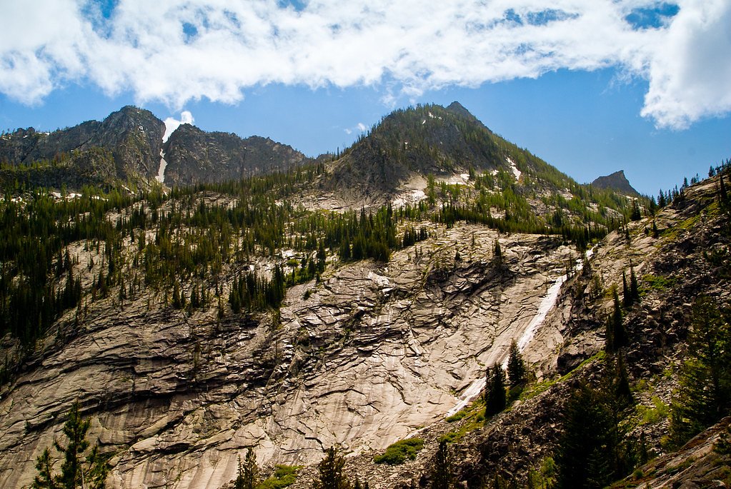
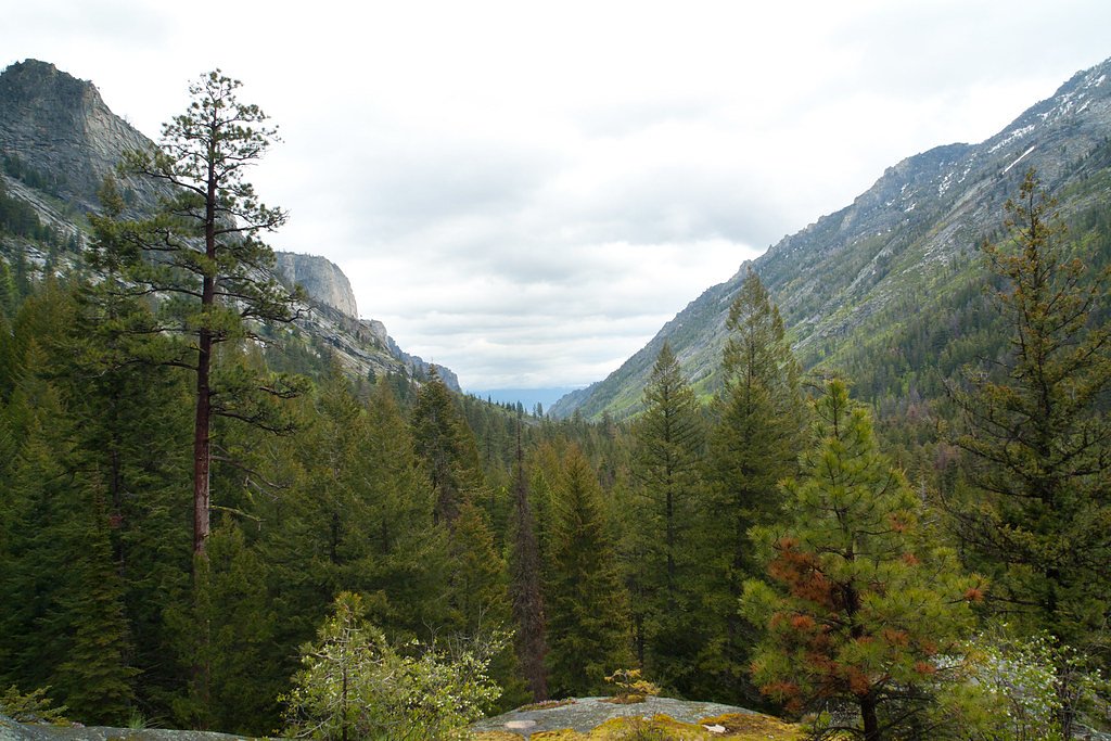
Canyon Falls sits in a wooded canyon of Montana and is managed by the U.S. Forest Service as part of the Bitterroot National Forest. The falls are reached via the USFS Canyon Creek Trail (Trail #525), which threads through native forest and offers classic mountain waterfall views — a short, scenic outing that rewards photographers and day-hikers alike. The route and surrounding land are administered by the USFS, so trail conditions and signage follow Forest Service maintenance and standards. The hike to the falls is a moderate, out-and-back romp of about 2.0 miles with roughly 300 feet of elevation gain (USFS GIS mileage recorded as 2.48 miles). For overnight options, Blodgett Campground is nearby, about 6.59 km from the trailhead, providing a convenient base for multi-day exploration of the Bitterroot's trails and streams.
The Setting
Canyon Falls sits at 7,165 feet within Bitterroot National Forest, in the high mountains of Montana.
Trail & Hike Details
The Approach
The moderate hike follows Canyon Creek (#525), a 2.0-mile out-and-back trail over natural surface. Expect 300 feet of elevation gain with grades of 12-20%. The trail is moderately developed (Class 2).
USFS Trail
CANYON CREEK #525
Trail Class
Moderately Developed
Surface
Avg Grade
USFS Segment
2.48 miTrail Description
Canyon Creek Trail (USFS Trail #525) is classified Class 2 and is a native-material surface (NAT) trail that typically grades 12–20%. The route is roughly 2.0 miles out-and-back (USFS GIS: 2.48 miles) with about 300 feet of cumulative elevation gain and is rated moderate. The trail is non-technical but can be steep in places; expect a natural tread of dirt, roots and rock. Sturdy footwear and standard day-hiking preparation are recommended for this moderate forest hike.
What to Expect
Dogs are welcome.
Accessibility
The trail is not wheelchair accessible. Uneven terrain and elevation changes require steady footing.
Frequently Asked Questions
🐶 Are Dogs Allowed at Canyon Falls?
✅ Dogs are allowed
Are There Any Fees or Permits Required?
🆖 No fees required
🏊 Is There Swimming at Canyon Falls?
❌ Swimming is not allowed
When to Visit
The best time to visit is late spring through early fall when the trail is clear of snow and the waterfall flow is at its peak.
Seasonal Access
The best time to visit is Spring, Summer, and Fall. Access roads and trails may close during winter due to snow. Check with Bitterroot National Forest for seasonal road closures.
Safety Information
Be cautious of slippery rocks near the waterfall. Carry bear spray and be aware of wildlife. Check weather conditions before your visit, as the trail can become hazardous in wet or snowy conditions.
Know when to go.
Get a free email alert when waterfalls near Hamilton hit peak flow. We only send when conditions are worth the trip — no weekly newsletters, no spam.
Weather Forecast
Location & Access
Getting There
Canyon Falls is located near Big Timber, Montana, and can be accessed via the West Boulder River area. Visitors typically drive to a trailhead and hike to the falls.
Get Directions on Google MapsParking
Parking is available at the trailhead, but spaces may be limited during peak seasons.
Elevation
7,165 feet above sea level
Coordinates
46.244979° N, -114.321960° W
Land Management
Managed by USFS
Visitor Tips & Gear
Start early to avoid crowds and ensure you have enough daylight for the hike. Bring plenty of water and snacks, and be prepared for changing weather conditions.
This trail sits at 7,165 ft above sea level
Elevated TrailUV radiation is roughly 29% stronger at this elevation than at sea level, and the dry air accelerates dehydration. Extra sun protection and fluids go a long way.
As an Amazon Associate, we earn from qualifying purchases.

Coppertone Sport SPF 50 Sunscreen
UV intensity jumps ~4% per 1,000 ft — at this elevation you can burn in half the time.

Sun Bum SPF 30 Lip Balm (3-Pack)
Lips have almost no natural UV protection and burn fast in thin, dry mountain air.

Liquid I.V. Electrolyte Packets
You lose moisture ~2x faster at elevation — electrolytes help you absorb water efficiently.

ROCKNIGHT Polarized UV400 Sunglasses
High-altitude glare off rock and water is intense — UV400 lenses block 99%+ of UVA/UVB.
As an Amazon Associate, we earn from qualifying purchases.
With 2.0 miles and 300 ft of elevation gain, sturdy boots and trekking poles will help on this moderate trail. Sun exposure on the trail makes good sun protection a must in summer.

Polarized Sunglasses (Knockaround)
Cuts glare off the water so you actually see the falls — and your photos turn out better too.

Columbia Watertight II Rain Jacket
Packs into its own pocket, seam-sealed, and keeps you dry from spray and surprise rain.

Earth Pak Waterproof Dry Bag
Keeps your phone and gear dry when waterfall mist soaks everything else.

Waterproof Phone Pouch (AiRunTech)
Cheap insurance — take photos right next to the falls without killing your phone.

Timberland Euro Sprint Mid Waterproof
Trusted waterproof boot with premium leather and grippy rubber sole — reliable on rocky, wet trails.

TrailBuddy Trekking Poles
Lightweight aluminum, cork grips, and flip-locks that actually hold — a best-seller for good reason.
Where to Stay

SkyWater Cabins

Hannon House

Bitterroot River Inn and Conference Center

Quality Inn Hamilton Bitterroot Valley
Browse vacation cabins and private rentals nearby
Unique outdoor stays — tents, yurts, and treehouses
Rent a campervan or RV for your waterfall road trip
Some links are affiliate links. We may earn a commission at no extra cost to you.
Nearby Campground
Blodgett Campground
4.1 miles away · 0 sites
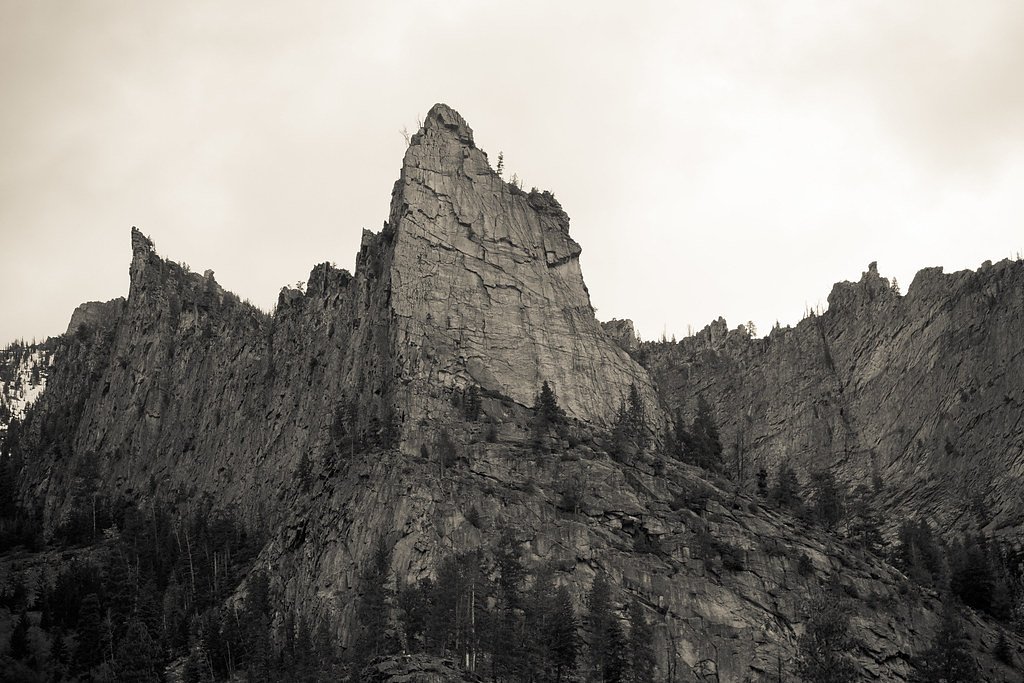
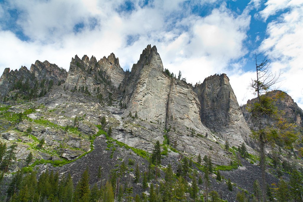
Blodgett Campground consists of 5 campsites, 1 walk-in site, plus 1 host site, complete with picnic tables, fire rings, and a vault toilet. There are two accessible campsites. The campground rests under the towering cliff faces of Blodgett Canyon which are very popular to rock climbers. Blodgett Canyon Picnic Area is across Blodgett Creek. Campground can accommodate RV's or trailers to 45 feet.
Book on Recreation.govNearby Hot Springs
Hot springs near Hamilton, Montana
Prospector Hot Springs
Prospector Hot Springs lies more than six miles from the nearest road in the backcountry near the Selway-Bitterroot Wilderness,...

Sleeping Child Hot Springs
Sleeping Child Hot Springs emerges at 122 degrees Fahrenheit within the Bitterroot National Forest, managed by the US Forest Se...
Blue Joint Hot Springs 2
Blue Joint Hot Springs 2 flows at 84°F at 4,936 feet elevation in Bitterroot National Forest, matching the temperature of its c...
Blue Joint Hot Spring 1
Blue Joint Hot Spring 1 reaches 84°F at 5,031 feet elevation in the Bitterroot National Forest, running 42.5 degrees above ambi...
Medicine Hot Springs
Medicine Hot Springs delivers 117°F water on Bitterroot National Forest land in Ravalli County, Montana, with alkaline chemistr...

Lolo Hot Springs, Granite Springs
Lolo Hot Springs registers 111°F with unusually alkaline water at pH 9.3 and very low mineral content, dominated by 52 mg/L sod...
Looking for a soak after your hike? Explore more hot springs near Hamilton, Montana on SoakingSprings.
Explore Montana springsAdditional Information
Nearby Attractions
Nearby attractions include the West Boulder River and other hiking trails in the Absaroka-Beartooth Wilderness.
Wildlife
The area is home to wildlife such as deer, elk, and various bird species. Be cautious of bears and carry bear spray.
Cities near Canyon Falls
Other waterfalls named Canyon Falls
4 other waterfalls share this name across the U.S.
Writing about Canyon Falls? Embed this waterfall on your site for free.