Whitefish Falls
By Armen Suny · Last verified Mar 2026
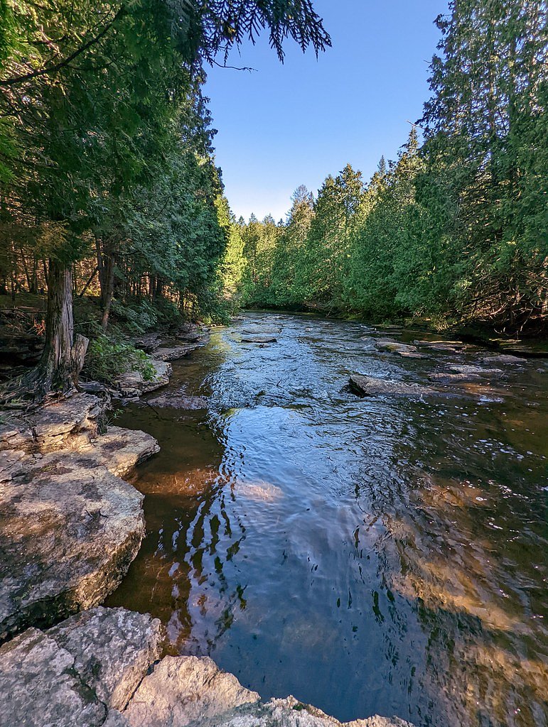
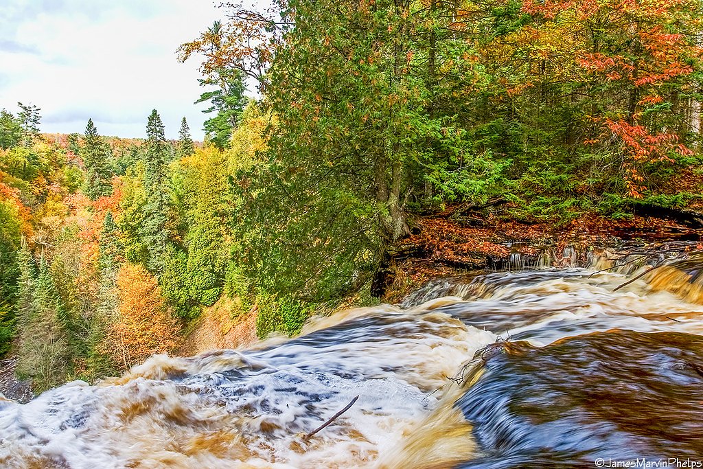
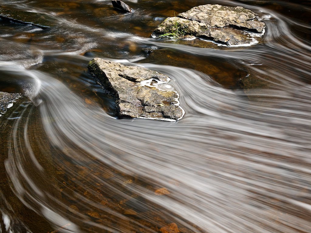
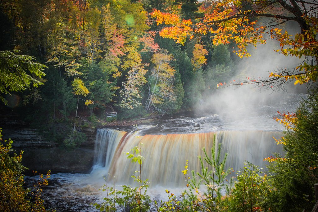
Photo Credits (5)
Difficulty
Easy
Trail Length
0.6 miles
Trail Type
Out And Back
Elevation Gain
100 ft
About Whitefish Falls
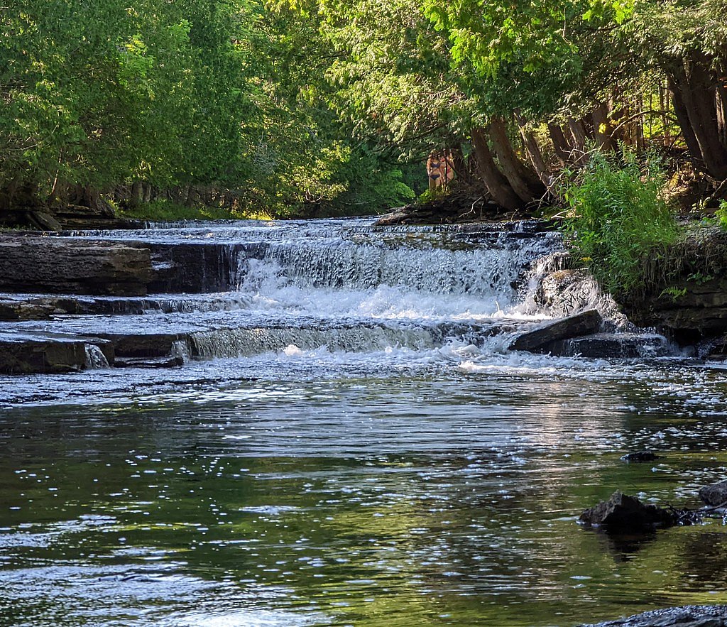
Tucked into Michigan’s Upper Peninsula along the Whitefish River near Eben Junction, Whitefish Falls is a photographer’s delight — a series of cascades framed by lush northern hardwoods and mossy rock. The falls sit on land owned by DESG and are managed by the U.S. Forest Service as part of the Whitefish unit of the Michigan Wild and Scenic River Study Area (WSR), giving the site a quietly protected, backcountry feel. Whether you visit for a peaceful picnic, birdwatching, or to capture the falls at golden hour, the setting feels intimate and approachable without feeling overbuilt. The short approach makes Whitefish Falls an easy option for families and casual hikers. The river and cascades change character with the seasons, from spring runoff and thunderous flow to gentle summer ribbons and iced sculptural edges in winter, offering a variety of photo and nature-viewing opportunities throughout the year.
The Setting
Whitefish Falls sits at 935 feet within Whitefish, Michigan Wild And Scenic River Study Area, fed by the Middle Branch Escanaba River, in the foothills of Michigan.
Trail & Hike Details
The Approach
The easy 0.6-mile out-and-back trail gains 100 feet of elevation on the way to the falls.
Trail Description
USFS information lists the access as a short, out-and-back route of roughly 0.6 miles with about 100 feet of elevation gain and an overall difficulty rating of easy. There is no USFS trail number listed for the approach; the route follows a wooded footpath into the riparian corridor. The tread can be uneven and may become muddy after rain, so sturdy shoes are recommended — but the short distance and modest climb make the outing accessible for most visitors. Surface, formal grade, and trail class are not specified in the USFS data provided for this route.
What to Expect
Dogs are welcome.
Accessibility
The trail is short and relatively flat, but the surface may be uneven. Contact the managing agency for accessibility details.
Frequently Asked Questions
🐶 Are Dogs Allowed at Whitefish Falls?
✅ Dogs are allowed
Are There Any Fees or Permits Required?
🆖 No fees required
🏊 Is There Swimming at Whitefish Falls?
❌ Swimming is not allowed
When to Visit
Spring and early summer are the best times to visit, as the water flow is typically strongest during these seasons. Fall offers beautiful foliage, while winter provides a unique view of the falls frozen in ice.
Seasonal Access
The best time to visit is Spring, Summer, and Fall. Winter access may be limited.
Safety Information
Exercise caution near the falls, as rocks can be slippery. Be aware of changing weather conditions, and avoid visiting during heavy rain or snowstorms. Carry a map or GPS, as cell service may be limited in the area.
Current Water Conditions
Based on a USGS gauge 22.6 miles away
276 ft³/s
Current discharge — how much water is flowing
Higher than usual for this time of year
Based on 57 years of record
2.38 ft
Water depth at gauge
7-Day Discharge Trend
What does this mean for your visit?
The water is flowing higher than usual for this time of year.
About This Gauge
This gauge is on a regional waterway. Conditions at the falls may differ, especially after local rain.
7-Day Flow Outlook
Based on the USGS gauge MIDDLE BRANCH ESCANABA RIVER NR PRINCETON, MI (36 km away).
Today
Roaring
276 cfs
9/10Tomorrow
Roaring
254 cfs
9/10Sun
Roaring
264 cfs
6/10Mon
Roaring
284 cfs
6/10Tue
Roaring
283 cfs
6/10Wed
Roaring
304 cfs
6/10Thu
Roaring
289 cfs
6/10Best window: Today — roaring flow, mostly sunny (trip score 9/10).
Best time of year: this gauge typically runs highest from late March to late June, peaking in April.
How we calculate this
This is a transparent outlook, not a precise forecast. We take the waterfall's current flow strength (how it ranks against its historical normal for today, from the nearest USGS stream gauge), carry that ranking forward along the gauge's seasonal curve, and nudge it for forecast rain. Confidence is highest for the next day or two and falls further out. Always check official conditions and your own judgment before visiting — high flows can be dangerous.
Know when to go.
Get a free email alert when waterfalls near Chatham hit peak flow. We only send when conditions are worth the trip — no weekly newsletters, no spam.
Weather Forecast
Location & Access
Getting There
Whitefish Falls is located off Eben Road, near Eben Junction in Michigan's Upper Peninsula. The falls are accessible via a short drive from the main road, but the exact trailhead location may require local guidance or GPS navigation.
Get Directions on Google MapsParking
There is limited parking available near the trailhead. Visitors should be prepared for potentially unmarked or informal parking areas.
Elevation
935 feet above sea level
Coordinates
46.218839° N, -87.051534° W
Land Management
Managed by USFS
Visitor Tips & Gear
Wear sturdy footwear, as the trail may be uneven or slippery. Bring insect repellent during warmer months, as mosquitoes and other insects are common in the area. Check local conditions before visiting, especially in winter, as snow and ice may make access more difficult.
As an Amazon Associate, we earn from qualifying purchases.
For this easy 0.6 miles trail, lightweight trail shoes and a water bottle are usually sufficient. Sun exposure on the trail makes good sun protection a must in summer.

Polarized Sunglasses (Knockaround)
Cuts glare off the water so you actually see the falls — and your photos turn out better too.

Columbia Watertight II Rain Jacket
Packs into its own pocket, seam-sealed, and keeps you dry from spray and surprise rain.

Earth Pak Waterproof Dry Bag
Keeps your phone and gear dry when waterfall mist soaks everything else.

Waterproof Phone Pouch (AiRunTech)
Cheap insurance — take photos right next to the falls without killing your phone.

JOBY GorillaPod Starter Kit
Wraps around railings and rocks for long-exposure waterfall shots — no flat surface needed.

Osprey Daylite Daypack
Light, organized, and just the right size for a day hike — fits water, snacks, and layers.
Where to Stay

Cornell Home w/ Fire Pit & Hunting Access!

Quality Inn & Suites Munising

UP Badger Lodge BnB-Lake Family

Boarders Inn & Suites by Cobblestone Hotels - Munising
Browse vacation cabins and private rentals nearby
Unique outdoor stays — tents, yurts, and treehouses
Rent a campervan or RV for your waterfall road trip
Some links are affiliate links. We may earn a commission at no extra cost to you.
Nearby Campground
West Zone
14.6 miles away · 0 sites
The West Unit is located in the central of the Upper Peninsula, bordering two of the Great Lakes - Lake Superior and Lake Michigan. The western portion of the Hiawatha extends from the towns of Rapid River and Manistique, along Lake Michigan, to the town of Munising on the Lake Superior shore. For information about free educational campground programs on these three Ranger Districts, visit the Events page.
Book on Recreation.govAdditional Information
Nearby Attractions
Nearby attractions include Eben Ice Caves, Pictured Rocks National Lakeshore, and Laughing Whitefish Falls State Park.
Wildlife
The area is home to a variety of wildlife, including birds, deer, and small mammals. Visitors may also encounter insects such as mosquitoes and ticks.
Cities near Whitefish Falls
Nearby Waterfalls
Other waterfalls named Whitefish Falls
2 other waterfalls share this name across the U.S.
Writing about Whitefish Falls? Embed this waterfall on your site for free.