Photo Credits (4)
About Whitefish Falls
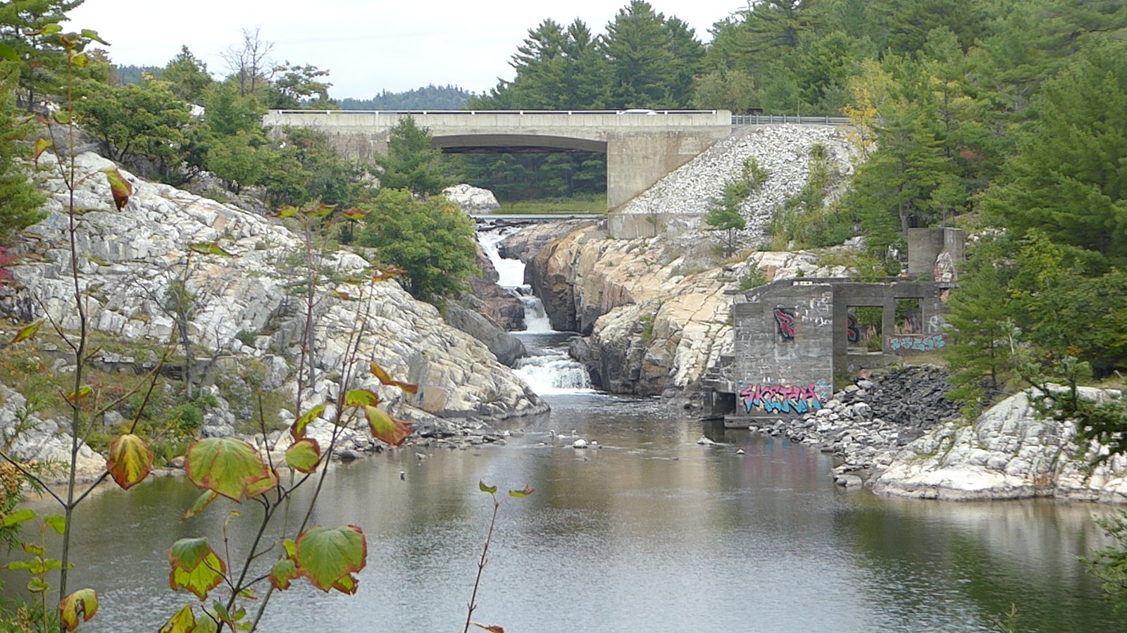
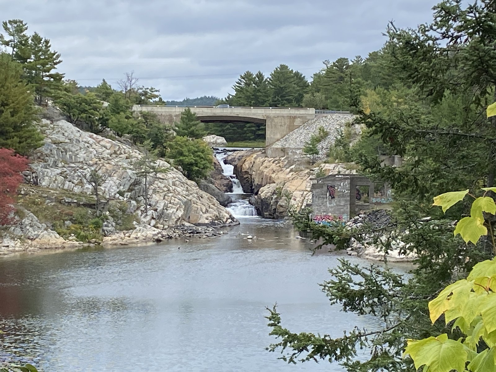
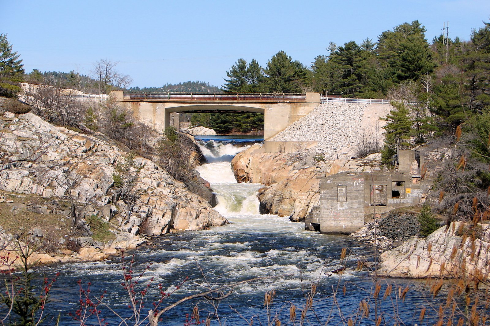
Whitefish Falls is a remote, likely small to medium-sized waterfall in northwestern Ontario near Red Lake (approximately 36.2 miles / ~58 km away by road). The falls sit in a sparsely developed boreal landscape and are best described as a natural, undeveloped cascade on a local stream or river. Access is typically via gravel/logging roads and informal trails; there are no developed visitor facilities at the site. Seasonal flow and appearance likely vary considerably, with highest flows in spring.
Why This Waterfall Exists
Whitefish Falls flows over dense iron-rich rock, primarily iron formation, laid down over 2.5-3.2 billion years ago. These resistant rocks form a durable ledge that water cannot easily wear away, creating the falls where softer material downstream has already eroded.
Trail & Hike Details
Trail Description
There does not appear to be a developed or well-maintained trail to Whitefish Falls. Access may require walking a short distance from a gravel road over uneven, potentially brushy terrain and across small streams. Expect unmarked routes, damp or boggy ground in places, and typical boreal forest obstacles (roots, rocks, blowdown). Routes may be seasonal and can change after storms or spring thaw.
What to Expect
A remote, natural waterfall setting with few if any other visitors. Expect mixed forest, rocky banks, and possibly steep or slippery approaches near the water. Water flow will be highest in spring runoff and lower in late summer. In summer there will likely be many insects (mosquitoes, black flies). Limited or no facilities (no restrooms, signage, or maintained viewpoints).
Accessibility
Not wheelchair accessible. Terrain is natural and likely rough; the site is undeveloped and not suitable for visitors requiring mobility accommodations.
Frequently Asked Questions
🐶 Are Dogs Allowed at Whitefish Falls?
❌ Dogs are not allowed
Are There Any Fees or Permits Required?
🆖 No fees required
🏊 Is There Swimming at Whitefish Falls?
❌ Swimming is not allowed
When to Visit
Spring (late snowmelt into early summer) for highest water flow and dramatic scenery. Summer offers easier road access but lower flows and more insects. Fall provides good color and cooler weather; check road conditions. Winter may freeze the falls and make access difficult or require snowmobile/over-snow travel, only attempt in winter if experienced and properly equipped.
Seasonal Access
The best time to visit is Spring, Summer, Fall, and Winter. Check with the managing park or local authority for current conditions.
Safety Information
Remote location: limited or no cell service and few other visitors. Risks include slippery rocks and unstable banks near the water, cold and fast-moving water, insects in summer, variable weather, and wildlife encounters. Roads may be rough or seasonally closed; check conditions and bring emergency communication. Always tell someone your route and expected return time.
Current Water Conditions
17.9 m³/s
Current discharge — how much water is flowing
32.82 m
Water depth at gauge
7-Day Discharge Trend
About This Gauge
7-Day Flow Outlook
Based on the WSC gauge TROUTLAKE RIVER BELOW WOMAN RIVER (8 km away).
Today
Moderate
18 m³/s
8/10Tomorrow
Moderate
18 m³/s
8/10Tue
Moderate
18 m³/s
8/10Wed
Moderate
19 m³/s
6/10Thu
Moderate
19 m³/s
8/10Fri
Moderate
18 m³/s
9/10Sat
Moderate
19 m³/s
6/10Best window: Fri — moderate flow, mainly sunny (trip score 9/10).
How we calculate this
This is a transparent outlook, not a precise forecast. We take the waterfall's current flow strength (how it ranks against its historical normal for today, from the nearest WSC stream gauge), carry that ranking forward along the gauge's seasonal curve, and nudge it for forecast rain. Confidence is highest for the next day or two and falls further out. Always check official conditions and your own judgment before visiting — high flows can be dangerous.
Know when to go.
Get a free email alert when waterfalls near Red Lake hit peak flow. We only send when conditions are worth the trip — no weekly newsletters, no spam.
Weather Forecast
Location & Access
Getting There
Coordinates: 50.881, -93.1526. The falls are in a remote area north of Red Lake. Expect to travel on provincial highways followed by long gravel or logging roads; some roads may be rough, seasonally closed, or require a high-clearance 4x4. There may be no formal trailhead signage. Visitors should plan for limited or no cell service and navigate using offline maps or GPS.
Get Directions on Google MapsParking
No formal parking lot is known. Parking is likely an informal pullout on a gravel road. Park well off the travel surface and avoid blocking gates or logging operations.
Elevation
347 metres above sea level
Coordinates
50.880987° N, -93.152560° W
Visitor Tips & Gear
• Check local conditions and road reports before traveling; some logging roads may be closed or gated. • Use a high-clearance vehicle and expect slow travel on gravel roads; consider a local guide if unfamiliar with the area. • Carry a topographic map, GPS, or reliable offline navigation; cell service may be unreliable. • Wear sturdy footwear and be prepared for wet, uneven terrain. Watch for slippery rocks near the falls. • Practice Leave No Trace, pack out all waste. Avoid creating new social trails. • Bring insect repellent and wear long sleeves/pants during mosquito season. • Let someone know your plans and expected return time due to remoteness.
Where to Stay
Browse vacation cabins and private rentals nearby
Unique outdoor stays — tents, yurts, and treehouses
Rent a campervan or RV for your waterfall road trip
Some links are affiliate links. We may earn a commission at no extra cost to you.
Nearby Campground
Gold Pines Fishing Camp on Lac Seul
27.1 km away
Additional Information
Nearby Attractions
Red Lake region attractions include numerous lakes and fishing opportunities, backcountry canoeing, and provincial wilderness areas. Specific nearby named attractions are not confirmed for the immediate falls location; visitors often combine waterfall visits with broader exploration of the Red Lake area.
Wildlife
Typical boreal species, moose, black bear, beavers, wolves, foxes, and a variety of birds (raptors, waterfowl, songbirds). Be aware of bears and practice proper food storage and wildlife safety.
Cities near Whitefish Falls
Other waterfalls named Whitefish Falls
2 other waterfalls share this name across Canada.
Writing about Whitefish Falls? Embed this waterfall on your site for free.